NOAA’s New Weather Satellite is Operational, and its Pictures of Earth are Gorgeous

Polar-orbiting satellites capture swaths of data throughout the globe, and observe the entire planet twice each day. The global mosaic, captured by the VIIRS instrument on the recently launched NOAA-21 satellite, is a composite image created from these swaths. Image Credit: NOAA STAR VIIRS Imagery Team.

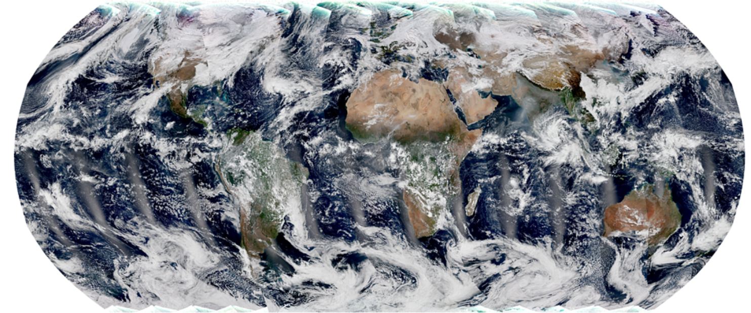
You’d have to be in some kind of sense-of-wonder-repressed coma not to appreciate satellite images of Earth. If you are, then images from the NOAA’s newest satellite might pull you out of it.

And they’re only a taste of the fascinating images that it will provide.

Continue reading “NOAA’s New Weather Satellite is Operational, and its Pictures of Earth are Gorgeous”