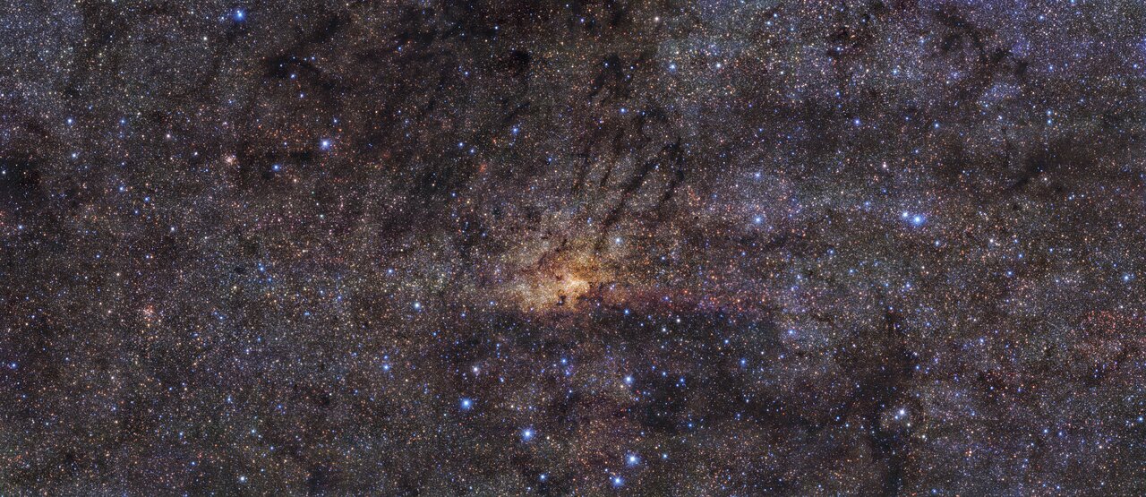
Taken with the HAWK-I instrument on ESO’s Very Large Telescope in the Chilean Atacama Desert, this stunning image shows the Milky Way’s central region with an angular resolution of 0.2 arcseconds. This means the level of detail picked up by HAWK-I is roughly equivalent to seeing a football (soccer ball) in Zurich from Munich, where ESO’s headquarters are located. The image combines observations in three different wavelength bands. The team used the broadband filters J (centred at 1250 nanometres, in blue), H (centred at 1635 nanometres, in green), and Ks (centred at 2150 nanometres, in red), to cover the near infrared region of the electromagnetic spectrum. By observing in this range of wavelengths, HAWK-I can peer through the dust, allowing it to see certain stars in the central region of our galaxy that would otherwise be hidden.
A team of scientists in Canada have found a Fast Radio Burst (FRB) that repeats every 16 days. This is in stark contrast to other FRBs, which are more sporadic. Some of those sporadic FRBs occur in clusters, and repeat irregularly, but FRBs with a regular, repeatable occurrence are rare.
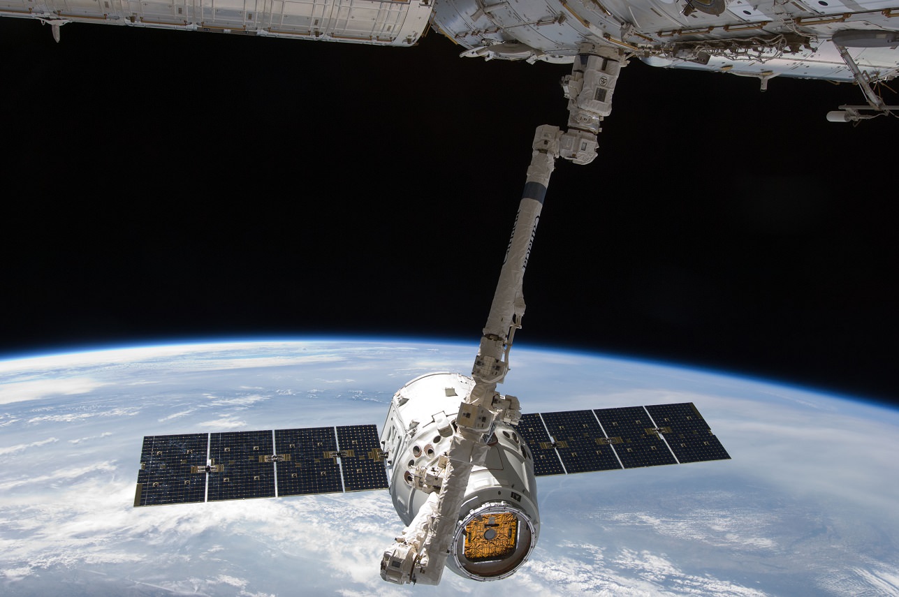
The Canadarm 2 with the robotic hand Dextre attached riding shotgun on the International Space Station. Image Credit: NASA
Check out this image of the Canadian Space Agency’s (CSA) Canadarm2 on the International Space Station. The CSA’s Dextre is attached to one end of the arm. The Canadarm2 played a vital role in assembling the ISS, while Dextre helps maintain the ISS, freeing astronauts from routine yet dangerous spacewalks, and allowing them to focus on science.
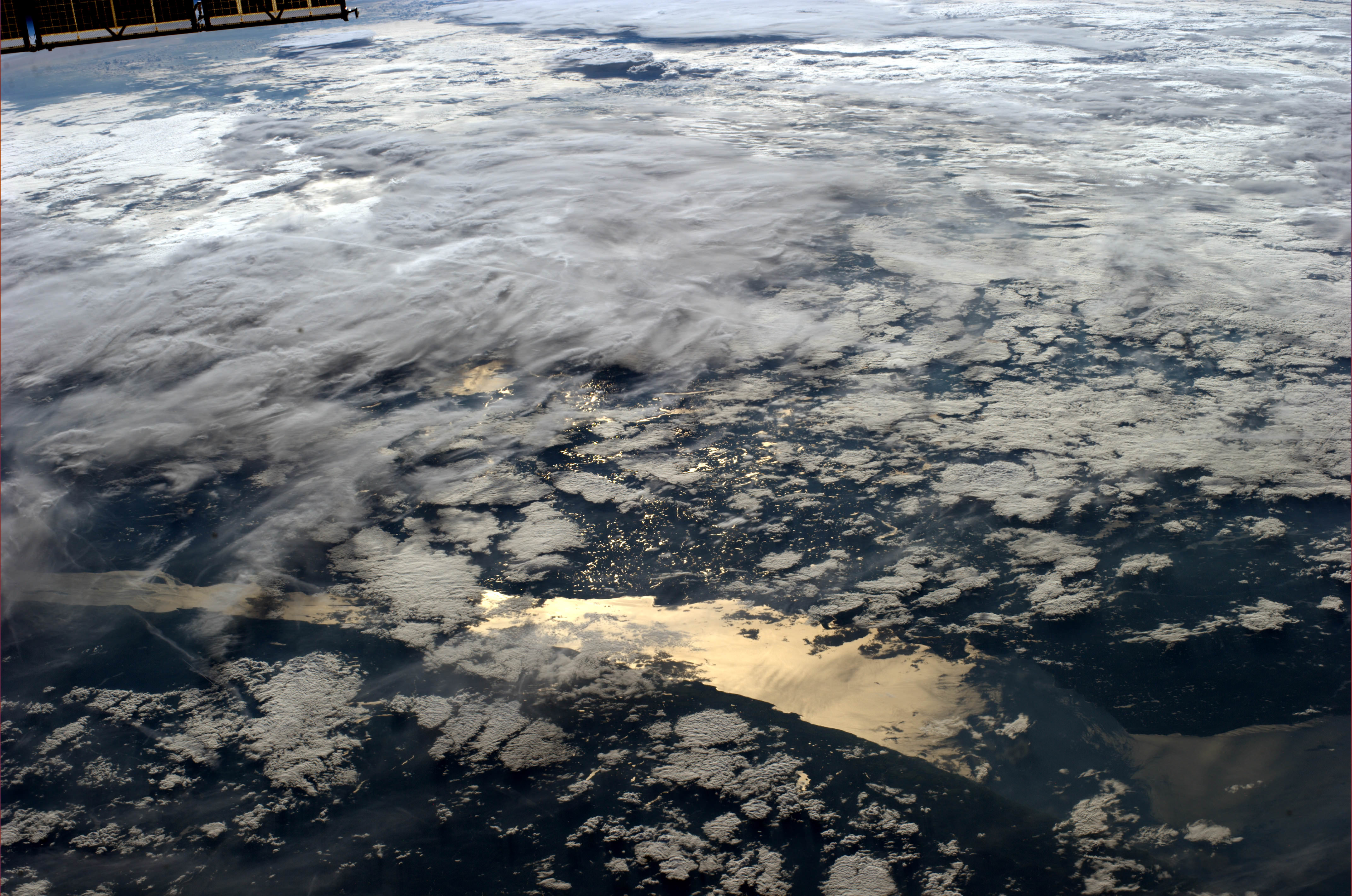
A view of the St. Lawrence Seaway and Canada under the clouds seen from the International Space Station by ESA astronaut Alexander Gerst. Credit: ESA/NASA.
On 1 July, Canadians celebrate Canada Day, which honors the day the nation was officially born when the Constitution Act united three colonies into a single country. Astronauts both past and present send their greetings today: ESA astronaut Alexander Gerst took this image, above, from the International Space Station and sent the message from space: “Canada is beautiful! Happy Canada Day!”
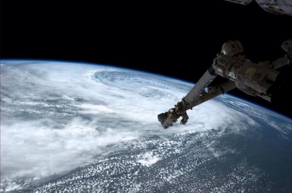
Below, NASA astronaut Reid Wiseman took a beautiful image showing storms swirling near Winnipeg, Manitoba.
And then, there’s a very special new video featuring former Canadian astronaut Chris Hadfield and his brother Dave singing an original song by Dave titled, “In Canada.” It’s pretty great, and it gives you an inside look at the Hadfield family (they do family rocket launches!) and what it’s like to live in Canada. If you think Chris has a great singing voice, you’ll love Dave’s voice (they sound almost exactly the same!) and when they harmonize, it’s golden because they blend perfectly as only sibling voices can.
Storm begins to swirl near Winnipeg, Canada, as seen from the International Space Station on June 29, 2014. Image taken by astronaut Reid Wiseman. Credit: NASA.
Find out more about the song and Dave’s various endeavor’s at his website.
We send special Canada Day greetings to the Canadians at Universe Today, our publisher Fraser Cain, and journalists Elizabeth Howell and Daniel Majaess.
The robotic Canadarm2 is routinely used to berth spacecraft to the International Space Station, such as SpaceX's Dragon. Credit: NASA
About six years ago, the Canadarm — Canada’s iconic robotic arm used in space — was almost sold to a company in the United States, along with other space technology from MacDonald, Dettwiler and Associates. The Canadian government blocked the sale and swiftly came out with a promise: a space policy to better support Canada’s industry.
That promise was made in September 2008. “Time is of the essence,” then-Industry Minister Jim Prentice told reporters upon announcing a space policy would be created. Today, 65 months later, the government released the high-level framework of that policy. Astronauts, telescopes and yes, the Canadarm are all prominently mentioned in there.
A lot has happened in six years. Policy-makers used to cite successor Canadarm2’s role in space station construction. Now the arm also does things that were barely imaginable in 2008 — namely, berthing commercial spacecraft such as SpaceX’s Dragon at the International Space Station. It shows how quickly space technology can change in half a decade.
At 13 pages, there isn’t a lot of information in Canada’s framework yet to talk about, but there are some statements about government priorities. Keep the astronaut program going (which is great news after the success of Chris Hadfield). A heavy emphasis on private sector collaboration. And a promise to keep funding Canada’s contribution to the James Webb Space Telescope, NASA’s next large observatory in space.
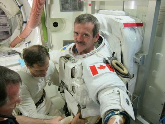
Canadian astronaut Chris Hadfield prior to his world-famous Expedition 34/35 mission in 2013. Credit: NASA
These are the Top 5 priorities listed in the plan:
Canada First: Serving Canada’s interests of “sovereignty, security and prosperity.” As an example: The country has a huge land-mass that is sparsely populated, so satellites are regularly used to see what ship and other activity is going on in the territories. This is a big reason why the Radarsat Constellation of satellites is launching in 2018.
Working together globally: Canada has a tiny space budget ($488.7 million in 2013-14, $435.2 million in 2014-15 and $382.9 million in 2015-16), so it relies on other countries to get its payloads, astronauts and satellites into space. This section also refers to Canada’s commitment to the International Space Station, which (as with other nations) extends to at least 2024. That’s good news for astronauts Jeremy Hansen and David Saint-Jacques, who are waiting for their first trip there.
Promoting Canadian innovation: The James Webb Telescope (to which Canada is contributing optics and a guidance system) is specifically cited here along with the Canadarm. Priority areas are Canada’s historic strengths of robotics, optics, satellite communications, and space-based radar, as well as “areas of emerging expertise.”
Inspiring Canadians: Basically a statement saying that the government will “recruit, and retain highly qualified personnel,” which in more real terms means that it will need to keep supporting Canadian space companies financially through contracts, for example, to make this happen.
That last point in particular seemed to resonate with at least one industry group.
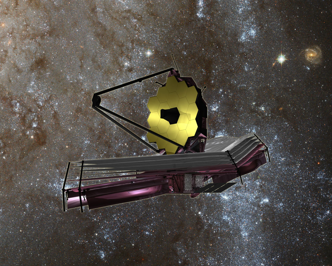
James Webb Space Telescope. Image credit: NASA/JPL
“A long-term strategic plan for Canada’s space program is critical for our industry. In order to effectively invest in innovation, technology and product development, we rely heavily on knowing what the government’s priorities for the space program are,” stated Jim Quick, president of the Aerospace Industries Association of Canada (a major group that represents the interests of private space companies.)
While we wait for more details to come out, here’s some valuable background reading. The space-based volume of the Emerson Report (the findings of a government-appointed aerospace review board listed in 2012) called for more money for and more stable funding of the Canadian Space Agency, among other recommendations.
And here’s the government’s point-by-point response in late 2013. In response to funding: “The CSA’s total funding will remain unchanged and at current levels. The government will also leverage existing programs to better support the space industry.” Additionally, the CSA’s space technologies development program will be doubled to $20 million annually by 2015-16, which is still below the Emerson report’s recommendation of adding $10 million for each of the next three years.
What are your thoughts on the policy? Let us know in the comments.
We record the Weekly Space Hangout every Friday at 12 pm Pacific / 3 pm Eastern. You can watch us live on Google+, Cosmoquest or listen after as part of the Astronomy Cast podcast feed (audio only).
Zoomable map of the US and Canada pinpoints everyone with a dot. (Credit: Brandon Martin-Anderson/Census Dotmap)
Now this is something different: an interactive and zoomable map of the United States and Canada, made not from political boundaries or geographic landforms but rather of tiny dots — 341,817, 095 of them, to be exact — each one representing an individual person counted in the 2010 (US) and 2011 (Canada) censuses. There’s no other feature on this map except those dots, each randomly placed within the regional blocks used by the census, yet we still end up with a very recognizable structure.
So if you were listed in either of these censuses, you helped to make this map!
The Census Dotmap is a project by Brandon Martin-Anderson, who wanted an image of human settlement patterns that didn’t use political boundaries. He wrote a script that organized all the census data into points that got drawn into the block-level counts… well, you can see more about how he made it here.
(Just how accurate are population counts? According to the US Census Bureau, the 2010 count was “exemplary”… although renters and certain minority groups are traditionally undercounted.)
Dotmap of the Vancouver, BC area
The bottom line is that this is really interesting to explore… if you live in a somewhat remote area, and you see a dot there, most likely that’s you! (It’s a little harder to determine who’s who in the more populated areas… the dots don’t pinpoint specific street addresses.)
And yes, Alaska and Hawaii are on there too… they just didn’t fit in the screenshot above. In fact all of northern Canada is there too, the dots are just very few and widely spaced out. But it’s not blank.
Check it out… you can even buy a print of the entire map, or a particular region or city. Now that’s leaving your mark on the world!
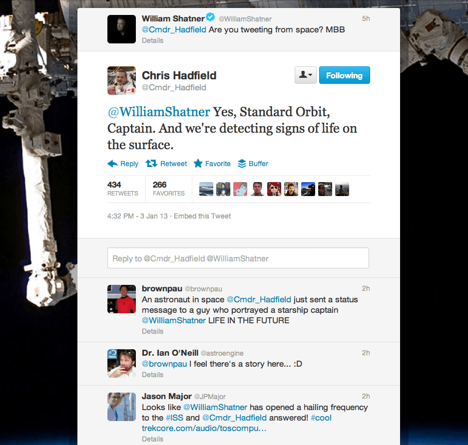
Chris Hadfield’s response to William Shatner got quite a bit of attention on Twitter
You know that you’re living in a very special point in time when you can watch a man who became famous playing a starship captain on television send a tweet to a man who’s actually working in a spaceship orbiting the Earth — and get an amusing response back.
Which is exactly what happened earlier today when William Shatner got a reply from Chris Hadfield, currently part of the Expedition 34 crew aboard the ISS. For many people Shatner was the first starship captain remembered from TV in the late ’60s, and in a couple of months Chris Hadfield will become the first Canadian astronaut to assume command of the International Space Station.
(Shatner, by the way, is also from Canada. Hmm…maybe there’s something more going on here…)
Today Canada’s Minister of Industry Christian Paradis unveiled the technologies that comprise Canada’s contribution to the James Webb Space Telescope, a next-generation infrared observatory that’s seen as the successor to Hubble.
CSA will provide JWST with a two-in-one instrument: a Fine Guidance Sensor (FGS) Near-Infrared Imager and Slitless Spectrograph (NIRISS). Both were designed, built and tested by COM DEV International in Ottawa and Cambridge, Ontario, with technical contributions from the Université de Montréal and the National Research Council Canada.
“Canada has a proud legacy in space and we are once again pushing the frontier of what is possible. These two outstanding technologies are perfect examples of how Canada has secured its world-class reputation. Our Government is committed to ensuring the long-term competitiveness and prosperity of such a vital economic sector.”
– The Honourable Christian Paradis
The FGS consists of two identical cameras that are critical to Webb’s ability to “see.” Their images will allow the telescope to determine its position, locate its celestial targets, and remain pointed to collect high-quality data. The FGS will guide the telescope with incredible precision, with an accuracy of one millionth of a degree.
The NIRISS will have unique capabilities for finding the earliest and most distant objects in the Universe’s history. It will also peer through the glare of nearby young stars to unveil new Jupiter-like exoplanets. It will have the capability of detecting the thin atmosphere of small, habitable, earth-like planets and determine its chemical composition to seek water vapour, carbon dioxide and other potential biomarkers such as methane and oxygen.
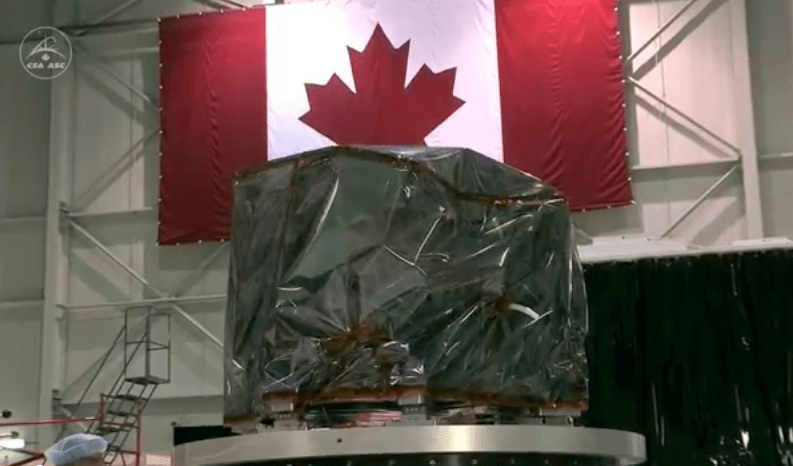
The FGS/NIRISS instruments can be seen in this development video from CSA:
“Imagine the challenge at hand here: to design and deliver technology capable of unprecedented levels of precision to conduct breakthrough science on board the largest, most complex and most powerful telescope ever built,” said Steve MacLean, President of the CSA. “The Webb telescope will be located 1.5 million kilometers from Earth— too far to be serviced by astronauts like Hubble was. At that distance, the technology simply has to work. This is the outstanding level of excellence Canadians are capable of achieving. It’s something for all of us to be proud of.”
The instruments will be delivered to NASA on July 30.
Read more on the CSA press release here, and learn more about the James Webb here.
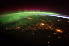
Aurora Borealis over Western Canada from the ISS Expedition 30 crew. Credit: NASA
Video Caption: Up the East Coast of North America. Credit: NASA
The North American continent is literally set ablaze in a confluence of Auroral and Manmade light captured in spectacular new videos snapped by the astronauts serving aboard the International Space Station (ISS).
The Expedition 30 crew has recently filmed lengthy sequences of images that are among the most stunning ever taken by astronauts flying in orbit some 240 miles (385 kilometers) over the United States and Canada.
[/caption]
Teams working at the Crew Earth Observations center at NASA’s Johnson Space Center in Houston, Texas have assembled hundreds of individual still images taken onboard the ISS into a series of amazing videos.
Two videos collected here focus on the East and West coasts of North America and show the path traveled by the station from the crew’s perspective as they photographed the light emitted by hundreds of millions of humans living below and the brilliant light of the Aurora Borealis shining above them.
Night time Panorama of US East Coast from the ISS
Astronauts captured this stunning nighttime panorama of the major cities along the East Coast of the United States on Jan. 29. Credit: NASA
Now the NASA team has assembled the entire sequence of images taken on January 29, 2012 from 05:33:11 to 05:48:10 GMT into a video -see above.
The orbital pass runs from Central America just southwest of Mexico and continues to the North Atlantic Ocean, northeast of Newfoundland. It begins by looking over Central America towards the Gulf of Mexico and the southeastern United States. As the ISS travels northeast over the gulf, some southeastern United States cities can be distinguished, like New Orleans, Mobile, Jacksonville, and Atlanta. Continuing up the east coast, some northeastern states, like Washington, D.C., Baltimore, Philadelphia, and New York City stand out brightly along the coastline. The Aurora Borealis shines in the background as the pass finishes near Newfoundland
The 2nd video is titled “Across Southwest Canada at Night”
This sequence of shots was taken January 25, 2012 from 12:34:11 to 12:36:28 GMT, on a pass from near the border of British Columbia, Canada and Washington state, near Vancouver Island, to southern Alberta, near Calgary.
The main focus of this video is the Aurora Borealis over Canada, which appears very near the ISS during this short and exciting video.
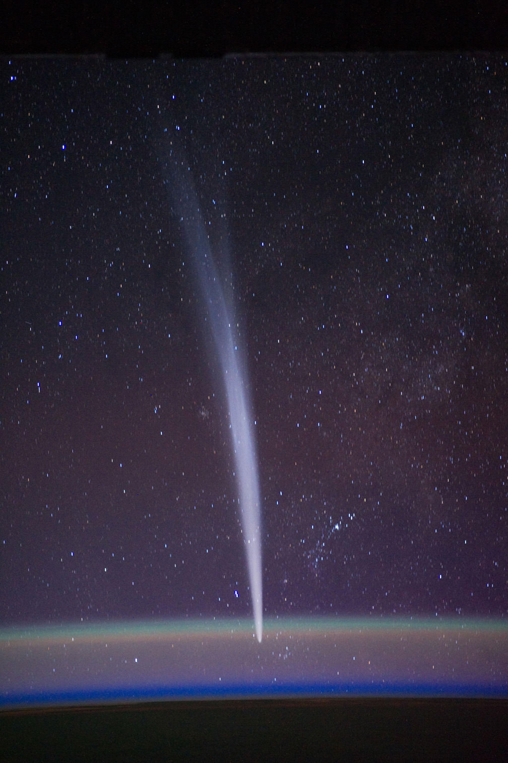
And don’t forget the fabulous ISS shots of Comet Lovejoy taken in December 2011 by Expedition 30 Commander Dan Burbank.
Comet Lovejoy on 22 Dec. 2011 from the International Space Station. Comet Lovejoy is visible near Earth’s horizon in this nighttime image photographed by NASA astronaut Dan Burbank, Expedition 30 commander, onboard the International Space Station on Dec. 22, 2011. Credit: NASA/Dan Burbank
For an otherworldly and eerie perspective, click here to see what a Manmade artifact on the surface of Mars looks like as seen from Mars Orbit – also taken just a few days ago on Jan. 29, 2012, but this time by a robot in place of a human !
Nighttime Panorama of US East Coast from the ISS. Astronauts aboard the International Space Station (ISS) captured this stunning nighttime panorama of the major cities along the East Coast of the United States on Jan. 29. Credit: NASA
[/caption]
Do you live here?
Tens of millions of Earthlings live and work in the bustling and seemingly intertwined American mega-metropolis of the Philadelphia-New York City-Boston corridor (bottom-center splotch) captured in this stunning “Cities at Night” panorama of the East Coast of the United States along the Atlantic seaboard (image above).
Look northward and you’ll see the home to millions more Earthlings inhabiting the brilliantly lit Canadian cities of Toronto (launch site for “Lego Man in Space“) and Montreal to the west of Lake Ontario (dark oval at left-center).
The gorgeous panorama showing a portion of the Earth at Night and the atmospheric limb and light activity from the Aurora Borealis was snapped by the Expedition 30 crew living and working aboard the million pound International Space Station (ISS) on Jan. 29.
Lately, the 6 man international crew of Expedition 30 from Russia, Holland and the US have been on a roll taking one after another magnificent Nighttime pictures of our Home Planet, Auroras’ and celestial wonders like Comet Lovejoy.
Be sure to take a comparative look at the recent panorama of Western Europe at Night snapped by the ISS crew a week before on Jan 22 – here.
To test your geography smarts, here’s a map of the US East Coast highlighting much of what’s visible in the ISS panorama.
This Earthling has lived in cities on the US East Coast and Western Europe – images above and below Western Europe at Night
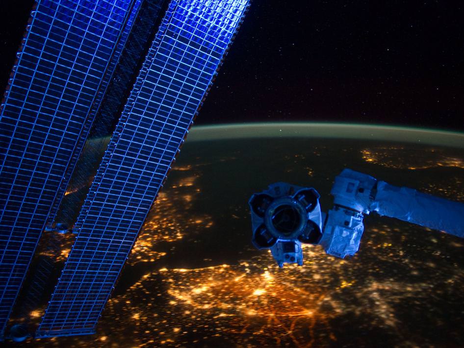
European ‘Cities at Night’ from the ISS with station solar arrays and robotic hand in foreground. Credit: NASA
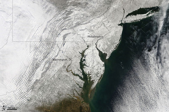
Two years ago in Feb. 2010, the US East Coast was struck by “Snowmageddon”, and this is how we looked from space
Meanwhile, two of the Expedition 30 crew members, Russian Flight Engineers Oleg Kononenko and Anton Shkaplerov, are preparing for a spacewalk on Friday, Feb. 16. They will be installing equipment outside the ISS on the Russian Pirs, Poisk and Zvezda modules.


 The FGS consists of two identical cameras that are critical to Webb’s ability to “see.” Their images will allow the telescope to determine its position, locate its celestial targets, and remain pointed to collect high-quality data. The FGS will guide the telescope with incredible precision, with an accuracy of one millionth of a degree.