Two Satellites Collide in Earth Orbit

An iridium satellite flar as seen from the ISS. Credit: Don Pettit, NASA

[/caption]
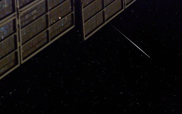
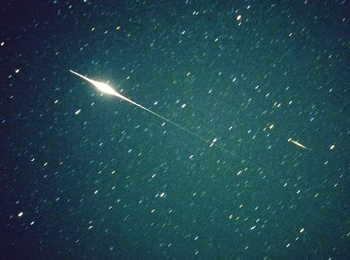
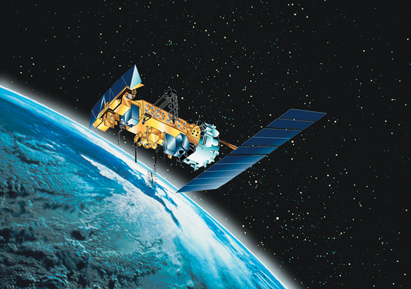
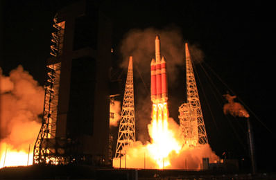
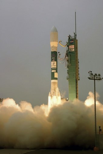
A commercial Iridium communications satellite collided with a Russian satellite or satellite fragment, on Tuesday, creating a cloud of wreckage in low-Earth orbit, according to CBS News. A source quoted in the article said U.S. Space Command is tracking about 280 pieces of debris, most of it from a non-operational Russian satellite. It appears the International Space Station is not currently threatened by the debris, but it’s not yet clear whether the debris poses a risk to any other satellites in similar orbits. Iridium operates a constellation of approximately 66 satellites, along with orbital spares, to support satellite telephone operations around the world.

Neither NASA or Iridium Satellite LLC has officially released any information about the collision, and a spokesman for U.S. Space Command was not aware of the incident. But one NASA manager who asked not to be named, seemed to confirm the collision and said, “Everybody is saying the risk (of further collisions) is minimal to NASA assets.”
UPDATE: The Spaceflightnow.com article has been updated with quotes from a statement by Iridium and U.S. Strategic Command, that confirm the collision took place.

In an article on Spaceflightnow.com, Nicholas Johnson, NASA’s chief scientist for orbital debris at the Johnson Space Center in Houston, confirmed the collision. “They collided at an altitude of 790 kilometers (491 miles) over northern Siberia Tuesday about noon Washington time,” said “The U.S. space surveillance network detected a large number of debris from both objects.”

Iridium Satellite System.  Credit: Spaceflightnow.com
Iridium Satellite System. Credit: Spaceflightnow.com

The Iridium spacecraft are in orbits tilted 86.4 degrees to the equator at an altitude of about 485 miles while the ISS orbits Earth at an altitude of about 215 miles in an orbit tilted 51.6 degrees to the equator. Other civilian science satellites operate in polar orbits similar to Iridium’s and presumably could face an increased risk as a result of the collision.

Johnson said the collision is unprecedented. “Nothing to this extent (has happened before),” he said. “We’ve had three other accidental collisions between what we call catalog objects, but they were all much smaller than this and always a moderate sized objects and a very small object. And these are two relatively big objects. So this is a first, unfortunately.”

Sources: CBS News, Spaceflightnow.com

NASA Launch Notes: Go/No-Go

The Delta II rocket lofts the NOAA-N Prime spacecraft into the night sky over Vandenberg Air Force Base in California. Photo credit: NASA/Carleton Bailie, ULA

[/caption]
Just a few notes on a couple of NASA launches; one was a go, and the other is a no-go for now. The NOAA-N Prime spacecraft got off the ground early Friday morning, lifting off at 2:22 a.m. PST, after working through technical problems that delayed the launch twice. The spacecraft successfully reached its polar orbit, and was renamed NOAA-19. The new satellite will collect data about the Earth’s surface and atmosphere to aid in weather forecasts, climate observations and search and rescue operations. Watch the launch video. On the other side of the coin, the launch of space shuttle Discovery on a space station assembly mission, which was delayed earlier this week from Feb. 12 to Feb. 19 because of concerns about hydrogen flow control valves, has now been slipped to no earlier than Feb. 22 to give engineers more time to complete testing, NASA officials said today.

Each shuttle has three of these valves, one for each main engine. They operate like lawn sprinklers, popping up as required to route hydrogen gas into pipes leading to the external tank to maintain the internal pressure needed to feed propellant to the main engines.

During the launch of Endeavour last November, one of the three flow control valves allowed more hydrogen to pass through than expected, while the other two worked fine. There was no problem with Endeavour’s ascent, but mission managers want to understand the issues better before sending Discovery to the space station to bring up the final solar array on STS-119.

Attired in training versions of their shuttle launch and entry suits, the STS-119 crew members await the start of a training session in the Space Vehicle Mockup Facility at Johnson Space Center, Houston. Image: NASA

For more information on Discovery, check out NASA’s STS-119 web page, and here’s where you’ll find more info on NOAA-19.

“Over Twitter” To Find Out What’s Orbiting Over Your Head

An iridium flare from an orbiting satellite. Credit:HobbySpace.com

[/caption]
If you enjoy satellite spotting and are a fan of the social networking mini-feed Twitter here’s something just for you. Robert Simpson at Orbiting Frog has created a Twitter feed that reports upcoming visible transits of interesting objects orbiting over several cities in the world, such as Amsterdam, Belfast, Chicago, Hong Kong, Honolulu, Moscow, New York, Paris, Rome, San Francisco, Sydney, and Vancouver. And he is willing to take requests for creating feeds for cities all over the planet. Rob creates the feeds with data from the Heaven’s Above website to determine when the International Space Station (ISS) and Hubble will be visible in the relevant location. When an overhead pass approaches a certain location, an alert appears on the Twitter feed. You will get 30-45 minutes warning on the sighting opportunity. So, if you’re a Twitter-aholic like me, check out Orbiting Frog’s website.

What’s really great is that the Tweet alerts only appear when the weather in your location is good enough to allow the transit to be seen. The weather data comes from Yahoo! Weather. Each Tweet provides information on the magnitude and elevation of the orbiting object so you’ll know where to look (and how hard you have to squint to see it!)

Rob says if you live within 20 miles of one of these cities, the data in the feed will still be correct for your location. Within 50 miles of one of these cities then the data will still be only a minute out in most cases.

To make a request for adding a particular city, check out Orbiting Frog.

Rob also has info on how to subscribe to an RSS feed for the same info if you’re not into Twitter. But, personally, I think Twitter is going to take over the universe, and resistance is futile, so you might as well join in.

Once again, here’s the Orbiting Frog website page on Over Twitter. Enjoy!

Satellite That Went ‘Splat’ Now Ready for Liftoff

Artist concept of NOAA N-Prime in orbit. Credit: NOAA

[/caption]
On September 6, 2003, the NOAA N-Prime satellite fell to floor of the factory where it was being assembled, and suffered significant damage. But now, over five years later, the satellite that perhaps should have the nickname of “Phoenix” is ready to head into polar orbit around the Earth to improve weather forecasting and monitor environmental events around the world. Liftoff from Vandenberg Air Force Base, California is scheduled for early Wednesday morning (Feb. 4) at 2:22 a.m. PST (5:22 a.m. EST; 1022 GMT), on board a Delta 2 rocket. NOAA N-Prime will provide a continuity of service, as well as restoring degraded service from older weather forecasting satellites.

UPDATE: The launch of the NOAA-N Prime weather satellite was scrubbed early on Feb. 4 when a launch pad gaseous nitrogen pressurization system failed. This system maintains pressurization and purges to various systems of the Delta II rocket prior to launch. Immediate repair to this system is being undertaken.

The next launch attempt will be no earlier than Thursday, Feb. 5 at 2:22 a.m. PST., weather permitting.


The NOAA N-Prime satellite on the floor of the factory of where it was being assembled.  Credit: NASA
The NOAA N-Prime satellite on the floor of the factory of where it was being assembled. Credit: NASA

After the National Oceanic and Atmospheric Administration’s N-Prime satellite tipped over while on a holding cart, engineers didn’t know if the satellite would be salvageable. It took several months to survey the damage and inventory spare parts to make sure the satellite could be rebuilt, according to Gary Davis, Director of the Office of Systems Development at NOAA’s Satellite and Information Service, interviewed for an article in Spaceflightnow.com.

“We put together a philosophy that, without question, if we had a spare part, we would swap it out. If we didn’t have a spare part, we would attempt to fix. If we couldn’t fix, then we would have to buy new,” Davis said.

About 75 percent of the craft’s components were replaced with new or spare hardware. Engineers recertified components they decided to keep on the spacecraft, and the company that built the satellite, Lockheed Martin, disassembled the satellite and conducted vibration and thermal tests on every part engineers planned to reuse.

NOAA-N Prime is the fifth and last in the current series of five polar-orbiting satellites with improved imaging and sounding capabilities.

Watch a video about NOAA N-Prime.

The satellite will collect meteorological data and transmit the information to NOAA’s Satellite and Information Service, which processes the data for input to the National Weather Service for its long-range weather and climate forecasts. Forecasters worldwide also will be able to access the satellite’s images and data.
NOAA-N Prime has sensors that will be used in the Search and Rescue Satellite-Aided Tracking System to monitor for distress signals around the world.

Watch the launch live on NASA TV, or follow the events on NASA’s Launch Blog.

Sources: NASA, Spaceflightnow.com

Iran Launches Satellite into Orbit

Iran launched its first functioning satellite into orbit late Monday using a modified long-range missile to place a home-produced research and telecommunications satellite into space. Iran now joins a small group of space-faring nations with the ability to build and launch their own satellites. In 2005, Iran used a Russian rocket to launch a satellite, and in August of 2008 Iran reported they launched a dummy satellite into orbit using their own Safir-2 rocket, but other sources said the rocket suffered a catastrophic failure. This most recent launch, however, was the country’s first success in using their own rocket and their own functional satellite, launched from Iranian territory. The launch coincided with a 10-day celebration of the 30th anniversary of Iran’s Islamic revolution, according to the Fars news agency. On Iranian television, Iran’s President Mahmoud Ahmadinejad said the satellite was a “step toward justice and peace.”

Watch video of the launch, which includes several replays:

Continue reading “Iran Launches Satellite into Orbit”

Top Secret: What Did That Delta IV Heavy Take into Space?

The Delta IV Heavy launch on January 17th (Chris Miller/Spaceflight Now)

[/caption]On Saturday, very little was known about the mammoth payload a Delta IV Heavy was carrying into space. Launching from Florida’s Cape Canaveral Air Force Station, the 70 metre-high rocket blasted into the atmosphere with a mystery satellite known only as the NROL-26 mission. As the acronym suggests, the mission was carrying a National Reconnaissance Office satellite. However, a little after T+7 minutes 40 seconds, shortly after the second stage engines had fired, a media blackout prevented the world from knowing where the payload was going.

Four days on from this secretive rocket launch, what do we know about NROL-26?

The Delta IV Heavy is part of Boeing’s Integrated Defense Systems division Delta IV rocket family. This monster of a launch vehicle can deliver 1.9 million pounds of thrust, carrying large payloads to geosynchronous orbit, some 22,300 miles (36,000 km) above the Earth’s surface. The Delta IV was designed with military and commercial payloads in mind.

Watching the video of Saturday’s launch, one cant help but be in awe of this rocket system. The Delta IV Heavy carried out its second fully successful flight on that day (the Delta IV Heavy first demonstration flight failed to reach the correct orbit in 2004), placing the most expensive (and most clandestine) military spacecraft into orbit. Naturally, details are rather sketchy about what the spacecraft actually is and what it is going to do, but some estimates put the total cost of the rocket plus payload at over $2 billion, so it is obviously a very important mission.

Once NROL-26 successfully reached its destination (wherever that may be), the satellite was renamed “USA 202”. We can say with some certainty that USA 202 is an advanced spy satellite of some description. According to one source, the intent of USA 202 is to act as the next generation in orbital eavesdropping technology, deploying an antenna possibly as wide as 350 feet.

According to GlobalSecurity.org (a military think-tank), USA 202 could be of an “Advanced Mentor” design. Older versions are believed to have been launched by the National Reconnaissance Office and the Central Intelligence Agency under the code name “MENTOR” from 1995 to 2003. These satellites, in geostationary orbits, collect ground-based radio emissions using very large antennae (some as wide as 100 metres). They are also thought to be very big satellites, weighing in at over five tonnes. Like USA 202, these older satellites are highly classified and there is no official word confirming or denying any of the specifications.

Last weekend’s successful Delta IV Heavy launch will come as a relief to the security services operating the top secret satellite as launches have fallen behind schedule through failures and technical challenges. These spy satellites are critical to the White House and Pentagon, as the information gathered by USA 202 aid military decisions and shape foreign policy. In this case, it is thought Saturday’s Delta IV Heavy launch will enhance the ability to intercept communications from rogue states and terrorist organizations around the planet.

Let’s hope USA 202 remains operational for its designated lifespan, as we know what happens to spy satellites that don’t behave

Sources: Space Flight Now, Space.com, Boeing, Florida Everyone Forgot,

The Inauguration of President Barack Obama from Space

Today's inauguration as seen from over 400 miles high (GeoEye)

[/caption]

Travelling at 17,000 mph at an altitude of 423 miles, the 4,300 lb GeoEye-1 snapped a very high resolution image of Washington D.C. just before Barack Obama became the 44th President of the United States. Looking like crowds of ants vying for space around Capitol Hill and the White House, hundreds of thousands of spectators gathered to watch this historic day unfold…

GeoEye-1 took this satellite photo of Barack Obama's inauguration ceremony (GeoEye)
While Washington D.C. celebrated the inauguration of President Barack Obama, the staff at the satellite imagery company GeoEye were hard at work, processing a unique view of the nation’s capital. One of the world’s most advanced imaging satellites (used by Google Maps and Google Earth) called GeoEye-1 was able to grab this incredible image from orbit, providing a view none of the cameras on the ground could experience.

GeoEye commissioned this orbital photograph in response to numerous media requests. The satellite is able to attain a resolution of 0.41 meters, although this preliminary view has been shrunk by media sources for distribution. It does however, capture a unique view of what is a historic day not only for the US but for the World.

More information about GeoEye-1:
In August 2008, Google signed a deal with the satellite imagery company GeoEye for exclusive use of the images produced by the company’s new GeoEye-1 satellite. GeoEye-1 was launched on board a United Launch Alliance Delta II rocket from Vandenberg Air Force Base, California, on September 6th 2008. The satellite is currently in a Sun-synchronous orbit, over 400 miles above the surface of Earth, imaging the surface in unprecedented detail. A US government licence actually limits the resolution of available images to 0.5 metres (the camera on GeoEye-1 can attain a resolution of 0.41 metres). GeoEye-1’s competitors can resolve objects down to 0.6 metres at the smallest. The GeoEye products are currently used by Google for several projects, such as Google Earth and Google Maps.
–Universe Today article, “Google Satellite” Will Have an Orbital View Over Obama’s Inauguration

Source: CNET

“Google Satellite” Will Have an Orbital View Over Obama’s Inauguration

Washington D.C. from orbit. The Google Satellile GeoEye-1 will spy on Obama's inauguration (Google)

[/caption]

President-elect Barack Obama’s inauguration on Capitol Hill will be the place-to-be on Tuesday (January 20th). According to some news sources, tickets for the event were trading for a price exceeding 5 figures (in one case, according to CNN in November, an online vendor was asking for $20,095 for a single ticket – I hope they get a “free” bottle of Champagne with that!). It would appear that ticket demand outstripped supply, making the 44th presidential inauguration one of the hottest (and most costly) events to attend in 2009.

However, there is a far cheaper (and less crowded) alternative to view Obama and Biden getting sworn into office. A satellite called GeoEye-1 will be orbiting 423 miles above Washington D.C. looking down at the vast crowd minutes before the excitement begins…

GeoEye-1 launch on September 6th 2008 (Reuters)
In August 2008, Google signed a deal with the satellite imagery company GeoEye for exclusive use of the images produced by the company’s new GeoEye-1 satellite. GeoEye-1 was launched on board a United Launch Alliance Delta II rocket from Vandenberg Air Force Base, California, on September 6th 2008. The satellite is currently in a Sun-synchronous orbit, over 400 miles above the surface of Earth, imaging the surface in unprecedented detail. A US government licence actually limits the resolution of available images to 0.5 metres (the camera on GeoEye-1 can attain a resolution of 0.41 metres). GeoEye-1’s competitors can resolve objects down to 0.6 metres at the smallest. The GeoEye products are currently used by Google for several projects, such as Google Earth and Google Maps.

On Tuesday, however, it is not Google that is interested in getting the ultimate birds-eye view of the festivities at Capitol Hill; GeoEye itself is commissioning a high-resolution photography run at 11:19 EST as the satellite buzzes overhead at a speed of 17,000 mph. Usually, the presidential inauguration takes place at noon, so GeoEye-1 will be able to grab a snapshot of the growing crowds of spectators 41 minutes before the new commander-in-chief takes office.

An image of the Inauguration has been requested by many news organizations,” a GeoEye spokesperson said. “So, if the weather cooperates, the image will be distributed to news organizations and bloggers around the world. The image will be available about three hours after it’s taken.”

I for one, will be hovering over the GeoEye website, waiting for the orbital view of Washington D.C. to appear in the comfort of my office…

Source: VentureBeat

XMM Newton Zeroes in on Zombie Star

False colour X-ray image of the sky region around SGR 1627-41 obtained with XMM-Newton. Credits: ESA/XMM-Newton/EPIC (P. Esposito et al.)

[/caption]
Soft Gamma-ray Repeaters (SGRs) are strange and relatively rare objects, with only five known to exist (four in the Milky Way and one in the Large Magellanic Cloud.) Each is between 10 and 30 km across, yet contains about twice the mass of the Sun. SGRs are collapsed cores of large stars that have exploded, called neutron stars, and seemingly, they refuse to die: they will repeatedly flare up after remaining quiet for long periods. Now, ESA’s XMM-Newton spacecraft zeroed in on one of these stellar zombies, SGR 1627-41 revealing it to be extremely unique and unusual.

What sets SGRs apart from other neutron stars is that they possess magnetic fields that are up to 1000 times stronger. This has led astronomers to call them magnetars.

SGR 1627-41 was discovered in 1998 by NASA’s Compton Gamma Ray Observatory when it burst into life emitting around a hundred short flares during a six-week period. It then faded before X-ray telescopes could measure its rotation rate. Thus, SGR 1627-41 was the only magnetar with an unknown period.

But now, XMM Newton was able to determine the rotation rate for the first time: it rotates once every 2.6 seconds. “This makes it the second fastest rotating magnetar known,” says Sandro Mereghetti, INAF/Istituto di Astrofisica Spaziale e Fisica Cosmica, Milan, one of the team.

XMM Newton Spacecraft.  Credit: ESA
XMM Newton Spacecraft. Credit: ESA

Theorists are still puzzling over how these objects can have such strong magnetic fields. One idea is that they are born spinning very quickly, at 2-3 milliseconds. Ordinary neutron stars are born spinning at least ten times more slowly. The rapid rotation of a new-born magnetar, combined with convection patterns in its interior, gives it a highly efficient dynamo, which builds up such an enormous field.

With a rotation rate of 2.6 seconds, this magnetar must be old enough to have slowed down. Another clue to the magnetar’s age is that it is still surrounded by a supernova remnant. During the measurement of its rotation rate, XMM-Newton also detected X-rays coming from the debris of an exploded star, possibly the same one that created the magnetar. “These usually fade to invisibility after a few tens of thousand years. The fact that we still see this one means it is probably only a few thousand years old”, says Mereghetti.

If it flares again, the team plan to re-measure its rotation rate. Any difference will tell them how quickly the object is decelerating. There is also the chance that SGR 1627-41 will release a giant flare. Only three such events have been seen in the last 30 years, each from a different SGR, but not from SGR 1627-41.

These superflares can supply as much energy to Earth as solar flares, even though they are halfway across the Galaxy, whereas the Sun is at our celestial doorstep. “These are intriguing objects; we have much still to learn about them,” says Mereghetti.

Source: ESA

Wilkins Ice Shelf in Danger

Wilkins Ice Shelf, Credits: A. Humbert, Münster University, Germany (based on ESA Envisat images)

[/caption]
Recent satellite images show new rifts have developed on the Wilkins Ice Shelf which could possibly lead to the opening of the ice bridge that has been preventing the shelf from disintegrating and breaking away from the Antarctic Peninsula. The ice bridge connects the Wilkins Ice Shelf to two islands, Charcot and Latady. As seen in the image above acquired Envisat on November 26, 2008, new rifts (denoted by different colored lines and dates of the events) have formed to the east of Latady Island and appear to be moving in a northerly direction. “These new rifts, which have joined previously existing rifts on the ice shelf (blue dotted line), threaten to break up the chunk of ice located beneath the 21 July date, which would cause the bridge to lose its stabilization and collapse,” said Dr. Angelika Humbert from the Institute of Geophysics at Münster University.

The Wilkins Ice Shelf, a broad plate of floating ice south of South America on the Antarctic Peninsula, had been stable for most of the last century before it began retreating in the 1990s. The peninsula has been experiencing extraordinary warming in the past 50 years of 2.5°C.

In the past 20 years, seven ice shelves along the Antarctic Peninsula have retreated or disintegrated, including the most spectacular break-up of the Larsen B Ice Shelf in 2002, which Envisat captured within days of its launch.

Map showing break-up events of Larsen-B and Wilkins ice shelves, as observed by Envisat, in Antarctica.   Credits: ESA
Map showing break-up events of Larsen-B and Wilkins ice shelves, as observed by Envisat, in Antarctica. Credits: ESA

In February 2008 an area of about 400 km² broke off from the Wilkins Ice Shelf, narrowing the ice bridge down to a 6 km strip. At the end of May 2008 an area of about 160 km² broke off, reducing the ice bridge to just 2.7 km. Between 30 May and 9 July 2008, the ice shelf experienced further disintegration and lost about 1,350 km².

If the ice shelf breaks away from the peninsula, it will not cause a rise in sea level since it is already floating. However, ice shelves on the Antarctic Peninsula are sandwiched by extraordinarily raising surface air temperatures and a warming ocean, making them important indicators for on-going climate change.

Source: ESA