What is the Diameter of Earth?

Our beautiful, precious, life-supporting Earth as seen on July 6, 2015 from a distance of one million miles by a NASA scientific camera aboard the Deep Space Climate Observatory spacecraft. Credits: NASA

For those people who have had the privilege of jet-setting or traveling the globe, its pretty obvious that the world is a pretty big place. When you consider how long it took for human beings to settle every corner of it (~85,000 years, give or take a decade) and how long it took us to explored and map it all out, terms like “small world” cease to have any meaning.

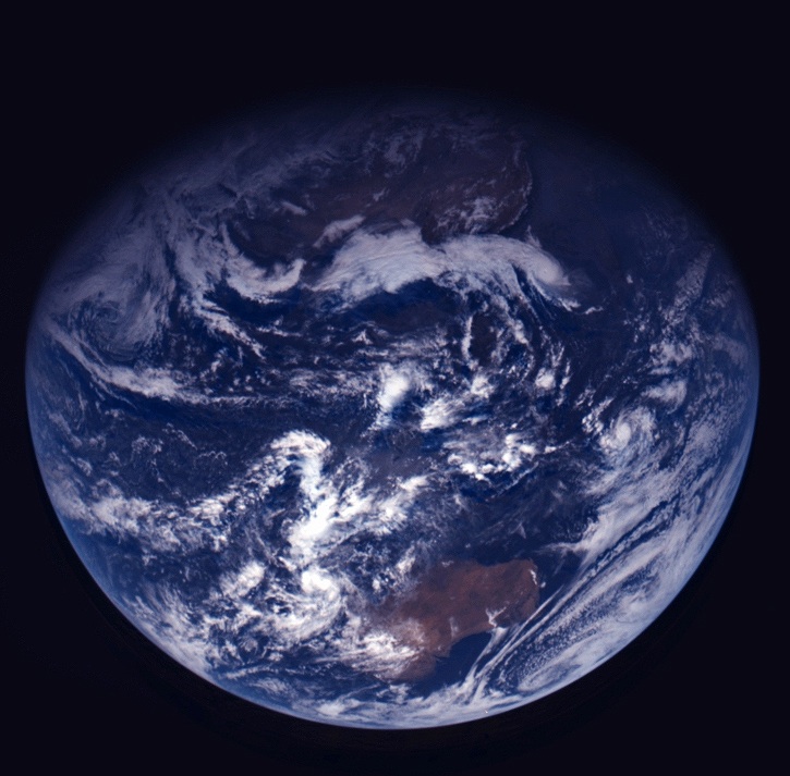
But to complicate matters a little, the diameter of Earth – i.e. how big it is from one end to the other – varies depending on where you are measuring from. Since the Earth is not a perfect sphere, it has a different diameter when measured around the equator than it does when measured from the poles. So what is the Earth’s diameter, measured one way and then the other?

Oblate Spheroid:

Thanks to improvements made in the field of astronomy by the 17th and 18th centuries  – as well as geodesy, a branch of mathematics dealing with the measurement of the Earth – scientists have learned that the Earth is not a perfect sphere. In truth, it is what is known as an “oblate spheroid”, which is a sphere that experiences flattening at the poles.

Data from the Earth2014 global relief model, with distances in distance from the geocentre denoted by color. Credit: Geodesy2000

According to the 2004 Working Group of the International Earth Rotation and Reference Systems Service (IERS), Earth experiences a flattening of 0.0033528 at the poles. This flattening is due to Earth’s rotational velocity – a rapid 1,674.4 km/h (1,040.4 mph) – which causes the planet to bulge at the equator.

Equatorial vs Polar Diameter:

Because of this, the diameter of the Earth at the equator is about 43 kilometers (27 mi) larger than the pole-to-pole diameter. As a result, the latest measurements indicate that the Earth has an equatorial diameter of 12,756 km (7926 mi), and a polar diameter of 12713.6 km (7899.86 mi).

In short, objects located along the equator are about 21 km further away from the center of the Earth (geocenter) than objects located at the poles. Naturally, there are some deviations in the local topography where objects located away from the equator are closer or father away from the center of the Earth than others in the same region.

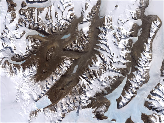
The most notable exceptions are the Mariana Trench – the deepest place on Earth, at 10,911 m (35,797 ft) below local sea level – and Mt. Everest, which is 8,848 meters (29,029 ft) above local sea level. However, these two geological features represent a very minor variation when compared to Earth’s overall shape – 0.17% and 0.14% respectively.

Meanwhile, the highest point on Earth is Mt. Chiborazo. The peak of this mountain reaches an attitude of 6,263.47 meters (20,549.54 ft) above sea level. But because it is located just 1° and 28 minutes south of the equator (at the highest point of the planet’s bulge), it receives a natural boost of about 21 km.

Mean Diameter:

Because of the discrepancy between Earth’s polar and equatorial diameter, astronomers and scientists often employ averages. This is what is known as its “mean diameter”, which in Earth’s case is the sum of its polar and equatorial diameters, which is then divided in half. From this, we get a mean diameter of 12,742 km (7917.5 mi).

The difference in Earth’s diameter has often been important when it comes to planning space launches, the orbits of satellites, and when circumnavigating the globe. Given that it takes less time to pass over the Arctic or Antarctica than it does to swing around the equator, sometimes this is the preferred path.

We have written many interesting articles about the Earth and mountains here at Universe Today. Here’s Planet Earth, The Rotation of the Earth, What is the Highest Point on Earth?, and Mountains: How Are They Formed?

Here’s how the diameter of the Earth was first measured, thousands of years ago. And here’s NASA’s Earth Observatory.

We did an episode of Astronomy Cast just on the Earth. Give it a listen, Episode 51: Earth.

Sources:

How Long is a Year on Earth?

The eccentricity in Mars' orbit means that it is . Credit: NASA

A year on Earth is obviously 1 year long, since it’s the standard of measurement. But we can break it down further.

A year is 365.24 days. Or 8,765 hours, or 526,000 minutes, or 31.6 million seconds.

The tricky one is the number of days. Because the earth year doesn’t work out to exactly 365 days, we have the leap year. If we didn’t, days in the calendar wouldn’t match up with the position of the Earth in its orbit. Eventually, the months would flip around, and the northern hemisphere would have summer in January, and vice versa.

To fix this, we put on extra days in some years, called leap years. In those leap years, a year lasts 366 days, and not the usual 365. This gets tacked onto the end of February. Normally, February only has 28 days, but in leap years, it has 29 days.

When to you have leap years? It’s actually pretty complicated.

The basic rule is that you have a leap year if you can divide the year by 4. So 2004, 2008, etc. But years divisible by 100 are not leap years. So 1800, 1900 aren’t leap years. Unless they’re divisible by 400. So 1600 and 2000 are leap years. By following this algorithm, you can have an Earth orbit that lasts 365.24 days.

With the current system, it’s not actually perfect. There’s an extra 0.000125 days being accumulated. Over course of 8,000 years, the calendar will lose a single day.

Here’s an article about how astronomers might use cosmic rays to measure time on Earth.

And here is more information on how to calculate leap years from timeanddate.com.

We did an episode of Astronomy Cast just on the Earth. Give it a listen, Episode 51: Earth.

What is the Driest Place on Earth?

Dry Valleys. Image credit: NASA

The driest place on Earth is in Antarctica in an area called the Dry Valleys, which have seen no rain for nearly 2 million years. There is absolutely no precipitation in this region and it makes up a 4800 square kilometer region of almost no water, ice or snow. Water features include Lake Vida, Lake Vanda, Lake Bonney and the Onyx River. There is no net gain of water. The reason why this region receives no rain is due to Katabatic winds, winds from the mountains that are so heavy with moisture that gravity pulls them down and away from the Valleys.

One feature of note is Lake Bonney, a saline lake situated in the Dry Valleys. It is permanently covered with 3 to 5 meters of ice. Scientists have found mummified bodies of seals around the lake. Lake Vanda, also in the region, is 3 times saltier than the ocean. Temperatures at the bottom of this lake are as warm as 25 degrees Celsius.

The next driest place in the world measured by the amount of precipitation that falls is the Atacama Desert in Chile and Peru. There are no glaciers that are feeding water to this area; and thus, very little life can survive. Some weather stations in this region have received no rain for years, while another station reports an average of one millimeter per year.

Lowest Point on Earth

The Dead Sea from space. Image credit: NASA

The lowest point on land is the Dead Sea that borders Israel, the West Bank and Jordan. It’s 420 meters below sea level.

The Dead Sea sits on top of the Dead Sea Rift, a tectonic fault line between the Arabian and the African plates. The movement of these plates causes the Dead Sea to sink about one meter per year! The Dead Sea used to be connected to the Mediterranean Ocean, but over a geologic time scale, it became cut off and evaporation concentrated the salt in the water so that today, the Dead Sea is 30 to 31 percent mineral salts. It has the highest level of salinity of any body of water in the world. Just a side note, I’ve had a chance to swim in the dead sea, and it’s one of the strangest experiences I’ve ever had.

The lowest point on land in the Western Hemisphere is Death Valley in California at 86 meters below sea level.

The lowest point on the Earth’s crust is the Mariana’s Trench in the North Pacific Ocean. It is 11 kilometers deep. Like many of Earth’s extremes, the Mariana’s Trench is caused by the Pacific tectonic plate subducting beneath the Philippine plate; this means that the Pacific Plate is sliding underneath the Philippine plate. The point where the Philippine plate overlaps is Mariana’s Trench.

Could Humans Move the Earth?

When people learn that energy output from the Sun is increasing, and will boil away the planet’s oceans within a billion years, they wonder if there’s any way to stop the process. Obviously, we can’t stop the Sun from shining and increasing its energy output. But is there a way humans could move the Earth further away from the Sun?

The answer is yes. Well, it’s theoretically possible. Not with today’s technology, and not without an enormous amount of energy, but the laws of physics say it’s possible. In fact, nature does it all the time.

The trick is to replicate a natural process called a 3-body interaction. This is what happens when you have nice orbit perturbed by a 3rd object. In this case, we’ve got the Earth nicely orbiting the Sun. But if we could have an asteroid pass by the Earth in just the right way, its gravity would pull our planet out of its orbit just a tiny bit.

Instead of its current elliptical orbit, the Earth would start to spiral outward from the Sun, slowly drifting further and further away. This is very similar to how the Moon is slowly drifting away from the Earth.

If you timed things right, and used several asteroid passes, you could make the Earth spiral outward as the Sun’s energy output is increasing. Instead of getting roasted, we would slowly drift away from the Sun, matching the expanding habitable zone. This would give life on Earth billions more years, instead of a few hundred million.

Of course, playing pool with asteroids is a dangerous game. Give an asteroid the wrong trajectory and it could crash into our planet and end humanity in an instant. And if you get the calculations wrong, you could end up spiraling the Earth away from the Sun too quickly, and freeze the planet. You’ve got to get it just right.

How Far Down is the Center of the Earth?

Cut away of planet Earth

Everyone has wanted to dig a hole down to the center of the Earth at some time in their lives. I think I was in the 3rd grade, and my friends and I tried to dig down as far as we could go. I never told them my goal, but in my heart, we were going all the way through. In the end we actually got down about 2 meters, but the bottom kept filling in with water.

Of course, digging down to the centre of the Earth was always out of reach.

In order to be able to dig down to the center of the Earth, my friends and I would have needed to dig our way through 6,378 km of rock, mantle, and iron. Most of this journey would be through temperatures hot enough to melt rock, getting as high as 7,000 Kelvin at the center.

The first 35 km or so of digging would be through the outer crust of the Earth. Assuming we could actually get through the solid rock, and keep water from filling back into our super deep hole, we might actually be able to make some progress through this.

Temperatures rise as you get deeper, though. One of the deepest mines in the world is the TauTona gold mine in South Africa, a mere 3.6 kilometers deep. Even though this just scratches the surface of the Earth, temperatures at the bottom of TauTona already get as high as 55°C.

Once you break through the crust, you’re into the Earth’s mantle. At this point, you’re looking at about 3,000 km of rock heated to such a high temperature that it’s a liquid. Volcanoes are points on the Earth when magma from the mantle breaks through to the surface.

How we’d dig through that… I have no idea. But let’s say we could.

Then we’d break through into the core of Earth. This region extends for another 3,500 km or so, and its comprised almost entirely of iron, with a little nickel, and some other trace metals. And it’s even hotter than the mantle above it. This is where temperatures get to 7,000 Kelvin. Assuming we could bore through the iron, and could withstand the heat, we could get down to the center of the Earth.

At this point, we would have traveled 6,378 km to complete our journey. And then another 6,378 km to get through the other side and visit the folks in China.

Sources:
http://en.wikipedia.org/wiki/Earth_radius
http://en.wikipedia.org/wiki/TauTona_Mine
http://en.wikipedia.org/wiki/Mantle_%28geology%29

Temperature of Mars

Temperature of Mars
What is the Temperature of Mars? Image credit: NASA/JPL

[/caption]
Mars is farther from the Sun than the Earth, so, as you would expect, the temperature of Mars is colder. For the most part it is very cold on Mars. The only exception is during the summer days close to or at the equator. Even at the equator, the night time temperatures fall well below zero. On those summer days, it can be around 20 degrees Celsius then plummet to -90 C at night.

Mars follows a highly elliptical orbit, so temperatures vary quite a bit as the planet travels around the Sun. Since Mars has an axial tilt similar to Earth’s(25.19 for Mars and 26.27 for Earth), the planet has seasons as well. Add to that a thin atmosphere and you can see why the planet is unable to retain heat. The Martian atmosphere is over 96% carbon dioxide. If the planet had an atmosphere to retain heat, the carbon dioxide would cause a greenhouse effect that would heat Mars to jungle like temperatures.

Scientist know the current temperature of Mars, but what about the past. Rovers and orbiters have returned images that indicate erosion patterns that can only be caused by liquid water. That would seem to indicate that Mars was once much warmer and wetter. Here on Earth, those features would have been covered in soil after a few million years. So, was Mars warmer just a few million years ago? No, Mars has been a frigid planet for at least 3 billion years and some scientist believe it has been frozen for 4 billion years. The erosion features have not disappeared because there is no current liquid water or plate tectonics to change the landscape. What wind there is, does not seem strong enough to further erode the surface.

Tracking the presence of warmer weather and liquid water on Mars is important for a few reasons. One is that liquid water is essential for the evolution of life as we know it. Some scientists still hold out hope that there is microbial life deep beneath the surface where it is warmer and water may exist. Secondly, if humans are to ever explore the planet, they would need a water source. A human mission would take nearly two years to complete and storage space would be limited. Water ice may be melted upon arrival then purified, but finding a supply of liquid water would be even more expedient.

The temperature of Mars is a minor obstacle to early human exploration, while water is more pressing. Current spacesuits would survive the surface temperatures. Now, all we have to do is find a way to get there and back without having to spend two years in a cramped modern spacecraft.

Here’s news that Mars has probably been cold for billions of years, and more information about Mars, and just how cold it gets.

Here’s an overview of temperatures on Mars. Mars News has more info on Mars.

Finally, if you’d like to learn more about Mars in general, we have done several podcast episodes about the Red Planet at Astronomy Cast. Episode 52: Mars, and Episode 91: The Search for Water on Mars.

Sources:
http://www-k12.atmos.washington.edu/k12/resources/mars_data-information/temperature_overview.html
http://www.nasa.gov/multimedia/imagegallery/image_feature_1160.html
http://solarsystem.nasa.gov/planets/profile.cfm?Object=Mars&Display=Facts

Mars Tilt

Mars Ice Age.
Mars Ice Age.

Of all the features of Mars, its axial tilt is most similar to Earth. Mars’ tilt is 25 degrees, just a fraction away from the Earth’s 23.5 degrees. And because of this tilt, Mars has seasons, just like the Earth. Of course, since Mars takes twice as long as Earth to orbit the Sun, the seasons are twice as long.

Mars also has a very elliptical orbit. Because of this, the difference between its closest and most distant point along its orbit vary by 19%. This extreme difference makes the planet’s southern winters long and extreme. The northern winters aren’t as long or cold.

Astronomers know that the current tilt of Mars’ axis is just a fluke. Unlike Earth, the planet’s tilt has changed dramatically over long periods of time. In fact, astronomers think that the wobble in the tilt might help explain why vast underground reservoirs of water ice have been found at mid-latitudes, and not just around the planet’s poles. It’s possible that in the distant past, Mars was tilted at a much more extreme angle, and the ice caps were able to grow across the planet. When the tilt was less extreme, the ice remained, and was covered by a layer of dust.

Researchers have developed a model that accounts for the advance and retreat of the subsurface Martian ice sheets over 40 ice ages and 5 million years.

Here’s an article that explains how scientists track the Martian equator in the past. And the lopsided ancient oceans on Mars are explained by its tilt in the past.

Here’s some information about the tilt and seasons on Mars from MSSS. And the Wikipedia article about timekeeping on Mars.

Finally, if you’d like to learn more about Mars in general, we have done several podcast episodes about the Red Planet at Astronomy Cast. Episode 52: Mars, and Episode 91: The Search for Water on Mars.

Mars Dust Storms


Mars dust storms are much different than the dust devils that many people have seen in images sent back from the planet. On Mars a dust storm can develop in a matter of hours and envelope the entire planet within a few days. After developing, it can take weeks for a dust storm on Mars to completely expend itself. Scientists are still trying to determine why the storms become so large and last so long.

All Mars dust storms are powered by sunshine. Solar heating warms the Martian atmosphere and causes the air to move, lifting dust off the ground. The chance for storms is increased when there are great temperature variations like those seen at the equator during the Martian summer. Because the planet’s atmosphere is only about 1% as dense as Earth’s only the smallest dust grains hang in the air.

Surprisingly, many of the dust storms on the planet originate from one impact basin. Hellas Basin is the deepest impact crater in the Solar System. It was formed more than three billion years ago during the Late Bombardment Period when a very large asteroid hit the surface of Mars. The temperatures at the bottom of the crater can be 10 degrees warmer than on the surface and the crater is deeply filled with dust. The difference in temperature fuels wind action that picks up the dust, then storm emerge from the basin.

The dust storms were of great concern when probes were first sent to Mars. Early probes happened to arrive in orbit during large events. The Viking missions of 1976 easily withstood two big dust storms without being damaged. They were not the first missions to survive Martian dust storms. In 1971, Mariner 9 arrived at Mars during the biggest dust storm ever recorded. Mission controllers simply waited a few weeks for the storm to subside, then carried on with the mission. The biggest issue that rovers face during a dust storm is the lack of sunlight. Without the light, the rovers have trouble generating enough power to keep their electronic warm enough to function.

Mars dust storms are of great interest to scientists. Even though several spacecraft have observed the storms first hand, scientists are no closer to a definitive answer. For now, the storms on Mars are going to continue to present challenges to planning a human mission to the planet.

Here’s an article describing how the dust storms threatened the Mars rovers, and another discussing how electrical dust storms could make life on Mars impossible.

Here’s one of the best articles from NASA about the dust storms, and another gallery from NASA/JPL.

Finally, if you’d like to learn more about Mars in general, we have done several podcast episodes about the Red Planet at Astronomy Cast. Episode 52: Mars, and Episode 91: The Search for Water on Mars.

Sources:
http://science.nasa.gov/science-news/science-at-nasa/2003/09jul_marsdust/
http://www.jpl.nasa.gov/news/news.cfm?release=2007-080
http://science.nasa.gov/science-news/science-at-nasa/2001/ast16jul_1/

Mars Rotation

Mars, just a normal planet. No mystery here... (NASA/Hubble)

Mars rotation is 24 hours, 39 minutes, and 35 seconds if you are interested in the solar day or 24 hours, 37 minutes and 22 seconds for the sidereal day. Since the planet only rotates about 40 minutes slower than Earth, this is one category where the two planets are not very different. Mars, like all of the planets except Venus, rotates in prograde(counter clockwise). The planet has a rotational speed of 868.22 km/h at the equator. The similarity if the length of the day allows the engineers as NASA to switch their day to a ”Mars day” when they are working with rovers on the planet. This maximizes their time with the equipment, but drastically changes their actual Earth schedule. They end up working an ever changing day as the Martian/Earth day difference accumulates.

Mars is a well studied planet. As a matter of fact, it is the best understood planet in our Solar System other than our own. There are currently(July 2011) 6 missions either in orbit or on the planet’s surface. With all of the data accumulated, Mars rotation is only one of thousands of facts known about the planet. Here are a few more.

Multiple missions to Mars have found evidence of water ice and carbon dioxide ice under the planet’s surface. How do scientists know the difference? When the ice is exposed to the Martian atmosphere, carbon dioxide ice(dry ice) will melt and vaporize quickly, in one day or less. Water ice will take up to four days. The other way is to heat a sample in one of the tiny ovens aboard a rover. The spectrometer on the rover will then be able to detect H2O in the gases that the sample releases.

Mars has a reddish appearance because it is covered in rust. Well, iron oxide dust. That dust is every where. Mars has large dust storms that can sometimes cover the entire planet, so that dust is in the air as well. During global dust storms it is impossible to optical observe the surface.

Mars has not had plate tectonics for billions of years, if ever. The lack of plate movement allowed volcanic hotspots to spew magma onto the surface for millions of consecutive years. Because of these uninterrupted eruptions, there are many large volcanic mountains on Mars. Olympus Mons, on Mars, is the largest mountain in the Solar System.

Those are just a few teaser facts. I wish I had more space to keep going, but we have hundreds of more articles about Mars here on Universe Today and do not forget to check out NASA’s website. Good luck with your research.

Here’s an article about how crater impacts measure the ancient equator of Mars. How long is a day on Mars?

Enjoy some Mars facts from NASA, and Hubblesite’s News Releases about Mars.

Finally, if you’d like to learn more about Mars in general, we have done several podcast episodes about the Red Planet at Astronomy Cast. Episode 52: Mars, and Episode 91: The Search for Water on Mars.

Source: NASA