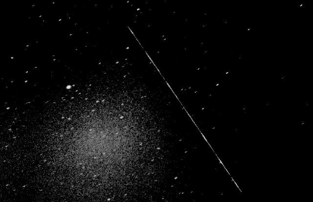
There are already tens of thousands of pieces of large debris in orbit, some of which pose a threat to functional satellites. Various agencies and organizations have been developing novel solutions to this problem, before it turns into full-blown Kessler Syndrome. But many of them are reliant on understanding what is going on with the debris before attempting to deal with it. Gaining that understanding is hard, and failure to do so can cause satellites attempting to remove the debris to contribute to the problem rather than alleviating it. To help solve that conundrum, a new paper from researchers at GMV, a major player in the orbital tracking market in Europe, showcases a new algorithm that can use ground-based telescopes to try figure out how the debris is moving before a deorbiter gets anywhere near it.
One of the most dangerous parts of dealing with out-of-control debris is figuring out how it is “tumbling”. This feature is particularly hard to resolve from the ground, since most space telescopes aren’t able to pick up more than a single pixel of even the largest pieces of debris. Therefore, researcher rely on another familiar astronomical feature - a light curve.
A light curve is a plot of the brightness of an object over time. In traditional astronomy, its used to track star activity or the transit of an exoplanet in front of its parent star. In this case, as a piece of debris tumbles, different parts of its reflect sunlight differently. For example, solar panels would reflect less sunlight than a shiny metal box that houses the electronics. As the light changes over time, it could show how rapidly the object is turning, and potentially in what direction.
With a sufficiently long light curve, solving for the variables describing a satellite’s spin becomes a math problem. In particular, it becomes a type known as an inverse problem. Inverse problems have a whole field of mathematics and engineering devoted to solving them, as they are useful in everything from food production to robotic control. However, this particular use case has a couple of confounding factors.
First, there can be massive changes in the light curve from relatively small changes in the satellite’s angle, making it “glint” in the eyes of the algorithm. That kind of abrupt change can throw off the algorithm, making it hard to find a correct movement estimation. Second, for some satellites there are several orientations that could look the same in a light curve - differentiating between those would be difficult, even for an inverse problem solution. Third, one of the standard ways of solving them, known mathematically as an “Unscented Kalman Filter” (UKF), fails unless the guess of the initial orientation of the satellite is within 5° of the true orientation.
Fraser discusses space debris and the danger it poses.To account for those difficulties, the GMV researchers developed a five-step pipeline in an algorithm they called AISwarm-UKF. First, they don’t rely on a single “guess” of what the orientation of the satellite is and then try to find what the best solution is. They start with thousands of potential “particles” that are oriented in all possible ways and use a statistical technique called Bayesian inference to narrow down those starting “particles” to those that most closely match the light curve.
Once done, the next step is to make sure the system isn’t wasting computational resources on bad guesses. It does this by “Systematic Resampling” - essentially duplicating high probability “particles” in the simulation while eliminating low-probability ones. A third step takes this process even further, by using a technique they call Particle Swarm Optimization. This drives the particles to a “best solution”, where the solution to the inverse function is minimized.
To understand what exactly that means, it's best to understand what exactly an inverse problem is. The purpose of inverse problem solutions is to find an “absolute minima” of a graphed line. In many instances, a “solver” algorithm will get stuck in what is known as a “local minima”. Think of a ski hill, with a dip in the middle of it before it continues down the rest of the hill. If that dip is deep enough, it can trick an inverse problem solver into thinking it’s found the best solution, while in fact the absolute minimum is in a completely different part of the “solution space”.
Fraser also discusses how to clean up that debris.The last few steps of the AISwarm-UKF algorithm are designed to make sure the solution doesn’t get stuck in a “local minima”, providing an incorrect answer. The next step, which acknowledges that there might be more tha one “correct” answer to the inverse problem, uses another algorithm called Density-Based Spatial Clustering to group sets of particles that are clustering around valid answers together. Since the “symmetry” of the satellite makes it hard to differentiate a between two different rotations that have similar light curves, this “clustering” step allows users to narrow down where exactly the potential solutions are. A final step, the actual Kalman filter, then uses these clustered groups as a starting point - allowing it to more accurately estimate the true “solution”, though it might think there is more than one of them.
To prove this pipeline works, the researchers ran an experiment on a simulated satellite with an artificially constructed light curve created by Grail, a simulation tool also developed at GMV. One notable difference was that having stereoscopic vision (i.e. light curves from two different ground-based telescopes) eliminated much of the ambiguity that symmetry introduced into the algorithm solution. Which makes sense, given that the light curves would be slightly different based on the geographical location of the ground-based telescopes, giving slightly different light curves that can be differentiated.
Ultimately, this algorithm will likely be wrapped up in a software package that GMV provides to its customers, such as the German Space Situational Awareness Center and the Spanish Space Agency. As debris becomes more and more of a problem for the operation of existing satellites, tools like AISwarm-UKF will become more and more valuable in helping to track and dispose of the threat. Even if it is a commercial software, it's good to still have this tool for when we need it.
Learn More:
J. Rubio et al - Attitude Estimation of Uncontrolled Space Objects: A Bayesian-Informed Swarm Intelligence Approach
UT - There's a Cloud of Space Debris Around Earth. Here's how we Could get a Better Picture of it
UT - A new Method to Capture High-Resolution Images of Space Debris
