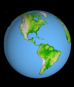
Image credit: NASA
NASA has released a new image of the entire Earth based on images taken during the Shuttle Radar Topography Mission. The global data set greatly improves maps of the Earth’s surface between 60-degrees North and South of the equator – 80% of the globe. Previous maps of the United States have a similar resolution as the SRTM30 data – about 1 km – but the rest of the world is often inaccurate. SRTM is capable of producing even higher-resolution maps, down to 30 metres.
A brand new look and understanding of the place we call home. That’s what you’ll get in a complete global topographic data set generated by NASA and the National Imagery and Mapping Agency (NIMA).
Produced by the Shuttle Radar Topography Mission, the global data set, called “SRTM30,” greatly improves maps of Earth’s land mass located between 60 degrees north and 60 degrees south of the equator. That’s roughly from the southern tip of Greenland to below the southern tip of South America.
Until now, the primary source of digital elevation data for scientists and analysts involved in global studies has been the U.S. Geological Survey’s “GTOPO30,” published in 1996, it consists of elevation measurements spaced every 30-arc-seconds. An arc-second is a measure of latitude and longitude used by geographers that corresponds to about 30.9 meters, or 101.4 feet, at the equator. This allows identification of features roughly the size of Disneyland in California. The SRTM30 map matches the GTOPO30 resolution, but with its seamless quality, the map represents a leap in global-scale accuracy.
“SRTM30 is a powerful demonstration of the benefits which accrue from NASA’s human space flight program and satellite radar mapping technology,” said John LaBrecque, manager, Solid Earth and Natural Hazards Program, NASA Headquarters, Washington.
“The quality of previous maps of the Earth varied considerably, because they were compiled from various data gathered by generations of explorers and surveyors. In some places these maps are inaccurate. Using NASA technology, six Space Shuttle astronauts mapped 80 percent of Earth’s land surface in just 10 days to produce the first 3-D map of the Earth’s surface at a known and uniform accuracy,” he said.
The need for accurate topographic maps is everywhere from planning a hike to building a new highway. Knowing the exact shape and location of mountain peaks and river valleys is as important to the safe and efficient flight of aircraft as it is to the management of water resources and the control of forest fires.
Newly released images, representing the new SRTM30 data products, depict Earth in two ways: as an image with all the continents shown (a common map-making method known as a Mercator projection); and as three globe images of Earth as viewed from points in space centered over the Americas, Africa and the western Pacific. Two visualization methods were combined to produce the images: shading and color-coding of topographic height. The shaded image was derived by computing topographic slope in the northwest-southeast direction, so northwest slopes appear bright and southeast slopes appear dark. Color-coding depicts the lowest elevations in green, rising through yellow and tan, to white at the highest elevations.
The SRTM30 map is one of a series of land surface products emerging from the very successful Shuttle Radar Topography Mission (SRTM). SRTM has produced more detailed topographic data for North and South America that resolves features approximately 90 feet square, or 10 times the global SRTM30 database.
The SRTM data were processed at NASA’s Jet Propulsion Laboratory, Pasadena, Calif., into research-quality digital elevation data. NIMA is providing additional processing to develop official mapping products. The U.S. Geological Survey Earth Resources Observation Systems Data Center in Sioux Falls, S.D. provides final archiving and distribution of the SRTM data products.
The SRTM mission is a cooperative project of NASA, NIMA, German and Italian space agencies. The project is part of NASA’s mission to understand and protect our home planet.
The new images are available on the JPL Planetary Photojournal at:
http://photojournal.jpl.nasa.gov/catalog/PIA03394
http://photojournal.jpl.nasa.gov/catalog/PIA03395
http://photojournal.jpl.nasa.gov/catalog/PIA03396
Information about the Shuttle Radar Topography Mission is available at:
http://www.jpl.nasa.gov/srtm/
Original Source: NASA News Release
