Latest From Mars: Frosty Landscapes, Ancient Lakebed, Potential Landing Site
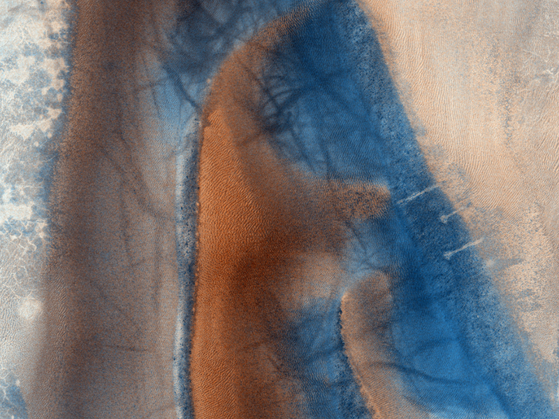
A new batch of images has been released by the HiRISE camera on the Mars Reconnaissaince Orbiter and –as usual — they are stunning. In the image above, there is a lot going on! Numerous dust devil tracks have left their criss-crossing marks on the dune field found in Richardson Crater. The dunes are covered by seasonal carbon dioxide frost, which has only partially defrosted, although the image was acquired late in Mars’ southern spring. There are channels carved into the ground and HiRISE scientists says the could have been created by blocks of carbon dioxide ice (dry ice) slide down the slope and sublimate (evaporate directly from solid to gas). Wouldn’t that be fun to be there and watch happen!
See more of the “coolest” and latest Mars images from HiRISE below:
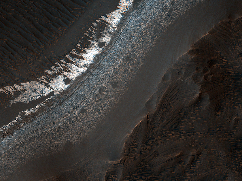
This image shows what could have been a once-habitable ancient lake on Mars, and a never-before-seen impact “megabreccia” in Holden Crater. The megabreccia is topped by layers of fine sediments that formed in what apparently was a long-lived, calm lake that filled Holden crater on early Mars, HiRISE scientists say.
“Holden crater has some of the best-exposed lake deposits and ancient megabreccia known on Mars,” said HiRISE’s principal investigator, professor Alfred McEwen of the UA’s Lunar and Planetary Laboratory. ”Both contain minerals that formed in the presence of water and mark potentially habitable environments. This would be an excellent place to send a rover or sample-return mission to make major advances in understanding if Mars supported life.“
Holden Crater is an impact crater that formed within an older, multi-ringed impact basin called Holden Basin. Before an impact created Holden crater, large channels crossed and deposited sediments in Holden Basin. While water certainly flowed over the planet later in its history, it may have flowed only in short-lived, or catastrophic events.
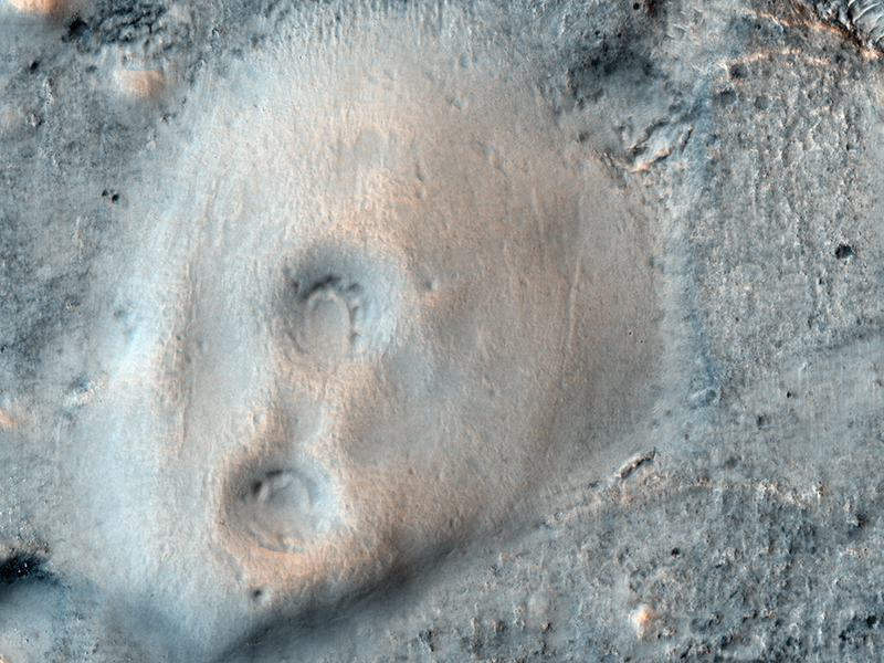
Will a future spacecraft touch down at this location? Acidalia Planitia has several mounds thought to be “mud” volcanoes. Mud volcanoes are geological structures formed when a mixture of gas, liquid and fine-grained rock (or mud) is forced to the surface from several meters to kilometers underground. Scientists are targeting these mud volcanoes because the sediments, brought from depth, could contain organic materials that might provide evidence for possible past and present microbial life on Mars.
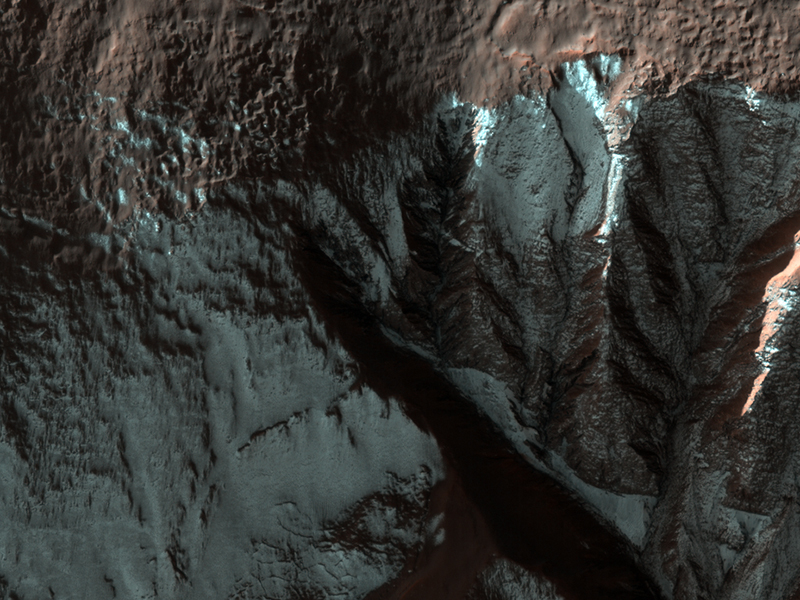
Here are some frosty gullies in a crater in Terra Sirenum in the Southern hemisphere of Mars, and HiRISE scientists say the frost is likely water frost instead of of CO2 frost because temperatures at this latitude probably do not get cold enough for carbon dioxide to condense.
The formation of gullies on Mars have been a point of disagreement among planetary scientists, as several theories support erosion by liquid water, while others favor dry debris flows or carbon dioxide. A major unknown is, said Kelly Kolb at the HiRISE site, if the gullies are formed by liquid water, does the water originate from the surface or subsurface?
“Dendritic structures, such as those seen in the alcove displayed in the subimage (approximately 1.3 km across; 2560 x 3000, 7MB), form from surface runoff on Earth,” Kolb wrote. “Water originating in the subsurface would not produce a structure like this. This alcove is evidence for a surface source for the water possibly required to form gullies.”
Kolb also noted that on this images, gullies occur at multiple elevations along the same crater wall. “This is uncommon on Mars. Gullies, whether or not they are found in conjunction with an obvious horizontal layer, usually form at the same elevation on a given slope. It is unknown what caused these gullies to form at multiple elevations. Their locations are suggestive of a distributed water source, which also favors a surface, rather than a confined subsurface origin of water, such as an aquifer.”
Recent Posts
Fish Could Turn Regolith into Fertile Soil on Mars
What a wonderful arguably simple solution. Here’s the problem, we travel to Mars but how…
New Simulation Explains how Supermassive Black Holes Grew so Quickly
One of the main scientific objectives of next-generation observatories (like the James Webb Space Telescope)…

Don't Get Your Hopes Up for Finding Liquid Water on Mars
In the coming decades, NASA and China intend to send the first crewed missions to…
Webb is an Amazing Supernova Hunter
The James Webb Space Telescope (JWST) has just increased the number of known distant supernovae…
Echoes of Flares from the Milky Way’s Supermassive Black Hole
The supermassive black hole at the heart of our Milky Way Galaxy is a quiet…
Warp Drives Could Generate Gravitational Waves
Will future humans use warp drives to explore the cosmos? We're in no position to…