[/caption]
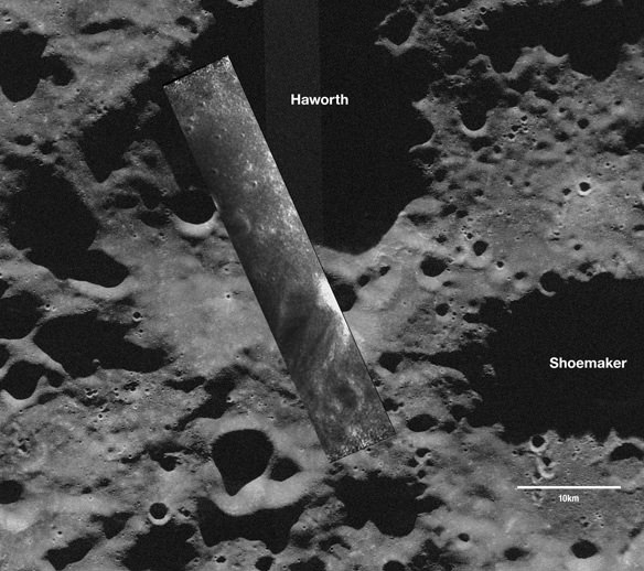
A few “new” images have been released from the Chandrayaan-1 lunar orbiter mission. The latest are the first images from NASA’s radar instrument that’s hitching a ride on board the Indian Space Research Organization’s (ISRO) spacecraft. Called the Mini-SAR (synthetic aperture radar), NASA’s instrument recently passed initial in-flight tests and sent back its first data from Nov. 17, 2008, showing the first look inside one of the Moon’s coldest, darkest craters. The image above shows a swath from the Mini-SAR overlaid on a ground-based telescope image of Haworth Crater. The swath shows the floor of this permanently-shadowed polar crater on the moon that isn’t visible from Earth. The instrument will map both polar regions to search the insides of craters for water ice.
“The only way to explore such areas is to use an orbital imaging radar such as Mini-SAR,” said Benjamin Bussey, deputy principal investigator for Mini-SAR, from the Johns Hopkins University Applied Physics Laboratory. “This is an exciting first step for the team which has worked diligently for more than three years to get to this point.”
Bright areas represent surface roughness or slopes pointing toward the spacecraft. The data cover an area approximately 50 kilometers (31 miles) by 18 kilometers (11 miles).
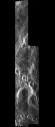
Two more radar swaths from the Moon’s north pole have been stitched together to show the western rim of Seares crater. The mosaic covers an area roughly 80 kilometers (50 miles) long by 20 kilometers (12.5 miles) wide.
“During the next few months we expect to have a fully calibrated and operational instrument collecting valuable science data at the moon,” said Jason Crusan, program executive for the Mini-RF Program, which also includes a radar instrument on the upcoming Lunar Reconnaissance Orbiter mission
Mini-SAR is one of 11 instruments on Chandrayaan 1. Not setting any speed records in making the images available to the public, a few other images were recently released that were also taken in November 2008. Mission managers have had to deal with the spacecraft overheating slightly due to orbiting in almost continual sunlight, and therefore they decided to use only one instrument at a time. Normal operations should begin soon, where all the instruments will be able to function normally and together.
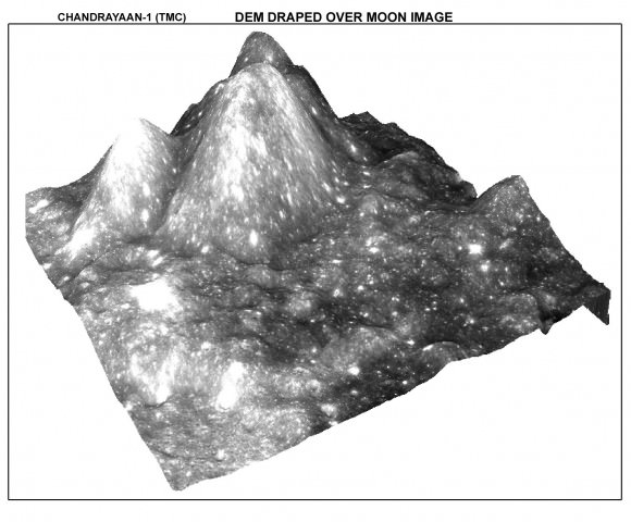
This Digital Elevation Model of the lunar surface was generated by using imagery from India’s Terrian Mapping Camera. The TMC will map topography on both sides of the Moon and prepare a 3-dimensional atlas with high spatial and altitude resolution.
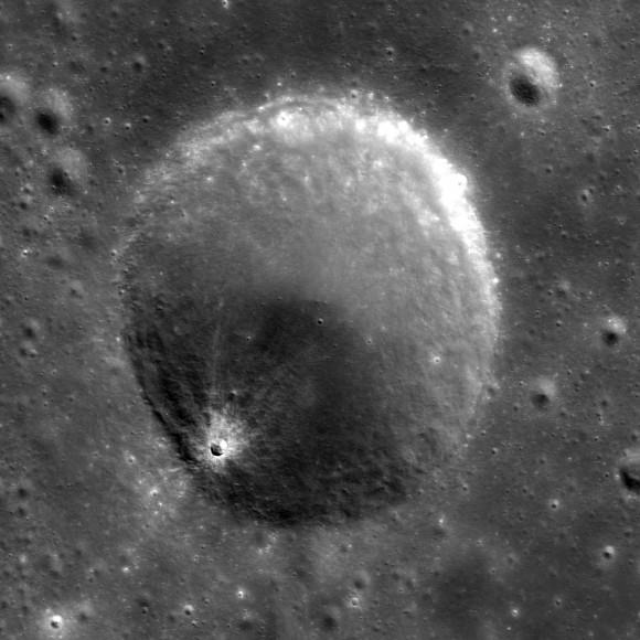
This image, also from the TMC, shows details of a lunar crater.
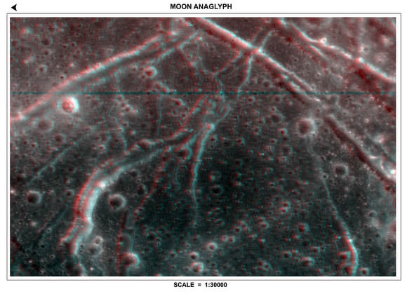
Here’s one of several 3D images of different regions of lunar surface captured by TMC. By looking through 3D glasses, you get a grasp of the height of features shown here. More 3D anaglyph images are available on the ISRO site.
Chandrayaan-1 launched from India on Oct. 21, 2008 and began orbiting the moon Nov. 8.
Sources: NASA, ISRO,

wouldnt it be great if they took a picture of the american flag. it would rule out all doubt
Trust me those conspiracy theorists wouldn’t even believe it when they at standing next to the flag on the Moon. They would come up with some wierd theory that someone planted that there 5 minutes before.
The same would be true if you give them images of the flag, they would invent some theory that it was digitally manipulated.
i think u are right. but anyways. it shouldnt be that hard to get the picture. many non belivers would wake up i think
Hey can these Indians release any of there own infromation or data ? finally somebody else goes to the moon and we only get the NASA data out… Is it some secret mission to charm snakes or climb up a rope out of a basket???….. Did we outsorce a mission just to fly a SAR…. No wait, a US school outsorced a moon mission for less it costs to launch a march madness venue.
That might wake up the Americans…….
Bill, the Terrain Mapping Camera (TMC) was designed and built by Indian (meaning someone from the country of India) Scientists working at the Indian (ditto) Space Research Organisation. (ISRO)
I know how you feel kenn , those CT’s piss me off also.
It would be of great benefit to us if useful quantity’s of water ice where to be found, I hope they do find some.
To be honest, I am really impressed by the ground based image. Awsome reolution given the 10 km scale bar. Some of the smaller craters that are clearly resolved are less than 500 meters across.
Any info on the set up that took the image?
“Bill, the Terrain Mapping Camera (TMC) was designed and built by Indian (meaning someone from the country of India) Scientists working at the Indian (ditto) Space Research Organisation. (ISRO)”
Not to mention that China and Japan have their own Lunar orbiting probes at the moment too, and what they do with their data is purely up to them
(indeed, as the Japanese satellite is capable of what we’ve come to call ‘high-definition’ video, I believe they’re hanging onto that for possible commercial release, rather than just give it away…)
“The same would be true if you give them images of the flag, they would invent some theory that it was digitally manipulated.”
And it’s likely that neither India nor the others, feel a need to go out of their way to confirm Apollo landings whose occurrence they don’t question, they’re there to learn something new.
As far a people in Hiroshima say, NASA landed men on the moon in the late 60’s and they dont need pictures and also note nobody has come close since. SNAKE CHARMING…… eat sushi dot heads. JSA
I don’t think the flag has any colours any more as the nylon has probably been bleached/degraded by the sun. If its still there at all.
is Bill turning green ? bile and jealousy both are green