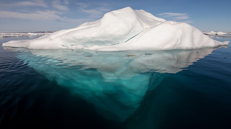
Satellites really are quite a wonder. They can help forecast the weather, track climate change and help you navigate around the world. There are even satellites that can not only track icebergs but can map the Antarctic in the merest blink of an eye. In fact, faster than that since a typical blink takes about 0.2 seconds but the Sentinel-1 satellites can map icebergs in just 0.01 seconds, that's 20 times for every blink of an eye!
In a report published in The Cryosphere, authored by Anne Braakmann-Folgmann she highlighted the importance of tracking large icebergs in the Antarctic. It's not just about sea levels, but has impacts on the whole environment from ocean physics and chemistry to biology and maritime operations, understanding their extent is a crucial activity. This is not a one time activity though, to successfully understand the impact of iceberg movements and changes continuous monitoring is essential.
Satellites with conventional cameras reveal icebergs, sea ice and clouds all coloured white making it difficult to distinguish between them. Using the radar technology aboard Sentinel-1, the icebergs appear bright against the much darker ocean and sea ice. This makes it easier for humans trying to chart the area but also opens up the ability for artificial intelligence (AI) to get in on the act.
This is not just theoretical though, a new neural network has been developed that can successfully chart the extent of icebergs regardless of sea condition, coastline or smaller icebergs.The network is based upon the U-Net design which uses images as inputs and can be used to classify objects in the image or identify their location and size. It takes the whole image into account and allows the network to chart the extent of icebergs with incredible accuracy and speed.
An extensive training process was undertaken where the system constantly assessed its forecasts and adjusted configuration parameters based on the differences between its own prediction and manual input. A dataset was compiled with between 15 to 46 images per iceberg across the seasons from 2014 to 2020 leading to the development of the algorithm which was tested on icebergs ranging in size from 54 sq km to 1052 sq km.
With an accuracy of 99% and an entire mapping run taking just 0.01 second, Sentinel-1 is well on the way to heralding a step change in our observational capability and our ability to forecast the impacts of icebergs. In what was once a heavily manual and time consuming process, AI has yet again lightened the load and brought with it, impressive capabilities that will revolutionise our understanding of the Antarctic environment.
