Many of us have dreamed about flying over the surface of Mars—someday. The planet offers so many cool places to study, and doing it in person is something for future Marsnauts to consider. The Mars Express spacecraft has been mapping the Red Planet for years. It now gives us an up-close look now, through an animation of thousands of images of Mars from its cameras.
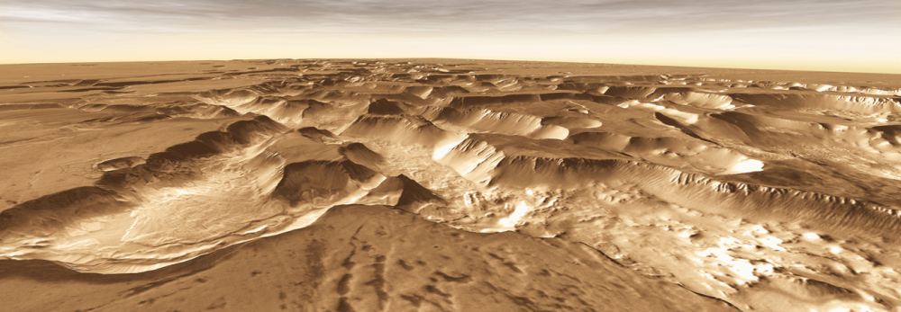
One of the most striking areas on Mars is its Noctis Labyrinthus—Latin for the "Labyrinth of Night." It lies between Mars's Valles Marineris and the gigantic volcanoes of the Tharsis Bulge. This shattered terrain is a system of valleys that stretch out across nearly 1,200 kilometers. Scientists combined ESA's Mars Express images into an amazing flyover of this terrain, giving us a tasty hint of what future explorers will see.
A flight over Mars's Noctis Labyrinthus region made from Mars Express images. Courtesy ESA.What Caused Noctis Labyrinthus?
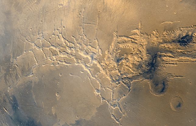
This maze of valleys didn't just happen overnight. It's a fracture zone at the heart of a region called the Tharsis Rise. Essentially, the valleys formed when volcanism in the Tharsis region led to the creation of a bulge, which caused much of the surrounding area to arch up. That created tectonic stresses on the surrounding areas.
The crust actually grew thinner and structures called "grabens" formed. ("Graben" means "grave".) Think of grabens as trenches of material that settled down as the crust thinned and extended. In addition, there are fractures running under most of the region. Some of the grabens are as deep as 5,000 meters, a testament to the tectonic forces at work in Mars's ancient past.
Flying Over This Region of Mars
A flight over Noctis Labyrinthus is a trip through time. For example, the highest plateaus in the imagery represent the original surface level. So, imagine what it looked like before all the tectonic activity and before chunks of surface fell away.
The intersecting canyons and valleys created by the volcanic stresses may look small here, but they are up to 30 km wide and six km deep. Over the millennia, gigantic landslides thundered down the slopes, covering up the older surface units. Other valley slopes show large dune fields. These formed when Martian winds blew sand across the surface. All in all, this flyover gives you an idea of millions of years of geologic history. It's somewhat analogous to flying over and through Earth's Grand Canyon and studying the cross-cutting fracture zone at its base. Such a flyover would show the earliest structures that contribute to the complexity of the Canyon.
Creating the Mars Flyover
It's cool to think of Mars Express focusing a high-resolution movie camera on the surface. However, this movie comprises many individual images. The views come from more than eight Mars Express orbits. In addition to images, the team combined images with topographic information from a digital terrain model. That helped the visualization team generate a three-dimensional landscape, with every second of the video comprising 50 separate frames rendered according to a pre-defined camera path.
In addition to showing the ancient history of Mars terrain, the video also shows some Mars Express history. The opening credits (Mars globe, first 24 seconds) were created using the recent 20-year Mars global color mosaic. Haze has been added to conceal the limits of the terrain model. It starts building up at a distance of between 150 and 200 km. The video is centered at the Martian coordinates of 7°S, 265°E.
