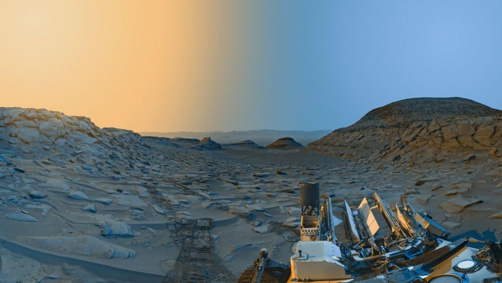
The Mars rover Curiosity continues to make its way up the slopes of Mount Sharp on Mars. On April 8th, its navigation cameras snapped a pair of images—one in the morning and one in the afternoon. They show distinctly different lighting angles during a crisp Martian winter day. The images got combined with a color overlay to produce a fantastic "postcard" from the Red Planet.
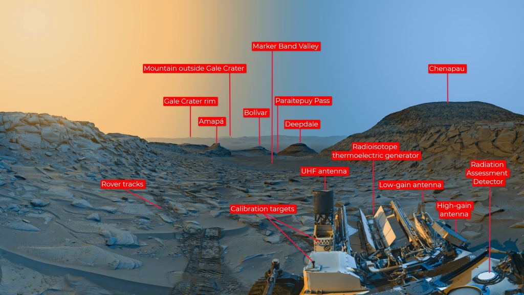
Curiosity's in the foothills of Mount Sharp at a point overlooking a place called "Marker Band Valley." That region used to be a lake, back in Mars's early history. It's rich in sulfates, which are salty minerals left behind as Mars dried up. The region likely contains intriguing clues to the ancient climate of Mars, particularly as the planet was losing its water.
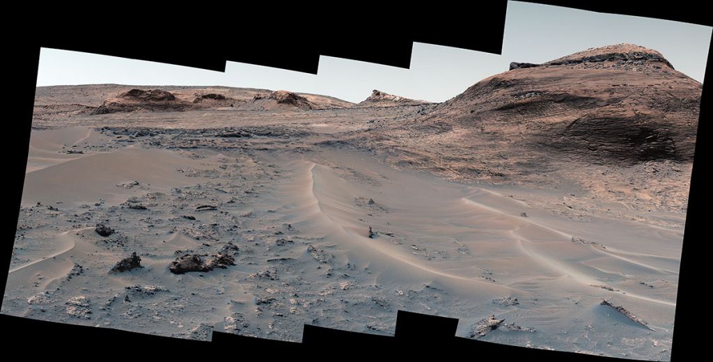
The rover arrived at the valley in October 2022 after a particularly difficult trip through some rough landscapes. It pushed through the sandy "Paraitepuy Pass" and captured images of a series of high hills as it went. The rover also captured views of rock ripples that formed in that ancient watery environment, on its way to the Marker Band Valley overlook.
Curiosity's Clear View
What's amazing about this view of the valley is how clear the air is. Normally there's quite a bit of dust in the Martian air. However, since the region where Curiosity is exploring is now experiencing winter, there's less dust in the atmosphere. The clearer view allowed the cams to see a very distant mountain outside the rim of the crater.
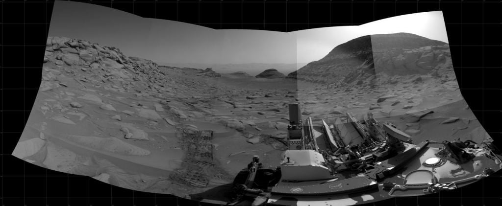
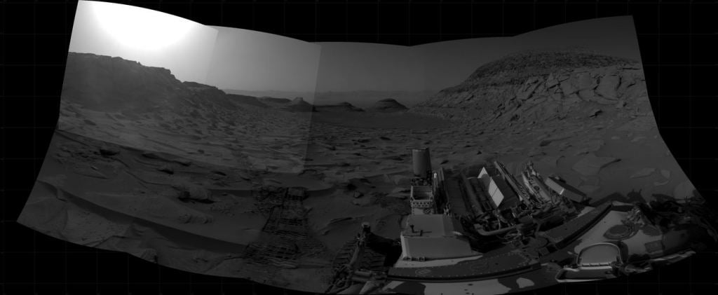
These two images above also show how much the view can change depending on the time of day, according to Curiosity engineer Doug Ellison. By capturing two 7.5-minute-long panoramas at two different times of day, the scene shows dramatic shadows similar to stage lighting coming in from the left and right of center stage. "Anyone who's been to a national park knows the scene looks different in the morning than it does in the afternoon," he said. "Capturing two times of day provides dark shadows because the lighting is coming in from the left and the right like you might have on a stage—but instead of stage lights, we're relying on the Sun."
So, what features do we see in this combined image? Marker Band Valley lies dead center. The big hill to the far right is called Chenapau. Several smaller hills called Amapa, Bolivar, and Deepdale lie farther away. Beyond that is the rim of the crater, and that distant mountain is 87 kilometers outside of the crater.
What's Next for the Rover?
The rover continues its climb up Mount Sharp, heading roughly east from its last position. It's doing ChemCam observations before heading on another drive. The Mastcam is studying a lumpy, layered rock called "Ananas Berg" and those images will get added to a large inventory of rock features and terrain along the rover's route. There's also an intriguing pit filled with sand that caught people's attention, so the rover will try to get images of that, too.
The area Curiosity is traveling through has been pretty challenging. There are steep slopes, uneven regions of bedrock, and lots of fine-grained sand. Mission planners chose a route that takes the rover up through the area and will eventually put it onto some flatter ground.
For More Information
NASA’s Curiosity Captures Martian Morning, Afternoon in New ‘Postcard’
Curiosity Mars Rover Reaches Long-awaited Salty Region
NASA Mars Exploration
