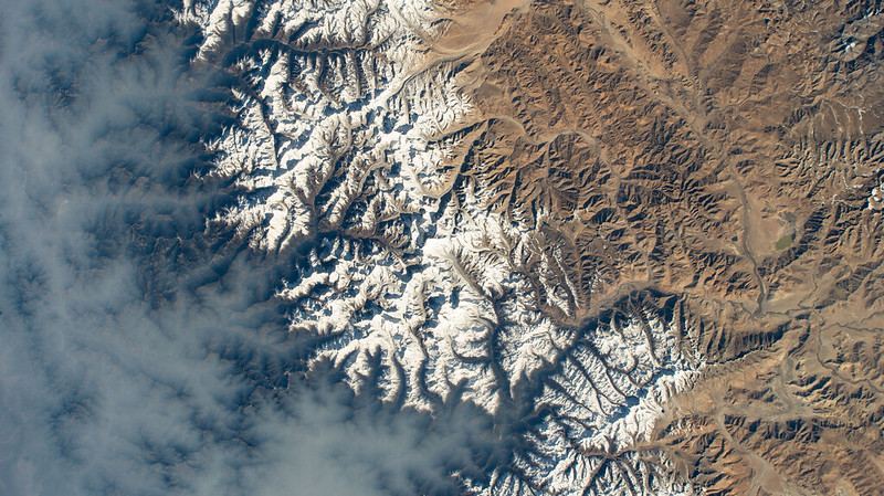
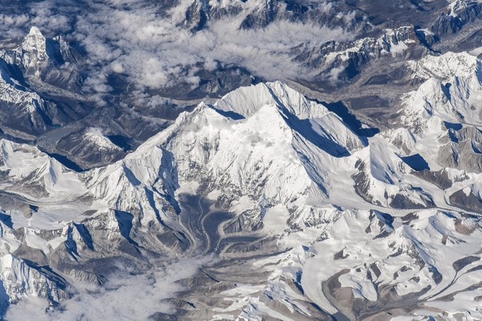
Earth is a favorite target for the cameras and astronauts aboard the International Space Station (ISS). This week, NASA shared an amazing picture of the Himalayan mountain range as seen from space. This jagged set of mountains stretches out across Asia above the Indian subcontinent and is home to Mount Everest, the tallest mountain on Earth. It's centered in the image.
The Himalayan range defines the southern edge of the Tibetan Plateau in an arc-shaped sweep that covers about 2500 kilometers. The countries of Bhutan, India, Nepal, China, and Pakistan all lie along its borders or have parts of the range crossing them.
History and Features of the Himalayas
Geologically speaking, the Himalayas are among the youngest mountain ranges on the planet. They began to form when the Eurasian and ancient Indo-Australian plates began a long-term collision. This action began around 225 million years ago. At that time, India was actually a super-sized island off the coast of Australia. The action of the two plates carried it up into a collision with Asia. The mountains formed between 40 and 50 million years ago as the two plates met head-on and Earth's crust began to break apart. Essentially, older rocks on one plate pushed over younger rocks on the other plate. That raised the mountain range over millions of years.
Today, the Himalayan range has ten of the tallest 14 mountains in the world. They range from Mount Everest at 8,848 meters (28,029 feet) to the well-known Dhaulagiri, Karakoram (K2), and Annapurna (both above 8,000 meters). Lesser-known, but no less spectacular are Nanda Devi, Nun, and Kangto (members of the 7000+-meter collection). Mount Everest, of course, is a climber's challenge, with crowds of mountaineers seeking its summit each season.
A Snapshot of Life Along the Himalayas
The politics and international relationships of the Himalayan countries aren't visible from space. From the ISS, all we see are landmasses and mountains, cut by rivers, snowy peaks, and dry deserts. But, the region contains several political hotspots. Most people know about the political relationship between India and Pakistan, which is complex and tense. Nepal is landlocked and bordered by Tibet (claimed by China), and Bangladesh. Nearby are parts of India, and Bhutan.
The mountain range is sometimes referred to as our planet's "Third Pole". They are an important source of water for at least 600 million people. The range also contains the headwaters of several major rivers, including the Indus, Ganges, and Tsangpo-Brahamaputra. At least 53 million people call the mountains home, which also contains a number of environmentally sensitive regions.
This snapshot of the Himalayas comes from the ongoing Expedition 69 to the International Space Station. The high-definition camera was mounted outside the station, which was 423 km (263 miles) above the surface. This current expedition began on March 23, 2023, with seven people aboard. It's part of NASA's efforts to map Earth's mountains as preparation for future surface explorations on the Moon in the Artemis era.
For More Information
The Himalayas and Mount Everest in Nepal
The Himalayas
Continental/Continental: The Himalayas
Expedition 69
