NASA’s Aqua Satellite Watches Ships Crossing the Atlantic Ocean
Images acquired of the Aqua satellite of the sea lanes off the coast of Portugal, taken on January 16th, 2018. Credit: NASA/Jeff Schmaltz, LANCE/EOSDIS Rapid Response
Earth, when viewed from space, is a pretty spectacular thing to behold. From orbit, one can see every continent, landmass, and major feature. Weather patterns are also eerily clear from space, with everything from hurricanes to auroras appearing as a single system. On top of that, it is only from orbit that the full extent of human activity can be truly appreciated.
For instance, when one hemisphere of Earth passes from day into night, one can see the patchwork of urban development by picking out the filamentary structure of lights. And as NASA’s Aqua satellite recently demonstrated with a high-resolution image it captured over the Atlantic Ocean, ships criss-crossing the ocean can also create some beautiful patterns.
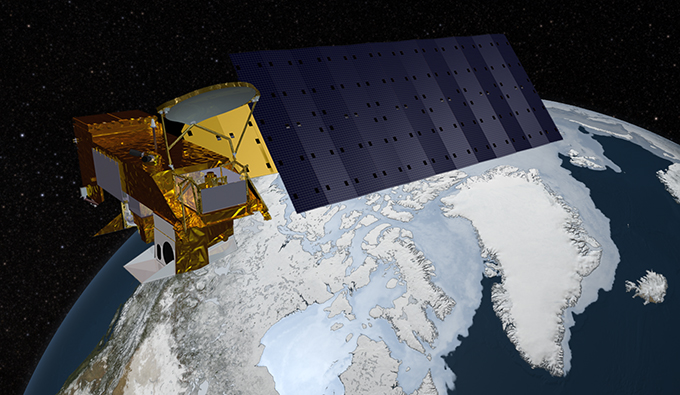
As part of the NASA-centered international Earth Observing System (EOS), the Aqua satellite was launched on May 4th, 2002, to collect information on Earth’s water cycle. Using a suite of six Earth-observing instruments, this satellite has gathered global data on ocean evaporation, water vapor in the atmosphere, clouds, precipitation, soil moisture, sea ice, land ice, and snow cover.
The image was acquired on January 16th, 2018, by the Moderate Resolution Imaging Spectroradiometer (MODIS). Pictured in this image are ships off the coast of Portugal and Spain producing cloud trails known as ship tracks. Some of these tracks stretch for hundreds of kilometers and grow broader with distance – i.e. the narrow ends are the youngest while the broader, wavier ends are older.
These clouds form when water vapor condenses around tiny particles of pollution emitted by the ship’s exhaust. This is due to the fact that some particles generated by ships (like sulfates) are soluble in water and seeds clouds. This also causes light hitting these clouds to scatter in many directions, making them appear brighter and thicker than unpolluted maritime clouds (which are seeded by larger particles like sea salt).
As always, seeing things from space provides an incredible sense of perspective. This is especially helpful when attempting to monitor and model something as complex as Earth’s environment and humanity’s impact on it. And of course, it also allows for some breathtaking photos!
Further Reading: NASA
Recent Posts
SpaceX Moves Ahead With Falcon 9 Launches After FAA Go-Ahead
The Federal Aviation Administration has ruled that SpaceX can resume Falcon 9 rocket launches while…
Is This How You Get Hot Jupiters?
When we think of Jupiter-type planets, we usually picture massive cloud-covered worlds orbiting far from…

Now Uranus’ Moon Ariel Might Have an Ocean too
Venus is known for being really quite inhospitable with high surface temperatures and Mars is…
Why is JWST Having So Much Trouble with the TRAPPIST-1 System?
When the James Webb Space Telescope was launched it came with a fanfare expecting amazing…
Planetary Habitability Depends on its Star’s Magnetic Field
The extrasolar planet census recently passed a major milestone, with 5500 confirmed candidates in 4,243…
A Solution to the “Final Parsec Problem?”
Supermassive Black Holes are Nature's confounding behemoths. It's difficult for Earth-bound minds to comprehend their…