
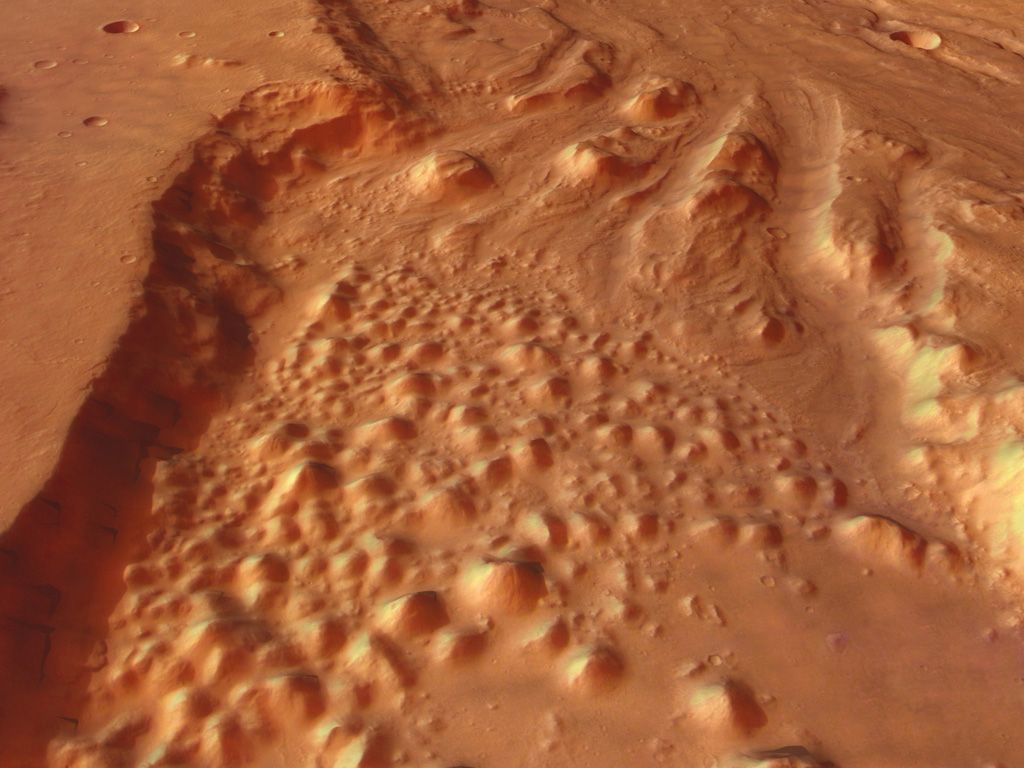
Perspective view of an ancient floodplain on Mars. Image credit: ESA. Click to enlarge.
This image, taken by the High Resolution Stereo Camera (HRSC) aboard ESA?s Mars Express spacecraft, shows a large depression called Iani Chaos and the upper reaches of a large outflow channel called Ares Vallis.
Image strips were taken in October 2004, during three orbits from a 350-kilometre altitude, with a resolution of 15 metres per pixel. The strips have then been matched to a mosaic that covers an area from 17.5? western longitude to 3? North. The Iani Chaos depression ? 180 kilometres long and 200 kilometres wide ? is connected to the beginning of Ares Vallis by a 100-kilometre wide transition zone.
From here, Ares Vallis continues its course for about 1400 kilometres through the ancient Xanthe Terra highlands, bordered by valley flanks up to 2000 metres high. Eventually Ares Vallis empties into Chryse Planitia.
This image helps illuminate the complex geological history of Mars. Ares Vallis is one of several big outflow channels on Mars in this region that formed billions of years ago. Many surface features suggest that erosion of large water flows had carved Ares Vallis in the Martian landscape.
Most likely gigantic floods ran downhill, carving a deep canyon into Xanthe Terra. Rocks eroded from the valley flanks were milled into smaller fractions and transported in the running water.
Finally this sedimentary load was deposited far north at the mouth of Ares Vallis in the Chryse plains, where NASA?s Mars Pathfinder landed in 1997 to search for traces of water with its small Sojourner rover.
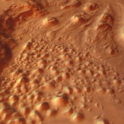
The scene displayed in the image shows the transition zone between Iani Chaos and Ares Vallis. A chaotic distribution of individual blocks of rock and hills forms a disrupted pattern. These ?knobs? are several hundred metres high. Scientists suggest that they are remnants of a preexisting landscape that collapsed after cavities had formed beneath the surface.
The elongated curvature of features extending from south to north along with terraces, streamlined ‘islands’ and the smooth, flat surface in the valley centre are strong hints that it was running water that carved the valley.
Ice stored in possible cavities in the Martian highland might have been melted by volcanic heat. Pouring out, the melting water would have followed the pre-existing topography to the northern lowlands.
A hundred kilometres further, a ten-kilometre-wide valley arm merges into Ares Vallis from the west. Large amounts of water originating from Aram Chaos (outside the image) joined the stream of Ares Vallis. Fan-shaped deposits on the valley floor are the remnants of landslides at the northern flanks.
At the freshly eroded cliffs possible lava layers are visible: such layers are found almost everywhere in Xanthe Terra. Further downstream, another valley branch enters Ares Vallis from the east after passing through an eroded impact crater in Xanthe Terra. West of Ares Vallis, a subtler riverbed is running parallel to the main valley.
The High Resolution Stereo Camera (HRSC) experiment on the ESA Mars Express Mission is led by Principal Investigator (PI) Prof. Dr. Gerhard Neukum who is also responsible for the technical design of the camera. The science team of the experiment consists of 45 Co-Investigators from 32 institutions and ten nations.
The camera was developed at the German Aerospace Centre (DLR) under the leadership of the PI and constructed in cooperation with industrial partners (EADS-Astrium, Lewicki Microelectronic GmbH and Jena-Optronik GmbH).
Original Source: ESA News Release