Of course the stars have been with people since people have been on Earth. Wandering along the ecliptic in an annual cycle allowed those with good memories to see the stars arc across the night sky, disappear and then reappear perhaps months later. Those with a good imagination then came along and, perhaps after reviewing the shapes of clouds, went on to name groups of stars; Leo the lion, the Big Dipper and Orion the hunter. These names represent the basic coordinates in star maps and also the basic orientation for astronomers when discussing their latest night time observations. A star map is essential for quickly learning this built up information and, with its knowledge, provides a common basis for discussing night time delights.
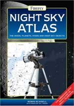
Robin Scagell in his book provides maps of the night skies. First he outlines the coordinate system; orbits, declination, right ascension, and ecliptics. Maps in semi-circular segments then illustrate the stars. A group of six illustrate the northern hemisphere. One pair gives a north and south view for a January evening at about midnight and with a false horizon drawn for a number of latitudes. Another shows May and a third pair shows September. Three other pairs show the segments if viewed from the southern hemisphere. These maps are quite small about 10 cm in diameter and show the constellations, names of significant stars and a washed area that represents the contribution from the Milky Way.
The main value of this book is the use of these guide maps with following detailed maps. Much like a road map that has blow ups with greater details, each of the semi-circular segments has four or five links to higher fidelity maps. And these higher fidelity maps are the purpose for the book’s larger format as these are each also a semicircle of diameter about 30 cm. Now it’s a bit curious as to how semi-circles divided to semi-circles, perhaps there’s a fair amount of overlap. Anyway these higher fidelity maps each appear twice. The first shows stars in black on a white background as well as constellation boundaries. The second is a photo-realistic image (stars as white dots on a black background) which show the night sky as a viewer would see it. In total there are eight pairs of these higher fidelity maps.
Following the maps are sections on what to see, sort of like a tourist’s map for a city. The moon gets large attention with lots of clear, fine scale photographs. Four, full page quarter circle maps provide place names on a shaded relief. The sun and each planet also have write-ups and pictures though, not surprisingly, the amount of information is inversely proportional to the distance from Earth. Of course these have no maps as no amateur astronomer has equipment able to discern geographic features except perhaps a little of Mars (the ice caps).
The final chapter of the book does get back into maps. Fifty of the most important constellations (presumably according to the author) have a small map (about 10cm by 10cm) alongside a write-up of the interesting features; galaxies, nebulae and other deep sky objects. This is a particularly good chapter with in-depth information much as a large city map presents details on tourist sections and popular sites. Once centring a constellation in the eyepiece of your favourite telescope, using this map quickly allows a viewer to identify features as well as their relative positions. Hence the constellation Pegasus becomes the stars Sadalbari, Matar and Enif. And thus the learning of the night sky via the maps in this book, quickens.
As an atlas this book is good but not great. I put it to the test, went out, got my bearings using the Big Dipper and then looked in the book. Note I’m no expert. However, this being April made the large scale maps very difficult. The nearest map (May at Midnight) did not do my view justice. Going to the higher fidelity maps was no help as I couldn’t get an appreciation of the scale. However, starting with the constellation Big Dipper (or Ursa Major), I was able to learn more about the local sky group. More large scale maps would have helped. Also, in looking at the higher fidelity maps, I only referred to the high contrast, black on white views; never the photo-realistic ones. Nevertheless this book is an effective night sky atlas for those looking without aid or those using binoculars or small telescopes.
Travelling to visit the grandparents, planning for a vacation or going out to view stars at night all have much better results when undertaken with an appropriate map. Robin Scagell in his book, Night Sky Atlas provides the guidance for viewing the moon, planets, stars and other deep sky objects. So don’t get lost in the big, diamond endowed, velvet cloth that descends over us every evening, get this book and travel away.
See more reviews or order a copy online from Amazon.com
Review by Mark Mortimer.
