Volcanoes on Mars Helped Form its Early Oceans

Image of the Tharsis region of Mars taken by Mars Express featuring several prominent shield volcanoes includes the massive Olympus Mons (at left). Credit: ESA

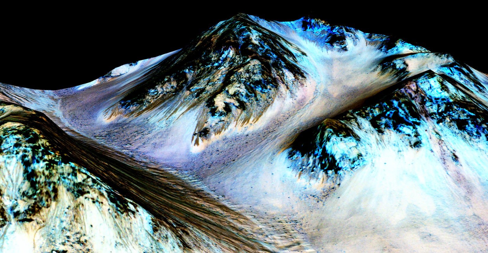
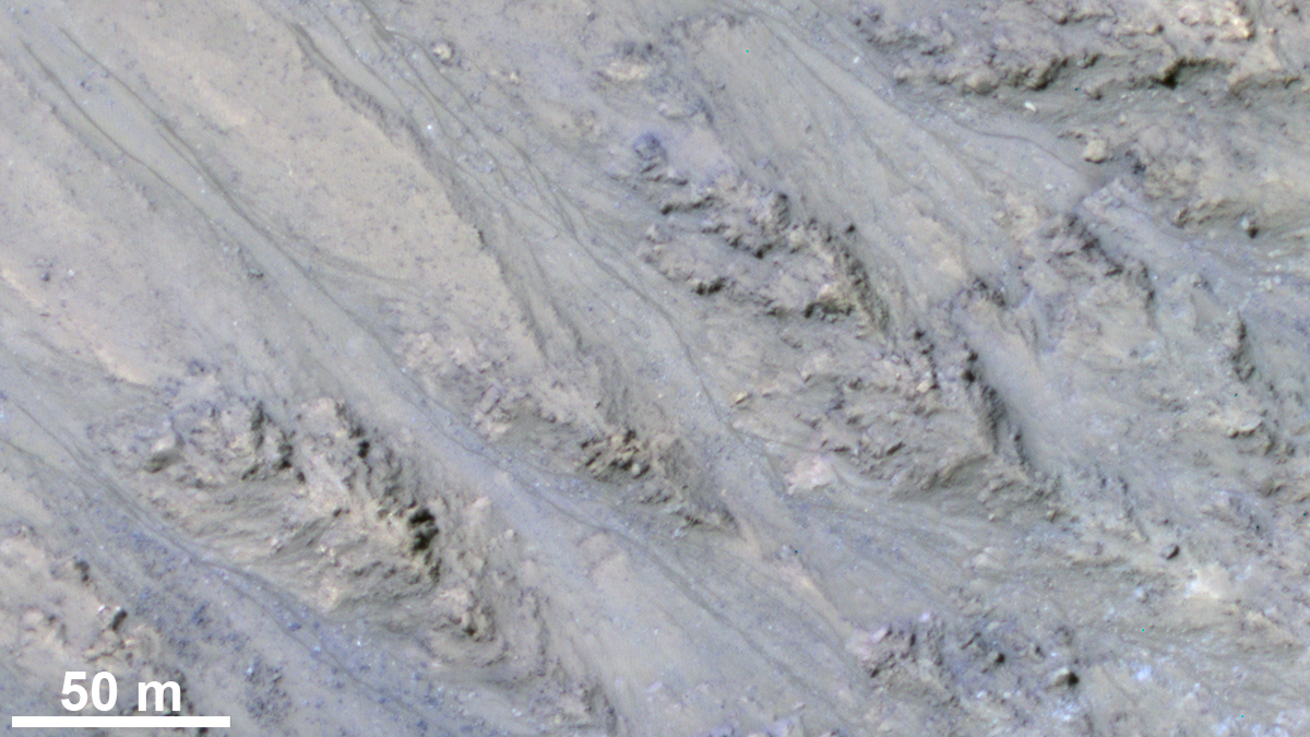
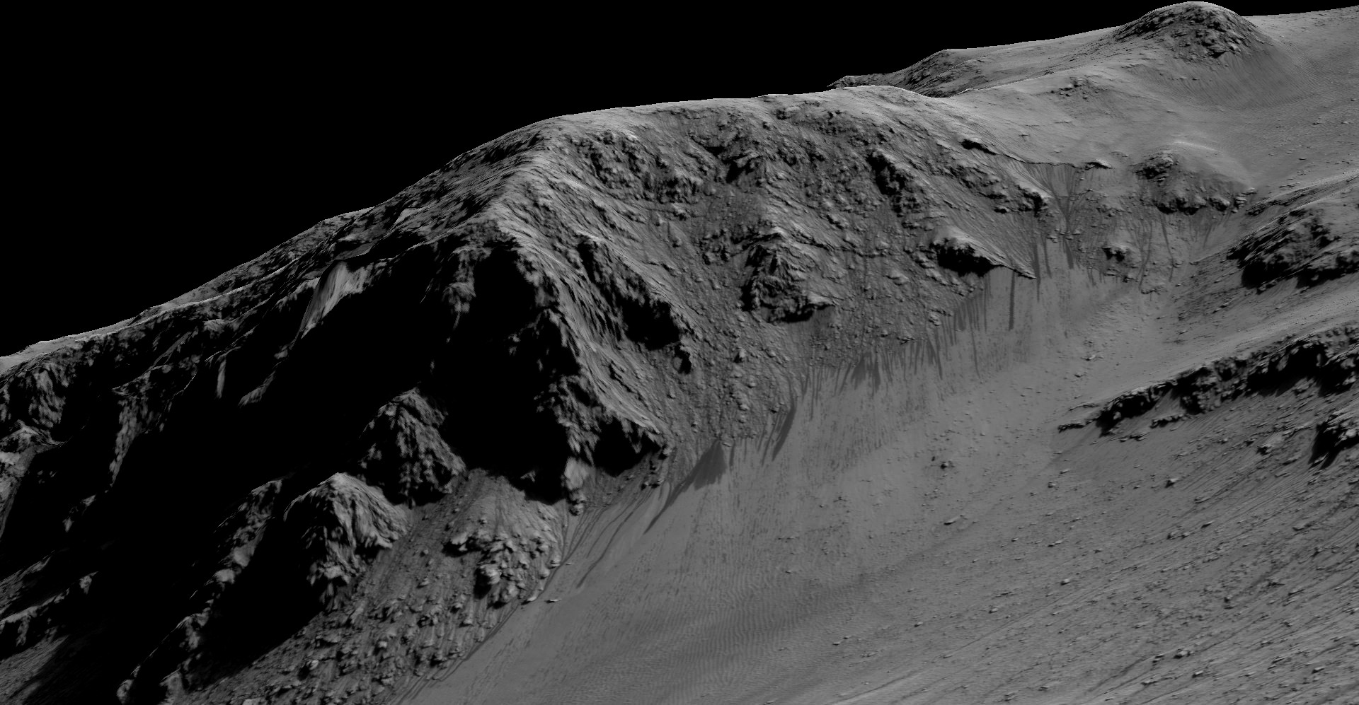
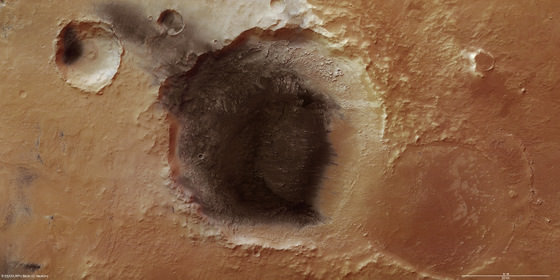
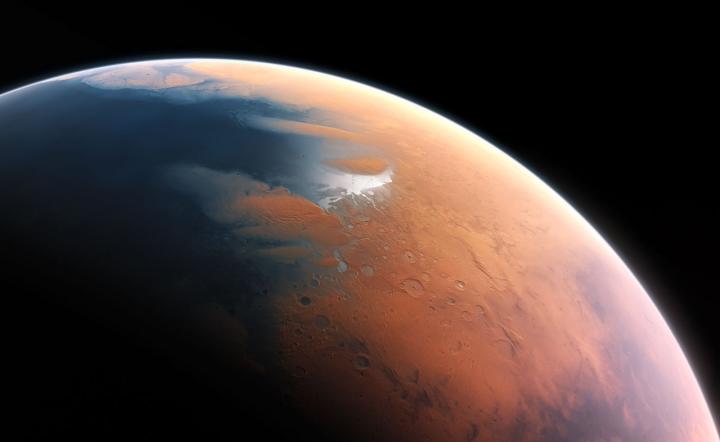
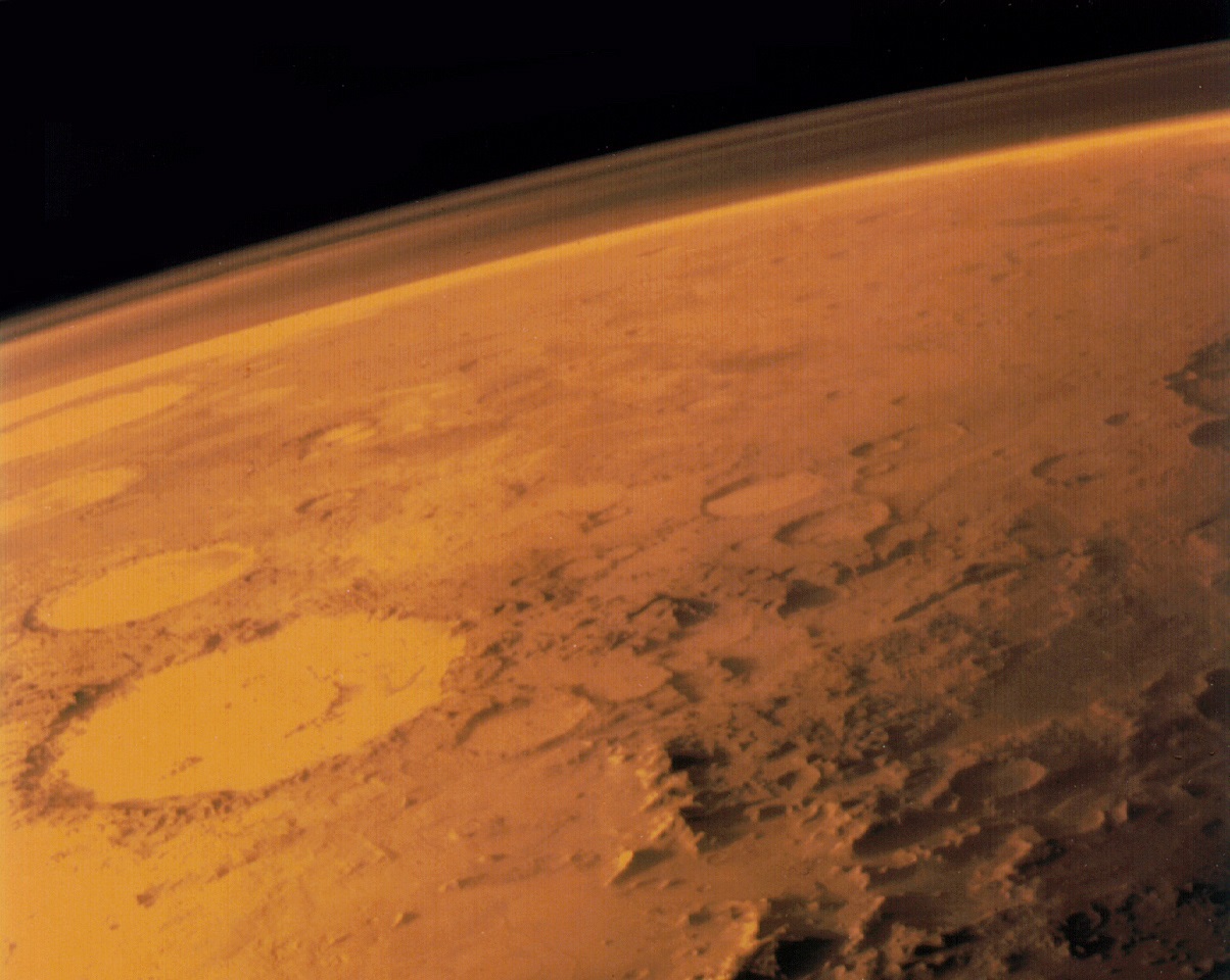
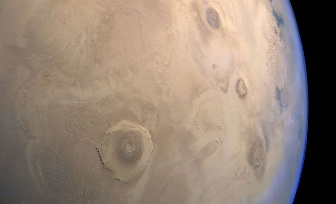
Thanks to the many missions that have been studying Mars in recent years, scientists are aware that roughly 4 billion years ago, the planet was a much different place. In addition to having a denser atmosphere, Mars was also a warmer and wetter place, with liquid water covering much of the planet’s surface. Unfortunately, as Mars lost its atmosphere over the course of hundreds of millions of years, these oceans gradually disappeared.

When and where these oceans formed has been the subject of much scientific inquiry and debate. According to a new study by a team of researchers from UC Berkeley, the existence of these oceans was linked to the rise of the Tharis volcanic system. They further theorize that these oceans formed several hundred millions years earlier than expected and were not as deep as previously thought.

The study, titled “Timing of oceans on Mars from shoreline deformation“, recently appeared in the scientific journal Nature. The study was conducted by Robert I. Citron, Michael Manga and Douglas J. Hemingway – a grad student, professor and post doctoral research fellow from the Department of Earth and Planetary Science and the Center for Integrative Planetary Science at UC Berkeley (respectively).


The early ocean known as Arabia (left, blue) would have looked like this when it formed 4 billion years ago on Mars, while the Deuteronilus ocean (right), about 3.6 billion years old, had a smaller shoreline. Credit: Robert Citron/UC Berkeley

As Michael Manga explained in a recent Berkeley News press release:

“The assumption was that Tharsis formed quickly and early, rather than gradually, and that the oceans came later. We’re saying that the oceans predate and accompany the lava outpourings that made Tharsis.”

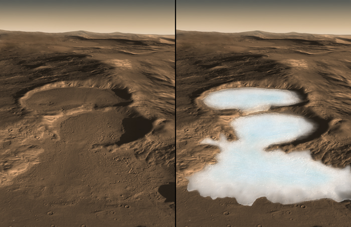
The debate over the size and extent of Mars’ past oceans is due to some inconsistencies that have been observed. Essentially, when Mars lost its atmosphere, its surface water would have frozen to become underground permafrost or escaped into space. Those scientists who don’t believe Mars once had oceans point to the fact that the estimates of how much water could have been hidden away or lost is not consistent with estimates on the oceans’ sizes.

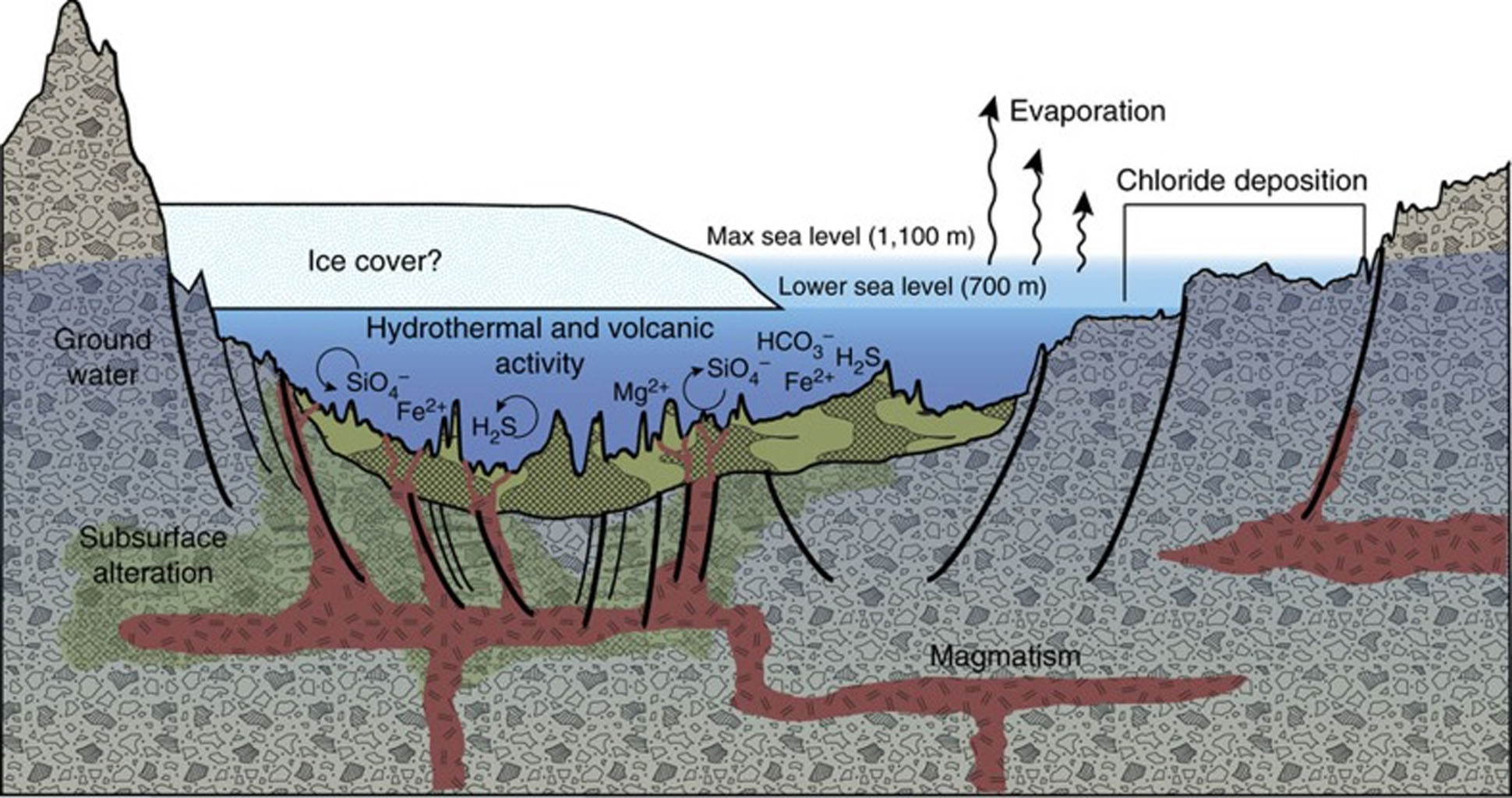
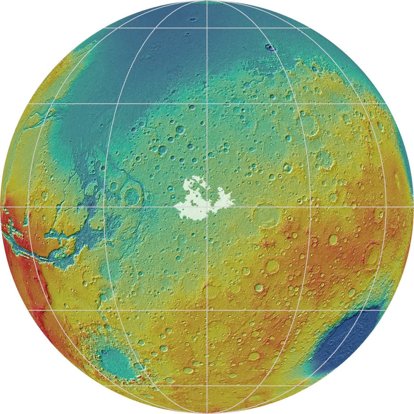
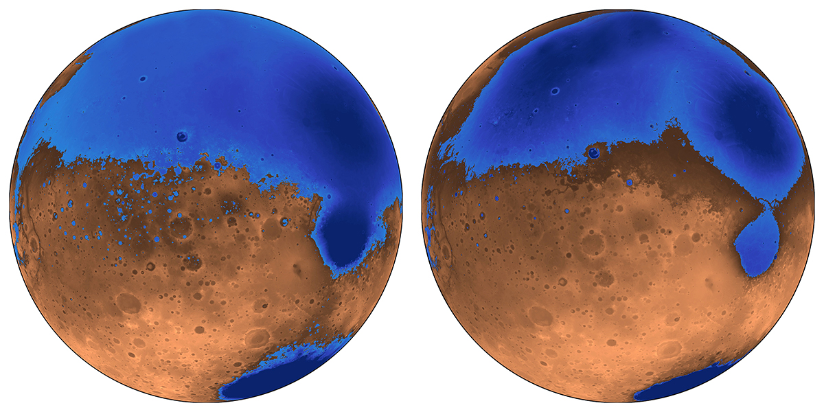
What’s more, the ice that is now concentrated in the polar caps is not enough to create an ocean. This means that either less water was present on Mars than previous estimates indicate, or that some other process was responsible for water loss. To resolve this, Citron and his colleagues created a new model of Mars where the oceans formed before or at the same time as Mars’ largest volcanic feature – Tharsis Montes, roughly 3.7 billion years ago.

A colorized image of the surface of Mars taken by the Mars Reconnaissance Orbiter. The line of three volcanoes is the Tharsis Montes, with Olympus Mons to the northwest. Valles Marineris is to the east. Image: NASA/JPL-Caltech/ Arizona State University

Since Tharsis was smaller at the time, it did not cause the same level of crustal deformation that it did later. This would have been especially true of the plains that cover most the northern hemisphere and are believed to have been an ancient seabed. Given that this region was not subject to the same geological change that would have come later, it would have been shallower and held about half the water.

“The assumption was that Tharsis formed quickly and early, rather than gradually, and that the oceans came later,” said Manga. “We’re saying that the oceans predate and accompany the lava outpourings that made Tharsis.”

In addition, the team also theorized that the volcanic activity that created Tharsis may have been responsible for the formation of Mars’ early oceans. Basically, the volcanoes would have spewed gases and volcanic ash into the atmosphere that would have led to a greenhouse effect. This would have warmed the surface to the point that liquid water could form, and also created underground channels that allowed water to reach the northern plains.

Their model also counters other previous assumptions about Mars, which are that its proposed shorelines are very irregular. Essentially, what is assumed to have been “water front” property on ancient Mars varies in height by as much as a kilometer; whereas on Earth, shorelines are level. This too can be explained by the growth of the Tharsis volcanic region, roughly 3.7 billion years ago.

A map of Mars today shows where scientists have identified possible ancient shoreline that may have been etched by intermittent oceans billions of years ago. Credit: Robert Citron/UC Berkeley.

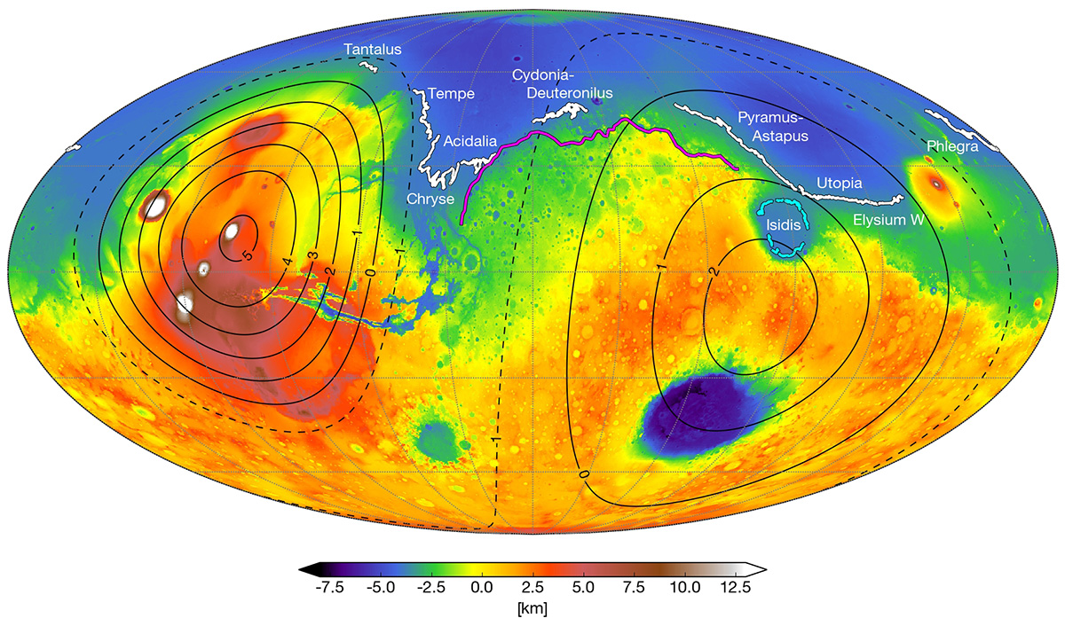
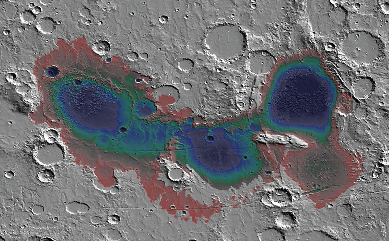
Using current geological data of Mars, the team was able to trace how the irregularities we see today could have formed over time. This would have began when Mars first ocean (Arabia) started forming 4 billion years ago and was around to witness the first 20% of Tharsis Montes growth. As the volcanoes grew, the land became depressed and the shoreline shifted over time.

Similarly, the irregular shorelines of a subsequent ocean (Deuteronilus) can be explained by this model by indicating that it formed during the last 17% of Tharsis’ growth – roughly 3.6 billion years ago. The Isidis feature, which appears to be an ancient lakebed slightly removed from the Utopia shoreline, could also be explained this way. As the ground deformed, Isidis ceased being part of the northern ocean and became a connected lakebed.

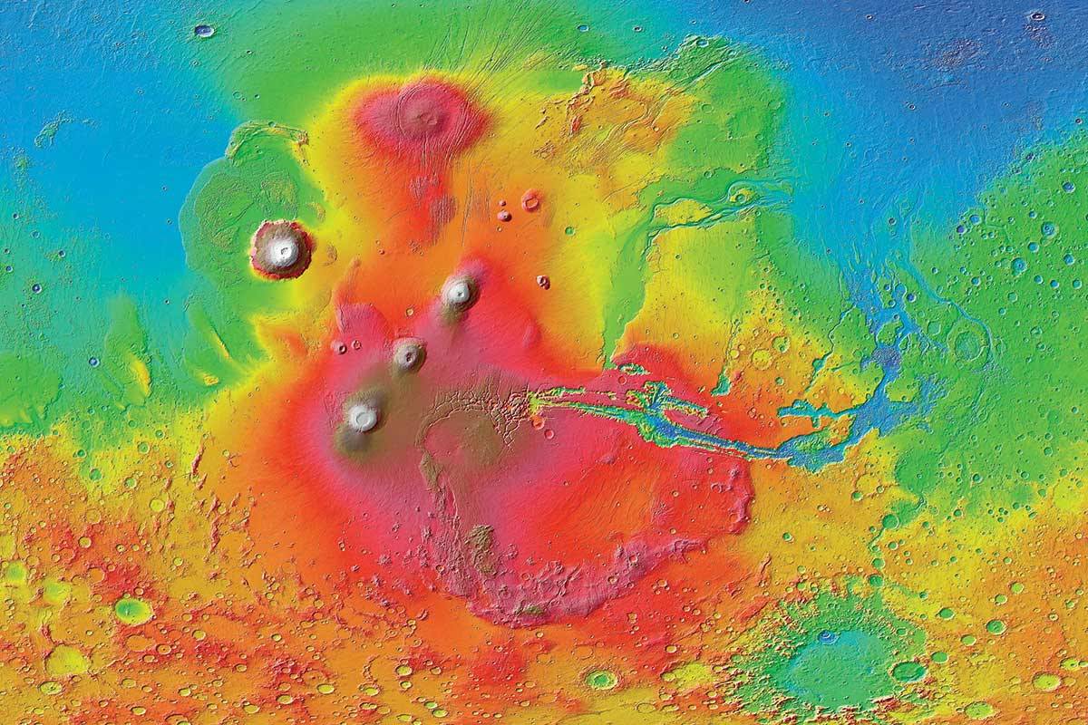
“These shorelines could have been emplaced by a large body of liquid water that existed before and during the emplacement of Tharsis, instead of afterwards,” said Citron. This is certainly consistent with the observable effect that Tharsis Mons has had on the topography of Mars. It’s bulk not only creates a bulge on the opposite side of the planet (the Elysium volcanic complex), but a massive canyon system in between (Valles Marineris).

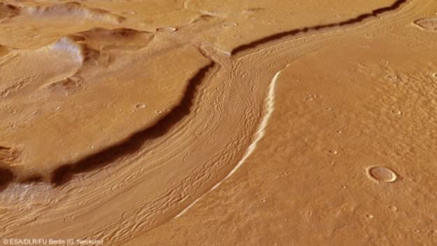
This new theory not only explains why previous estimates about the volume of water in the northern plains were inaccurate, it can also account for the valley networks (cut by flowing water) that appeared around the same time. And in the coming years, this theory can be tested by the robotic missions NASA and other space agencies are sending to Mars.

This artist’s concept from August 2015 depicts NASA’s InSight Mars lander fully deployed for studying the deep interior of Mars. Credit: NASA/JPL-Caltech

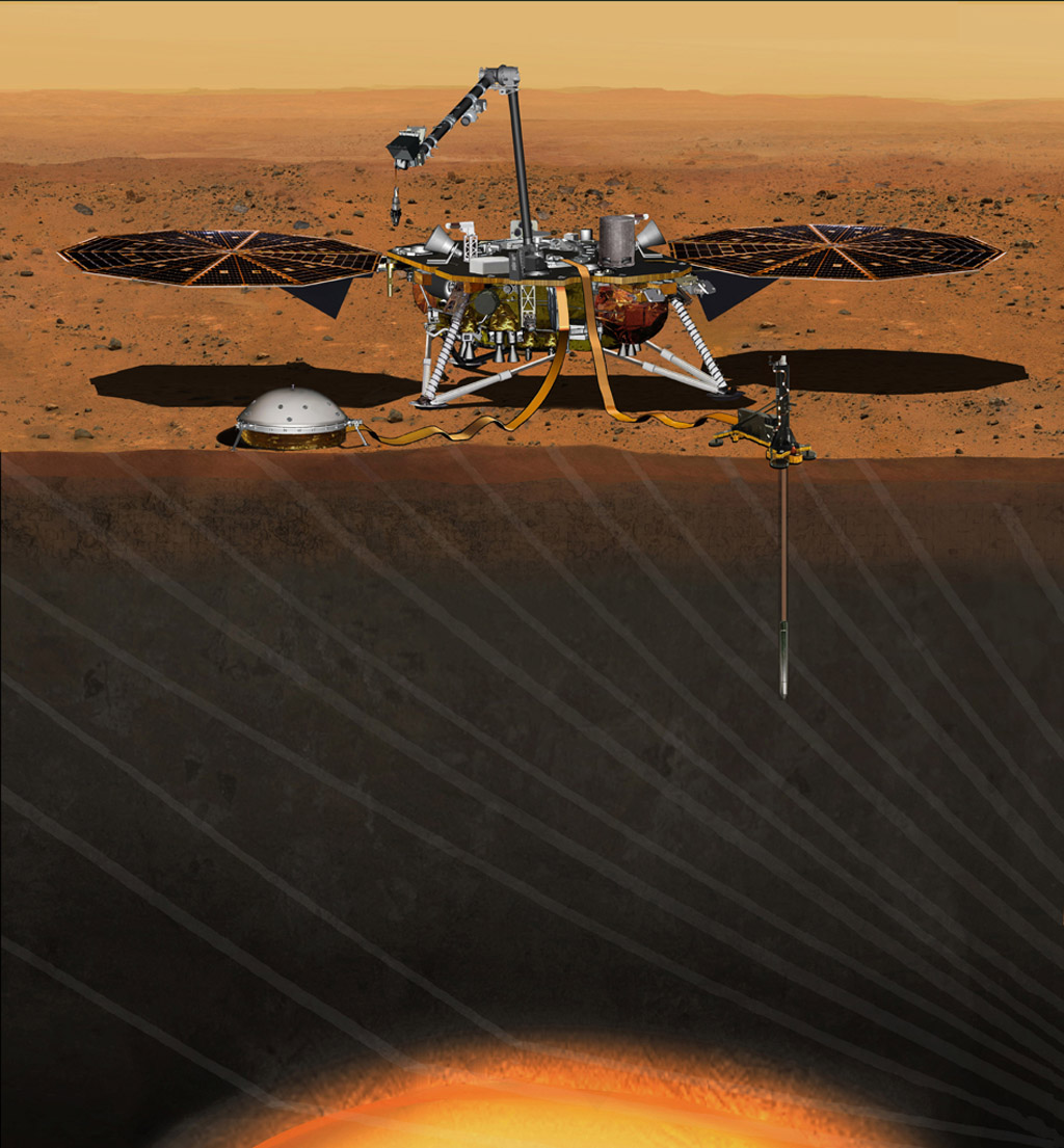
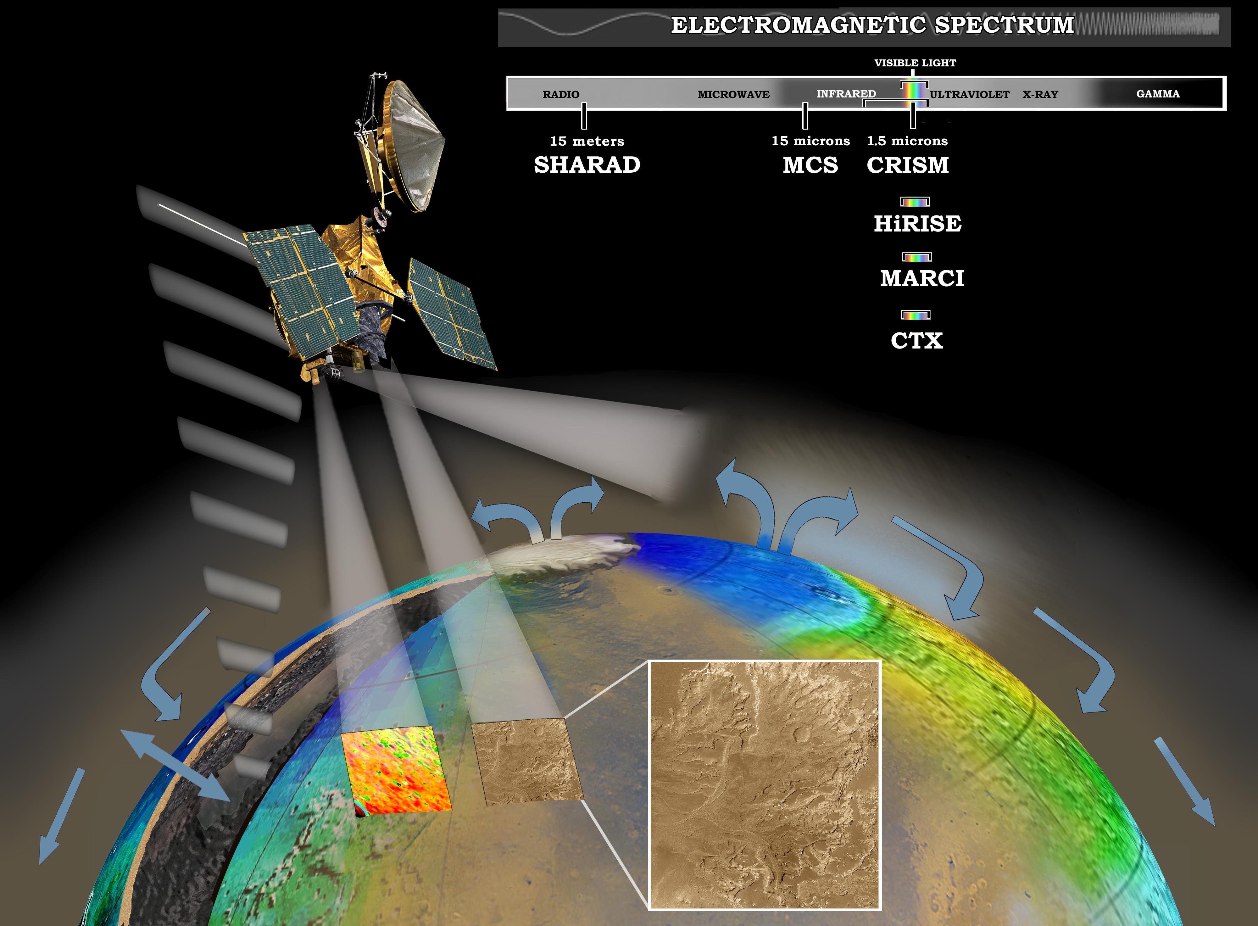
Consider NASA’s Interior Exploration using Seismic Investigations, Geodesy and Heat Transport (InSight) mission, which is scheduled for launch in May, 2018. Once it reaches Mars, this lander will use a suite of advanced instruments – which includes a seismometer, temperature probe and radio science instrument – to measure Mars interior and learn more about its geological activity and history.

Among other things, NASA anticipates that InSight might detect the remains of Mars’ ancient ocean frozen in the interior, and possibly even liquid water. Alongside the Mars 2020 rover, the ExoMars 2020, and eventual crewed missions, these efforts are expected to provide a more complete picture of Mars past, which will include when major geological events took place and how this could have affected the planet’s ocean and shorelines.

The more we learn about what happened on Mars over the past 4 billion years, the more we learn about the forces that shaped our Solar System. These studies also go a long way towards helping scientists determine how and where life-bearing conditions can form. This (we hope) will help us locate life it in another star system someday!

The team’s findings were also the subject of a paper that was presented this week at the 49th Lunar and Planetary Science Conference in The Woodlands, Texas.

Further News: Berkeley News, Nature

Curiosity has Lasted More than 2,000 Days on Mars, Triple its Original Mission Plan

Mosaic image of the Curiosity rover on Mars, which recently turned up more evidence that supports the idea that the planet was once habitability. Credit: NASA/JPL-Caltech/MSSS.

On August 5th, 2012, after spending over 8 months in space, NASA’s Curiosity rover landed on Mars. As part of the NASA Mars Science Laboratory (MSL) mission, and the latest in a series of rovers deployed to the Martian surface, Curiosity had some rather ambitious research goals. In addition to investigating Mars’ climate and geology, the rover was also tasked with revealing more about Mars’ past and determining if it ever supported microbial life.

And recently, the Curiosity rover hit another major milestone in its exploration of the Red Planet. As of January 26th, 2018 the rover has spent a total of 2,000 days on Mars, which works out to 5 years, 5 months and 21 days – or 1947 Martian days (sols). That’s especially impressive when you consider that the mission was only meant to last 687 days (668 sols), or just little under 2 years.

In all that time, the Curiosity rover has accomplished some major feats and has the scars to prove it! Some of it’s wheels have become teared, holed and cracked and its drill has been pushed almost to the point of breaking. And yet, Curiosity is still hard at work pushing itself up a mountain – both literally and figuratively! The rover has also managed to exceed everyone’s expectations.

MRO image of Gale Crater illustrating the landing location and trek of the Rover Curiosity. Credits: NASA/JPL, illustration, T.Reyes

As Ashwin Vasavada, the MSL Project Scientist, told Universe Today via email:

“In terms of challenges, the first 2000 days of Curiosity’s mission went better than I could have hoped. For much of the time, the rover remained as capable as the day it landed. We had a scare in the first year when a memory fault triggered additional problems and nearly resulted in the loss of the mission. We famously wore down our wheels pretty early, as well, but since then we’ve kept that under control. In the last year, we’ve had a major problem with our drill. That’s the only major issue currently, but we believe we’ll be back to drilling in a month or so. If that works out, we’ll amazingly be back to having all systems ready for science!”

As of the penning of this article, the rover is climbing Mount Sharp in order to collect further samples from Mars’ past. Also known as Aeolis Mons, this mountain resides in the center of the Gale Crater where Curiosity landed in 2012 and has been central to Curiosity’s mission. Standing 5,500 meters (18,000 ft) above the valley floor, Mount Sharp is believed to have formed from sediment that was slowly deposited by flowing water over billions of years.

This is all in keeping with current theories about how Mars once had a denser atmosphere and was able to sustain liquid water on its surface. But between 4.2 and 3.7 billion years ago, this atmosphere was slowly stripped away by solar wind, thus turning Mars into the cold and desiccated place that we know today. As a result, the study of Mount Sharp was always expected to reveal a great deal about Mars’ geological evolution.

Image of Mount Sharp taken by the Curiosity rover on Aug. 23rd, 2012. The layers at the base of Mt. Sharp show the geological history of Mars. Credit: NASA/JPL-Caltech/MSSS.

In it’s first year, Curiosity achieved a major milestone when the rover obtained drill samples from low-lying areas that indicated that lakes and streams existed in the Gale Crater between 3.3 to 3.8 billion years ago. In addition, the rover has also obtained ample evidence that the crater once had all the chemical elements and even a chemical source of energy needed for microbial life to exist.

“NASA’s charge to our mission was to determine whether Mars ever had conditions suitable for life,” said Vasavada. “Success was not a foregone conclusion. Would we arrive safely? Would the scientific instruments work? Would the area we chose for the landing site hold the clues we were looking for? For me, meeting each of these objectives are the highlights of the mission. I’ll never forget witnessing the launch, or nervously waiting for a safe touchdown. Discovering an ancient, freshwater lake environment at Gale crater was profound scientifically, but also was the moment that I knew that our team had delivered what we promised to NASA.”

Basically, by scaling Mount Sharp and examining the layers that were deposited over the course of billions of years, Curiosity is able to examine a living geological record of how the planet has evolved since then. Essentially, the lower layers of the mountain are believed to have been deposited 3.5 billion years ago when the Gale Crater was still a lakebed, as evidenced by the fact that they are rich in clay minerals.

The upper layers, meanwhile, are believed to have been deposited over the ensuing millions of years, during which time the lake in the Gale Crater appears to have grown, shrunk, disappeared and then reappeared. Basically, by scaling the mountain and obtaining samples, Curiosity will be able to illustrate how Mars underwent the transition from being a warmer, wetter place to a frozen and dry one.

Image taken of drill sample obtained at the ‘Lubango’ outcrop target on Sol 1320, Apr. 23, 2016. Lubango is located in the Stimson unit on the lower slopes of Mount Sharp inside Gale Crater. Credit: NASA/JPL/MSSS/Ken Kremer/kenkremer.com/Marco Di Lorenzo

As Vasavada explained, this exploration is also key to answering a number of foundational questions about the search for life beyond Earth:

“Curiosity established that Mars was once a suitable home for life; it had liquid water, key chemical building blocks, and energy sources required by life in the lake and groundwater environment within Gale crater. Curiosity also has detected organic molecules in ancient rocks, in spite of all the degradation that could have occurred in three billion years. While Curiosity cannot detect life itself, knowing that Mars can preserve organic molecules bodes well for missions that will explore ancient rocks, looking for signs of past life.”

At this juncture, its not clear how much longer Curiosity will last. Considering that it has already lasted over twice as long as originally intended, it is possible the rover will remain in operation for years to come. However, unlike the Opportunity rover – who’s mission was intended to last for 90 days, but has remained in operation for 5121 days (4984 sols) – Curiosity has a shelf life.

Whereas Opportunity is powered by solar cells, Curiosity is dependent on its Multi-Mission Radioisotope Thermoelectric Generator (MMRTG). Eventually, this slow-fission reactor will exhaust its supply of nuclear fuel and the rover will be forced to come to a halt. And considering how the rover has been put through its paces in the past 5 years, there’s also the chance that it will suffer a mechanical failure.

But in the meantime, there’s plenty of work to be done and lots of opportunities for vital research. As Vasavada put it:

“Curiosity won’t last forever, but in the years we have left, I hope we can complete our traverse through the lowermost strata on Mount Sharp. We’re well over halfway through. There are changes in the composition of the rocks ahead that might tell us how the climate of Mars changed over time, perhaps ending the era of habitability. Every day on Mars still counts, perhaps even more than before. Now every new discovery adds a piece to a puzzle that’s more than halfway done; it reveals more given all the other pieces already around it.”

And be sure to check out this retrospective of the Curiosity rover’s mission, courtesy of NASA:

Further Reading: Forbes, NASA

These Streaks on Mars Could be Flowing Sand, not Water

These dark, narrow, 100 meter-long streaks called recurring slope lineae flowing downhill on Mars are inferred to have been formed by contemporary flowing water. However, a new study by planetary scientists indicates that these may actually be the result of dry flows. Credits: NASA/JPL/University of Arizona

When robotic missions first began to land on the surface of Mars in the 1970s, they revealed a harsh, cold and desiccated landscape. This effectively put an end generations of speculation about “Martian canals” and the possibility of life on Mars. But as our efforts to explore the Red Planet have continued, scientists have found ample evidence that the planet once had flowing water on its surface.

In addition, scientists have been encouraged by the appearance of Recurring Slope Lineae (RSL), which were believed to be signs of seasonal water flows. Unfortunately, a new study by researchers from the U.S. Geological Survey indicates that these features may be the result of dry, granular flows. These findings are another indication that the environment could be too dry for microorganisms to survive.

The study, titled “Granular Flows at Recurring Slope Lineae on Mars Indicate a Limited Role for Liquid Water“, recently appeared in the scientific journal Nature Geoscience. Led by Dr. Colin Dundas, of the US Geological Survey’s Astrogeology Science Center, the team also included members from the Lunar and Planetary Laboratory (LPL) at the University of Arizona and Durham University.

This inner slope of a Martian crater has several of the seasonal dark streaks called “recurrent slope lineae,” or RSL, which were caputred by the HiRISE camera on NASA’s Mars Reconnaissance Orbiter. Credits: NASA/JPL-Caltech/UA/USGS

For the sake of their study, the team consulted data from the High Resolution Image Science Experiment (HiRISE) camera aboard the NASA Mars Reconnaissance Orbiter (MRO). This same instrument was responsible for the 2011 discovery of RSL, which were found in the middle latitudes of Mars’ southern hemisphere. These features were also observed to appear on Martian slopes during late spring through summer and then fade away in winter.

The seasonal nature of these flows was seen as a strong indication that they were the result of flowing salt-water, which was indicated by the detection of hydrated salt at the sites. However, after re-examining the HiRISE data, Dundas and his team concluded that RSLs only occur on slopes that are steep enough for dry grains to descend – in much the same way that they would on the faces of active dunes.

As Dundas explained in a recent NASA press release:

“We’ve thought of RSL as possible liquid water flows, but the slopes are more like what we expect for dry sand. This new understanding of RSL supports other evidence that shows that Mars today is very dry.”

Using pairs of images from HiRISE, Dundas and his colleagues constructed a series of 3-D models of slope steepness. These models incorporated 151 RSL features identified by the MRO at 10 different sites. In almost all cases, they found that the RSL were restricted to slopes that were steeper than 27° and each flow ended on a slope that matched the patterns seen in slumping dry sand dunes on Mars and Earth.

Dark, narrow streaks flowing downhill on Mars at sites like the Horowitz Crater are inferred to be due to seasonal flows of water. Credit: NASA/JPL-Caltech/Univ. of Arizona

Basically, sand flows end where a steep angle gives way to a less-steep “angle of repose”, whereas liquid water flows are known to extend along less steep slopes. As Alfred McEwen, HiRISE’s Principal Investigator at the University of Arizona and a co-author of the study, indicated, “The RSL don’t flow onto shallower slopes, and the lengths of these are so closely correlated with the dynamic angle of repose, it can’t be a coincidence.”

These observations is something of a letdown, since the presence of liquid water in Mars’ equatorial region was seen as a possible indication of microbial life. However, compared to seasonal brine flows, the present of granular flows is a far better fit with what is known of Mars’ modern environment. Given that Mars’ atmosphere is very thin and cold, it was difficult to ascertain how liquid water could survive on its surface.

Nevertheless, these latest findings do not resolve all of the mystery surrounding RSLs. For example, there remains the question of how exactly these numerous flows begin and gradually grow, not to mention their seasonal appearance and the way they rapidly fade when inactive. On top of that, there is the matter of hydrated salts, which have been confirmed to contain traces of water.

To this, the authors of the study offer some possible explanations. For example, they indicate that salts can become hydrated by pulling water vapor from the atmosphere, which might explain why patches along the slopes experience changes in color. They also suggest that seasonal changes in hydration might result in some trigger mechanism for RSL grainflows, where water is absorbed and release, causing the slope to collapse.

NASA’s Mars Reconnaissance Orbiter investigating Martian water cycle. Credit: NASA/JPL/Corby Waste

If atmospheric water vapor is a trigger, then it raises another important question – i.e. why do RSLs appear on some slopes and not others? As Alfred McEwen – HiRISE’s Principal Investigator and a co-author on the study – explained, this could indicate that RSLs on Mars and the mechanisms behind their formation may not be entirely similar to what we see here on Earth.

“RSL probably form by some mechanism that is unique to the environment of Mars,” he said, “so they represent an opportunity to learn about how Mars behaves, which is important for future surface exploration.” Rich Zurek, the MRO Project Scientist of NASA’s Jet Propulsion Laboratory, agrees. As he explained,

“Full understanding of RSL is likely to depend upon on-site investigation of these features. While the new report suggests that RSL are not wet enough to favor microbial life, it is likely that on-site investigation of these sites will still require special procedures to guard against introducing microbes from Earth, at least until they are definitively characterized. In particular, a full explanation of how these enigmatic features darken and fade still eludes us. Remote sensing at different times of day could provide important clues.”

In the coming years, NASA plans to carry out the exploration of several sites on the Martian surface using the Mars 2020 rover, which includes a planned sample-return mission. These samples, after being collected and stored by the rover, are expected to be retrieved by a crewed mission mounted sometime in the 2030s, and then returned to Earth for analysis.

The days when we are finally able to study the Mars’ modern environment up close are fast approaching, and is expected to reveal some pretty Earth-shattering things!

Further Reading: NASA

Sky Pointing Curiosity Captures Breathtaking Vista of Mount Sharp and Crater Rim, Climbs Vera Rubin Seeking Hydrated Martian Minerals

NASA’s Curiosity rover raised robotic arm with drill pointed skyward while exploring Vera Rubin Ridge at the base of Mount Sharp inside Gale Crater - backdropped by distant crater rim. This navcam camera mosaic was stitched from raw images taken on Sol 1833, Oct. 2, 2017 and colorized. Credit: NASA/JPL/Ken Kremer/kenkremer.com/Marco Di Lorenzo
NASA’s Curiosity rover raised robotic arm with drill pointed skyward while exploring Vera Rubin Ridge at the base of Mount Sharp inside Gale Crater – backdropped by distant crater rim. This navcam camera mosaic was stitched from raw images taken on Sol 1833, Oct. 2, 2017 and colorized. Credit: NASA/JPL/Ken Kremer/kenkremer.com/Marco Di Lorenzo

5 years after a heart throbbing Martian touchdown, Curiosity is climbing Vera Rubin Ridge in search of “aqueous minerals” and “clays” for clues to possible past life while capturing “truly breathtaking” vistas of humongous Mount Sharp – her primary destination – and the stark eroded rim of the Gale Crater landing zone from ever higher elevations, NASA scientists tell Universe Today in a new mission update.

“Curiosity is doing well, over five years into the mission,” Michael Meyer, NASA Lead Scientist, Mars Exploration Program, NASA Headquarters told Universe Today in an interview.

“A key finding is the discovery of an extended period of habitability on ancient Mars.”

The car-sized rover soft landed on Mars inside Gale Crater on August 6, 2012 using the ingenious and never before tried “sky crane” system.

A rare glimpse of Curiosity’s arm and turret mounted skyward pointing drill is illustrated with our lead mosaic from Sol 1833 of the robot’s life on Mars – showing a panoramic view around the alien terrain from her current location in October 2017 while actively at work analyzing soil samples.

“Your mosaic is absolutely gorgeous!’ Jim Green, NASA Director Planetary Science Division, NASA Headquarters, Washington D.C., told Universe Today

“We are at such a height on Mt Sharp to see the rim of Gale Crater and the top of the mountain. Truly breathtaking.”

The rover has ascended more than 300 meters in elevation over the past 5 years of exploration and discovery from the crater floor to the mountain ridge. She is driving to the top of Vera Rubin Ridge at this moment and always on the lookout for research worthy targets of opportunity.

Additionally, the Sol 1833 Vera Rubin Ridge mosaic, stitched by the imaging team of Ken Kremer and Marco Di Lorenzo, shows portions of the trek ahead to the priceless scientific bounty of aqueous mineral signatures detected by spectrometers years earlier from orbit by NASA’s fleet of Red Planet orbiters.

NASA’s Curiosity rover as seen simultaneously on Mars surface and from orbit on Sol 1717, June 5, 2017. The robot snapped this self portrait mosaic view while approaching Vera Rubin Ridge at the base of Mount Sharp inside Gale Crater – backdropped by distant crater rim. This navcam camera mosaic was stitched from raw images and colorized. Inset shows overhead orbital view of Curiosity (blue feature) amid rocky mountainside terrain taken the same day by NASA’s Mars Reconnaissance Orbiter. Credit: NASA/JPL/Ken Kremer/kenkremer.com/Marco Di Lorenzo

“Curiosity is on Vera Rubin Ridge (aka Hematite Ridge) – it is the first aqueous mineral signature that we have seen from space, a driver for selecting Gale Crater,” NASA HQ Mars Lead Scientist Meyer elaborated.

“And now we have access to it.”

The Sol 1833 photomosaic illustrates Curiosity maneuvering her 7 foot long (2 meter) robotic arm during a period when she was processing and delivering a sample of the “Ogunquit Beach” for drop off to the inlet of the CheMin instrument earlier in October. The “Ogunquit Beach” sample is dune material that was collected at Bagnold Dune II this past spring.

The sample drop is significant because the drill has not been operational for some time.

“Ogunquit Beach” sediment materials were successfully delivered to the CheMin and SAM instruments over the following sols and multiple analyses are in progress.

To date three CheMin integrations of “Ogunquit Beach” have been completed. Each one brings the mineralogy into sharper focus.

Researchers used the Mastcam on NASA’s Curiosity Mars rover to gain this detailed view of layers in “Vera Rubin Ridge” from just below the ridge. The scene combines 70 images taken with the Mastcam’s right-eye, telephoto-lens camera, on Aug. 13, 2017.
Credit: NASA/JPL-Caltech/MSSS

What’s the status of the rover health at 5 years, the wheels and the drill?

“All the instruments are doing great and the wheels are holding up,” Meyer explained.

“When 3 grousers break, 60% life has been used – this has not happened yet and they are being periodically monitored. The one exception is the drill feed (see detailed update below).”

NASA’s Curiosity rover explores sand dunes inside Gale Crater with Mount Sharp in view on Mars on Sol 1611, Feb. 16, 2017, in this navcam camera mosaic, stitched from raw images and colorized. Credit: NASA/JPL/Ken Kremer/kenkremer.com/Marco Di Lorenzo

NASA’s 1 ton Curiosity Mars Science Laboratory (MSL) rover is now closer than ever to the mineral signatures that were the key reason why Mount Sharp was chosen as the robots landing site years ago by the scientists leading the unprecedented mission.

Along the way from the ‘Bradbury Landing’ zone to Mount Sharp, six wheeled Curiosity has often been climbing. To date she has gained over 313 meters (1027 feet) in elevation – from minus 4490 meters to minus 4177 meters today, Oct. 19, 2017, said Meyer.

The low point was inside Yellowknife Bay at approx. minus 4521 meters.

VRR alone stands about 20 stories tall and gains Curiosity approx. 65 meters (213 feet) of elevation to the top of the ridge. Overall the VRR traverse is estimated by NASA to take drives totaling more than a third of a mile (570 m).

Curiosity images Vera Rubin Ridge during approach backdropped by Mount Sharp. This navcam camera mosaic was stitched from raw images taken on Sol 1726, June 14, 2017 and colorized. Credit: NASA/JPL/Marco Di Lorenzo/Ken Kremer/kenkremer.com

“Vera Rubin Ridge” or VRR is also called “Hematite Ridge.” It’s a narrow and winding ridge located on the northwestern flank of Mount Sharp. It was informally named earlier this year in honor of pioneering astrophysicist Vera Rubin.

The intrepid robot reached the base of the ridge in early September.

The ridge possesses steep cliffs exposing stratifications of large vertical sedimentary rock layers and fracture filling mineral deposits, including the iron-oxide mineral hematite, with extensive bright veins.

VRR resists erosion better than the less-steep portions of the mountain below and above it, say mission scientists.

Curiosity rover raises robotic arm high while scouting the Bagnold Dune Field and observing dust devils inside Gale Crater on Mars on Sol 1625, Mar. 2, 2017, in this navcam camera mosaic stitched from raw images and colorized. Note: Wheel tracks at right, distant crater rim in background. Credit: NASA/JPL/Ken Kremer/kenkremer.com/Marco Di Lorenzo

What’s ahead for Curiosity in the coming weeks and months exploring VRR before moving onward and upwards to higher elevation?

“Over the next several months, Curiosity will explore Vera Rubin Ridge,” Meyer replied.

“This will be a big opportunity to ground-truth orbital observations. Of interest, so far, the hematite of VRR does not look that different from what we have been seeing all along the Murray formation. So, big question is why?”

“The view from VRR also provides better access to what’s ahead in exploring the next aqueous mineral feature – the clay, or phyllosilicates, which can be indicators of specific environments, putting constraints on variables such as pH and temperature,” Meyer explained.

The clay minerals or phyllosilicates form in more neutral water, and are thus extremely scientifically interesting since pH neutral water is more conducive to the origin and evolution of Martian microbial life forms, if they ever existed.

How far away are the clays ahead and when might Curiosity reach them?

“As the crow flies, the clays are about 0.5 km,” Meyer replied. “However, the actual odometer distance and whether the clays are where we think they are – area vs. a particular location – can add a fair degree of variability.”

The clay rich area is located beyond the ridge.

Over the past few months Curiosity make rapid progress towards the hematite-bearing location of Vera Rubin Ridge after conducting in-depth exploration of the Bagnold Dunes earlier this year.

“Vera Rubin Ridge is a high-standing unit that runs parallel to and along the eastern side of the Bagnold Dunes,” said Mark Salvatore, an MSL Participating Scientist and a faculty member at Northern Arizona University, in a mission update.

“From orbit, Vera Rubin Ridge has been shown to exhibit signatures of hematite, an oxidized iron phase whose presence can help us to better understand the environmental conditions present when this mineral assemblage formed.”

Curiosity is using the science instruments on the mast, deck and robotic arm turret to gather detailed research measurements with the cameras and spectrometers. The pair of miniaturized chemistry lab instruments inside the belly – CheMin and SAM – are used to analyze the chemical and elemental composition of pulverized rock and soil gathered by drilling and scooping selected targets during the traverse.

A key instrument is the drill which has not been operational. I asked Meyer for a drill update.

“The drill feed developed problems retracting (two stabilizer prongs on either side of the drill retract, controlling the rate of drill penetration),” Meyer replied.

“Because the root cause has not been found (think FOD) and the concern about the situation getting worse, the drill feed has been retracted and the engineers are working on drilling without the stabilizing prongs.”

“Note, a consequence is that you can still drill and collect sample but a) there is added concern about getting the drill stuck and b) a new method of delivering sample needs to be developed and tested (the drill feed normally needs to be moved to move the sample into the chimera). One option that looks viable is reversing the drill – it does work and they are working on the scripts and how to control sample size.”

Ascending and diligently exploring the sedimentary lower layers of Mount Sharp, which towers 3.4 miles (5.5 kilometers) into the Martian sky, is the primary destination and goal of the rover’s long term scientific expedition on the Red Planet.

“Lower Mount Sharp was chosen as a destination for the Curiosity mission because the layers of the mountain offer exposures of rocks that record environmental conditions from different times in the early history of the Red Planet. Curiosity has found evidence for ancient wet environments that offered conditions favorable for microbial life, if Mars has ever hosted life,” says NASA.

Stay tuned. In part 2 we’ll discuss the key findings from Curiosity’s first 5 years exploring the Red Planet.

As of today, Sol 1850, Oct. 19, 2017, Curiosity has driven over 10.89 miles (17.53 kilometers) since its August 2012 landing inside Gale Crater from the landing site to the ridge, and taken over 445,000 amazing images.

Stay tuned here for Ken’s continuing Earth and planetary science and human spaceflight news.

Ken Kremer

Map shows route driven by NASA’s Mars rover Curiosity through Sol 1827 of the rover’s mission on Mars (September 27, 2017). Numbering of the dots along the line indicate the sol number of each drive. North is up. Since touching down in Bradbury Landing in August 2012, Curiosity has driven 10.84 miles (17.45 kilometers). The base image from the map is from the High Resolution Imaging Science Experiment Camera (HiRISE) in NASA’s Mars Reconnaissance Orbiter. Credit: NASA/JPL/UA
Curiosity’s Traverse Map Through Sol 1717. This map shows the route driven by NASA’s Mars rover Curiosity through the 1717 Martian day, or sol, of the rover’s mission on Mars (June 05, 2017). The base image from the map is from the High Resolution Imaging Science Experiment Camera (HiRISE) in NASA’s Mars Reconnaissance Orbiter. Credit: NASA/JPL-Caltech/Univ. of Arizona

Flowing Water on Mars Likely Cold and Frosty, Says New Study

In the past, glaciers may have existed on the surface of Mars, providing meltwater during the summer to create the features we see today. Credit: NASA/Caltech/JPL/UTA/UA/MSSS/ESA/DLR Eric M. De Jong, Ali Safaeinili, Jason Craig, Mike Stetson, Koji Kuramura, John W. Holt

Thanks to decades of exploration using robotic orbiter missions, landers and rovers, scientists are certain that billions of years ago, liquid water flowed on the surface of Mars. Beyond that, many questions have remained, which include whether or not the waterflow was intermittent or regular. In other words, was Mars truly a “warm and wet” environment billions of years ago, or was it more along the lines of “cold and icy”?

These questions have persisted due to the nature of Mars’ surface and atmosphere, which offer conflicitng answers. According to a new study from Brown University, it appears that both could be the case. Basically, early Mars could have had significant amounts of surface ice which experienced periodic melting, producing enough liquid water to carve out the ancient valleys and lakebeds seen on the planet today.

The study, titled “Late Noachian Icy Highlands Climate Model: Exploring the Possibility of Transient Melting and Fluvial/Lacustrine Activity Through Peak Annual and Seasonal Temperatures“, recently appeared in Icarus. Ashley Palumbo – a Ph.D. student with Brown’s Department of Earth, Environmental and Planetary Science – led the study and was joined by her supervising professor (Jim Head) and Professor Robin Wordsworth of Harvard University’s School of Engineering and Applied Sciences.

Extensive valley networks spidering through the southern highlands of Mars suggest that the planet was once warmer and wetter. Credit: NASA/JPL-Caltech/Arizona State University

For the sake of their study, Palumbo and her colleagues sought to find the bridge between Mars’ geology (which suggests the planet was once warm and wet) and its atmospheric models, which suggest it was cold and icy. As they demonstrated, it’s plausible that during the past, Mars was generally frozen over with glaciers. During peak daily temperatures in the summer, these glaciers would melt at the edges to produce flowing water.

After many years, they concluded, these small deposits of meltwater would have been enough to carve the features observed on the surface today. Most notably, they could have carved the kinds of valley networks that have been observed on Mars southern highlands. As Palumbo explained in a Brown University press release, their study was inspired by similar climate dynamics that take place here on Earth:

“We see this in the Antarctic Dry Valleys, where seasonal temperature variation is sufficient to form and sustain lakes even though mean annual temperature is well below freezing. We wanted to see if something similar might be possible for ancient Mars.”

To determine the link between the atmospheric models and geological evidence, Palumbo and her team began with a state-of-the-art climate model for Mars. This model assumed that 4 billion years ago, the atmosphere was primarily composed of carbon dioxide (as it is today) and that the Sun’s output was much weaker than it is now. From this model, they determined that Mars was generally cold and icy during its earlier days.

Nanedi Valles, a roughly 800-kilometre valley extending southwest-northeast and lying in the region of Xanthe Terra, southwest of Chryse Planitia. Credit: ESA/DLR/FU Berlin (G. Neukum)

However, they also included a number of variables which may have also been present on Mars 4 billion years ago. These include the presence of a thicker atmosphere, which would have allowed for a more significant greenhouse effect. Since scientists cannot agree how dense Mars’ atmosphere was between 4.2 and 3.7 billion years ago, Palumbo and her team ran the models to take into account various plausible levels of atmospheric density.

They also considered variations in Mars’ orbit that could have existed 4 billion years ago, which has also been subject to some guesswork. Here too, they tested a wide range of plausible scenarios, which included differences in axial tilt and different degrees of eccentricity. This would have affected how much sunlight is received by one hemisphere over another and led to more significant seasonal variations in temperature.

In the end, the model produced scenarios in which ice covered regions near the location of the valley networks in the southern highlands. While the planet’s mean annual temperature in these scenarios was well below freezing, it also produced peak summertime temperatures in the region that rose above freezing. The only thing that remained was to demonstrate that the volume of water produced would be enough to carve those valleys.

Luckily, back in 2015, Professor Jim Head and Eliot Rosenberg (an undergraduate with Brown at the time) created a study which estimated the minimum amount of water required to produce the largest of these valleys. Using these estimates, along with other studies that provided estimates of necessary runoff rates and the duration of valley network formation, Palumbo and her colleagues found a model-derived scenario that worked.

Was Mars warm and watery (i.e. a blue planet?) or an ice ball that occasionally experienced melting? Credit: Kevin Gill

Basically, they found that if Mars had an eccentricity of 0.17 (compared to it’s current eccentricity of 0.0934) an axial tilt of 25° (compared to 25.19° today), and an atmospheric pressure of 600 mbar (100 times what it is today) then it would have taken about 33,000 to 1,083,000 years to produce enough meltwater to form the valley networks. But assuming for a circular orbit, an axial tile of 25°, and an atmosphere of 1000 mbar, it would have taken about 21,000 to 550,000 years.

The degrees of eccentricity and axial tilt required in these scenarios are well within the range of possible orbits for Mars 4 billion years ago. And as Head indicated, this study could reconcile the atmospheric and geological evidence that has been at odds in the past:

“This work adds a plausible hypothesis to explain the way in which liquid water could have formed on early Mars, in a manner similar to the seasonal melting that produces the streams and lakes we observe during our field work in the Antarctic McMurdo Dry Valleys. We are currently exploring additional candidate warming mechanisms, including volcanism and impact cratering, that might also contribute to melting of a cold and icy early Mars.”

It is also significant in that it demonstrates that Mars climate was subject to variations that also happen regularly here on Earth. This provides yet another indication of how our two plane’s are similar in some ways, and how research of one can help advance our understanding of the other. Last, but not least, it offers some synthesis to a subject that has produced a fair share of disagreement.

The subject of how Mars could have experienced warm, flowing water on its surface – and at a time when the Sun’s output was much weaker than it is today – has remained the subject of much debate. In recent years, researchers have advanced various suggestions as to how the planet could have been warmed, ranging from cirrus clouds to periodic bursts of methane gas from beneath the surface.

While this latest study has not quite settled the debate between the “warm and watery” and the “cold and icy” camps, it does offer compelling evidence that the two may not be mutually exclusive. The study was also the subject of a presentation made at the 48th Lunar and Planetary Science Conference, which took place from March 20th to 24th in The Woodland, Texas.

Further Reading: Brown University, Icarus

Ancient Hydrothermal Vents Found on Mars, Could Have Been a Cradle for Life

MOLA topographic data, colorized to show the maximum (1,100?m) and minimum (700?m) level of an ancient sea. Credit: NASA/Joseph R. Michalski (et al.)/Nature Communications

It is now a well-understood fact that Mars once had quite a bit of liquid water on its surface. In fact, according to a recent estimate, a large sea in Mars’ southern hemisphere once held almost 10 times as much water as all of North America’s Great Lakes combined. This sea existed roughly 3.7 billion years ago, and was located in the region known today as the Eridania basin.

However, a new study based on data from NASA’s Mars Reconnaissance Orbiter (MRO) detected vast mineral deposits at the bottom of this basin, which could be seen as evidence of ancient hot springs. Since this type of hydrothermal activity is believed to be responsible for the emergence of life on Earth, these results could indicate that this basin once hosted life as well.

The study, titled “Ancient Hydrothermal Seafloor Deposits in Eridania Basin on Mars“, recently appeared in the scientific journal Nature Communications. The study was led by Joseph Michalski of the Department of Earth Sciences and Laboratory for Space Research at the University of Hong Kong, along with researchers from the Planetary Science Institute, the Natural History Museum in London, and NASA’s Johnson Space Center.


The Eridania basin of southern Mars is believed to have held a sea about 3.7 billion years ago, with seafloor deposits likely resulting from underwater hydrothermal activity. Credit: NASA

Together, this international team used data obtained by the MRO’s Compact Reconnaissance Spectrometer for Mars (CRISM). Since the MRO reached Mars in 2006, this instrument has been used extensively to search for evidence of mineral residues that form in the presence of water. In this respect, CRISM was essential for documenting how lakes, ponds and rivers once existed on the surface of Mars.

In this case, it identified massive mineral deposits within Mars’ Eridania basin, which lies in a region that has some of the Red Planet’s most ancient exposed crust. The discovery is expected to be a major focal point for scientists seeking to characterize Mars’ once-warm and wet environment. As Paul Niles of NASA’s Johnson Space Center said in a recent NASA press statement:

“Even if we never find evidence that there’s been life on Mars, this site can tell us about the type of environment where life may have begun on Earth. Volcanic activity combined with standing water provided conditions that were likely similar to conditions that existed on Earth at about the same time — when early life was evolving here.”

Today, Mars is a cold, dry place that experiences no volcanic activity. But roughly 3.7 billion years ago, the situation was vastly different. At that time, Mars boasted both flowing and standing bodies of water, which are evidenced by vast fluvial deposits and sedimentary basins. The Gale Crater is a perfect example of this since it was once a major lake bed, which is why it was selected as the landing sight for the Curiosity rover in 2012.

Illustrates showing the origin of some deposits in the Eridania basin of southern Mars resulting from seafloor hydrothermal activity more than 3 billion years ago. Credit: NASA

Since Mars had both surface water and volcanic activity during this time, it would have also experienced hydrothermal activity. This occurs when volcanic vents open into standing bodies of water, filling them with hydrated minerals and heat. On Earth, which still has an active crust, evidence of past hydrothermal activity cannot be preserved. But on Mars, where the crust is solid and erosion is minimal, the evidence has been preserved.

“This site gives us a compelling story for a deep, long-lived sea and a deep-sea hydrothermal environment,” Niles said. “It is evocative of the deep-sea hydrothermal environments on Earth, similar to environments where life might be found on other worlds — life that doesn’t need a nice atmosphere or temperate surface, but just rocks, heat and water.”

Based on their study, the researchers estimate that the Eridania basin once held about 210,000 cubic km (50,000 cubic mi) of water. Not only is this nine times more water than all of the Great Lakes combined, it is as much as all the other lakes and seas on ancient Mars combined. In addition, the region also experienced lava flows that existed  after the sea is believed to have disappeared.

From the CRISM’s spectrometer data, the team identified deposits of serpentine, talc and carbonate. Combined with the shape and texture of the bedrock layers, they concluded that the sea floor was open to volcanic fissures. Beyond indicating that this region could have once hosted life, this study also adds to the diversity of the wet environments which are once believed to have existed on Mars.

A scale model compares the volume of water contained in lakes and seas on the Earth and Mars to the estimated volume of water contained in an ancient Eridania sea. Credit: JJoseph R. Michalski (et al.)/Nature Communications

Between evidence of ancient lakes, rivers, groundwater, deltas, seas, and volcanic eruptions beneath ice, scientists now have evidence of volcanic activity that occurred beneath a standing body of water (aka. hot springs) on Mars. This also represents a new category for astrobiological research, and a possible destination for future missions to the Martian surface.

The study of hydrothermal activity is also significant as far as finding sources of extra-terrestrial, like on the moons of Europa, Enceladus, Titan, and elsewhere. In the future, robotic missions are expected to travel to these worlds in order to peak beneath their icy surfaces, investigate their plumes, or venture into their seas (in Titan’s case) to look for the telltale traces of basic life forms.

The study also has significance beyond Mars and could aid in the study of how life began here on Earth. At present, the earliest evidence of terrestrial life comes from seafloor deposits that are similar in origin and age to those found in the Eridania basin. But since the geological record of this period on Earth is poorly preserved, it has been impossible to determine exactly what conditions were like at this time.

Given Mars’ similarities with Earth, and the fact that its geological record has been well-preserved over the past 3 billion years, scientists can look to mineral deposits and other evidence to gauge how natural processes here on Earth allowed for life to form and evolve over time. It could also advance our understanding of how all the terrestrial planets of the Solar System evolved over billions of years.

Further Reading: NASA

Old Mars Odyssey Data Indicates Presence of Ice Around Martian Equator

A new paper suggests hydrogen-possibly water ice-in the Medusa Fossae area of Mars, which is in an equatorial region of the planet to the lower left in this view. Image Credit: Steve Lee (University of Colorado), Jim Bell (Cornell University), Mike Wolff (Space Science Institute), and NASA

Finding a source of Martian water – one that is not confined to Mars’ frozen polar regions – has been an ongoing challenge for space agencies and astronomers alike. Between NASA, SpaceX, and every other public and private space venture hoping to conduct crewed mission to Mars in the future, an accessible source of ice would mean the ability to manufacture rocket fuel on sight and provide drinking water for an outpost.

So far, attempt to locate an equatorial source of water ice have failed. But after consulting old data from the longest-running mission to Mars in history – NASA’s Mars Odyssey spacecraft – a team of researchers from the John Hopkins University Applied Physics Laboratory (JHUAPL) announced that they may have found evidence of a source of water ice in the Medusae Fossae region of Mars.

This region of Mars, which is located in the equatorial region, is situated between the highland-lowland boundary near the Tharsis and Elysium volcanic areas. This area is known for its formation of the same name, which is a soft deposit of easily-erodible material that extends for about 5000 km (3,109 mi) along the equator of Mars. Until now, it was believed to be impossible for water ice to exist there.

Artist’s conception of the Mars Odyssey spacecraft. Credit: NASA/JPL

However, a team led by Jack Wilson – a post-doctoral researcher at the JHUAPL – recently reprocessed data from the Mars Odyssey spacecraft that showed unexpected signals. This data was collected between 2002 and 2009 by the mission’s neutron spectrometer instrument. After reprocessing the lower-resolution compositional data to bring it into sharper focus, the team found that it contained unexpectedly high signals of hydrogen.

To bring the information into higher-resolution, Wilson and his team applied image-reconstruction techniques that are typically used to reduce blurring and remove noise from medical and spacecraft imaging data. In so doing, the team was able to improve the data’s spatial resolution from about 520 km (320 mi) to 290 km (180 mi). Ordinarily, this kind of improvement could only be achieved by getting the spacecraft much closer to the surface.

“It was as if we’d cut the spacecraft’s orbital altitude in half,” said Wilson, “and it gave us a much better view of what’s happening on the surface.” And while the neutron spectrometer did not detect water directly, the high abundance of neutrons detected by the spectrometer allowed the research team to calculate the abundance of hydrogen. At high latitudes on Mars, this is considered to be a telltale sign of water ice.

The first time the Mars Odyssey spacecraft detected abundant hydrogen was in 2002, which appeared to be coming from subsurface deposits at high latitudes around Mars. These findings were confirmed in 2008, when NASA’s Phoenix Lander confirmed that the hydrogen took the form of water ice. However, scientists have been operating under the assumption that at lower latitudes, temperatures are too high for water ice to exist.

This artist’s concept of the Mars Reconnaissance Orbiter highlights the spacecraft’s radar capability. Credit: NASA/JPL

In the past, the detection of hydrogen in the equatorial region was thought to be due to the presence of hydrated minerals (i.e. past water). In addition, the Mars Reconnaissance Orbiter (MRO) and the ESA’s Mars Express orbiter have both conducted radar-sounding scans of the area, using their Shallow Subsurface Radar (SHARAD) and Mars Advanced Radar for Subsurface and Ionospheric Sounding (MARSIS) instruments, respectively.

These scans have suggested that there was either low-density volcanic deposits or water ice below the surface, though the results seemed more consistent with their being no water ice to speak of. As Wilson indicated, their results lend themselves to more than one possible explanation, but seem to indicate that water ice could part of the subsurface’s makeup:

“[I]f the detected hydrogen were buried ice within the top meter of the surface. there would be more than would fit into pore space in soil… Perhaps the signature could be explained in terms of extensive deposits of hydrated salts, but how these hydrated salts came to be in the formation is also difficult to explain. So for now, the signature remains a mystery worthy of further study, and Mars continues to surprise us.”

Given Mars’ thin atmosphere and the temperature ranges that are common around the equator – which get as high as 308 K (35 °C; 95 °F) by midday during the summer – it is a mystery how water ice could be preserved there. The leading theory though is that a mixture of ice and dust was deposited from the polar regions in the past. This could have happened back when Mars’ axial tilt was greater than it is today.

The MARSIS instrument on the Mars Express is a ground penetrating radar sounder used to look for subsurface water and ice. Credit: ESA

However, those conditions have not been present on Mars for hundreds of thousands or even millions of years. As such, any subsurface ice that was deposited there should be long gone by now. There is also the possibility that subsurface ice could be shielded by layers of hardened dust, but this too is insufficient to explain how water ice could have survived on the timescales involved.

In the end, the presence of abundant hydrogen in the Medusae Fossae region is just another mystery that will require further investigation. The same is true for deposits of water ice in general around the equatorial region of Mars. Such deposits mean that future missions would have a source of water for manufacturing rocket fuel.

This would shave billions of dollars of the costs of individual mission since spacecraft would not need to carry enough fuel for a return trip with them. As such, interplanetary spacecraft could be manufactured that would be smaller, lighter and faster. The presence of equatorial water ice could also be used to provide a steady supply of water for a future base on Mars.

Crews could be rotated in and out of this base once every two years – in a way that is similar to what we currently do with the International Space Station. Or – dare I say it? – a local source of water could be used to supply drinking, sanitation and irrigation water to eventual colonists! No matter how you slice it, finding an accessible source of Martian water is critical to the future of space exploration as we know it!

Further Reading: NASA

New Study Could Help Locate Subsurface Deposits of Water Ice on Mars

Mars Express' view of Meridiani Planum. Credits: ESA/DLR/FU Berlin (G. Neukum)

It is a well-known fact that today, Mars is a very cold and dry place. Whereas the planet once had a thicker atmosphere that allowed for warmer temperatures and liquid water on its surface, the vast majority of water there today consists of ice that is located in the polar regions. But for some time, scientists have speculated that there may be plenty of water in subsurface ice deposits.

If true, this water could be accessed by future crewed missions and even colonization efforts, serving as a source of rocket fuel and drinking water. Unfortunately, a new study led by scientists from the Smithsonian Institution indicates that the subsurface region beneath Meridiani Planum could be ice-free. Though this may seem like bad news, the study could help point the way towards accessible areas of water ice on Mars.

This study, titled “Radar Sounder Evidence of Thick, Porous Sediments in Meridiani Planum and Implications for Ice-Filled Deposits on Mars“, recently appeared in the Geophysical Research Letters. Led by Dr. Thomas R. Watters, the Senior Scientist with the Center for Earth and Planetary Studies at the Smithsonian Institution, the team examined data collected by the ESA’s Mars Express mission in the Meridiani Planum region.

Artist’s impression of a global view of Mars, centered on the Meridiani Planum region. Credit: Air and Space Museum/Smithsonian Institution

Despite being one of the most intensely explored regions on Mars, particularly by missions like the Opportunity rover, the subsurface structure of Meridiani Planum has remained largely unknown. To remedy this, the science team led by Dr. Watters examined data that had been collected by the Mars Advanced Radar for Subsurface and Ionospheric Sounding (MARSIS) instrument aboard the ESA’s Mars Express orbiter.

Developed by researchers at the University of Rome in partnership with NASA’s Jet Propulsion Laboratory (and with the help of private contractors), this device used low-frequency radio pulses to study Mars’ ionosphere, atmosphere, surface, and interior structure. The way these pulses penetrated into certain materials and were reflected back to the orbiter was then used to determine the bulk density and compositions of those materials.

After examining the Meridiani Planum region, the Mars Express probe obtained readings that indicated that the subsurface area had a relatively low dielectric constant. In the past, these kinds of readings have been interpreted as being due to the presence of pure water ice. And in this case, the readings seemed to indicate that the subsurface was made up of porous rock that was filled with water ice.

However, with the help of newly-derived compaction models for Mars, the team concluded that these signals could be the result of ice-free, porous, windblown sand (aka. eolian sands). They further theorized that the Meridiani Planum region, which is characterized by some rather unique physiographic and hydrologic features, could have provided an ideal sediment trap for these kinds of sands.

Artist’s impression of the Mars Express rover, showing radar returns from its MARSIS instrument. Credit: ESA/NASA/JPL/KU/Smithsonian

“The relatively low gravity and the cold, dry climate that has dominated Mars for billions of years may have allowed thick eolian sand deposits to remain porous and only weakly indurated,” they concluded. “Minimally compacted sedimentary deposits may offer a possible explanation for other nonpolar region units with low apparent bulk dielectric constants.”

As Watters also indicated in a Smithsonian press statement:

“It’s very revealing that the low dielectric constant of the Meridiani Planum deposits can be explained without invoking pore-filling ice. Our results suggest that caution should be exercised in attributing non-polar deposits on Mars with low dielectric constants to the presence of water ice.”

On its face, this would seem like bad news to those who were hoping that the equatorial regions on Mars might contain vast deposits of accessible water ice. It has been argued that when crewed missions to Mars begin, this ice could be accessed in order to supply water for surface habitats. In addition, ice that didn’t need to come from there could also be used to manufacture hydrazine fuel for return missions.

This would reduce travel times and the cost of mounting missions to Mars considerably since the spacecraft would not need to carry enough fuel for the entire journey, and would therefore be smaller and faster. In the event that human beings establish a colony on Mars someday, these same subsurface deposits could also used for drinking, sanitation, and irrigation water.

A subsurface view of Miyamoto crater in Meridiani Planum from the MARSIS radar sounder. . Credit: ESA/NASA/JPL/KU/Smithsonian

As such, this study – which indicates that low dielectric constants could be due to something other than the presence of water ice – places a bit of a damper on these plans. However, understood in context, it provides scientists with a means of locating subsurface ice. Rather than ruling out the presence of subsurface ice away from the polar regions entirely, it could actually help point the way to much-needed deposits.

One can only hope that these regions are not confined to the polar regions of the planet, which would be far more difficult to access. If future missions and (fingers crossed!) permanent outposts are forced to pump in their water, it would be far more economical to do from underground sources, rather than bringing it in all the way from the polar ice caps.

Further Reading: Smithsonian NASM, Geophysical Research Letters

Study of Martian Sedimentary Layers Reveals More About the Planet’s Past

An artist’s impression of what Mars might have looked like with water. Credit: ESO/M. Kornmesser

As of 2016, Mars became the permanent residence of no less than eight robotic missions, a combination of orbiters, rovers and landers. Between extensive studies of the Martian atmosphere and surface, scientists have learned a great deal about the planet’s history and evolution. In particular, they have uncovered voluminous amounts of evidence that Mars once had flowing water on its surface.

The most recent evidence to this effect from the University of Texas at Austin, where researchers have produced a study detailing how water deposited sediment in Mars’ Aeolis Dorsa region. According to their research, this area contains extensive sedimentary deposits that act as a historical record of Mars, cataloguing the influence played by water-based erosion over time.

The study, titled “Fluvial Stratigraphy of Valley Fills at Aeolis Dorsa, Mars: Evidence for Base-Level Fluctuations Controlled by a Downstream Water Body“, recently appeared in the scientific journal GeoScienceWorld. Led by Benjamin D. Cardenas – a geologist with the Jackson School of Geosciences at the University of Texas at Austin – the team examined satellite data of the Aeolis Dorsa region to study the structure of sedimentary deposits.

MOLA Topographic Map of Aeolis Quadrangle (MC-23) on the planet Mars. Credit: USGS

For years, Aeolis Dorsa has been of interest to scientists since it contains some of the most densely-packed sedimentary layers on Mars, which were deposited by flowing water (aka. fluvial deposits). These deposits are visible from orbit because of the way they have undergone a process known as “topographic inversion” – which consists of deposits filling low river channels, then being exhumed to create incised valleys.

By definition, incised valleys are topographic lows produced by “riverine” erosion – i.e. relating to a river or riverbank. On Earth, these valleys are commonly created by rising sea levels, and then filled with sediment as a result of falling sea levels. As sea levels rise, the valleys are cut from the landscape as the waters move inland; and as the sea levels drop, retreating waters deposit sediment within them.

According to the study, this process has created an opportunity for geophysicists and planetary scientist to observe Mars’ geological record in three dimensions and across significant distances. As Cardenas told Universe Today via email:

“Sedimentary rocks in general record information about the environments under which they were deposited. Fluvial (river) deposits specifically record information about the way rivers migrated laterally, the way they aggraded vertically, and how these things changed over time.”
The dotted white arrow points to curved strata recording point bar growth and river migration while the black arrow shows topographically inverted river deposits outcropping as ridges (e.g., black arrow). Credit: hou.usra.edu

Here on Earth, the statigraphy (i.e. the order and position of sedimentary layers) of sedimentary rocks has been used by geologists for generations to place constraints on what conditions were like on our planet billions of years ago. It has only been in recent history that the study of sedimentary layers has been used to place constraints on what environmental conditions were like on other planetary bodies (like Mars) billions of years ago.

However, most of these studies have produced data that has been unable to resolve sedimentary packaging at the sub-meter scale. Instead, satellite images have been used to define large-scale stratigraphic relationships, such as deposition patterns along past water channels. In other words, the studies have focused on cataloging the existence of past water flows on Mars more than what has happened since then.

As Cardenas indicated, he and his team took a different approach, one which considered that Mars has experienced changes over the past 3.5 billion years. As he explained:

“In general, there has been the assumption that a lot of the martian surface is not particularly different than it was 3.5 billion years ago. We make an effort to demonstrate that the modern surface at our study area, Aeolis Dorsa, is the result of burial, exhumation, and un-equal erosion, and it can’t be assumed that the modern surface represents the ancient surface at all. We really try to show that what we see today, the features we can measure today, are sedimentary deposits of rivers, and not actual rivers. This is incredibly important to realize when you start making interpretations of your observations, and it is frequently a missed point.”
Perspective view of Reull Vallis based on images taken by the ESA’s Mars Express. Reull Vallis, a river-like structure, is believed to have formed when running water flowed in the distant martian past. Credit and Copyright: ESA/DLR/FU Berlin (G. Neukum)

For the sake of their research, Cardenas and his team used stereo pairs of high-resolution images and topographic data taken by the Context Camera (CTX) and the High Resolution Imaging Science Experiment (HiRISE) aboard the Mars Reconnaissance Orbiter (MRO). This data was then combined with the Integrated Software for Imagers and Spectrometers (ISIS) –  a digital image-processing package used by the U.S. Geological Survey (USGS) – and NASA’s Ames Stereo Pipeline.

These processed the paired images into high-resolution topographic data and digital elevation models (DEMs) which were then compared to data from the Mars Orbiting Laser Altimeter (MOLA) instrument aboard the Mars Global Surveyor (MSG). The final result was a series of DEMs that were orders of magnitude higher in terms of resolution than anything previously produced.

For all of this, Cardenas and his colleagues were able to identify stacking patterns in the fluvial deposits, noted changes in sedimentation styles, and suggested mechanisms for their creation. In addition, the team introduced a brand new method to measure the flow direction of the rivers that left these deposits, which allowed them to see how the landscape has changed over the past few billion years.

“The study shows there was a large body of water on Mars ~3.5 billion years ago, and that this body of water increased and decreased in volume slowly enough that river sedimentation had time to adjust styles,” said Cardenas. “This is more in line with slower climatic changes, and less in line with catastrophic hydrologic events. Aeolis Dorsa is positioned along hypothesized coastlines of an ancient northern ocean on Mars. It’s interesting to find coastal river deposits at Aeolis Dorsa, but it doesn’t help us constrain the size of the water body (lake, ocean, etc.)”

Nanedi Valles, a roughly 800-kilometre valley believed to be caused by ground-water outflow. Copyright ESA/DLR/FU Berlin (G. Neukum)

In essence, Cardenas and his colleagues concluded that – similar to Earth – falling and rising water levels in a large water body forced the formation of the paleo-valleys in their study area. And in a way that is similar to what is happening on Earth today, rivers that formed in coastal regions were strongly influenced by changes in water levels of a large, downstream water body.

For some time, it has been something of a foregone conclusion that the surface of Mars is dead, its features frozen in time. But as this study demonstrated, the landscape has undergone significant changes since it lost its atmosphere and surface water. These findings will no doubt be the subject of interest as we get closer to mounting a crewed mission to the Martian surface.

Further Reading: GSA, GeoScienceWorld

Turns Out, Mars Sucks Even Worse Than We Knew

Image taken by the Viking 1 orbiter in June 1976, showing Mars thin atmosphere and dusty, red surface. Credits: NASA/Viking 1

One of the most significant finds to come from our ongoing exploration and research efforts of Mars is the fact that the planet once had a warmer, wetter environment. Between 4.2 and 3.7 billion years ago, the planet had a thicker atmosphere and was able to maintain liquid water on its surface. As such, it has been ventured that life could have once existed there, and might still exist there in some form.

However, according to some recent lab tests by a pair of researchers from the UK Center for Astrobiology at the University of Edinburgh, Mars may be more hostile to life than previously thought. Not only does this not bode well for those currently engaged in the hunt for life on Mars (sorry Curiosity!), it could also be bad news for anyone hoping to one day grow things on the surface (sorry Mark Watney!).

Their study, titled “Perchlorates on Mars Enhance the Bacteriocidal Effects of UV Light“, was recently published in the journal Science Reports. Performed by Jennifer Wadsworth and Charles Cockell – a postgraduate student and a professor of astrobiology at the UK Center for Astrobiology, respectively – the purpose of this study was to see how perchlorates (a chemical compound that is common to Mars) behaved under Mars-like conditions.

An artist’s impression of what Mars might have looked like with water, when any potential Martian microbes would have evolved. Credit: ESO/M. Kornmesser

Basically, perchlorates are a negative ion of chlorine and oxygen that are found on Earth. When the Pheonix lander touched down on Mars in 2008, it found that this chemical was also found on the Red Planet. While stable at room temperature, perchlorates become active when exposed to high levels of heat energy. And under the kinds of conditions associated with Mars, they become rather toxic.

Interestingly enough, the presence of perchlorates on the surface of Mars was presented in 2015 as evidence of there being liquid water there in the past. This was due to the fact that these compounds were found both in-situ and as part of what are known as “brine sweeps”. In other words, some of the discovered perchlorates took the form of streaky lines that were thought to have been the result of water evaporating.

Water, as we all know, is also an essential ingredient to life as we know it, and it’s discovery of Mars was seen as evidence that life could have once existed there. Hence, as Jennifer Wadsworth (the study’s lead author) told Universe Today via email, she and Dr. Cockell were interested to see how such compounds would behave under conditions that are particular to Mars:

“There is a relatively large amount of perchlorate on Mars (0.6 weight percent) and it was confirmed to be a component of a Martian brine by NASA in 2015. It has been speculated that these brines may be habitable. There has been previous work done showing that perchlorates can be ‘activated’ by ionizing radiation which leads them to chlorinate amino acids and degrade organics. We wanted to test whether perchlorate could be activated by UV under Martian environmental conditions to directly kill bacteria. We thought it would be interesting to investigate in light of the discussions of brine habitability.”

Scientists were able to gauge the rate of water loss on Mars by measuring the ratio of water

After recreating the temperature conditions that are common to the Martian surface, Wadsworth and Cockell began exposing the samples to ultra-violet light – which the surface of Mars gets plenty of exposure to. What they found was that under cold conditions, the samples became activated when exposed to UV radiation. And As Wadsworth explained, the results were less than encouraging:

“The main results were that perchlorate, that is usually only activated at high temperatures, can be activated by only using UV light. This is interesting because this compound is abundant on Mars (where it’s very cold), so we might have previously thought it wouldn’t be possible to activate it under Martian conditions. We also found the bactericidal effect increased when bacteria were irradiated with perchlorate and other Martian compounds (iron oxide and hydrogen peroxide). This is important because it is lethal to bacteria when activated. So, if we want to find life on Mars, we have to take this into consideration.”

Iron oxide – aka. rust – and hydrogen peroxide are two compounds that are also found in abundance on the surface of Mars. In fact, it is the prevalence of iron oxide in the soil that gives Mars its distinct, reddish appearance. When Wadsworth and Cockell added these compounds to the perchlorates, the result was nothing less than a 10.8-fold increase in the death of bacterial cells, when compared to perchlorates alone.

While the surface of Mars has long been suspected of having toxic effects, this study shows that it could actually be very hostile to living cells. Thanks to the toxic combination that is created when these three chemical compounds come together and are activated by UV light, the most basic of life forms may be unable to survive there. For those researchers attempting to determine if Mars could in fact be habitable, this is not good news!

Sorry, Mark Watney. Turns out, your potatoes are growing in dirt that is toxic to lifeforms. Credit: Twentieth Century Fox Film Corporation

It is also bad news as far as the existence of liquid water is concerned. While the presence of liquid water in Mars’ past was seen as compelling evidence for past habitability, this water would not have been particularly supportive for life as we know it. Not if these compounds were present in Mars’ surface water, which this study would seem to suggest. Luckily, this research does present a few silver linings.

On the one hand, the fact that perchlorates became hostile to B. subtilis in the presence of UV does not necessarily mean that the Martian surface is hostile to all life. Second, the presence of these bacteria-killing compounds means that contaminants left behind by robotic explorers are not likely to survive long. So the risk of contaminating Mars’ environment (always a going concern for any mission) is very low.

As Wadsworth explained, there are unanswered questions, and more research is necessary:

“We don’t know exactly how far reaching the effect of UV and perchlorate would penetrate the surface layers, as the precise mechanism isn’t understood. If it’s the case of altered forms of perchlorate (such as chlorite or hypochlorite) diffusing through the environment, that might extend the uninhabitable zone. If you’re looking for life you have to additionally keep the ionizing radiation in mind that can penetrate the top layers of soil, so I’d suggest digging at least a few meters into the ground to ensure the levels of radiation would be relatively low. At those depths, it’s possible Martian life may survive.”

As for all the potential Mark Watney’s out there (the protoganist from The Martian), there might be some good news as well. “Perchlorate can be dangerous to humans so we’d just have to make sure we keep it out of the austronauts’ living quarters,” said Wadsworth. “We could potentially use it in sterilization processes. I think the more immediate threat to Martian colonies would be the amount of radiation reaching the surface.”

So maybe we don’t need to cancel our tickets to Mars just yet! However, as the day draws nearer to where people like Elon Musk and Bas Lansdorp are able to make commercial trips to the Red Planet a reality, we will need to know precisely how terrestrial organisms will fare on the planet – and that includes us! And if the prospects don’t look good, we better make certain we have some decent counter-measures in place.

Further Reading: Nature, University of Edinburgh