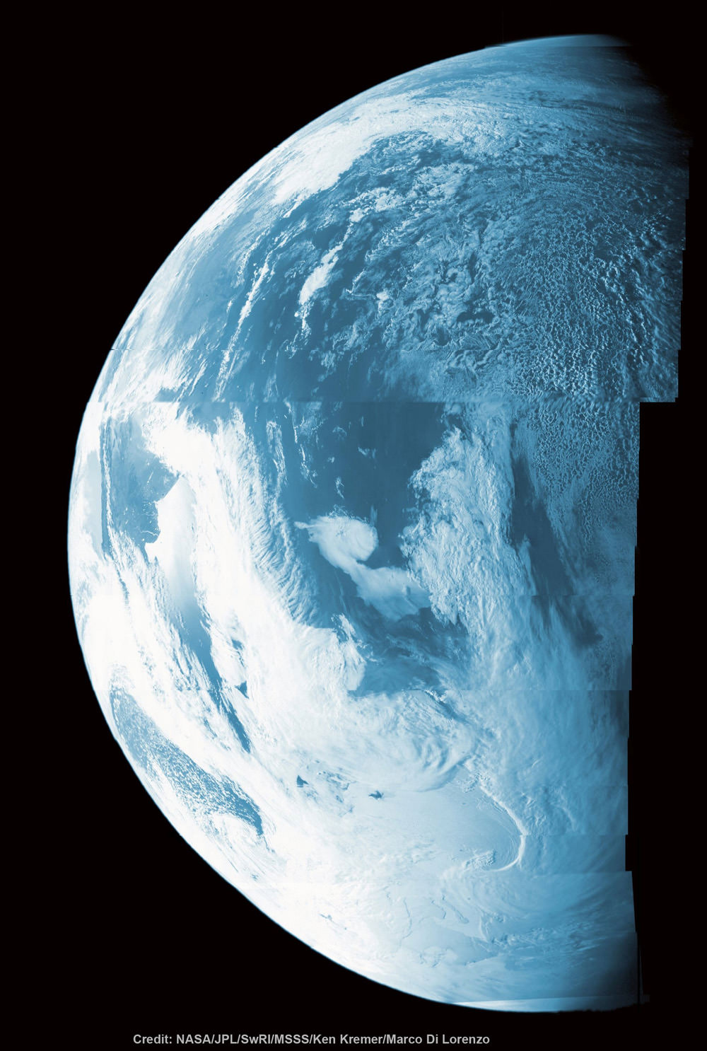
This colorized composite shows more than half of Earth’s disk over the coast of Argentina and the South Atlantic Ocean as the Juno probe slingshotted by on Oct. 9, 2013 for a gravity assisted acceleration to Jupiter. The mosaic was assembled from raw images taken by the Junocam imager. Credit: NASA/JPL/SwRI/MSSS/Ken Kremer/Marco Di Lorenzo
Happy Earth Day! Earth Day is good time to think about the beauty of our home planet and reflect on our stewardship of environmental resources like air and water.
Sometimes, though, our planet can be a bit unpredictable. The folks at HooplaHa have put together this entertaining 2-minute look at a few of our planet’s oddities… and it’s like a combo of “Funniest Home Videos” and “Science Friday.” While our astute readers will likely already know several of these facts, this video will be sure to make you smile.
NOAA's GOES-East satellite captured this stunning view of the Americas on Earth Day, April 22, 2014 at 11:45 UTC/7:45 a.m. EDT. The data from GOES-East was made into an image by the NASA/NOAA GOES Project at NASA's Goddard Space Flight Center. Credit: NASA/NOAA.
It’s been said that one of the reasons Earth Day was started back in 1970 was because of the images of Earth from space taken during the Apollo missions to the Moon. So, what better way to celebrate than to see how Earth looks today from space?
NOAA’s GOES-East satellite captured this stunning view of the Americas on Earth Day, April 22, 2014 at 11:45 UTC/7:45 a.m. EDT.
Find out more about this image and what all is visible here.
More satellite images will likely be taken today, and we’ll add them as they become available.
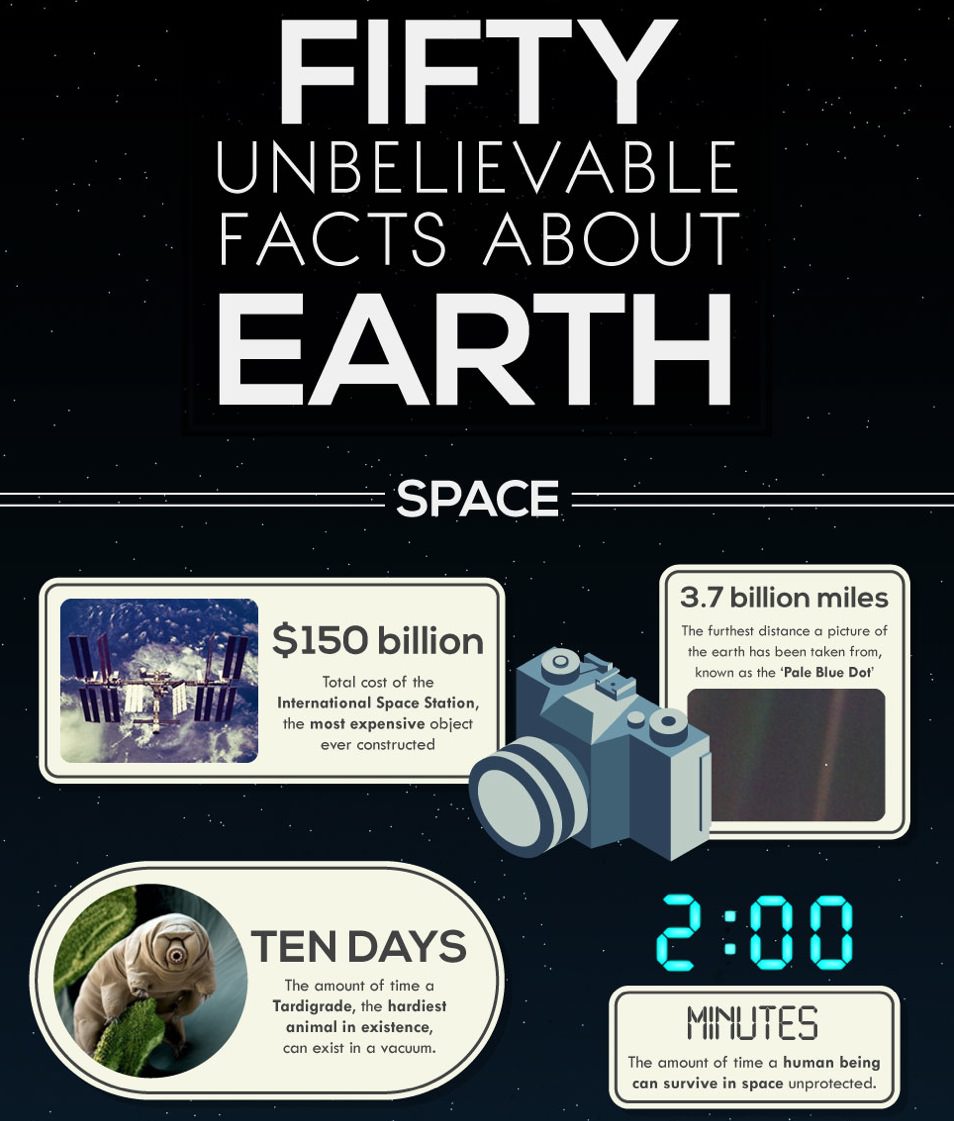
Do you know how much material falls onto Earth from space every day? How many different species there are in the ocean? How far the continents move every year? In honor of Earth Day here’s a very cool infographic that answers those questions about our planet — and 47 more!
Check out the full version below:
And for more interesting information about our planet, click here and here.
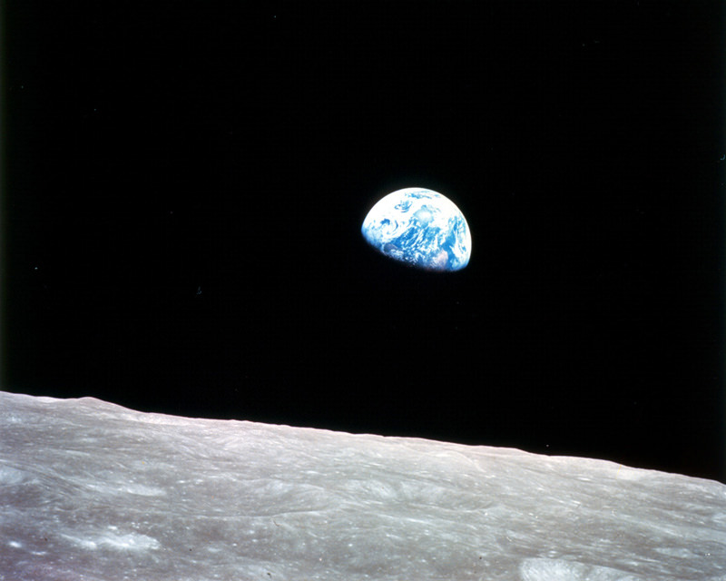
The first color photo of Earth taken from orbit around the Moon. (NASA)
On December 24, 1968, Apollo 8 astronauts Frank Borman, William Anders and Jim Lovell were the first humans to witness an Earthrise as our home planet came up over the lunar horizon. The photos they captured were the first of their kind, instantly inspiring the imaginations of millions and highlighting the beauty and fragility of our world.
Now, NASA has used modern satellite data to recreate the scenes that the Apollo 8 astronauts saw 44 years ago and combined them with their historic photographs to present a new “Earthrise”… version 2.0.
Created in recognition of Earth Day 2012, the Earthrise animation was made from data acquired by NASA’s Lunar Reconnaissance Orbiter’s laser altimeter, as well as the Moderate Resolution Imaging Spectroradiometer (MODIS) on the Terra Earth-observing satellite.
“This visualization recreates for everyone the wondrous experience of seeing Earth from that privileged viewpoint,” says LRO Project Scientist Rich Vondrak of NASA’s Goddard Space Flight Center.
Animator Ernie Wright recreated the scene using Apollo mission reports and photos taken by the crew. The audio is a recording of original communication from the astronauts.
[/caption]
“I think the one overwhelming emotion that we had was when we saw the earth rising in the distance over the lunar landscape… it makes us realize that we all do exist on one small globe. For from 230,000 miles away it really is a small planet.”
In honor of Earth Day, enjoy this beautiful timelapse compiled by science educator James Drake, who put together one of the first ISS flyover videos. This video was created from images produced by the Russian geostationary Electro-L Weather Satellite, and the images are some of the largest whole disk images of our planet, as the satellite is orbiting at about 40,000 km. Each image is 121 megapixels, and the resolution is 1 kilometer per pixel. They are taken every half hour in four different wavelengths of light — three visible, and one infrared. The infrared light is reflected by forests and vegetation, which appear orange in these images. Enjoy!
See more at Drake’s Planet Earth web page, including a zoomable, full resolution image of Earth, as well as other image downloads.