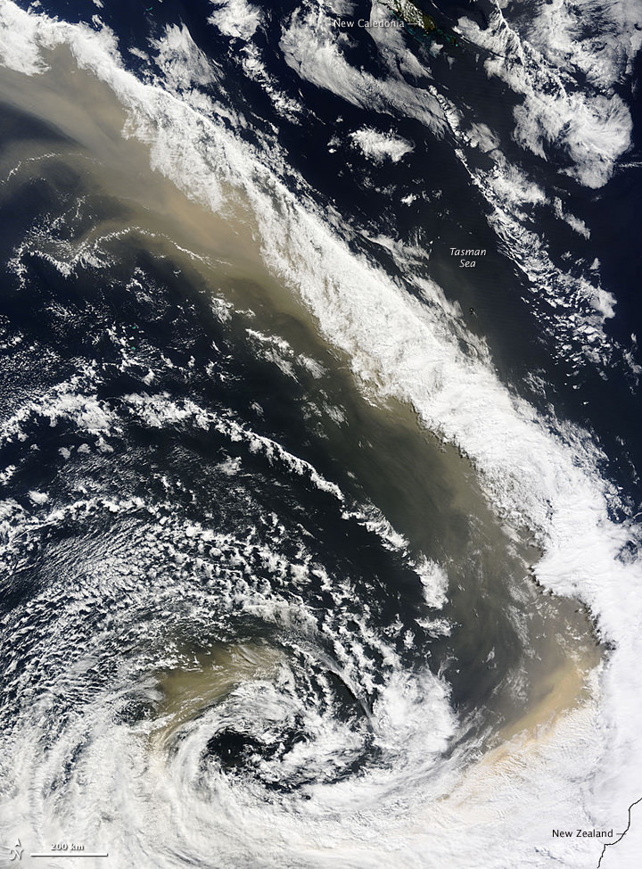
[/caption]This isn’t a special effect image from a new catastrophe movie; it is an actual satellite image of the dust storm sweeping over and around eastern Australia, heading across the Tasman Sea toward New Zealand. A dense wall of dust descended upon Sydney on Sept. 23, creating an apocalyptic scene (see these images from Boston Globe’s Big Picture) and the river of dust continues unabated across water. The Moderate Resolution Imaging Spectroradiometer (MODIS) on NASA’s Terra satellite captured this image of the storm on September 24, at 11:10 a.m., New Zealand time (23:10 UTC on September 23). The distance between the far northern edge of the plume and the southern edge is about 3,450 kilometers (2,700 miles), roughly equivalent to the distance between New York City and Los Angeles. Below, see how the storm progressed across the Sea later in the day.

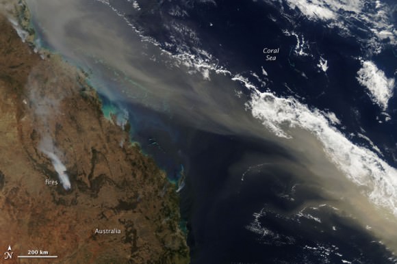
By the early afternoon of September 24, 2009, when the same satellite acquired this image, the thick dust that had covered the eastern shore of Australia previouly, stretched in a long plume from northern Queensland to New Zealand. This image shows the northern portion of the plume off the coast of Queenland. The tan dust is densely concentrated in a compact plume that mirrors the coastline. The gem-like blue-green Great Barrier Reef is visible beneath the plume near the top of the image where the tan dust mingles with gray-brown smoke from wildfires.
Source: NASA Earth Observatory

