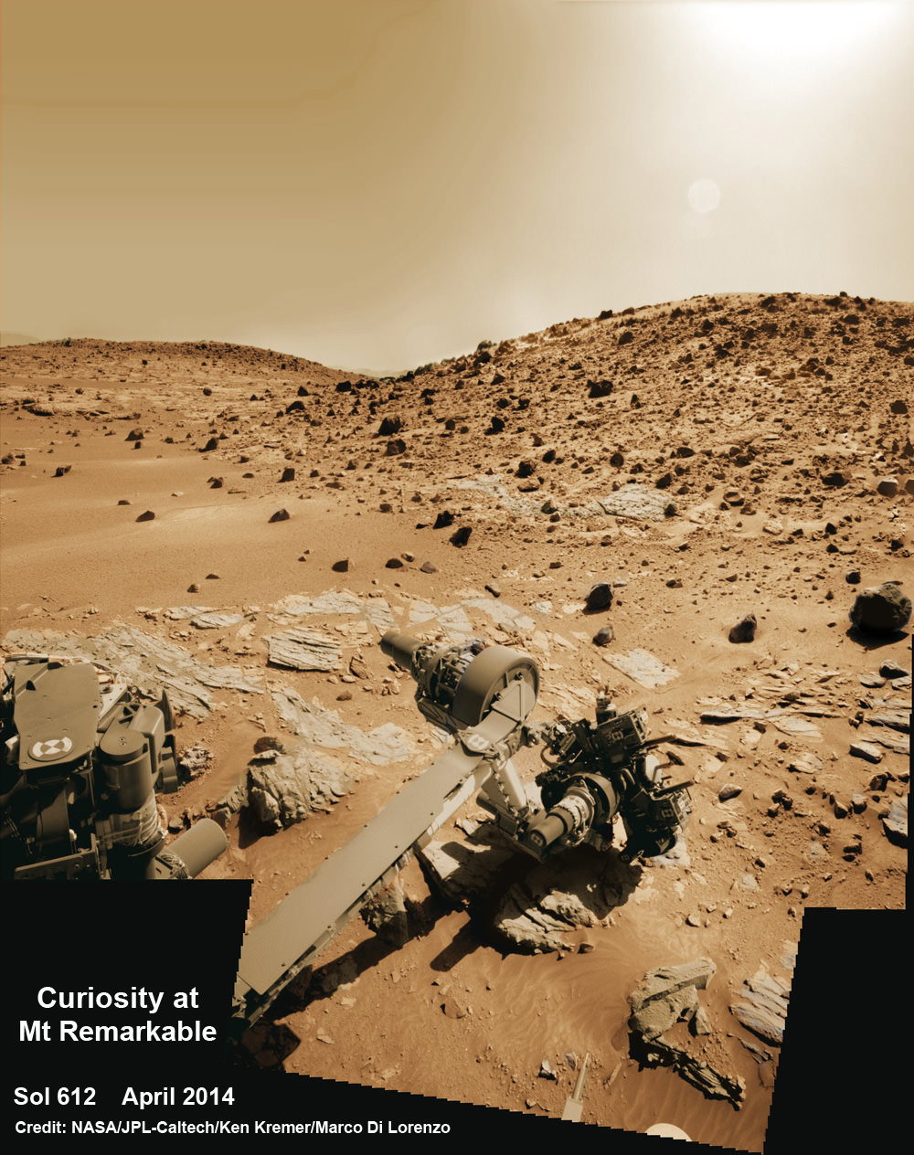
Composite photo mosaic shows deployment of NASA Curiosity rovers robotic arm and two holes after drilling into ‘Windjana’ sandstone rock on May 5, 2014, Sol 621, at Mount Remarkable as missions third drill target for sample analysis by rover’s chemistry labs. The navcam raw images were stitched together from several Martian days up to Sol 621, May 5, 2014 and colorized. Credit: NASA/JPL-Caltech/Ken Kremer – kenkremer.com/Marco Di Lorenzo
See additional Curiosity mosaics below-See our APOD featured on May 7, 2014[/caption]
After a rather satisfying test bore into a sandstone slab at “Kimberley” just last week, NASA’s rover Curiosity decided to go all the way for a deep drill excursion into the Red Planet rock target called “Windjana” and successfully collected powdery samples from the interior on Monday evening, May 5, Sol 621, that the rover will soon consume inside her belly for high tech compositional analysis with her state-of-the-art science instruments.
NASA reported the great news today, Tuesday, May 6, soon after receiving confirmation of the successful acquisition effort by the hammering drill, located at the terminus of the 1 ton robots 7-foot-long (2 meter) arm.
At long last its “Drill, Baby, Drill” time on Mars.
The “Kimberley Waypoint” drill campaign into “Windjana” at the Mount Remarkable butte thus marks only the third Martian rock bored for sampling analysis by the SUV sized rover. This also counts as a new type of Mars rock – identified as sandstone, compared to the pair of mudstone rocks bored into last year.
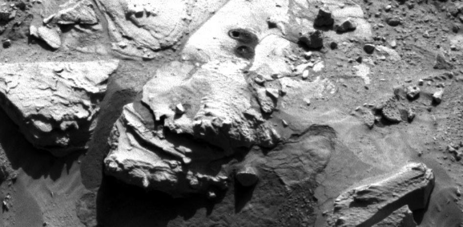
The fresh hole in “Windjana” created on Monday night was clearly visible in images received this afternoon and showed it was 0.63 inch (1.6 centimeters) in diameter and about 2.6 inches (6.5 centimeters) deep.
The operation went exactly as planned and left behind a residual pile of drill tailings much darker in color compared to the ubiquitous red color seen covering most of Mars surface.
The new full-depth hole is very close in proximity to the shallower “Mini-drill” test hole operation carried out on April 29 at Windjama to determine if this site met the science requirements for sampling analysis and delivery to the two onboard, miniaturized chemistry labs – SAM and CheMin.
“Windjana” is named after a gorge in Western Australia.

Featured on APOD – Astronomy Picture of the Day on May 7, 2014
“The drill tailings from this rock are darker-toned and less red than we saw at the two previous drill sites,” said Jim Bell of Arizona State University, Tempe, deputy principal investigator for Curiosity’s Mast Camera (Mastcam).
“This suggests that the detailed chemical and mineral analysis that will be coming from Curiosity’s other instruments could reveal different materials than we’ve seen before. We can’t wait to find out!”
In coming days, the sample will be pulverized and sieved prior to delivery to the Chemistry and Mineralogy instrument (CheMin) and the Sample Analysis at Mars instrument (SAM) for chemical and compositional analysis.
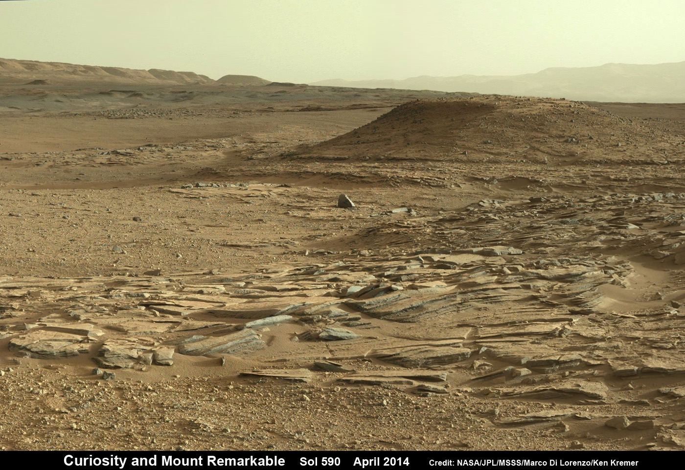
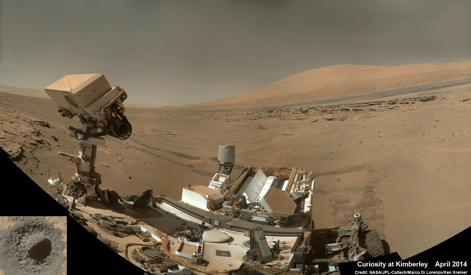
Windjana is an outcrop of sandstone located at the base of a Martian butte named Mount Remarkable at “The “Kimberley Waypoint” – a science stopping point reached by the rover in early April 2014 halfway along its epic trek to towering Mount Sharp, the primary destination of the mission.
See herein our illustrative photo mosaics of the Kimberly Waypoint region assembled by the image processing team of Marco Di Lorenzo and Ken Kremer.
The first two drill campaigns conducted during 2013 at ‘John Klein’ and ‘Cumberland’ inside Yellowknife Bay were on mudstone rock outcrops.
The science team chose Windjana for drilling “to analyze the cementing material that holds together sand-size grains in this sandstone,” says NASA.
“The Kimberley Waypoint was selected because it has interesting, complex stratigraphy,” Curiosity Principal Investigator John Grotzinger, of the California Institute of Technology, Pasadena, told me.
Curiosity departed the ancient lakebed at the Yellowknife Bay region in July 2013 where she discovered a habitable zone with the key chemical elements and a chemical energy source that could have supported microbial life billions of years ago – and thereby accomplished the primary goal of the mission.
Windjama is about 2.5 miles (4 kilometers) southwest of Yellowknife Bay.
Curiosity still has about another 4 kilometers to go to reach the base of Mount Sharp sometime later this year.

The sedimentary foothills of Mount Sharp, which reaches 3.4 miles (5.5 km) into the Martian sky, is the 1 ton robots ultimate destination inside Gale Crater because it holds caches of water altered minerals. Such minerals could possibly indicate locations that sustained potential Martian life forms, past or present, if they ever existed.
Stay tuned here for Ken’s continuing Curiosity, Opportunity, Chang’e-3, SpaceX, Orbital Sciences, LADEE, MAVEN, MOM, Mars and more planetary and human spaceflight news.