Studying Saturn’s Super Storm

Three views of Saturn's northern storm. ESO/University of Oxford/L. N. Fletcher/T. Barry

[/caption]

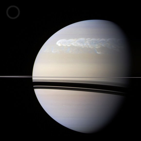
First seen by amateur astronomers back in December, the powerful seasonal storm that has since bloomed into a planet-wrapping swath of churning clouds has gotten some scrutiny by Cassini and the European Southern Observatory’s Very Large Telescope array situated high in the Chilean desert.

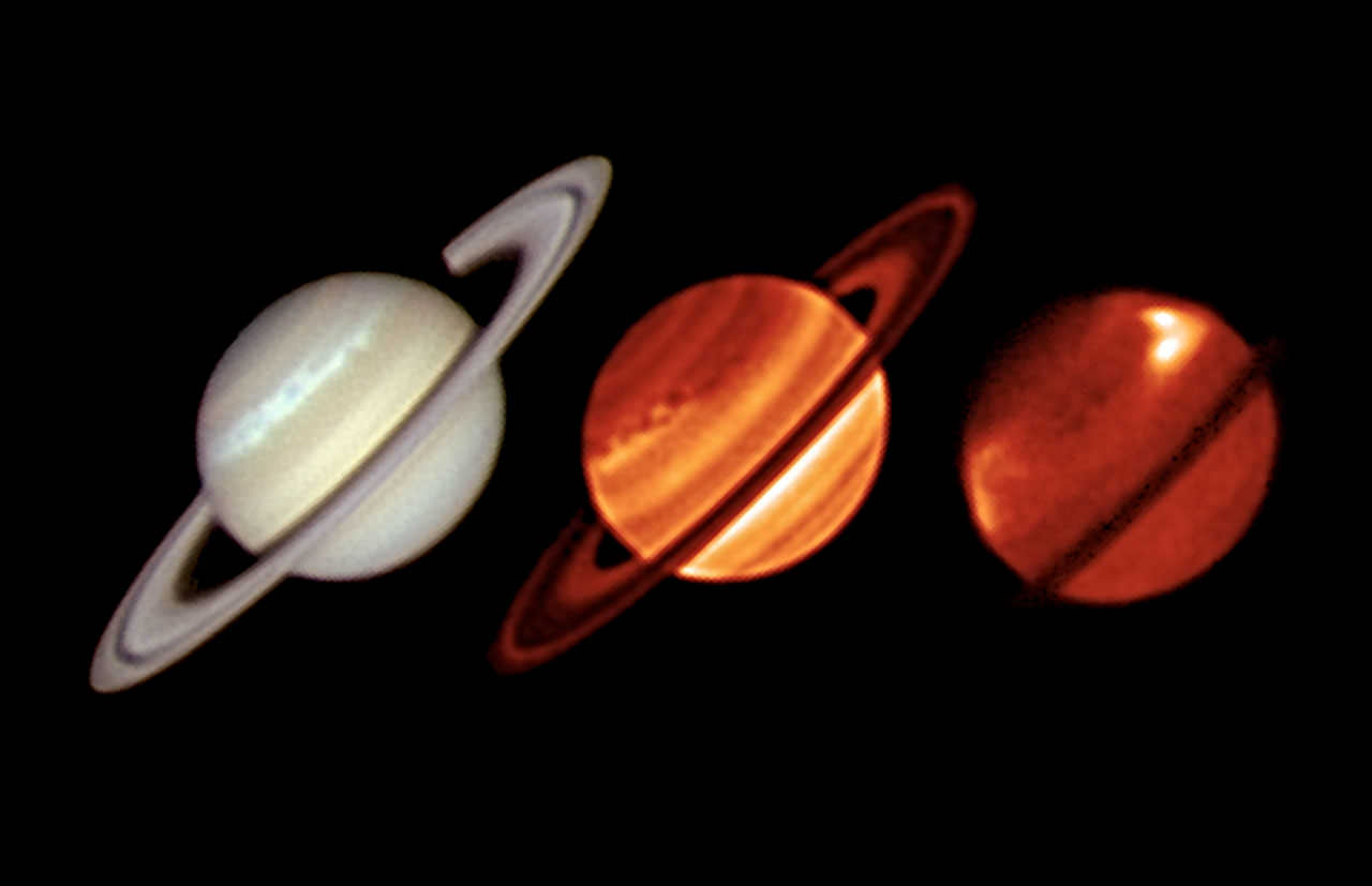
The image above shows three views of Saturn acquired on January 19: one by amateur astronomer Trevor Barry taken in visible light and the next two by the VLT’s infrared VISIR instrument – one taken in wavelengths sensitive to lower atmospheric structures one sensitive to higher-altitude features. 

Cassini image showing dredged-up ammonia crystals in the storm. NASA/JPL/Univ. of Arizona.

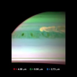
While the storm band can be clearly distinguished in the visible-light image, it’s the infrared images that really intrigue scientists. Bright areas can be seen along the path of the storm, especially in the higher-altitude image, marking large areas of upwelling warmer air that have risen from deep within Saturn’s atmosphere.

Normally relatively stable, Saturn’s atmosphere exhibits powerful storms like this only when moving into its warmer summer season about every 29 years. This is only the sixth such storm documented since 1876, and the first to be studied both in thermal infrared and by orbiting spacecraft.

The initial vortex of the storm was about 5,000 km (3,000 miles) wide and took researchers and astronomers by surprise with its strength, size and scale.

“This disturbance in the northern hemisphere of Saturn has created a gigantic, violent and complex eruption of bright cloud material, which has spread to encircle the entire planet… nothing on Earth comes close to this powerful storm.”

– Leigh Fletcher, lead author and Cassini team scientist at the University of Oxford in the United Kingdom.

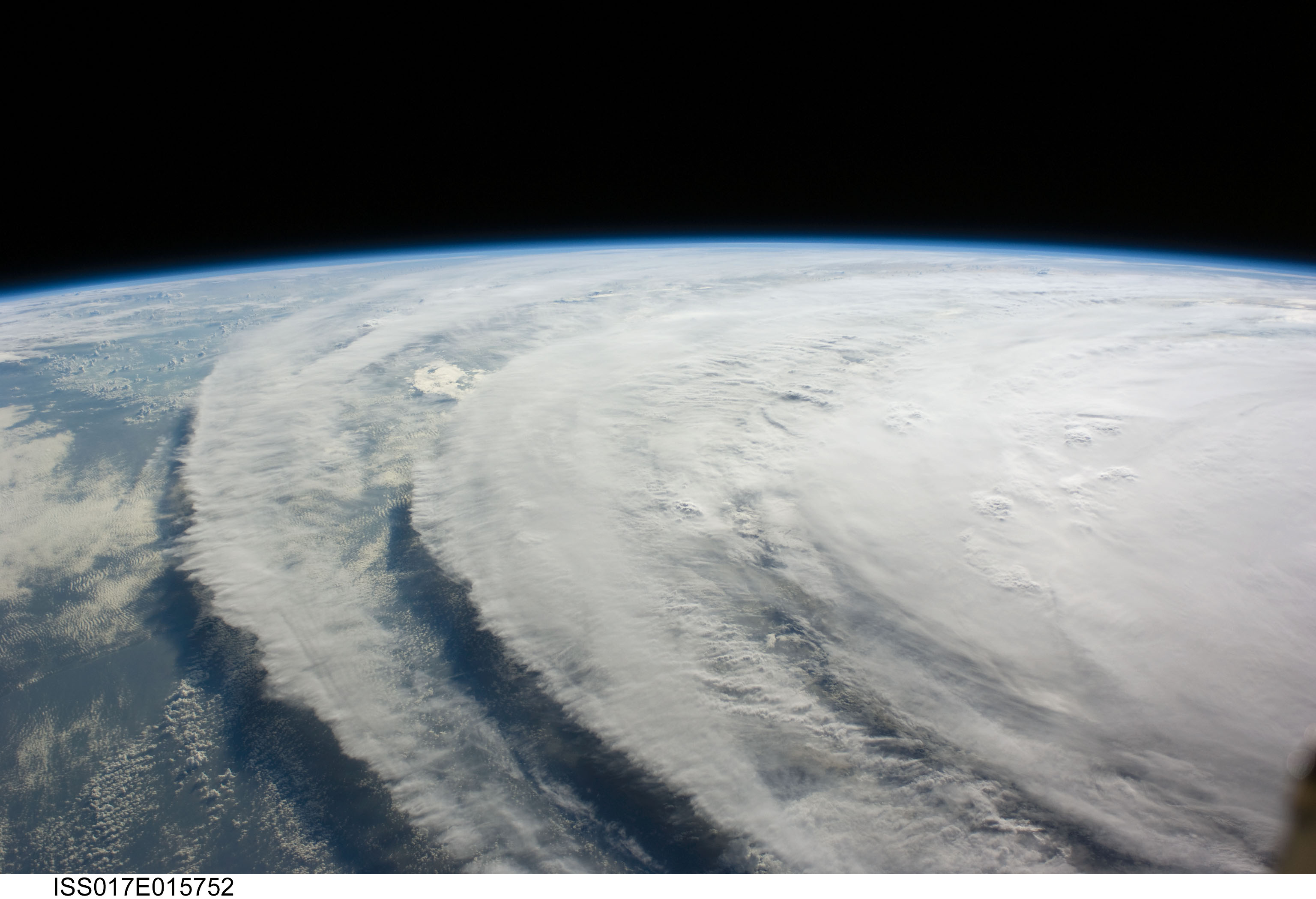
The origins of Saturn’s storm may be similar to those of a thunderstorm here on Earth; warm, moist air rises into the cooler atmosphere as a convective plume, generating thick clouds and turbulent winds. On Saturn this mass of warmer air punched through the stratosphere, interacting with the circulating winds and creating temperature variations that further affect atmospheric movement.

The temperature variations show up in the infrared images as bright “stratospheric beacons”. Such features have never been seen before, so researchers are not yet sure if they are commonly found in these kinds of seasonal storms.

“We were lucky to have an observing run scheduled for early in 2011, which ESO allowed us to bring forward so that we could observe the storm as soon as possible. It was another stroke of luck that Cassini’s CIRS instrument could also observe the storm at the same time, so we had imaging from VLT and spectroscopy of Cassini to compare. We are continuing to observe this once-in-a-generation event.”

– Leigh Fletcher

A separate analysis using Cassini’s visual and infrared mapping spectrometer confirmed the storm is very violent, dredging up larger atmospheric particles and churning up ammonia from deep in the atmosphere. Other Cassini scientists are studying the evolving storm and a more extensive picture will emerge soon.

Read the NASA article here, or the news release from ESO here.


The leading edge of Saturn's storm in visible RGB color from Cassini raw image data taken on February 25, 2011. (The scale size of Earth is at upper left.) NASA / JPL / Space Science Institute. Edited by J. Major.

Where do Hurricanes Occur?

View of Hurricane Ike From Space Station

What is a hurricane? Well, a hurricane is a tropical cyclone that occurs in the North Atlantic Ocean or the Northeast Pacific Ocean and remains east of the International Dateline. Tropical cyclones are characterized by a large low pressure center and numerous thunderstorms. These produce strong winds and heavy rain. These cyclones feed on heat released when moist air rises causing condensation of the water vapor that is contained in the moist air. These storms are fueled by a different heat mechanism than other cyclonic windstorms(nor’easters, polar lows, and European windstorms). They are classified as a warm core storm system.

All tropical cyclones are areas of low atmospheric pressure. As a matter of fact, the pressures recorded at the center of tropical cyclones are among the lowest that occur at sea level. A hurricane is characterized and driven by the release of large amounts of latent heat of condensation(water vapor condenses as it moves upward). This heat is distributed vertically around the center of the storm, so, except at the surface of water, it is warmer inside the cyclone than it is outside. At the center of the hurricane is an area of sinking air. If this area is strong enough, it can develop into a large eye. Weather in the eye is normally calm and free of clouds, but the surface of the sea may be tossing violently. The eye is normally circular in shape, and may range in size from 3 km to 370 km in diameter.

While a tropical cyclone’s primary energy source is the release of the heat of condensation, solar heating is the initial source of that evaporation. An initial warm core system(an organized thunderstorm complex) is necessary for the formation of a tropical cyclone, but a large flux of energy is needed to lower atmospheric pressure. The influx of warmth and moisture from the underlying ocean surface is critical for tropical cyclone strengthening and most of it comes from the lower 1 km of the atmosphere. Condensation leads to higher wind speeds. These faster winds and the lower pressure associated with them cause an increase in surface evaporation and more condensation. This positive feedback system continues and feeds the hurricane until the conditions for hurricane formation are gone. The rotation of Earth causes the system to spin,(the Coriolis effect) which gives it a cyclonic appearance and affects its trajectory.
Tropical cyclones are distinguished by the deep convection that fuels them. Since convection is strongest in the tropics it defines the initial domain of the tropical cyclone. To continue to feed itself a tropical cyclone must remain over warm water. When a tropical cyclone passes over land, it is cut off from its heat source and its strength diminishes rapidly. The passage of a tropical cyclone over the ocean can cause the upper layers of the ocean to cool substantially, which can influence subsequent cyclone development. Scientists at the National Center for Atmospheric Research in the US estimate that a tropical cyclone releases heat energy equal to 70 times the world energy consumption, 200 times the worldwide electrical generating capacity, or the same as exploding a 10 megaton nuclear bomb every 20 minutes.
Well, there you have the answer to what is a hurricane. It is a tropical nightmare, but if humans could somehow harness that energy we would never need fossil fuels again.

We have written many articles about hurricanes for Universe Today. Here’s an article about human influences generating more hurricanes, and here’s a NASA video of Hurricane Bill.

If you’d like more info on hurricanes, check out Visible Earth Homepage. And here’s a link to NASA’s Earth Observatory.

We’ve also recorded an episode of Astronomy Cast all about planet Earth. Listen here, Episode 51: Earth.

Sand Storm

Spring Sandstorm Scours China

[/caption]

A sand storm, also known as a dust storm is an atmospheric event when strong winds lift dust from one region and carry it into another. They’re most common in arid, desert regions where there’s little vegetation to hold the topsoil and sand down. Large sand storms can carry dust thousands of kilometers; dust that started in the Arabian desert can be dropped into the Pacific Ocean.

Sand storms get going when there’s a very dry region, without wet soil to hold the particles together. The smallest particles of sand can be pulled out of the ground by the wind, and held in suspension by the wind. It’s thought that static electricity in the storm can cause even more particles to pull out of the ground in addition to the wind effect. In some cases the dust is held low to the ground, but with the right atmospheric conditions, the sand can be carried more than 6 km high in the atmosphere.

Although sand storms are a natural event, it’s believed that poor farming techniques contribute to the problem. As the topsoil is depleted and erodes away by farming and grazing animals, it exposes the underlying sand and dust. This situation led to the huge dust storms of the Dust Bowl in the 1930s in the United States.

A dust storm can be quite a hazard if you get caught in one. The storms can spread over hundreds of kilometers, with driving winds that can be over 40 km/h. The sand can be thick enough to obscure visibility down to a very short distance. The dust can also be a danger to people with asthma and other respiratory illnesses.

Dust storms don’t just happen on Earth, they can also happen on Mars. In fact, dust storms can become so large on Mars they obscure the entire planet. When NASA’s Mariner 9 spacecraft arrived at Mars in 1971, there was a huge dust storm raging. Only the volcano Olympus Mons was visible above the haze of the dust storm. The most recent planet-wide dust storm occurred in 2007, posing a risk to the Mars Exploration Rovers. They rely on sunlight to power their solar panels, but the dust settling on their panels was reducing their power output.

We have written many articles about sand storms for Universe Today. Here’s an article about the black sand beaches, and here are some sandstorm pictures.

If you’d like more info on sandstorms, check out Visible Earth Homepage. And here’s a link to NASA’s Earth Observatory.

We’ve also recorded an episode of Astronomy Cast all about planet Earth. Listen here, Episode 51: Earth.