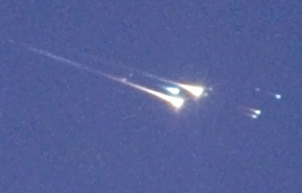
When WT1190F struck this atmosphere over the Indian Ocean around 6:20 Universal Time (12:20 a.m. CST) today , it broke apart into multiple fireballs against the blue sky. The object came down around 1:20 p.m. local time. Credit: IAC/UAE Space Agency/NASA/ESA
Clouds hampered observations from the ground in Sri Lanka during the re-entry of WT1190F overnight, but a team of astronomers captured spectacular images of the object from a high-flying plane over the Indian Ocean very close to the predicted time of arrival.
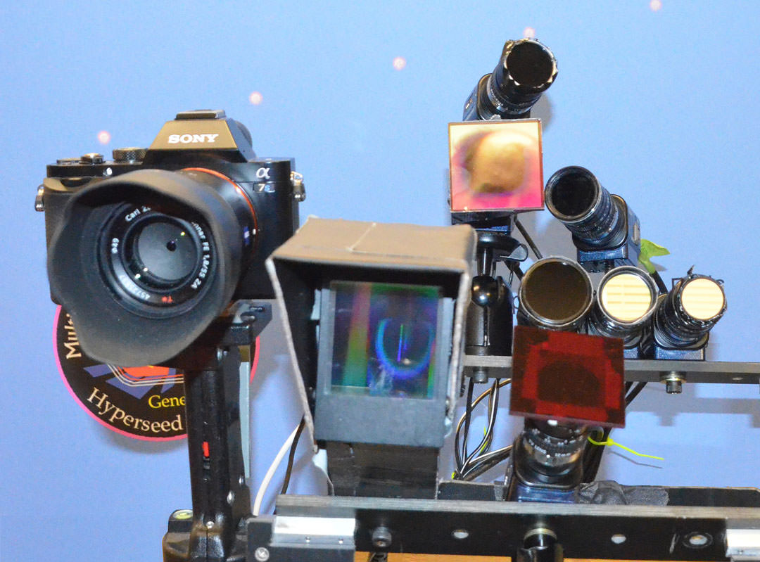
Peter Jenniskens of the SETI Institute and NASA Ames Research Center is shown here before the flight setting up the eleven staring cameras with a wider field of view, including two spectographic cameras, to catch the reentry. Credit: IAC/UAE Space Agency/NASA/ESA
The International Astronomical Center (IAC) and the United Arab Emirates Space Agency hosted a rapid response team to study the re-entry of what was almost certainly a rocket stage from an earlier Apollo moon shot or the more recent Chinese Chang’e 3 mission. In an airplane window high above the clouds, the crew, which included Peter Jenniskens, Mike Koop and Jim Albers of the SETI Institute along with German, UK and United Arab Emirates astronomers, took still images, video and gathered high-resolution spectra of the breakup.
Video and still imagery of WT1190F’s Reentry November 13, 2015
The group of seven astronomers hoped to study WT1190F’s re-entry as a test case for future asteroid entries as well as improve our understanding of space debris behavior. Photos and video show the object breaking up into multiple pieces in a swift but brief fireball. From the spectra, the team should be able to determine the object’s nature — whether natural or manmade.
Wide view of the colorful fireball and breakup when WT1190F struck Earth’s atmosphere. More than 20 cameras were used to record the event. Credit: IAC/UAE Space Agency/NASA/ESAAnimation from photos made on Nov. 12 when WT1190F was still in one piece in orbit about the Earth. Credit: Marco LangbroekFlying observatory. This Gulfstream 450 business jet, sponsored by United Arab Emirates and coordinated by Mohammad Shawkat Odeh from the International Astronomical Center, Abu Dhabi, was used by the team to observe and record the re-entry. Only five windows were available to make observations. Credit: IAC/UAE Space Agency/NASA/ESASETI Institute “staring cameras” used for wide field observations of the re-entry. Credit: IAC/UAE Space Agency/NASA/ESA
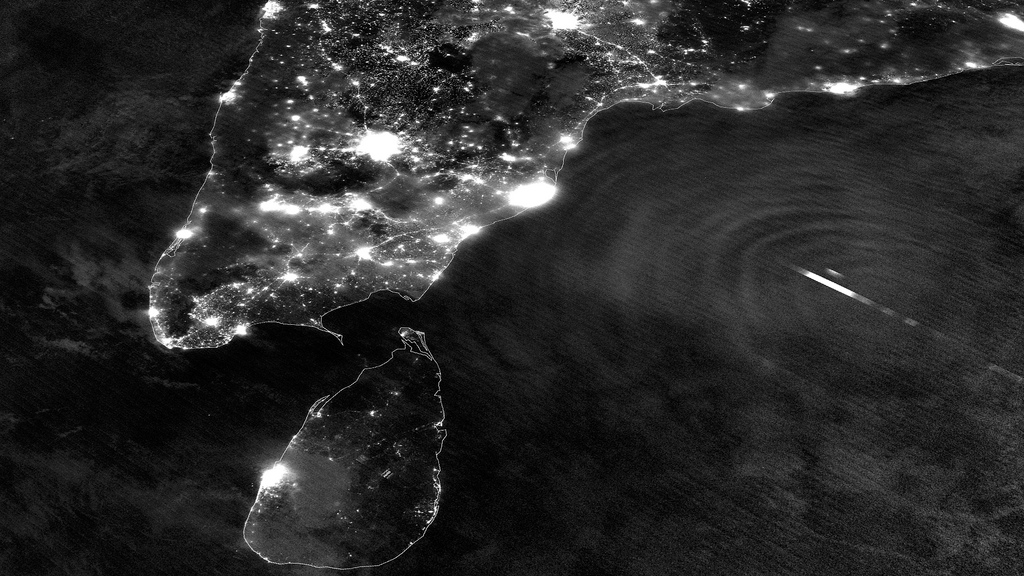
Nighttime image of southern India and Tropical Cyclone Mahasen (NASA/NOAA)
Last Monday, May 13, the Suomi NPP satellite captured a fascinating image of Tropical Cyclone Mahasen as it moved northeast over the Bay of Bengal. The clouds of the storm itself weren’t optically visible in the darkness of a nearly new Moon, but lightning flashes within it were… as well as the eerie ripples of atmospheric gravity waves spreading outwards from its center.
According to the Space Physics Research Group at the University of California, Berkeley:
Gravity waves are the oscillations of air parcels by the lifting force of bouyancy and the restoring force of gravity. These waves propagate vertically as well as horizontally, and actively transport energy and momentum from the troposphere to the middle and upper atmosphere. Gravity waves are caused by a variety of sources, including the passage of wind across terrestrial landforms, interaction at the velocity shear of the polar jet stream and radiation incident from space. They are found to affect atmospheric tides in the middle atmosphere and terrestrial weather in the lower atmosphere. (Source)
Atmospheric gravity waves aren’t to be confused with gravitational waves in space, which are created by very dense, massive objects (like white dwarf stars or black holes) orbiting each other closely.
When the image was captured, Tropical Cyclone Mahasen was moving north through the Indian Ocean along a track that placed landfall along the Bangladesh coast. As it moved off the coast of India Suomi’s VIIRS Day-Night Band was able to resolve lightning flashes towards the center of the storm, along with mesopheric gravity waves emanating outwards like ripples in a pond.
Such gravity waves are of particular interest to air traffic controllers so assist in identifying areas of turbulence.
Since the moon was in a new phase, the lights and other surface features of India and Sri Lanka are clearly visible although the clouds of Mahasen are not — a tradeoff that occurs as the amount of moonlight cycles throughout the month.
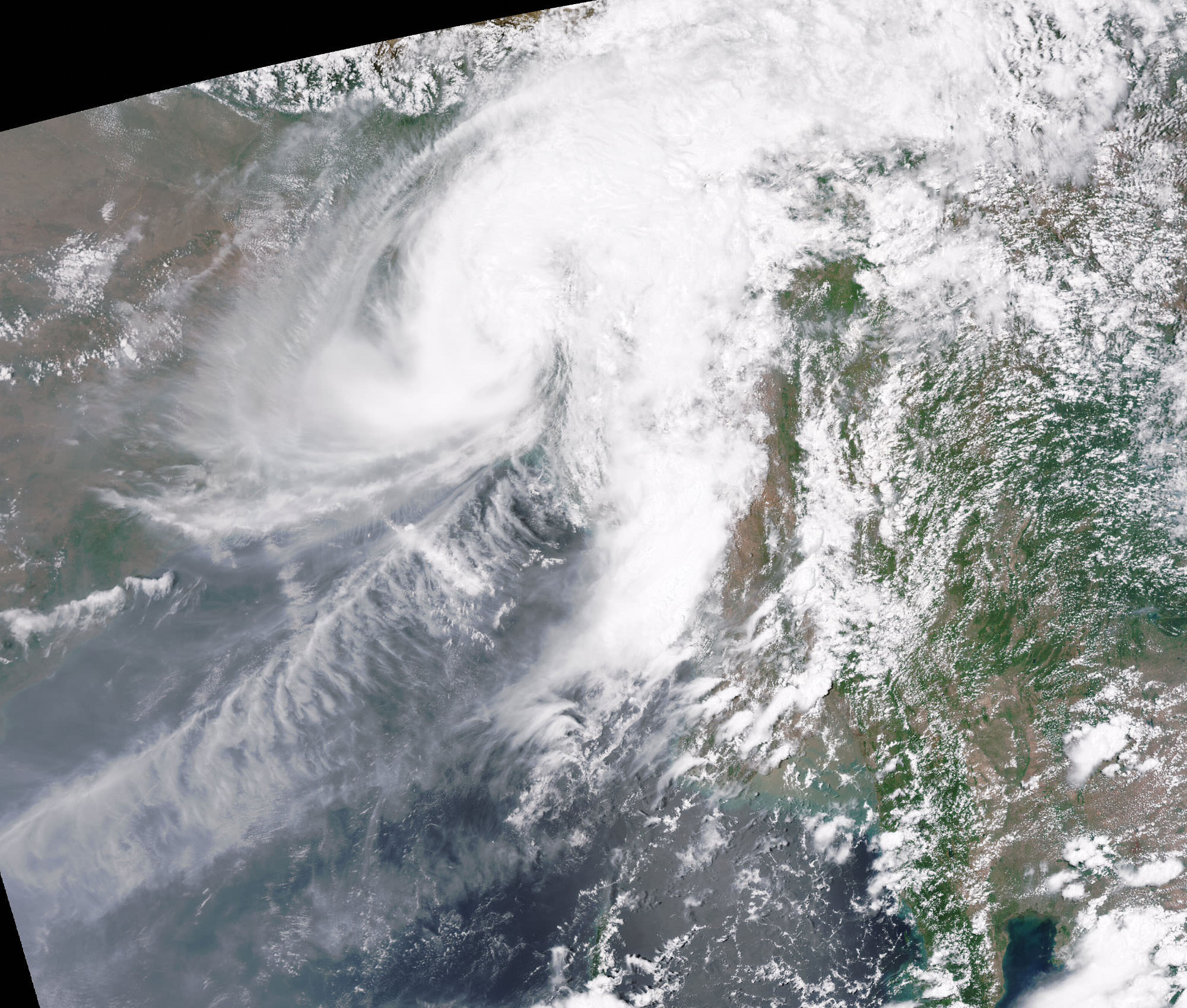
TS Mahasen on May 17, 2013 (Chelys/EOSnap)
Over the course of the next few days Mahasen weakened into a deep depression, making landfall as a tropical storm on Bangladesh on May 16. In preparation for the storm large-scale evacuations were recommended for parts of Myanmar; however, this resulted in the overcrowding of boats and several vessels capsized. (Source: eosnap.com)
NASA launched the National Polar-orbiting Operational Environmental Satellite System Preparatory Project (or NPP) on October 28, 2011 from Vandenberg Air Force Base. On Jan. 24, NPP was renamed Suomi National Polar-orbiting Partnership, or Suomi NPP, in honor of the late Verner E. Suomi. It’s the first satellite specifically designed to collect data to improve short-term weather forecasts and increase understanding of long-term climate change.
Suomi NPP orbits Earth about 14 times a day, observing nearly the entire surface of the planet.