
Hawaii is famous for its lovely mountains, tropical climate, and majestic oceanfront vistas. Another thing it is famous for is the string of volcanoes that dot its islands. As a land that sits atop a geographic hot spot – i.e. an area deep within the Earth’s mantle from which heat rises, forming magma that is then pushed to the surface – the island is also home to some serious volcanic activity.
Consider Haleakala, the massive shield volcano that constitutes more than 75% of the Hawaiian Island of Maui. The result of volcanic activity that took place roughly 1 million years ago, this volcano has played an active role in the geological and cultural history of the Hawaiian islands. Description and Naming:
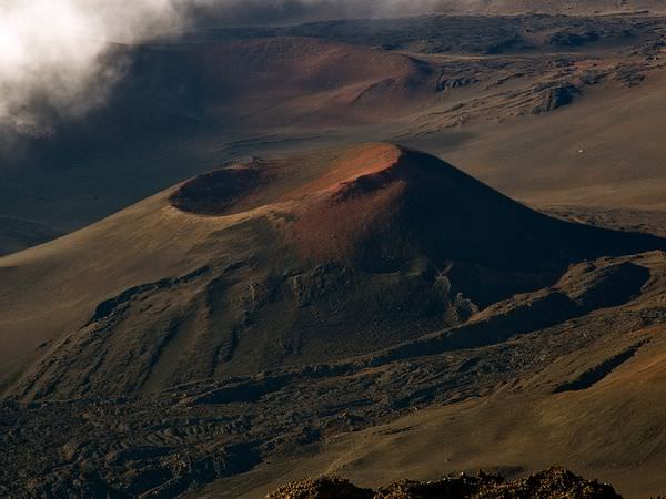
Like all shield volcanoes, Haleakala was formed from a series of highly fluid magma flows. This is the reason for its general appearance, as well as the designation – i.e. it resembles a broad shield lying on the ground. It’s tallest peak, which is named is Pu’u ‘Ula’ula (“Red Hill”) in native Hawaiian, measures 3,055 m (10,023 ft) tall.
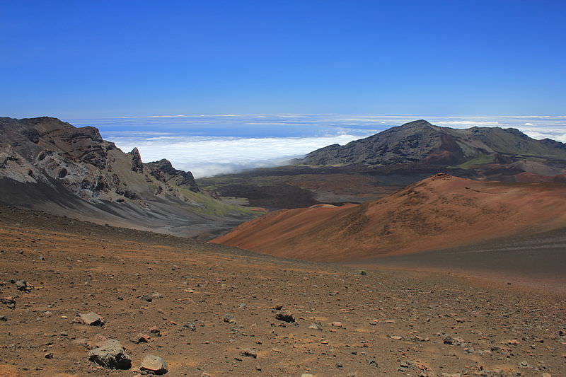
At Haleakala’s summit lies a massive depression (crater) that measures some 11.25 km (7 miles) in diameter and nearly 800 m (2,600 ft) deep. The name Haleakala means literally “House of the Sun”, which was given to the general mountain area by the early Hawaiian people.
Geology:
Haleakala is part of a sequence of lava flows that emerged near the end of East Maui. This region is believed to have begun experiencing lava flows about 2.0 million years ago, and it is estimated that the volcano formed from the ocean floor to its current shield-like shape over the course of the ensuing 600,000 years. The oldest exposed lava flow on East Maui is dated to 1.1 million years ago.
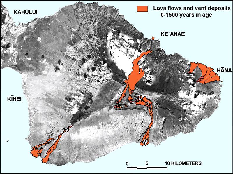
In the past 30,000 years, the volcanism on East Maui has been focused along the southwest and east rift zones. These two volcanic axes together form one gently curving arc that passes from La Perouse Bay (southwest flank of East Maui) through Haleakala Crater to Hana on the east flank.
The alignment of these axes continues east beneath the ocean as Haleakala Ridge, one of the longest rift zones along the Hawaiian Islands volcanic chain. The on-land segment of this lengthy volcanic line of vents is the zone of greatest hazard for future lava flows and cindery ash.
Contrary to popular belief, the Haleakala “crater” is not volcanic in origin, nor can it accurately be called a caldera (which is formed when the summit of a volcano collapses to form a depression). Scientists believe instead that the depression was formed when the headwalls of two large erosional valleys merged at the summit of the volcano.
History:
Haleakala has produced numerous eruptions in the last 30,000 years, including in the last 500 years. The volcano has figured prominently in the island’s history of human occupation. In Hawaiian folklore, the crater at the summit was home to the grandmother of the demigod Maui. According to the legend, Maui’s grandmother helped him capture the sun and force it to slow its journey across the sky in order to lengthen the day.
Until recently, the East Maui Volcano was thought to have last erupted around 1790, based largely on comparisons of maps made during the voyages of the explorers La Perouse and George Vancouver. Recent advanced dating tests, however, have shown that the last eruption was more likely to have taken place in the 17th century.
Modern geologic mapping efforts began in 1997, which yielded the most detailed and accurate picture of Haleakala’s volcanic history to date. In addition, there are fears that the volcano is not extinct, but just currently dormant, and may erupt again within the next 500 years.
For these reasons, the U.S. Geological Survey maintains a sparse seismic network on Haleakala volcano and conducts periodic surveys, using GPS receivers that gather data about the volcano’s surface deformation or lack thereof.
Modern Uses:
In 1916, Haleakala National Park was created, a 30,183-acre (122.15 km2) park surrounding the summit depression, Kipahulu Valley on the southeast, and ‘Ohe‘o Gulch (and pools), extending to the shoreline in the Kipahulu area. Within the park, 19,270 acres (77.98 km2) is a wilderness area, which is why the park area was designated an International Biosphere Reserve in 1980.
The main feature of this part of the park is the famous Haleakala Crater. Two main trails lead into the crater from the summit area – the Halemau’u and Sliding Sands trails. Haleakala is popular with tourists and locals alike, who often venture to its summit – or to the visitor center just below the summit – to view the sunrise. There is lodging in the crater in the form of a few simple cabins.
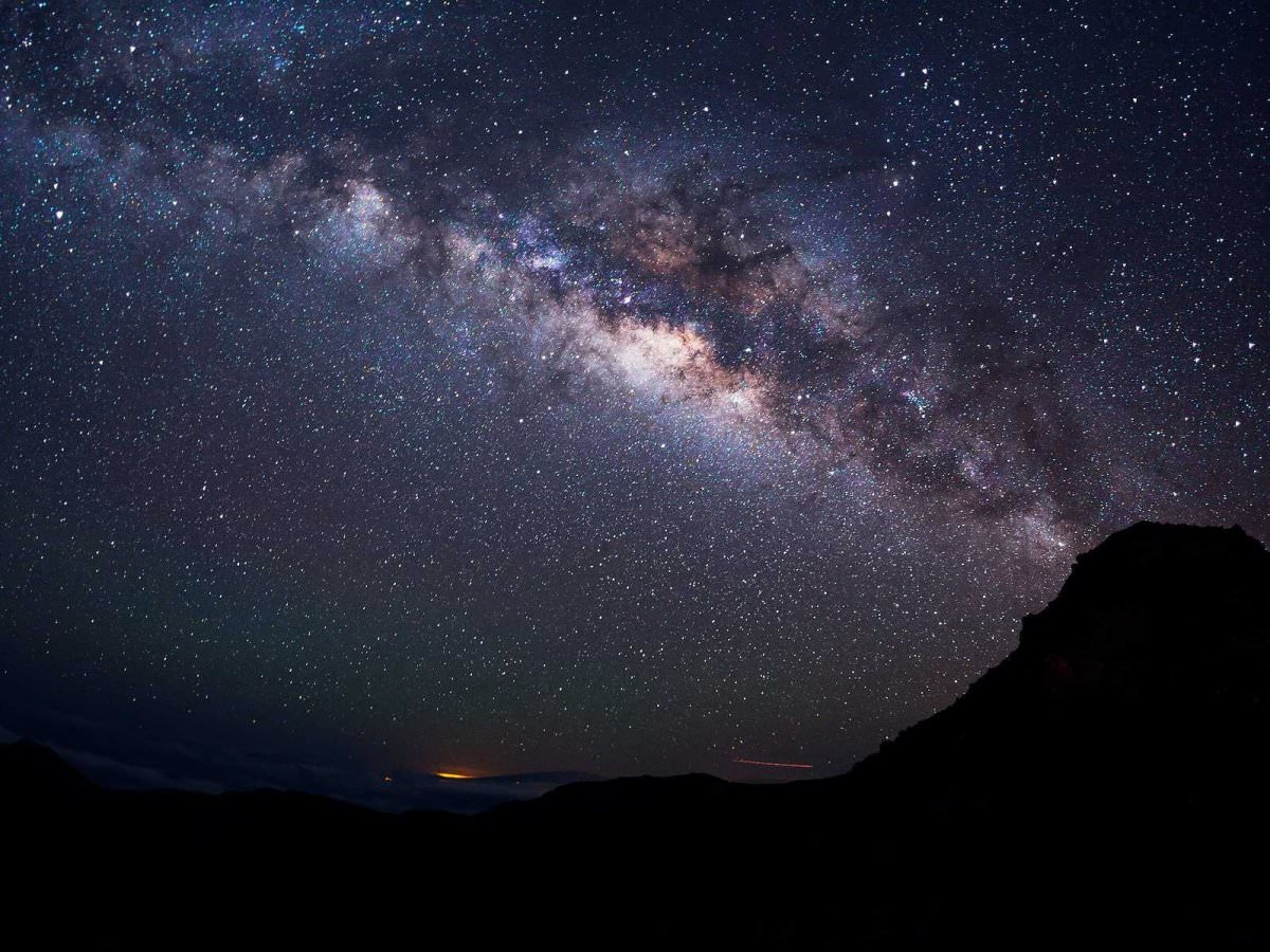
Because of the clarity and stillness of the air, the summit of Haleakala is one of the most valuable spots for observatories. It is also far enough away from the city lights to avoid light pollution, and above one-third of the planet’s atmosphere. Hence why the summit is the location of an astrophysical research facility – known as “Science City” – which is operated by a number of U.S. government and academic organizations.
These include the U.S. Department of Defense, the University of Hawaii, the Smithsonian Institution, the US Air Force, the Federal Aviation Administration (FAA), and others. Some of the telescopes operated by the US Department of Defense are involved in researching man-made (e.g. spacecraft, monitoring satellites, rockets, and laser technology) rather than celestial objects.
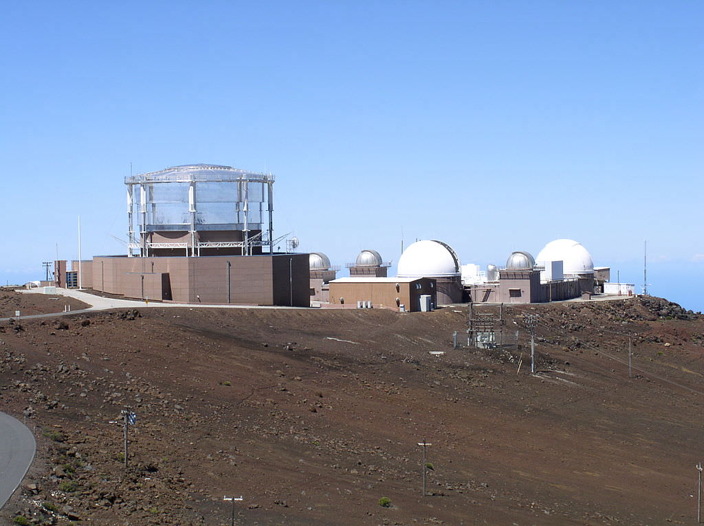
The scientific program is run in collaboration with defense contractors in the Maui Research and Technology Park in Kihei. Despite concerns that Maui’s growing population will mean increased incidents of light pollution, new telescopes are being added – such as the Pan-STARRS in 2006.
Although another 500 years or more may pass before Haleakala erupts again, it’s also possible that new eruptions will begin in the near future. However, according to the United States Geological Survey (USGS) Volcano Warning Scheme for the United States, the Volcanic-Alert Level as of June 2013 was “normal”. Given the likelihood of significant environmental and property damage, not to mention the potential loss of life, one can only hope this holds true for the foreseeable future.
Universe Today has articles on types of volcanoes and what are volcanoes, and the Pacific Ring of Fire.
For more information, check out Haleakala, a potentially hazardous volcano and Haleakala.
Astronomy Cast has an episode on volcanoes.