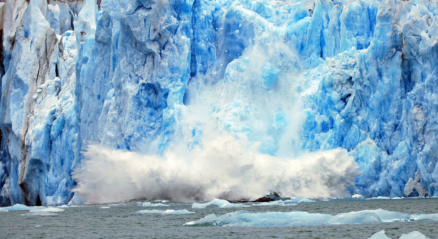
25 years of satellite data from the European Space Agency show the rate at which Earth is losing its ice speeding up. Image Credit: ESA
The rate at which Greenland is losing its ice is accelerating. This unsurprising conclusion comes from a new study based on 25 years of satellite data from the European Space Agency. The new study was published in Earth and Planetary Science Letters. Continue reading “Ice loss in Greenland is Accelerating”
Guests:This week, we welcome Andrew Helton and Ryan Hamilton, member of the SOFIA Telescope Team.
Andrew is the Instrument Scientist for the Faint Object infraRed CAmera for the SOFIA Telescope (FORCAST) dual channel, mid-infrared camera and spectrograph, one of the observatory’s facility-class science instruments.
Ryan is the Instrument Scientist for the upgraded High-resolution Airborne Wideband Camera (HAWC+) on board NASA’s Stratospheric Observatory for Infrared Astronomy (SOFIA).
We’ve had an abundance of news stories for the past few months, and not enough time to get to them all. So we’ve started a new system. Instead of adding all of the stories to the spreadsheet each week, we are now using a tool called Trello to submit and vote on stories we would like to see covered each week, and then Fraser will be selecting the stories from there. Here is the link to the Trello WSH page (http://bit.ly/WSHVote), which you can see without logging in. If you’d like to vote, just create a login and help us decide what to cover!
We record the Weekly Space Hangout every Friday at 12:00 pm Pacific / 3:00 pm Eastern. You can watch us live on Google+, Universe Today, or the Universe Today YouTube page.
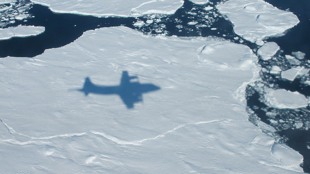
The NASA P-3B's shadow on sea ice off of southeast Greenland during an IceBridge survey on Apr. 9, 2013. Flying at a low altitude allows IceBridge researchers to gather detailed data. Credit: NASA / Jim Yungel
How much is the polar ice melting, and how are the sheets being affected by climate change? These are some of the questions that NASA’s Operation IceBridge seeks to answer. You can see a quick overview of the mission in the video above.
“IceBridge, a six-year NASA mission, is the largest airborne survey of Earth’s polar ice ever flown,” NASA stated in the YouTube description accompanying the video.
“It will yield an unprecedented three-dimensional view of Arctic and Antarctic ice sheets, ice shelves and sea ice. These flights will provide a yearly, multi-instrument look at the behavior of the rapidly changing features of the Greenland and Antarctic ice,” the agency added.
The aerial survey is intended to supplement information from NASA’s Ice Cloud and Land Elevation Satellite (ICESat), which has been orbiting Earth since 2003, and the forthcoming ICESat-2 that is expected to launch in early 2016.