This detail of the TESS northern panorama features a region in the constellation Cygnus. At center, the sprawling dark nebula Le Gentil 3, a vast cloud of interstellar dust, obscures the light of more distant stars. A prominent tendril extending to the lower left points toward the bright North America Nebula, glowing gas so named for its resemblance to the continent. Credit: NASA/MIT/TESS and Ethan Kruse (USRA)
NASA’s TESS planet-finding spacecraft completed its primary mission about 3 months ago. TESS’s (Transiting Exoplanet Survey Satellite) job was to search the brightest stars nearest to Earth for transiting exoplanets. It found 74 confirmed exoplanets, with another ~1200 candidates awaiting confirmation.
It surveyed 75% of the sky during its two-year primary mission, and now NASA has released a composite image of the northern sky, made up of more than 200 individual images.
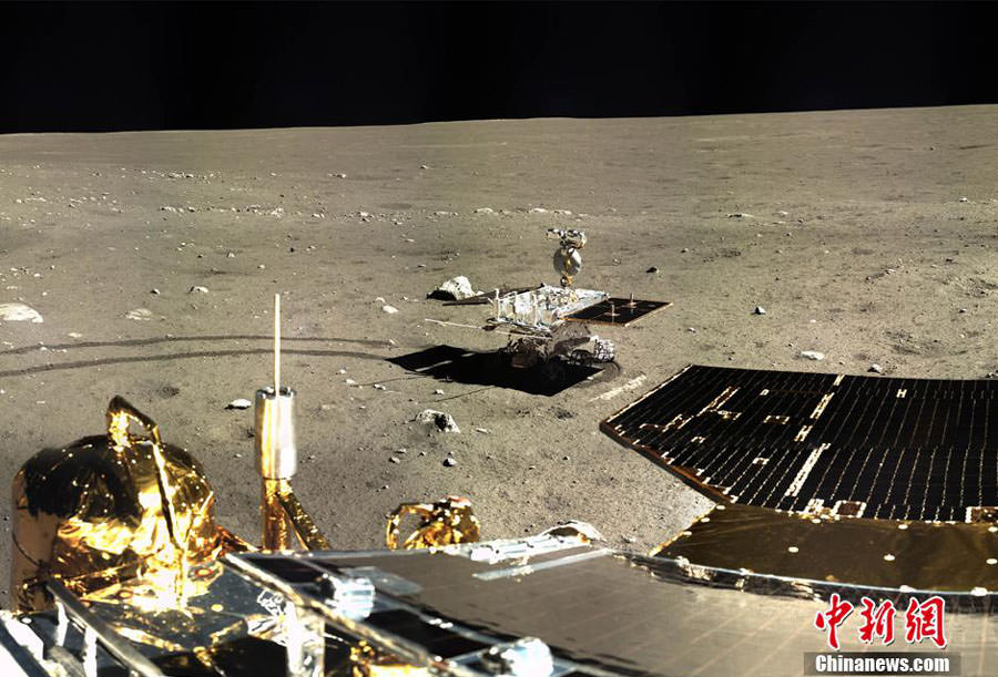
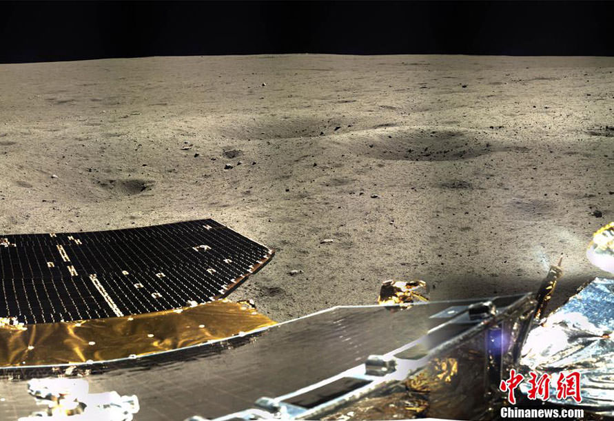
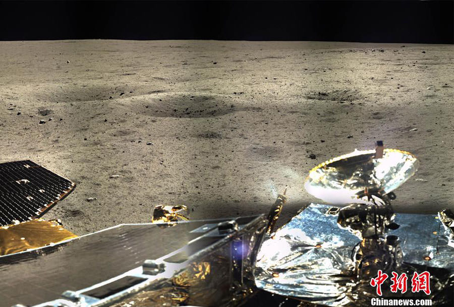
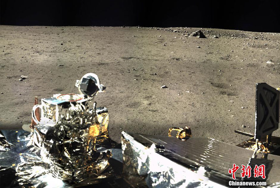
Little by little we’re getting sharper, clearer pictures from the Chinese Chang’e 3 moon mission. Yesterday the lander beamed back a series of new photos taken with its panoramic camera. Stitched together, they give us a more detailed and colorful look of the rover’s surroundings in northern Mare Imbrium. I’ve ordered the images starting with a nice crisp view of the Yutu rover; from there we turn by degree to the right across the five frames. The final mosaic unfortunately doesn’t have the resolution yet of the other images. Perhaps one will be published soon.
The lander’s solar panels stand out in the foreground with a smattering of small craters nearby. Credit: Chinanews.com
Right of the rover we see more panels and a radio communications dish. Credit: Chinanews.com
A larger crater surrounded by what appears to be excavated impact ejecta is visible near the horizon at upper right. Credit: Chinanews.com
Yutu’s tracks and another crater with ejecta stand out in this final image. Credit: Chinanews.com
Complete, if small, panorama stitched from the single images. Credit: Chinanews.com
One thing that stands out to my eye when looking at the photos is the brown color of the lunar surface soil or regolith. Color images of the moon’s surface by the Apollo astronauts along with their verbal descriptions indicate a uniform gray color punctuated in rare spots by patches of more colorful soils.
Apollo 15 astronauts salutes next to the American flag in 1971. The moon’s regolith or soil appears a variety of shades of gray. Credit: NASA
The famous orange soil scooped up by Apollo 17 astronaut Eugene Cernan comes to mind. Because Apollo visited six different moonscapes – all essentially gray – it makes me wonder if the color balance in the Chinese images might be off. Or did Chang’e 3 just happen to land on browner soils?
The orange soil found by Apollo 17 astronauts really stands out against a uniform gray moonscape. Credit: NASA
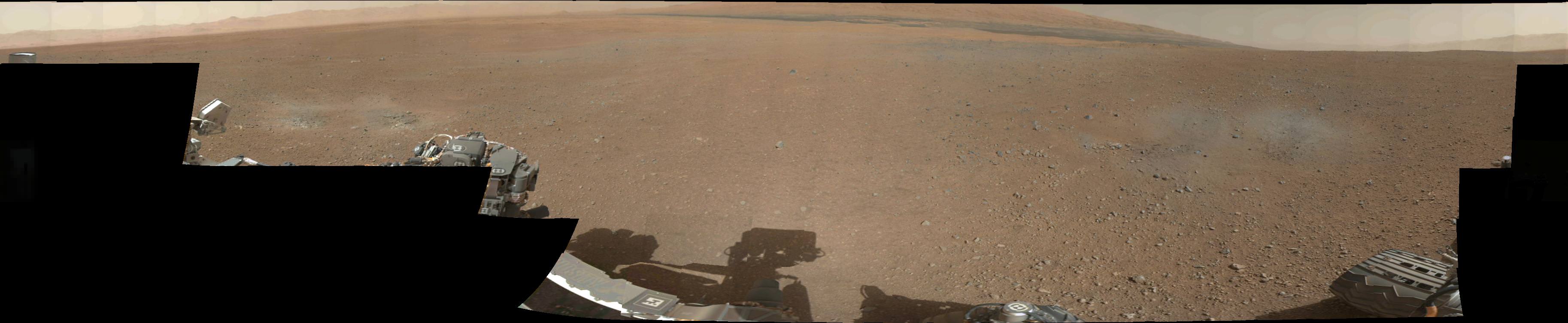
A still from a Mars Curiosity panorama stitched together from NASA images. Credit: Andrew Bodrov, from NASA/JPL-Caltech/MSSS images
Here’s a nice distraction to start off the day: pretend you’re playing in the sandbox of Mars alongside Curiosity. This new panorama shows the NASA Rover hanging out somewhat nearby Mount Sharp (Aeolis Mons), its ultimate destination for the two-year prime mission it’s currently on.
“The images for panorama [were] obtained by the rover’s 34-millimeter Mast Camera,” wrote Andrew Bodrov on a blog post describing his work. “The mosaic, which stretches about 30,000 pixels’ width, includes 101 images taken on Sol 437.”
Bodrov, who is from Estonia, frequently does space-related panoramas. We wrote about a couple of other Curiosity panoramas he did in March 2013, in February 2013 and August 2012.
Last year, he told Universe Today that he has used PTGui panoramic stitching software from New House Internet Services BV to accomplish the stunning views.
He also has a wealth of images from the Baikonur Cosmodrome, which is the launch site for Soyuz spacecraft missions.
“It’s very nice to see the achievements of humanity which allows you to see a picture of another world,” Bodrov said in 2012.
360-degree panoramic image of the Martian landscape surrounding NASA’s Curiosity. Credit: Andrew Bodrov
After seeing all the amazing imagery so far from NASA’s Mars rover Curiosity, I know everyone wants to go there and take in the visual treats of Gale Crater. With the help of a 360-degree panorama you can virtually explore Curiosity’s landing site; sort of like a Martian version of Google’s Street View.
Take a martian minute to explore the panorama at 360pano.eu.
Photographer Andrew Bodrov stitched together images from Curiosity’s navigation cameras to create the panorama. “After seeing some of the stitches of Curiosity’s images at NASA’s website, I decided to stitch the panorama myself,” Bodrov told Universe Today.
He uses PTGui panoramic stitching software from New House Internet Services BV (http://www.ptgui.com) to create the 360-degree view of the mountains and sky surrounding the car-sized rover that successfully landed on Mars on August 6th.
“NASA has still not published enough source material to assemble a complete panorama in color,” Bodrov says. He used a color filter to make the images more representable. He also added that the sky and sun in the panorama were added in Adobe Photoshop. He used the size of the Sun seen in this spectacular image of a Martian sunset from NASA’s Spirit rover taken in 2005 as a guide.
While Bodrov says the high-resolution images themselves are amazing, just seeing a picture of another world is more inspiring. “It’s very nice to see the achievements of humanity which allows you to see a picture of another world,” he said.
Doesn’t Gale Crater look lovely this time of year? This is the first 360-degree panorama of color images taken by Curiosity’s color Mast Camera. The individual images used in this first panorama may only have been thumbnail-sized, but the effect is no less stunning.
(Click the image to panoramify.)
The images were acquired on August 9 EDT. Although taken during late afternoon at Gale crater, the individual images still had to be brightened as Mars only receives half the amount of sunlight that Earth does.
Full-size 1200×1200 pixel images will be available at a later date.
The two grey patches in the foreground at left and right are the result of Curiosty’s sky crane rockets blasting the Martian surface. Scientists will be investigating these areas as they expose material that was previously hidden beneath Mars’ red dust.
The base of Gale Crater’s 3.4-mile (5.5 km) high central peak, named Mt. Sharp in honor of planetary science pioneer Robert P. Sharp, can be seen in the distance at center. (Check out an oblique view of a portion of Mt. Sharp acquired by HiRISE camera here.)
You can play with an interactive 360-degree panorama at the NASATech website, put together by John O’Connor, and if you look closely, visible is the full JPL logo on the middle right wheel — in Morse Code!
As always, you can find more news from the MSL mission here.
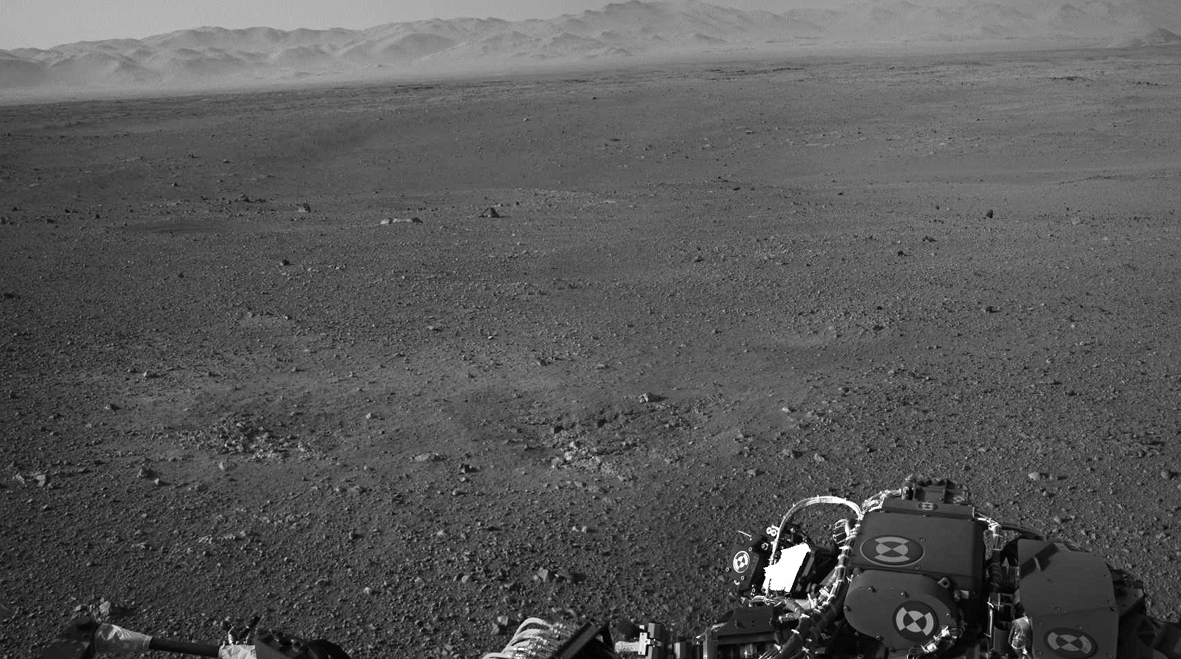
Taken this morning (mission Sol 2) with the rover’s left Navcam, here’s a high-res panorama of Curiosity’s view at its landing site within Gale crater. The wide-angle view was assembled from two separate raw images, so while the mountainous rim of the crater is lined up horizontally there’s some distortion in alignment of objects closer to the rover due to the angle of the Navcam lens. Still, it’s a very cool view of Curiosity’s surroundings!
See the latest images from the MSL mission here, and check out 3D anaglyph images from Curiosity here.