Weird Gravity Waves Pulse From a Tropical Cyclone

Nighttime image of southern India and Tropical Cyclone Mahasen (NASA/NOAA)

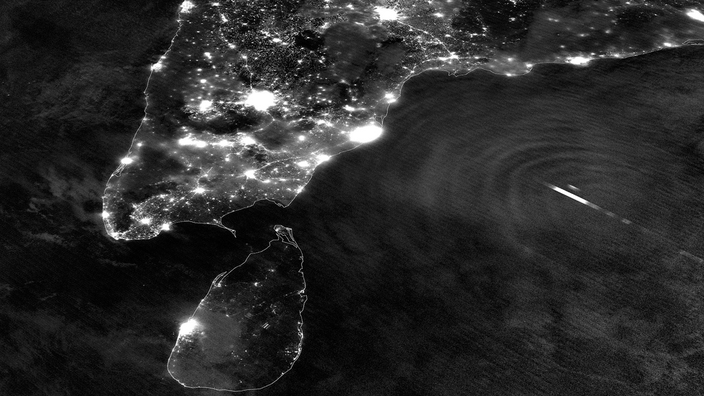
Last Monday, May 13, the Suomi NPP satellite captured a fascinating image of Tropical Cyclone Mahasen as it moved northeast over the Bay of Bengal. The clouds of the storm itself weren’t optically visible in the darkness of a nearly new Moon, but lightning flashes within it were… as well as the eerie ripples of atmospheric gravity waves spreading outwards from its center.

According to the Space Physics Research Group at the University of California, Berkeley:

Gravity waves are the oscillations of air parcels by the lifting force of bouyancy and the restoring force of gravity. These waves propagate vertically as well as horizontally, and actively transport energy and momentum from the troposphere to the middle and upper atmosphere. Gravity waves are caused by a variety of sources, including the passage of wind across terrestrial landforms, interaction at the velocity shear of the polar jet stream and radiation incident from space. They are found to affect atmospheric tides in the middle atmosphere and terrestrial weather in the lower atmosphere. (Source)

Atmospheric gravity waves aren’t to be confused with gravitational waves in space, which are created by very dense, massive objects (like white dwarf stars or black holes) orbiting each other closely.

When the image was captured, Tropical Cyclone Mahasen was moving north through the Indian Ocean along a track that placed landfall along the Bangladesh coast. As it moved off the coast of India Suomi’s VIIRS Day-Night Band was able to resolve lightning flashes towards the center of the storm, along with mesopheric gravity waves emanating outwards like ripples in a pond.

Such gravity waves are of particular interest to air traffic controllers so assist in identifying areas of turbulence.

Since the moon was in a new phase, the lights and other surface features of India and Sri Lanka are clearly visible although the clouds of Mahasen are not — a tradeoff that occurs as the amount of moonlight cycles throughout the month.

TS Mahasen on May 17, 2013 (Chelys/EOSnap)

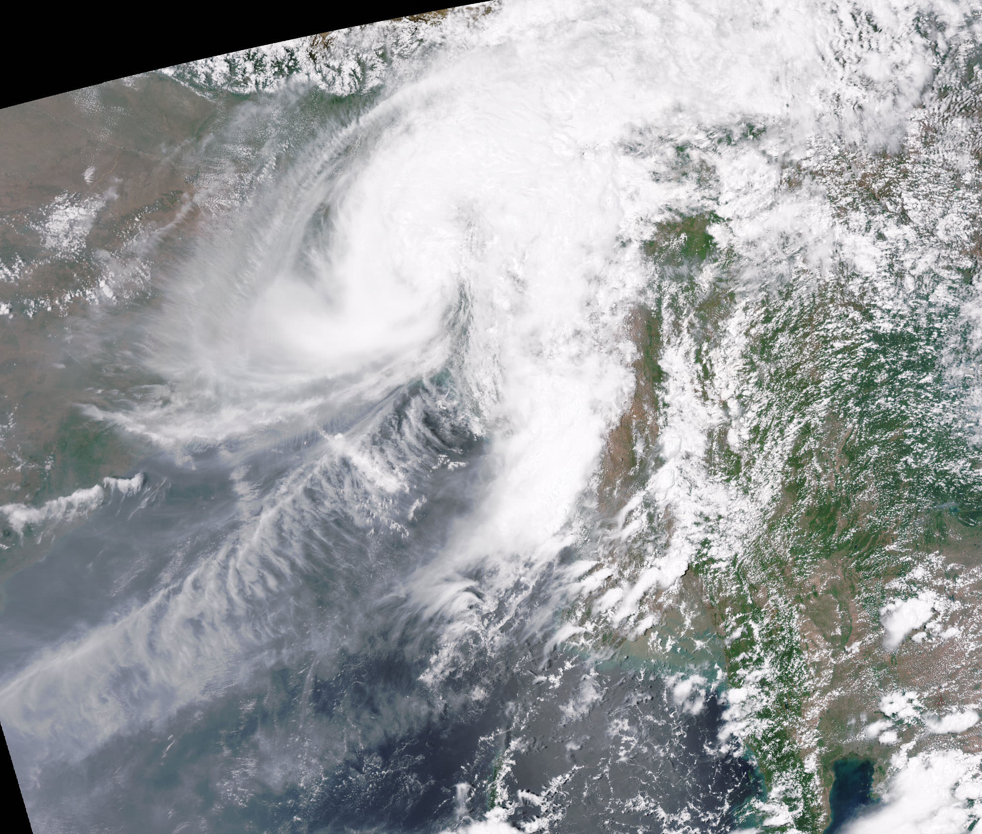
Over the course of the next few days Mahasen weakened into a deep depression, making landfall as a tropical storm on Bangladesh on May 16. In preparation for the storm large-scale evacuations were recommended for parts of Myanmar; however, this resulted in the overcrowding of boats and several vessels capsized. (Source: eosnap.com)

NASA launched the National Polar-orbiting Operational Environmental Satellite System Preparatory Project (or NPP) on October 28, 2011 from Vandenberg Air Force Base. On Jan. 24, NPP was renamed Suomi National Polar-orbiting Partnership, or Suomi NPP, in honor of the late Verner E. Suomi. It’s the first satellite specifically designed to collect data to improve short-term weather forecasts and increase understanding of long-term climate change.

Suomi NPP orbits Earth about 14 times a day, observing nearly the entire surface of the planet.

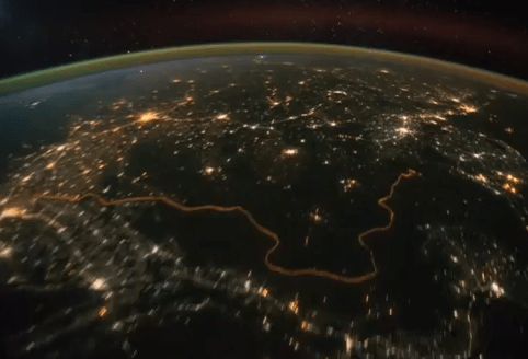
Main image source: NASA Goddard Space Flight Center

Time-Lapse: Earth

If you couldn’t tell, we love time-lapse videos… whether they’re made of photos looking up at the sky from Earth or looking down at Earth from the sky! This latest assembly by photographer Bruce W. Berry takes us on a tour around the planet from orbit, created from images taken by astronauts aboard the International Space Station and expertly de-noised, stabilized and smoothed to 24 frames per second. The result is — like several others before — simply stunning, a wonderful reminder of our place in space and the beauty of our living world.

See more of Bruce’s time-lapse projects here.

Music: “Manhatta” composed & performed by The Cinematic Orchestra.

Original images courtesy of the Image Science & Analysis Laboratory, NASA Johnson Space Center, The Gateway to Astronaut Photography of Earth.

ISS Night Flight in “Real Time”

We’ve featured wonderful time-lapse videos taken from the Space Station many times and each one is amazing to watch, but here’s something a little different: by taking photos at the rate of one per second and assembling them into a time-lapse, we can get a sense of what it’s like to orbit the planet at 240 miles up, 17,500 mph… in real time. Absolutely amazing!

Continue reading “ISS Night Flight in “Real Time””

A Night Flight Over the Mideast

India-Pakistan Border from ISS
India-Pakistan Border from orbit. Credit: NASA.


The cities of the Middle East and southern Asia shine bright in the night beneath the International Space Station as it passed high overhead on October 21, 2011.

This video, an animation made from dozens of still images taken by the Expedition 29 crew, was assembled by the Image Science and Analysis Laboratory at Johnson Space Center in Houston. It was uploaded to the Gateway to Astronaut Photography of Earth site on October 27.

[/caption]

Some glare from the Moon (off screen to the upper left) can be seen in the Plexiglas of the ISS window. The strobe-like flashes are lightning in clouds. Airglow is also visible as a band of hazy green light surrounding the planet.

Another particularly noticeable feature visible in this video is the bright orange line of the border between India and Pakistan. Erected by the Indian government to prevent smuggling, nearly 1200 miles (1930 km) of floodlights and fences separate the two countries, creating a geopolitical feature easily visible from orbit.

The website’s description states:

The sequence of shots was taken October 21, 2011 from 19:53:26 to 20:25:24 GMT, on a pass beginning over Turkmenistan, east of the Caspian Sea to southeastern China, just northwest of Hong Kong. City lights show at the beginning of the video as the ISS travels southeastward towards the India-Pakistan borderline (click here for the Earth Observatory article to learn more about this area). Pakistan’s second largest city, Lahore, can be easily seen as the brightly lit area left of track. Immediately downtrack of Lahore is New Delhi, India’s capital city, with the Kathiawar Peninsula right of track dimly lit. Smaller cities in southern India can be seen as the pass continues southeastward through southern India, into the Bay of Bengal. Lightning storms are also present, represented by the flashing lights throughout the video. The pass ends over western Indonesia, looking left of track at the island of Sumatra.

I particularly like the way the stars shine so prominently beyond Earth’s limb, and how the moonlight illuminates the clouds… not to mention the bloom of dawn at the end. What an incredible sight this must be for the ISS crew members! I can’t imagine ever getting tired of seeing this outside the Station windows.

Watch more ISS videos here.

Video courtesy of the Image Science & Analysis Laboratory, NASA Johnson Space Center.

Why Can We See the Moon During the Day?

Crescent Moon
Crescent Moon

We all know the basics of the Diurnal Cycle – day and night, sunrise and sunset. And we are all aware that during the day, the Sun is the most luminous object in the sky, to the point that it completely obscures the stars. And at night, the Moon (when it is visible) is the most luminous object, sometimes to the point that it can make gazing at the Milky Way and Deep-Sky Objects more difficult.

This dichotomy of night and day, darkness and light, are why the Moon and the Sun were often worshiped together by ancient cultures. But at times, the Moon is visible even in the daytime. We’ve all seen it, hanging low in the sky, a pale impression against a background of blue? But just what accounts for this? How is it that we can see the brightest object in the night sky when the Sun is still beaming overhead?

Continue reading “Why Can We See the Moon During the Day?”