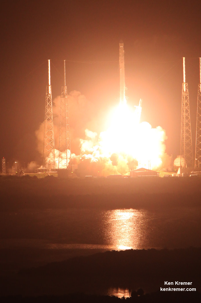
KENNEDY SPACE CENTER, FL – NASA’s constellation of experimental hurricane monitoring CYGNSS microsatellites was successfully air launched by the unique Orbital ATK winged Pegasus rocket on Thursday, Dec 15 – opening a new era in weather forecasters ability to measure the buildup of hurricane intensity in the tropics from orbit that will eventually help save lives and property from impending destructive storms here on Earth.
The agency’s innovative Cyclone Global Navigation Satellite System (CYGNSS) earth science mission was launched at 8:37 a.m. EST, Dec. 15, aboard a commercially developed Orbital ATK Pegasus XL rocket from a designated point over the Atlantic Ocean off the east coast of Florida.
Officials just announced this morning Dec. 16 that the entire fleet is operating well.
“NASA confirmed Friday morning that all eight spacecraft of its latest Earth science mission are in good shape.”
“The launch of CYGNSS is a first for NASA and for the scientific community,” said Thomas Zurbuchen, associate administrator for the agency’s Science Mission Directorate in Washington.
“As the first orbital mission in our Earth Venture program, CYGNSS will make unprecedented measurements in the most violent, dynamic, and important portions of tropical storms and hurricanes.”
Late Thursday, NASA announced that contact had been made with the entire fleet of eight small satellites after they had been successfully deployed and safely delivered to their intended position in low Earth orbit.
“We have successfully contacted each of the 8 observatories on our first attempt,” announced Chris Ruf, CYGNSS principal investigator with the Department of Climate and Space Sciences and Engineering at the University of Michigan.
“This bodes very well for their health and “status, which is the next thing we will be carefully checking with the next contacts in the coming days.”
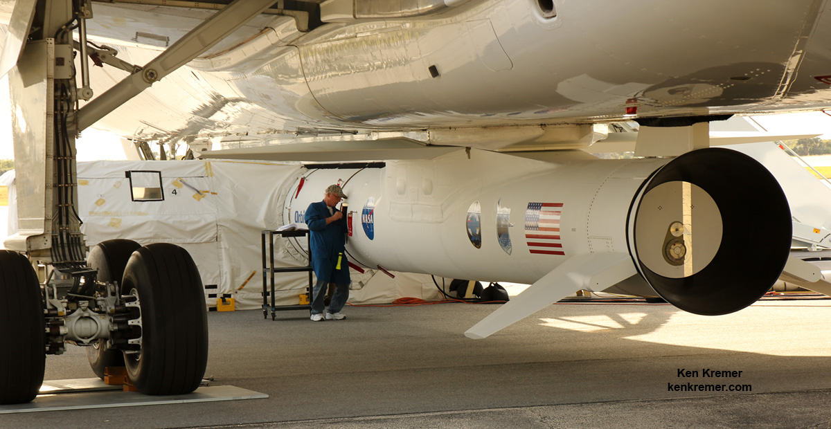
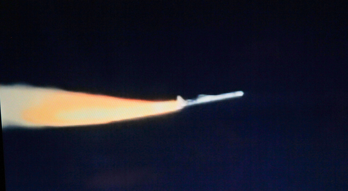
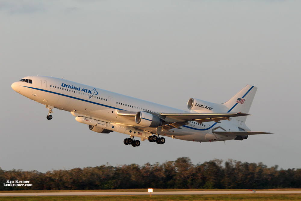
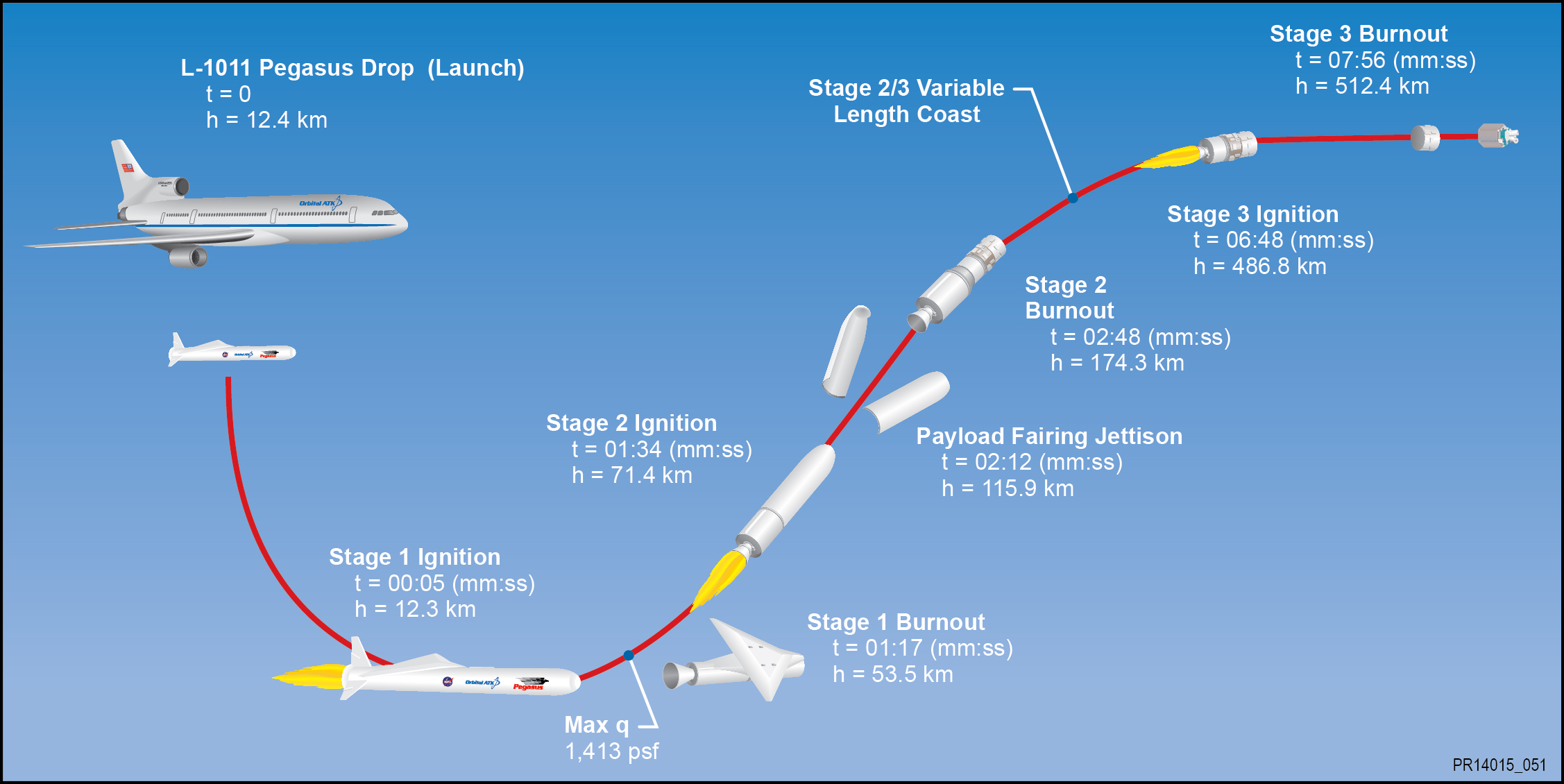
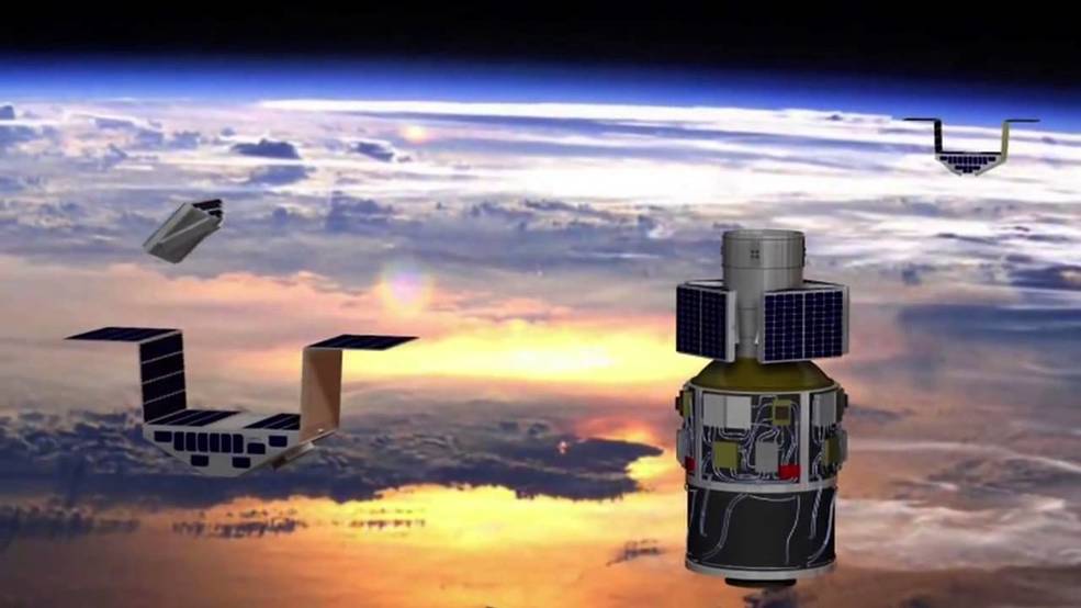
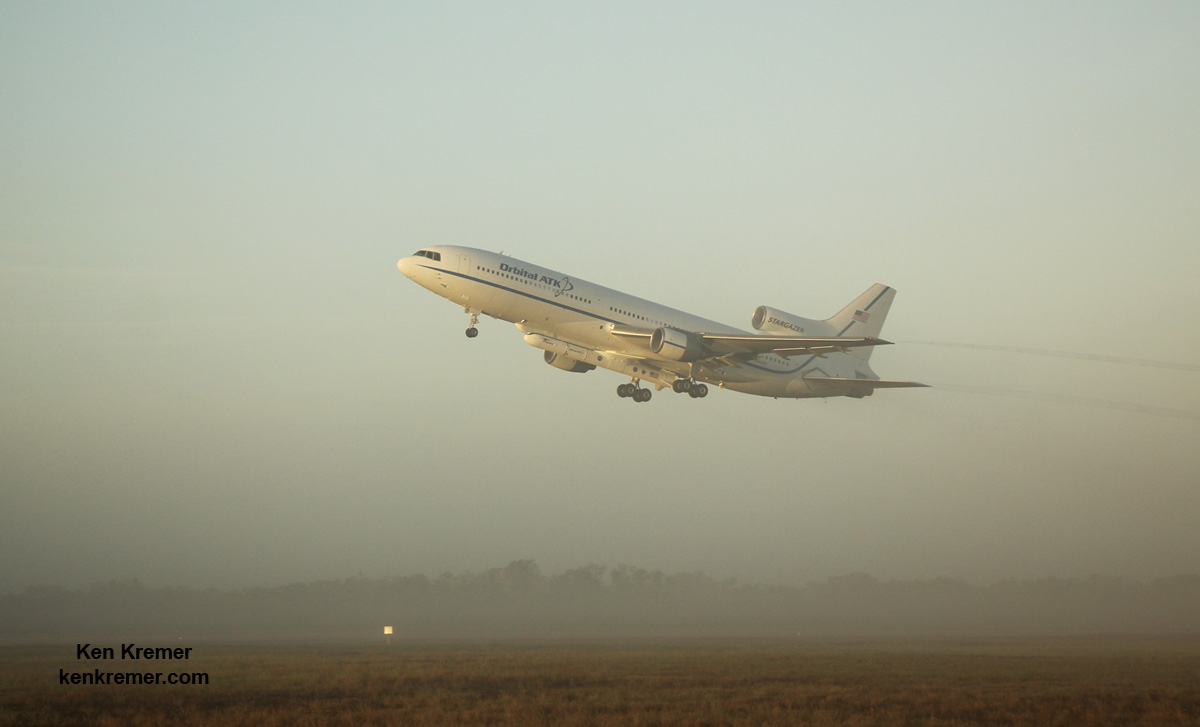
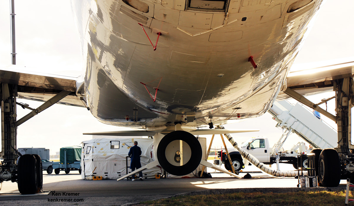
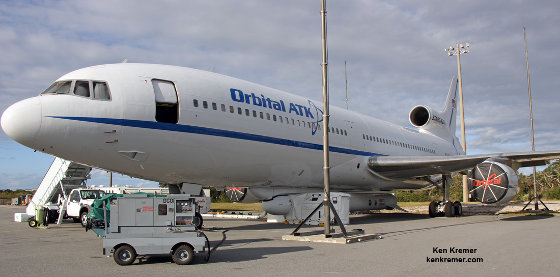
The three stage Pegasus XL rocket housing the CYGNSS earth science payload inside the payload fairing had been carried aloft to 39,000 feet by an Orbital ATK L-1011 Tristar and dropped from the aircrafts belly for an air launch over the Atlantic Ocean and about 110 nautical miles east-northeast of Daytona Beach.
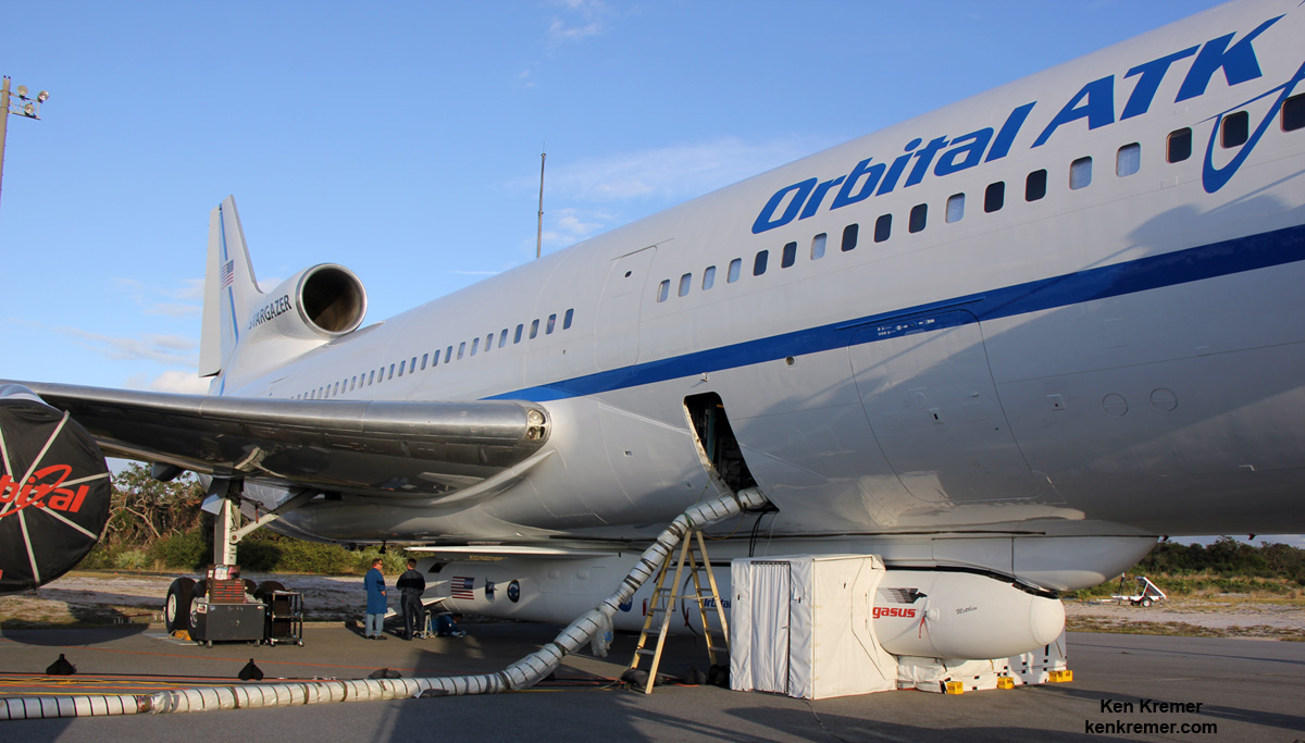
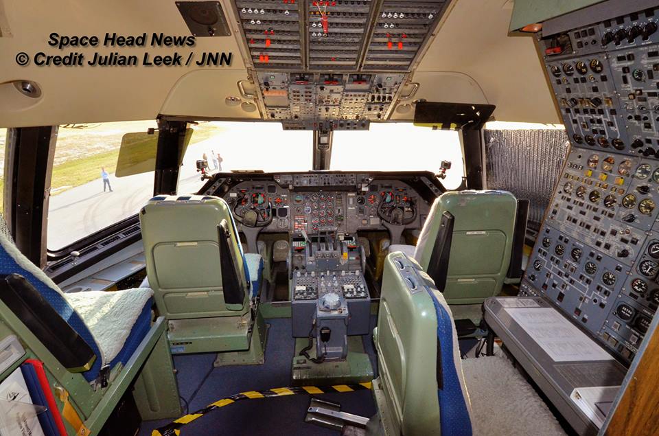
The L-1011 nicknamed Stargazer took off at about 7:30 a.m. EST from NASA’s Skid Strip on Cape Canaveral Air Force Station in Florida as the media including myself watched the events unfold under near perfect Sunshine State weather with brilliantly clear blue skies.
After flying to the dropbox point – measuring about 40-miles by 10-miles (64-kilometers by 16-kilometers) – the Pegasus rocket was dropped from the belly, on command by the pilot, for a short freefall of about 5 seconds to initiate the launch sequence and engine ignition.
Pegasus launches horizontally in midair with ignition of the first stage engine burn, and then tilts up to space to begin the approximate ten minute trek to LEO.
The rocket launch and satellite release when exactly as planned with no hiccups.
It’s a beautiful day, with gorgeous weather,” said NASA CYGNSS launch director Tim Dunn. “We had a nominal flyout, and all three stages performed beautifully. We had no issues at all with launch vehicle performance.”
Deployment of the first pair of CYGNSS satellites in the eight satellite fleet started just 13 minutes after launch. The other six followed sequentially staged some 30 seconds apart.
“It’s a great event when you have a successful spacecraft separation – and with eight microsatellites, you get to multiply that times eight,” Dunn added.
“The deployments looked great — right on time,” said John Scherrer, CYGNSS Project Manager at the Southwest Research Institute and today’s CYGNSS mission manager, soon after launch.
“We think everything looks really, really good. About three hours after launch we’ll attempt first contact, and after that, we’ll go through a series of four contacts where we hit two [observatories] each time, checking the health and status of each spacecraft,” Scherrer added several prior to contact..
CYGNSS small satellite constellation launch came after a few days postponement due to technical issues following an aborted attempt on Monday, when the release mechanism failed and satellite parameter issues cropped up on Tuesday, both of which were rectified.
NASA’s innovative Cyclone Global Navigation Satellite System (CYGNSS) mission is expected to revolutionize hurricane forecasting by measuring the intensity buildup for the first time.
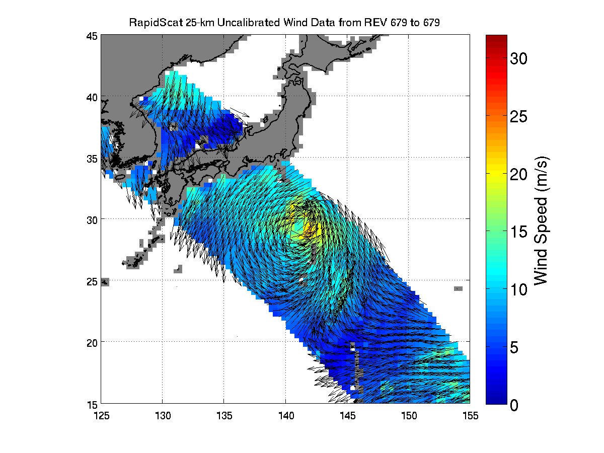
“The CYGNSS constellation consists of eight microsatellite observatories that will measure surface winds in and near a hurricane’s inner core, including regions beneath the eyewall and intense inner rainbands that previously could not be measured from space,” according to a NASA factsheet.
CYGNSS is an experimental mission to demonstrate proof-of-concept that could eventually turn operational in a future follow-up mission if the resulting data returns turn out as well as the researchers hope.
The CYGNSS constellation of 8 identical satellites works in coordination with the Global Positioning System (GPS) satellite constellation.
The eight satellite CYGNSS fleet “will team up with the Global Positioning System (GPS) constellation to measure wind speeds over Earth’s oceans and air-sea interactions, information expected to help scientists better understand tropical cyclones, ultimately leading to improved hurricane intensity forecasts.”
They will receive direct and reflected signals from GPS satellites.
“The direct signals pinpoint CYGNSS observatory positions, while the reflected signals respond to ocean surface roughness, from which wind speed is retrieved.”
This schematic outlines the key launch events:
The $157 million fleet of eight identical spacecraft comprising the Cyclone Global Navigation Satellite System (CYGNSS) system were all delivered to low Earth orbit by the Orbital ATK Pegasus XL rocket.
The nominal mission lifetime for CYGNSS is two years but the team says they could potentially last as long as five years or more if the spacecraft continue functioning.
Pegasus launches from the Florida Space Coast are infrequent. The last once took place over 13 years ago in late April 2003 for the GALEX mission.
Typically they take place from Vandenberg Air Force Base in California or the Reagan Test Range on the Kwajalein Atoll.
CYGNSS counts as the 20th Pegasus mission for NASA and the 43rd mission overall for Orbital ATK.
The CYGNSS spacecraft were built by Southwest Research Institute in San Antonio, Texas.
The solar panels and spacecraft dispenser were built by Sierra Nevada Corporation (SNC).
Each one weighs approx 29 kg. The deployed solar panels measure 1.65 meters in length.
The solar panels measure 5 feet in length and will be deployed within about 15 minutes of launch.
“We are thrilled to be a part of a project that helps gain better hurricane data that can eventually help keep a lot of people safe, but from a business side, we are also glad we could help SwRI achieve their mission requirements with better performance and lower cost and risk,” said Bryan Helgesen, director of strategy and business development for Space Technologies in SNC’s Space Systems business area, in a statement.
The Space Physics Research Laboratory at the University of Michigan College of Engineering in Ann Arbor leads overall mission execution in partnership with the Southwest Research Institute in San Antonio, Texas.
The Climate and Space Sciences and Engineering Department at the University of Michigan leads the science investigation, and the Earth Science Division of NASA’s Science Mission Directorate oversees the mission.
Stay tuned here for Ken’s continuing Earth and Planetary science and human spaceflight news.

………….
Learn more about ULA Atlas V EchoStar 19 comsat launch, GOES-R launch, Heroes and Legends at KSCVC, OSIRIS-REx, InSight Mars lander, ULA, SpaceX and Orbital ATK missions, Juno at Jupiter, SpaceX AMOS-6 & CRS-9 rocket launch, ISS, ULA Atlas and Delta rockets, Orbital ATK Cygnus, Boeing, Space Taxis, Mars rovers, Orion, SLS, Antares, NASA missions and more at Ken’s upcoming outreach events:
Dec. 16-18: “ULA Atlas V EchoStar 19 comsat launch,GOES-R weather satellite launch, OSIRIS-Rex, SpaceX and Orbital ATK missions to the ISS, Juno at Jupiter, ULA Delta 4 Heavy spy satellite, SLS, Orion, Commercial crew, Curiosity explores Mars, Pluto and more,” Kennedy Space Center Quality Inn, Titusville, FL, evenings