Cat 4 Hurricane Gonzalo Threatens Bermuda and Delays Antares Launch to Space Station

NOAA's GOES-East satellite captured this image of Hurricane Gonzalo off the U.S. East Coast on Oct. 16 at 13:07 UTC (9:07 a.m. EDT). Gonzalo is classified as Category 4 storm. Credit: NASA/NOAA GOES Project

Hurricane Gonzalo, the first major Atlantic Ocean basin hurricane in three years, has strengthened to a dangerous Category 4 storm, threatening Bermuda and forcing a postponement of the upcoming launch of the Orbital Sciences Antares rocket to the space station from the Virginia shore to no earlier than Oct. 27.

A hurricane warning is in effect for the entire island of Bermuda.

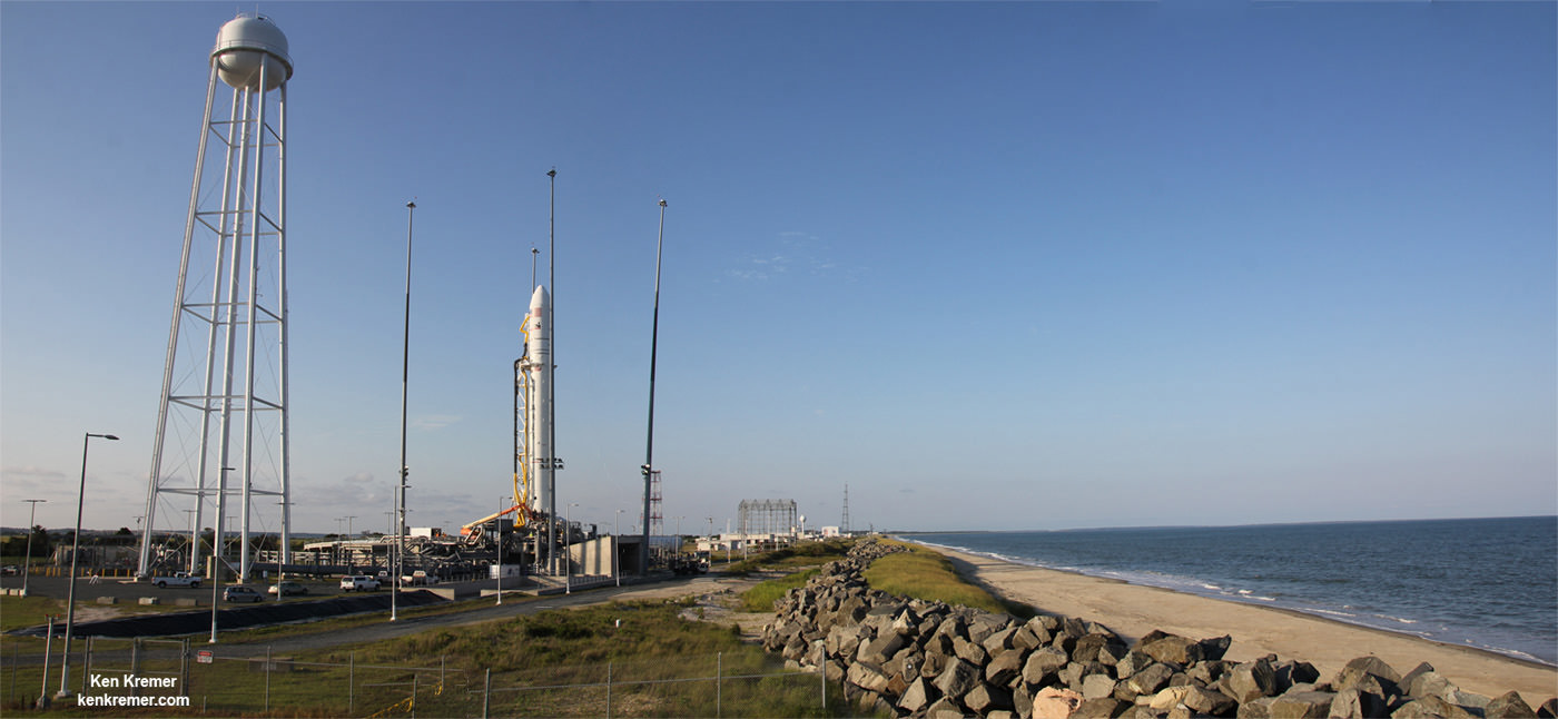
NASA and Orbital Sciences had no choice but to delay the Antares blastoff from Oct. 24 to no earlier than Oct. 27 because Bermuda is home to an “essential tracking site” that must be operational to ensure public safety in case of a launch emergency situation.

Antares had been slated for an early evening liftoff with the Cygnus cargo carrier on the Orb-3 mission to the International Space Station (ISS).

NASA and Orbital issued the following statement:

“Due to the impending arrival of Hurricane Gonzalo on the island of Bermuda, where an essential tracking site used to ensure public safety during Antares launches is located, the previously announced “no earlier than” (NET) launch date of October 24 for the Orb-3 CRS mission to the International Space Station for NASA is no longer feasible.”

Orbital Sciences Corporation Antares rocket and Cygnus spacecraft prior to blast off on July 13  2014 from Launch Pad 0A at NASA Wallops Flight Facility , VA, on the Orb-2 mission bound for the International Space Station.  Credit: Ken Kremer - kenkremer.com
Orbital Sciences Corporation Antares rocket and Cygnus spacecraft prior to blast off on July 13 2014 from Launch Pad 0A at NASA Wallops Flight Facility , VA, on the Orb-2 mission bound for the International Space Station. Credit: Ken Kremer – kenkremer.com

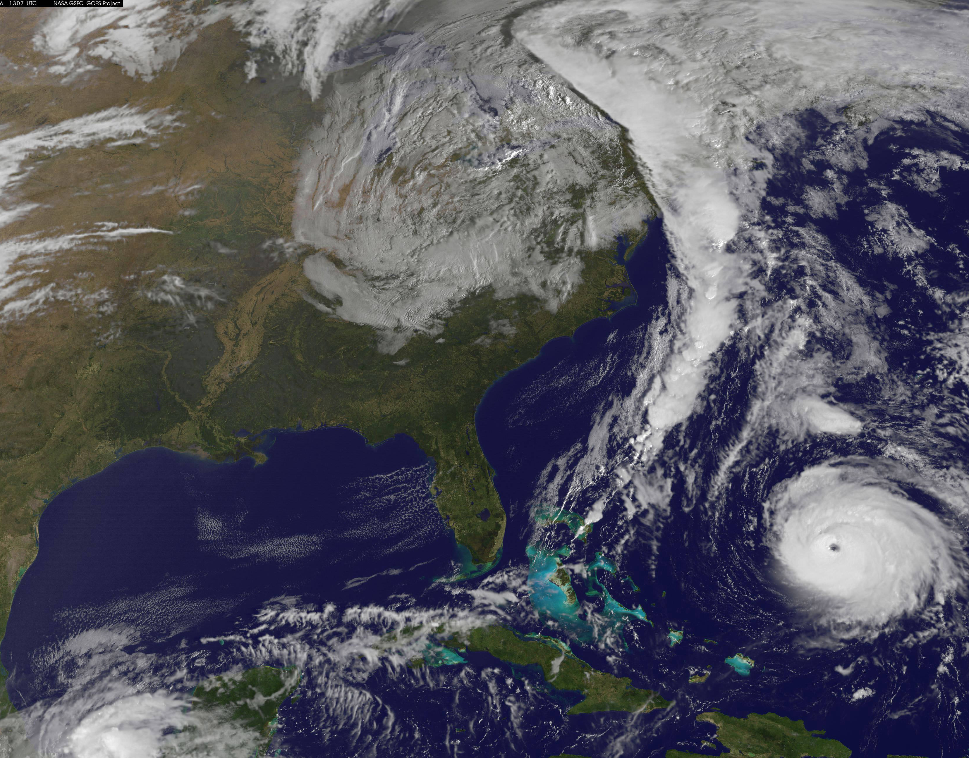
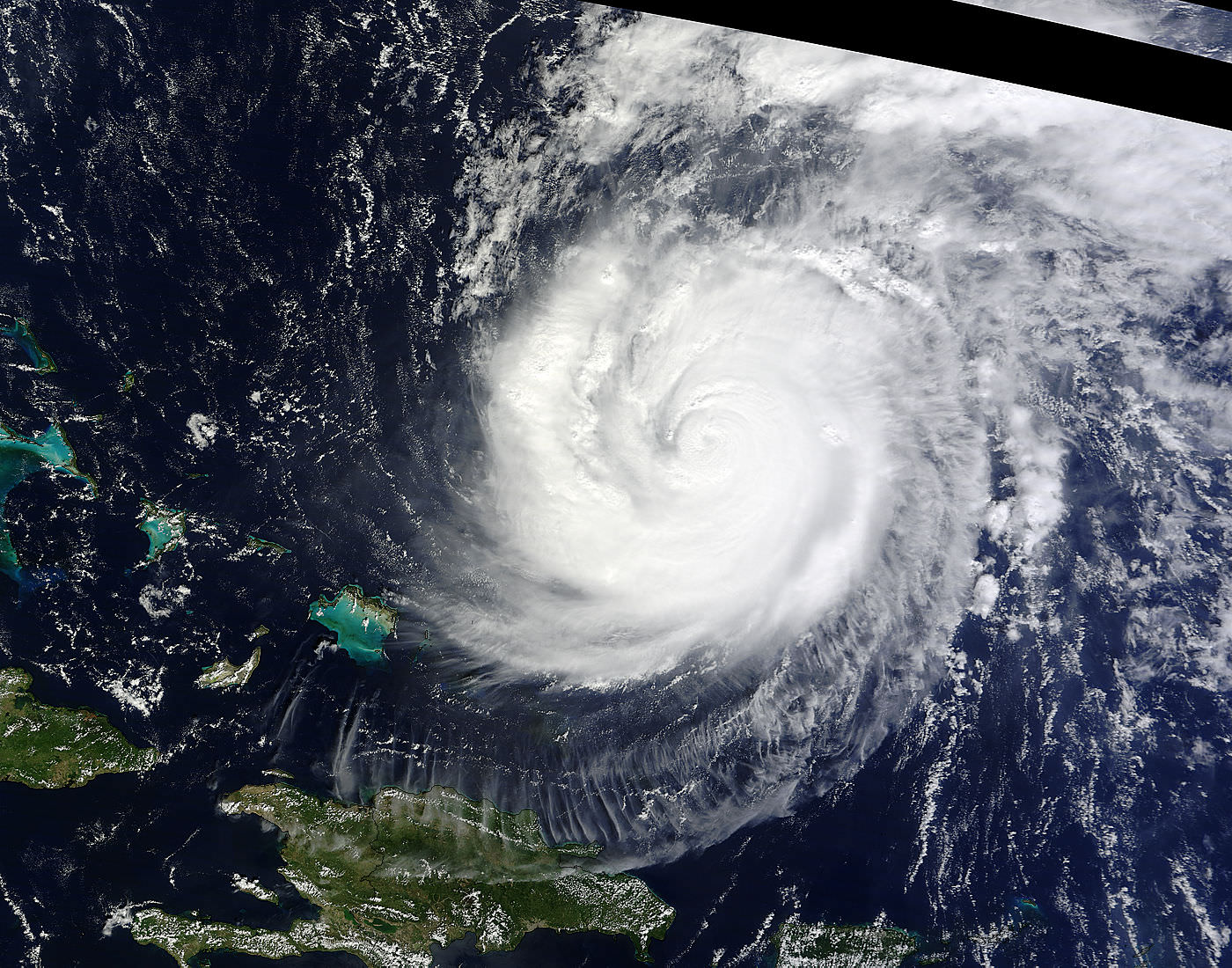
The powerful Gonzalo is currently expected to make a direct hit on Bermuda on Friday afternoon, Oct. 17. It’s packing devastating maximum sustained winds exceeding 145 mph (225 kph).

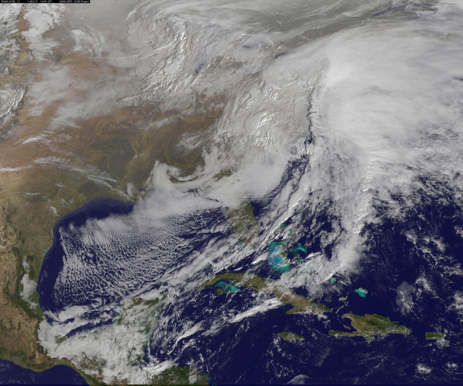
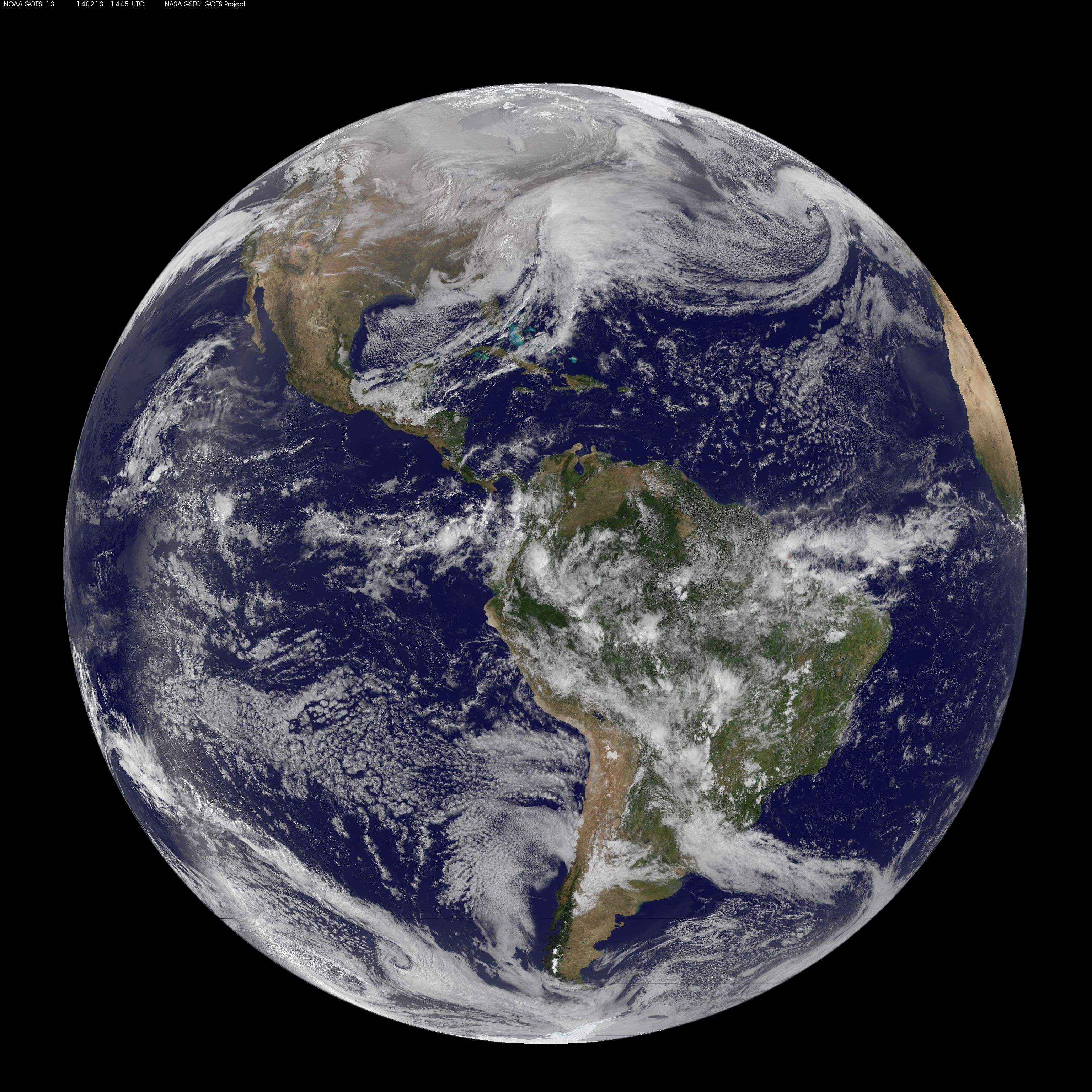
NASA and NOAA satellites including the Terra, Aqua and GOES-East satellites are providing continuous coverage of Hurricane Gonzalo as it moves toward Bermuda, according to a NASA update today.

The ISS-RapidScat payload tracking ocean winds, that was just attached to the exterior of the ISS, is also designed to help with hurricane monitoring and forecasting.

Tropical storm force winds and 20 to 30 foot wave heights are expected to impact Bermuda throughout Friday and continue through Saturday and into Sunday.

“The National Hurricane Center expects hurricane-force winds, and rainfall totals of 3 to 6 inches in Bermuda. A storm surge with coastal flooding can be expected in Bermuda, with large and destructive waves along the coast. In addition, life-threatening surf and riptide conditions are likely in the Virgin Islands, Puerto Rico, Dominican Republic, Bahamas. Those dangerous conditions are expected along the U.S. East Coast and Bermuda today, Oct. 16,” according to NASA.

On Oct. 15 at 15:30 UTC (11:30 a.m. EDT) NASA's Terra satellite captured this image of Hurricane Gonzalo in the Atlantic Ocean. Credit: NASA Goddard MODIS Rapid Response Team
On Oct. 15 at 15:30 UTC (11:30 a.m. EDT) NASA’s Terra satellite captured this image of Hurricane Gonzalo in the Atlantic Ocean. Credit: NASA Goddard MODIS Rapid Response Team

After the hurricane passes, a team will be sent to assess the impact of the storm on Bermuda and the tracking station. Further delays are possible if Bermuda’s essential infrastructure systems are damaged, such as power, transportation and communications.

The Antares/Cygnus rocket and cargo ship launch from the Mid-Atlantic Regional Spaceport at NASA’s Wallops Flight Facility along the eastrn shore of Virginia.

Liftoff is currently target for October 27 at 6:44 p.m. (EDT). The rendezvous and berthing of Cygnus with the ISS remains on November 2, with grapple of the spacecraft by the station’s robotic arm at approximately 4:58 a.m. (EST), according to a NASA update.

Stay tuned here for Ken’s continuing Earth and Planetary science and human spaceflight news.

Ken Kremer

Deadly Monster Winter Storm Batters US Eastern Seaboard – More Snow and Ice on the Way!

This visible image of the winter storm over the U.S. south and East Coast was taken by NOAA's GOES-13 satellite on Feb. 13 at 1455 UTC/9:45 a.m. EST. Snow covered ground can be seen over the Great Lakes region and Ohio Valley. Image Credit: NASA/NOAA GOES Project

This visible image of the winter storm over the U.S. south and East Coast was taken by NOAA’s GOES-13 satellite on Feb. 13 at 1455 UTC/9:45 a.m. EST. Snow covered ground can be seen over the Great Lakes region and Ohio Valley. Image Credit: NASA/NOAA GOES Project
Story updated[/caption]

A deadly monster storm is battering virtually the entire US Eastern seaboard today, Thursday, Feb. 13, as it moves from the Southeast to the Northeast and into the New England states, wreaking havoc and causing miserable weather conditions for over 100 million Americas.

This afternoon, NASA and NOAA published a new image taken by a GOES satellite that showed the extent of the clouds associated with the massive winter storm over the US East Coast – see above and below.

Blizzard, white out and slippery conditions have already caused more than 18 deaths.

The killer storm has brought relentless waves of snow, sleet and ice over the past two days covering a vast swath stretching from inland to coastal areas as it moved up from the southern to northern states.

More than a foot of snow has already fallen in many areas today stretching from the Mid-Atlantic into the entire Northeast region.

Several states have declared states of emergency.

This is the season’s 12th snow storm. In many Northeast localities, the accumulated snowfall totals are three times the normal average. As a result many municipalities are running out of road salt.

And to add insult to injury, much more icy snow is falling overnight into Friday on top of the massive existing mounds and piles of frozen ice and snow that’s accumulated over the past few weeks of subfreezing temperatures.

There are also predictions for patches of “thunder snow” — which is a snow storm mixed with thunder and lightning!

Full disk image of the winter storm over the U.S. south and East Coast was taken by NOAA's GOES-13 satellite on Feb. 13 at 1455 UTC/9:45 a.m. EST. Credit:  NASA/NOAA GOES Project
Full disk image of the winter storm over the U.S. south and East Coast was taken by NOAA’s GOES-13 satellite on Feb. 13 at 1455 UTC/9:45 a.m. EST. Credit: NASA/NOAA GOES Project

Incredibly, another round of snow is forecast for Saturday.

Much of the I-95 corridor where I also live has been especially hard hit.

The image above was created from data captured by NOAA’s GOES-East satellite today, Feb. 13 at 1455 UTC/9:45 a.m. EST by a team from the NASA/NOAA’s GOES Project at NASA’s Goddard Space Flight Center in Greenbelt, Md.

“The clouds and fallen snow data from NOAA’s GOES-East satellite were overlaid on a true-color image of land and ocean created by data from the Moderate Resolution Imaging Spectroradiometer or MODIS instrument that flies aboard NASA’s Aqua and Terra satellites,” said NASA in a statement.

An eight months pregnant 36 year old women was tragically killed in New York City accident today by a snowplow. Thank God the unborn baby was saved and delivered by cesarean section.

The storm has caused thousands of traffic accidents and several deaths.

Video Caption: This animation of NOAA’s GOES satellite data shows the progression of the major winter storm in the U.S. south from Feb. 10 at 1815 UTC/1:15 p.m. EST to Feb. 12 to 1845 UTC/1:45 p.m. EST. Credit: NASA/NOAA GOES Project, Dennis Chesters

Hundreds of thousands of customers have lost power due to fallen tree limbs on exposed power lines, mostly in the southeast. In recent days, hundreds of thousands of us here in the Northeast lost power after a severe ice storm.

Mountains of snow inundate the Northeast. Credit: Mark Usciak

Most of those affected were left with no heat in subfreezing temperatures. It’s definitely no fun when you can see you exhaled breath – indoors.

Many school districts were closed today. But not in NYC where the new Mayor Bill DeBlasio kept schools open, and faced a hail of criticism – including from NBC News weatherman Al Roker.

Over 6500 airplane flights have been cancelled, stranding over a half million people.

So after days of shoveling, even more is on tap for the morning. Be careful, pace yourself and don’t overdo it – as several people died from heart attacks digging out the heavy slushy mess


Here is this evenings forecast (Feb 13) from the National Weather Service (NWS):

STORM SUMMARY NUMBER 09 FOR SOUTHERN PLAINS TO EAST COAST WINTER STORM
NWS WEATHER PREDICTION CENTER COLLEGE PARK MD – – 1000 PM EST THU FEB 13 2014

…LOW PRESSURE CENTER HAS MOVED OFF THE NEW JERSEY COAST AND IS
RAPIDLY INTENSIFYING…HEAVY SNOW BANDS IMPACTING INTERIOR
NORTHEAST AND I 95 CORRIDOR…WINDS INCREASING ACROSS THE AFFECTED
REGION…

WINTER STORM WARNINGS AND WINTER WEATHER ADVISORIES ARE IN EFFECT
FOR THE NORTHERN MID ATLANTIC AND NORTHEAST….

FOR A DETAILED GRAPHICAL DEPICTION OF THE LATEST
WATCHES…WARNINGS AND ADVISORIES…PLEASE SEE WWW.WEATHER.GOV

AT 900 PM EST…THE MAIN CENTER OF A RAPIDLY INTENSIFYING LOW
PRESSURE SYSTEM WITH ESTIMATED CENTRAL PRESSURE OF 986 MB…29.12
INCHES…WAS LOCATED JUST EAST OF THE SOUTHERN NEW JERSEY COAST.
NATIONAL WEATHER SERVICE DOPPLER RADAR AND SURFACE OBSERVATIONS
INDICATED THAT OVER THE PAST FEW HOURS…A BAND OF HEAVY SNOW WAS
IMPACTING CENTRAL PENNSYLVANIA ACROSS NORTHERN NEW ENGLAND TO
NORTHERN MAINE. MEANWHILE…ANOTHER BAND OF MODERATE TO HEAVY
SNOW WAS LOCATED ALONG THE I 95 CORRIDOR FROM WASHINGTON DC TO NEW YORK CITY. EAST OF I 95 THE PRECIPITATION TYPE IS MAINLY RAIN…BUT A CHANGEOVER BACK TO SNOW IS EXPECTED.

Stay tuned here for Ken’s continuing planetary and human spaceflight news.

Ken Kremer

Recent ice and snow storms caused hundreds of thousands to lose power and heat in the Northeast. Credit: Ken Kremer
Recent ice and snow storms caused hundreds of thousands to lose power and heat in the Northeast in subfreezing temperatures. Credit: Ken Kremer
Mountains of snow inundate the Northeast. Credit: Mark Usciak

Could Cassini See You On “The Day The Earth Smiled?”

The face of Earth aimed toward Cassini during imaging on July 19, 2013

So along with the rest of the world, you smiled. You waved. You went outside on July 19, wherever you were, and looked upwards and out into the solar system knowing that our robotic representative Cassini would be capturing a few pixels’ worth of photons bouncing off our planet when they eventually reached Saturn, 900 million miles away. But did Cassini actually capture any photons coming from where you were? The image above will tell you.

Assembled by the Planetary Habitability Laboratory at the University of Puerto Rico at Arecibo (where the enormous 305-meter radio telescope is located) this image shows what side of Earth was facing Cassini when its “pale blue dot” images were obtained, at approximately 22:47 UTC (Cassini time.)

Didn’t make it into Cassini’s photo? That’s ok… maybe MESSENGER had already caught you earlier that very same day:

The view of Earth seen by MESSENGER from Mercury on July 19, 2013

Before Cassini took its images — several hours before, in fact — the MESSENGER spacecraft was holding some photo shoots of its own from 61 million miles in the other direction!

The image above shows the side of Earth that was facing Mercury on the morning of July 19, 2013, when MESSENGER was acquiring images in our direction during a hunt for any possible satellites of the innermost planet.

Earth was as bright (-4.8 magnitude) as the maximum brightness of Venus at the moment the image was taken from Mercury.

Of course, in both series of images specific details of our planet can’t be made out — Earth was barely more than a pixel in size (regardless of any bloom caused by apparent brightness.) Clouds, countries, continents, oceans… the entire population of our world, reduced to a single point of light — a “mote of dust suspended in a sunbeam.”

For both portrayals, high-resolution black and white images from the GOES East and Meteosat meteorological satellites were combined with color information from NASA Visible Earth to generate true-color images of our planet as it would have looked to each respective imaging spacecraft… if they had the impossibly-precise optics to resolve Earth from such distances, of course.

But it’s ok that they don’t… we can still use our imaginations.

Read more here on the PHL’s news release.

Earth from the geostationary weather satellite GOES East on July 19, 2013 at 5 PM EST. This is approximately the view that Cassini would have had of Earth during imaging.

Image credits: PHL @ UPR Arecibo, NASA/Johns Hopkins University Applied Physics Laboratory/Carnegie Institution of Washington, NERC Satellite Station, Dundee University, Scotland. Thanks to Prof. Abel Méndez (PHL/UCR) for the heads-up on these.