On the cusp of the 10th anniversary since launching to the Red Planet, NASA’s long lived Opportunity rover has discovered a habitable zone on Mars that once coursed with ‘drinkable water’ and possesses the chemical ingredients necessary to support a path to potential Martian microbes.
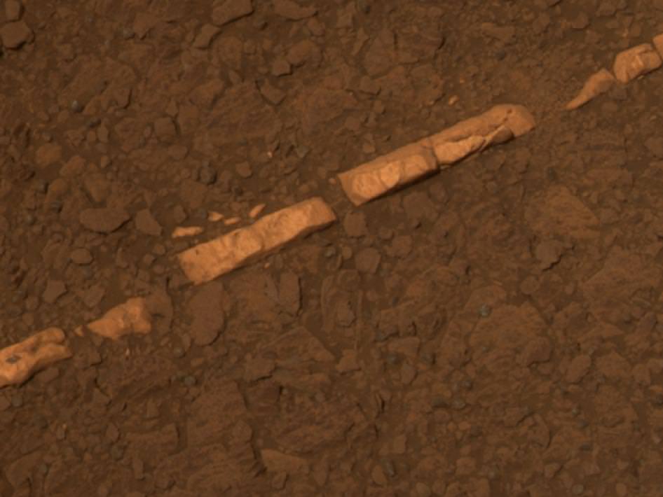
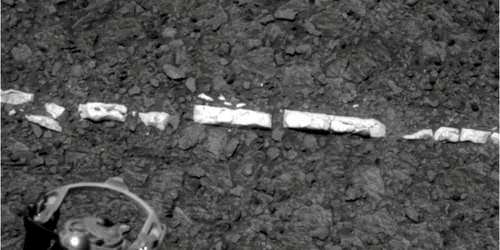
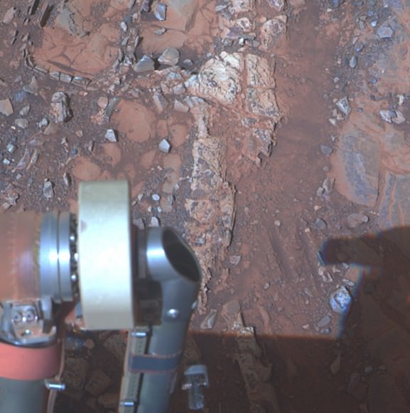
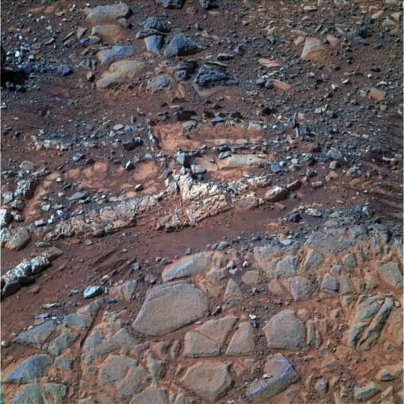
At a rock called “Esperance”, Opportunity found a cache of phyllosilicate clay minerals that typically form in neutral, drinkable water that is not extremely acidic or basic.
The finding ranks as “One of my personal Top 5 discoveries of the mission,” said Steve Squyres of Cornell University, Ithaca, N.Y., principal investigator for NASA’s rover mission at a media briefing.
And despite her advancing age Opportunity remains healthy after surviving in excess of an incredible 3333 Sols, or days, trekking across the alien and ever harsh Martian crater plains.
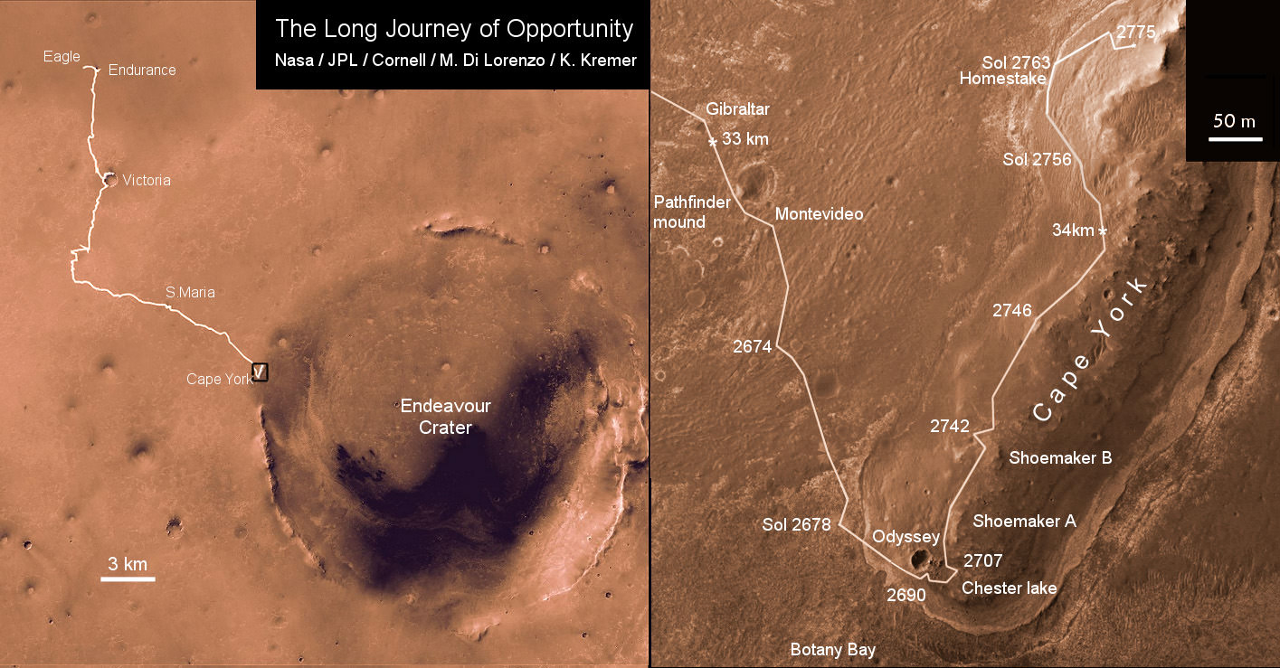
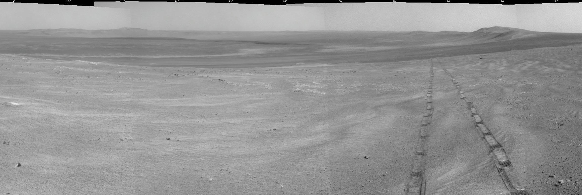
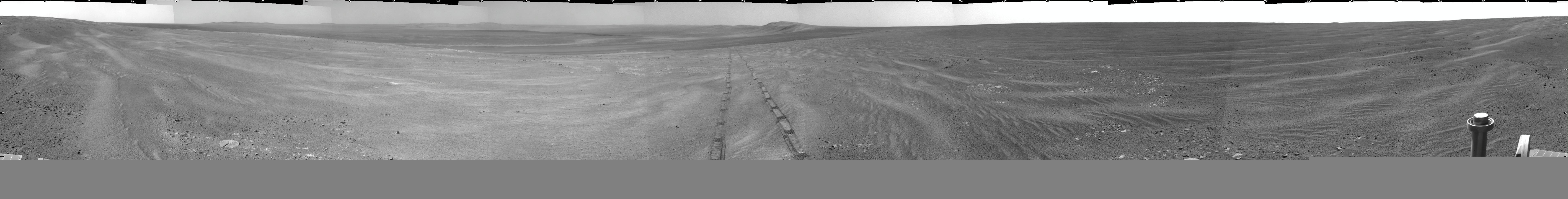
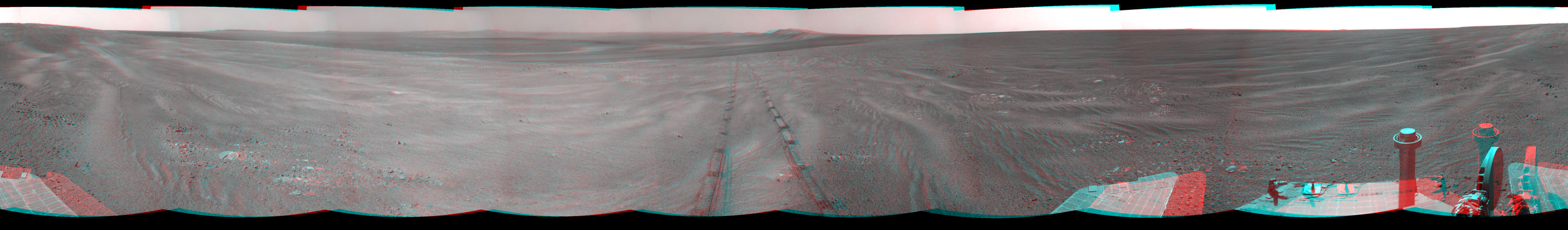
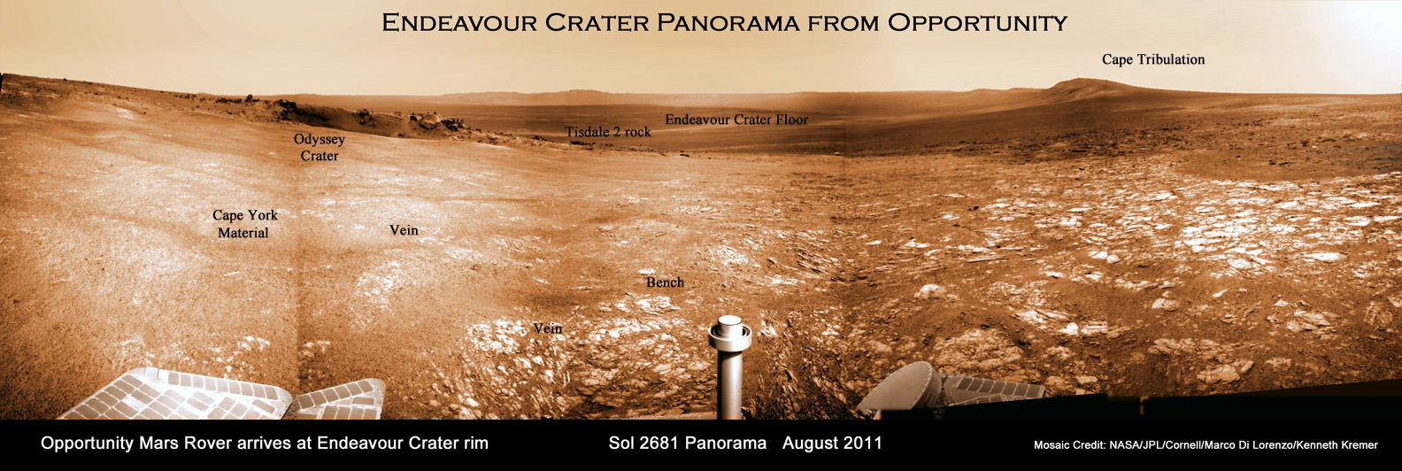
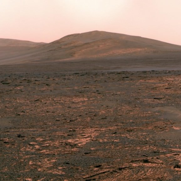
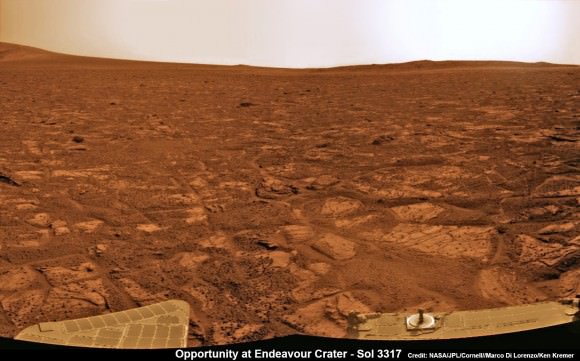
Furthermore the intrepid robot just sat sail on a southerly course for a new destination called “Solander Point” where researches hope to find more even evidence of habitable environments since they already spotted deeper stakes of ancient rocks transformed by water eons ago. See our current photo mosaics showing Solander Point as Opportunity roves across the crater floor – above and below by Marco Di Lorenzo and Ken Kremer.
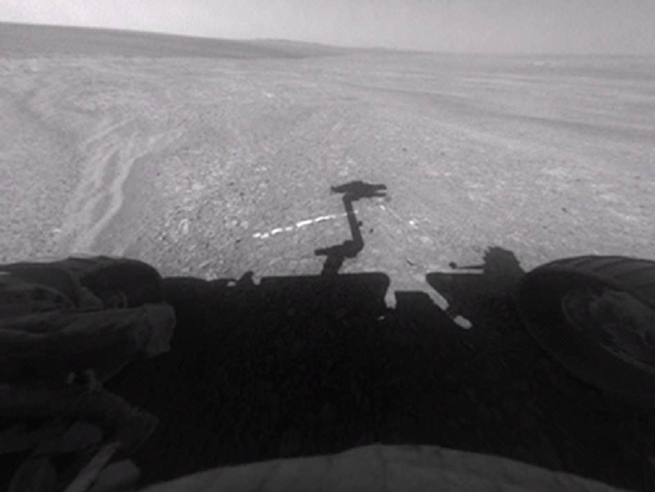
After weeks of trying, the rover deployed the robotic arm to drill at a sweet spot inside “Esperance” and collected convincing X-Ray spectroscopic data in the area she just investigated in May 2013 around the eroded rim of giant Endeavour Crater.
“Esperance is rich in clay minerals and shows powerful evidence of water alteration,” Squyres elaborated.
“This is the most powerful evidence we found for neutral pH water.”
“Clay minerals only tend to form at a more neutral pH. This is water you could drink,” Squyres gushed.
These finding represent the most favorable conditions for biology that Opportunity has yet seen in the rock histories it has encountered after nearly a decade roving the Red Planet.
“This is water that was much more favorable for things like pre-biotic chemistry – the kind of chemistry that could lead to the origin of life,” Squyres stated.
Esperance is unlike any rock previously investigated by Opportunity; rich in aluminum, which is strongly indicative of clay minerals, perhaps like montmorillonite.
Most rocks inspected to date by Opportunity were formed in an environment of highly acidic water that is extremely harsh to most life forms.
“If you look at all of the water-related discoveries that have been made by Opportunity, the vast majority of them point to water that was a very low pH – it was acid,” Squyres explained.
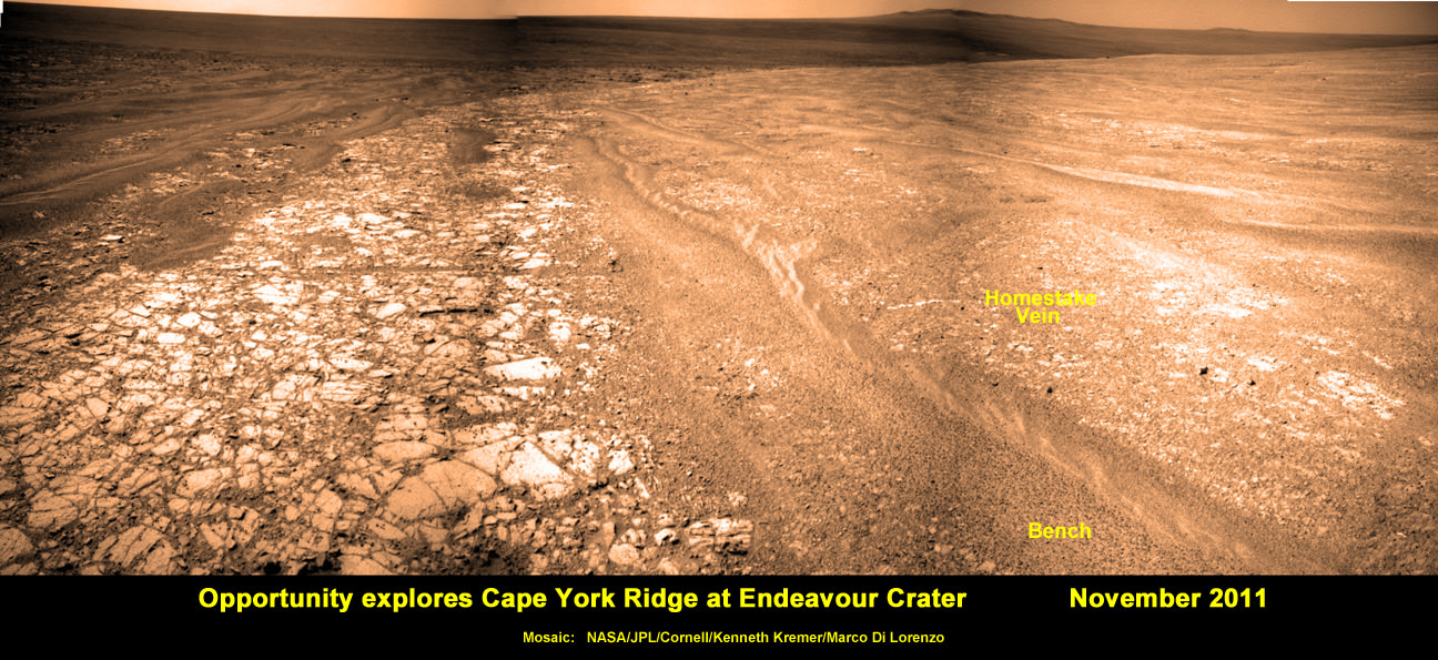
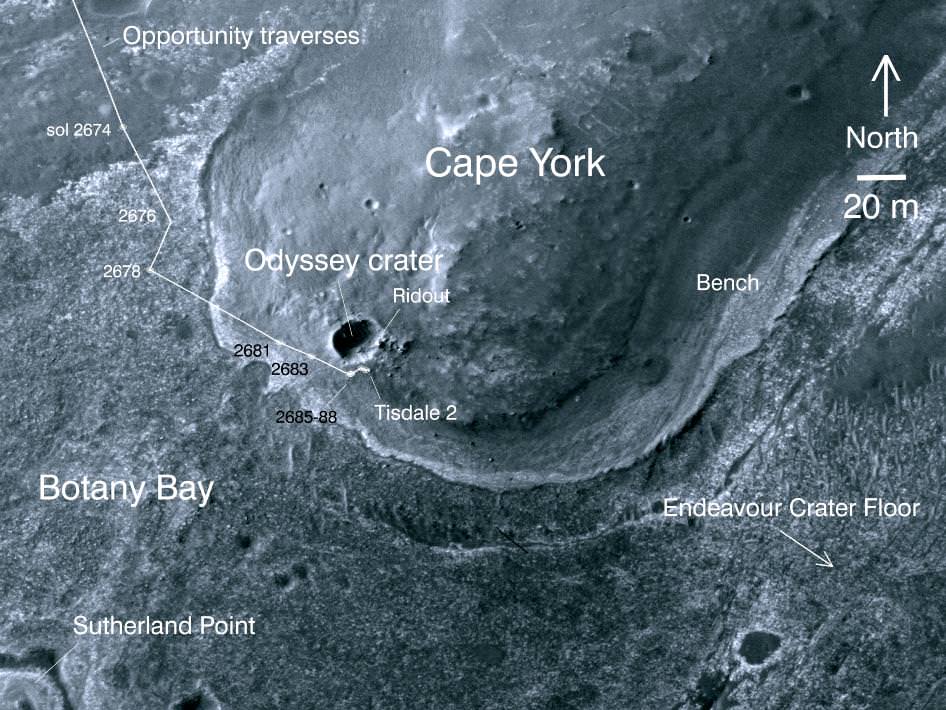
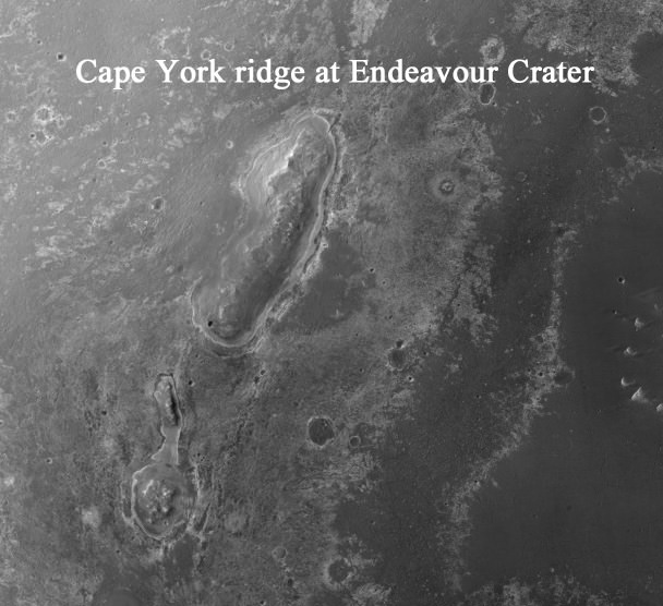
Esperance was found on ‘Cape York’, a hilly segment of the western rim of Endeavour crater which spans 14 miles (22 km) across. The robot arrived at the edge of Endeavour crater in mid-2011 and will spend her remaining life driving around the scientifically rich crater rim segments.
NASA’s new Curiosity rover also recently discovered clay minerals and a habitable environment at Gale Crater – on the other side of Mars – stemming from a time when Mars was warmer and wetter billions of years ago.
Over time Mars became the cold and dry place it is today. Scientists hope the rovers provide clues to Mars dramatic transformation.
The solar powered rover is now driving as quick as possible to reach the northerly tilled slopes of ‘Solander Point’ in August, before the onset of the next Martian winter.
‘Solander Point’ offers a much taller stack of geological layering than ‘Cape York.’ Both areas are raised segments of the western rim of Endeavour Crater.
“There’s a lot to explore there. In effect, it’s a whole new mission,” said Ray Arvidson, the mission’s deputy principal scientific investigator from Washington University in St. Louis, Mo.
Opportunity and her twin “Spirit” were launched to Mars on planned 90 day missions.
Both rovers have far exceeded everyone’s wildest expectations. Spirit endured more than 6 years inside Gusev Crater until succumbing to the bone chilling Martian winter in 2011.

Credit: NASA/JPL/Cornell/Ken Kremer (kenkremer.com)/Marco Di Lorenzo
Opportunity has lasted more than 37 times beyond the three month “warranty”.
“This is like your car not lasting 200,000 miles, or even a million miles. You’re talking about a car that lasts 2 million miles without an oil change,” Callas said. “At this point, how long Opportunity lasts is anyone’s guess.”
“Remember, the rover continues to operate in a very hostile environment, where we have extreme temperature changes every day, and the rover could have a catastrophic failure at anytime,” said John Callas, of NASA’s Jet Propulsion Laboratory, Pasadena, Calif., project manager for the Mars Exploration Rover Project.
“So every day is a gift.”
And don’t forget to “Send Your Name to Mars” aboard NASA’s MAVEN orbiter- details here. Deadline: July 1, 2013
…………….
Learn more about Mars, Curiosity, Opportunity, MAVEN, LADEE, CIBER, Conjunctions and NASA missions at Ken’s upcoming lecture presentations
June 11: “Send your Name to Mars on MAVEN” and “LADEE Lunar & Antares Rocket Launches from Virginia”; NJ State Museum Planetarium and Amateur Astronomers Association of Princeton (AAAP), Trenton, NJ, 730 PM.
June 12: “Send your Name to Mars on MAVEN” and “LADEE Lunar & Antares Rocket Launches from Virginia”; Franklin Institute and Rittenhouse Astronomical Society, Philadelphia, PA, 8 PM.
June 23: “Send your Name to Mars on MAVEN” and “CIBER Astro Sat, LADEE Lunar & Antares Rocket Launches from Virginia”; Rodeway Inn, Chincoteague, VA, 8 PM
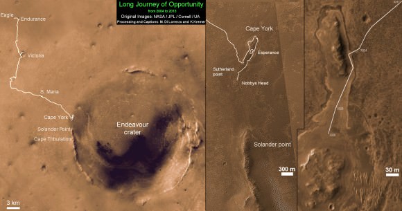
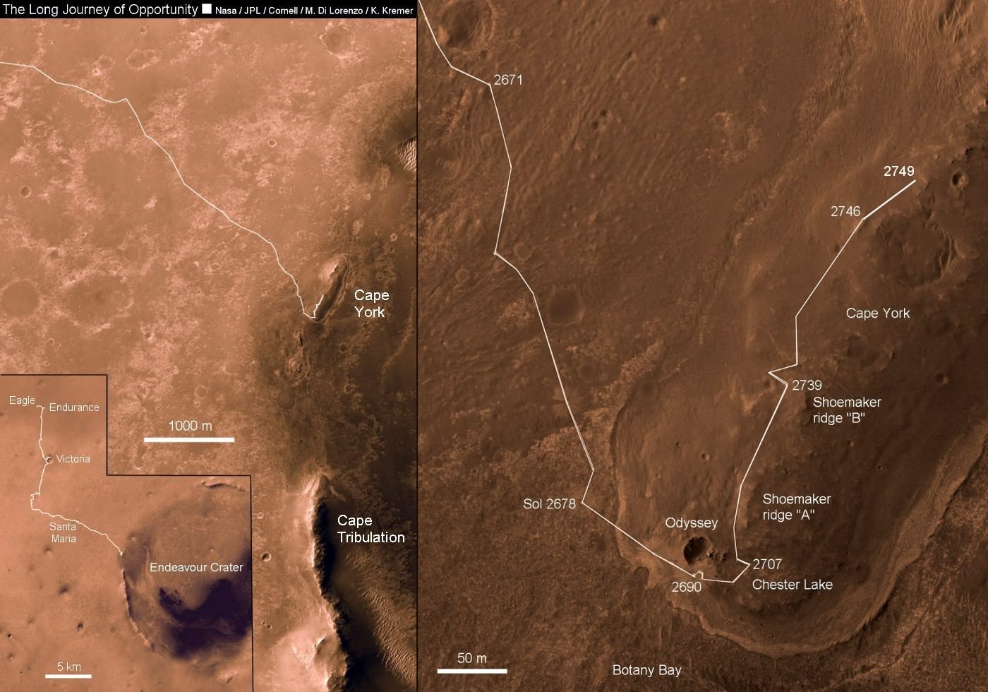
This map shows the entire path the rover has driven during more than 9 years and over 3330 Sols, or Martian days, since landing inside Eagle Crater on Jan 24, 2004 to current location heading south to Solander Point from Cape York ridge at the western rim of Endeavour Crater.
Credit: NASA/JPL/Cornell/ASU/Marco Di Lorenzo/Ken Kremer