Mars Has Lots of Water, But It’s Out of Reach

A cutout of the Martian interior beneath NASA's Insight lander. The top 5 kilometers of the crust appear to be dry, but a new study provides evidence for a zone of fractured rock 11.5-20 km below the surface that is full of liquid water—more than the volume proposed to have filled hypothesized ancient Martian oceans. Credit: James Tuttle Keane and Aaron Rodriquez, courtesy of Scripps Institute of Oceanography

Mars was once wet, but now its surface is desiccated. Its meagre atmosphere contains only a tiny trace amount of water vapour. But new research says the planet contains ample liquid water. Unfortunately, it’s kilometres under the surface, well out of reach.

Continue reading “Mars Has Lots of Water, But It’s Out of Reach”

An Ancient Martian Lake Was Larger Than Any Lake on Earth

In January 2024, DLR's HRSC on board ESA's Mars Express spacecraft captured the Caralis Chaos region, which has several interesting and sometimes puzzling landscape features – such as a field of small, light-coloured hills to the northeast (bottom-right of the image). The mounds are located in the remains of a depression that was once filled by a lake. Image Credit: ESA/DLR/FU Berlin (CC BY-SA 3.0 IGO)

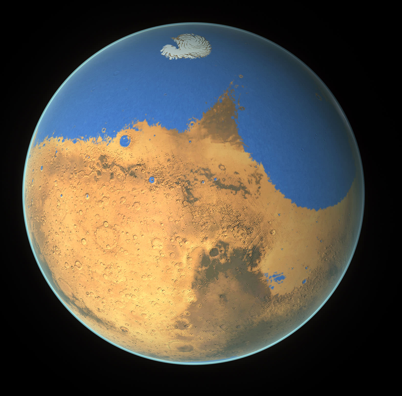
The ESA’s Mars Express orbiter captured an image of the remains of a vast ancient lake on Mars. The remnant lake bed has been weathered and altered by the passing of billions of years. In the planet’s distant past, scientists say, it held enough water to fill Earth’s Caspian Sea almost three times over.

Continue reading “An Ancient Martian Lake Was Larger Than Any Lake on Earth”

Resources on Mars Could Support Human Explorers

Mineral map of Mars showing the presence of patches that formed in the presence of water. Credit: ESA

In the coming decades, multiple space agencies and private companies plan to establish outposts on the Moon and Mars. These outposts will allow for long-duration stays, astrobiological research, and facilitate future Solar System exploration. However, having crews operating far from Earth for extended periods will also present some serious logistical challenges. Given the distances and costs involved, sending resupply missions will be both impractical and expensive. For this reason, relying on local resources to meet mission needs – aka. In-Situ Resource Utilization (ISRU) – is the name of the game.

The need for ISRU is especially important on Mars as resupply missions could take 6 to 9 months to get there. Luckily, Mars has abundant resources that can be harvested and used to provide everything from oxygen, propellant, water, soil for growing food, and building materials. In a recent study, a Freie Universität Berlin-led team evaluated the potential of harvesting resources from several previously identified deposits of hydrated minerals on the surface of Mars. They also presented estimates of how much water and minerals can be retrieved and how they may be used.

Continue reading “Resources on Mars Could Support Human Explorers”

Lake Shorelines on Titan are Shaped by Methane Waves

Map of Titan’s northern region of hydrocarbon ‘seas’ of methane and ethane, created from Cassini radar imaging. Credit: NASA/JPL/USGS.
Map of Titan’s northern region of hydrocarbon ‘seas’ of methane and ethane, created from Cassini radar imaging. New research suggests that wind-driven waves are eroding the moon's coastlines. Credit: NASA/JPL/USGS.

Distant Titan is an oddball in the Solar System. Saturn’s largest moon—and the second largest in the entire Solar System—has an atmosphere denser than Earth’s. It also has stable lakes and seas of liquid hydrocarbons on its surface.

New research shows that waves on these seas are eroding Titan’s coastlines.

Continue reading “Lake Shorelines on Titan are Shaped by Methane Waves”

Marsquakes Can Help Us Find Water on the Red Planet

The Mars InSight lander's seismic detector was used to observe seismic waves from Marsquakes and impacts. Courtesy NASA
The Mars InSight lander's seismic detector was used to observe seismic waves from Marsquakes and impacts. New research shows that the lander's seismic and magnetic data could be used to detect subsurface water on Mars. Image Credit: NASA

Earth is a seismically active planet, and scientists have figured out how to use seismic waves from Earthquakes to probe its interior. We even use artificially created seismic waves to identify underground petroleum-bearing formations. When the InSIGHT (Interior Exploration using Seismic Investigations, Geodesy and Heat Transport) lander was sent to Mars, it sensed Marsquakes to learn more bout the planet’s interior.

Researchers think they can use Marsquakes to answer one of Mars’ most pressing questions: Does the planet hold water trapped in its subsurface?

Continue reading “Marsquakes Can Help Us Find Water on the Red Planet”

Lighting Up the Moon’s Permanently Shadowed Craters

This illustration shows a solar reflector on a crater rim could deliver solar energy where it's needed in the bottom of permanently shadowed polar craters on the Moon. Image Credit: Texas A&M Engineering

The Moon’s polar regions are home to permanently shadowed craters. In those craters is ancient ice, and establishing a presence on the Moon means those water ice deposits are a valuable resource. Astronauts will likely use solar energy to work in these craters and harvest water, but the Sun never shines there.

What’s the solution? According to one team of researchers, a solar collector perched on the crater’s rim.

Continue reading “Lighting Up the Moon’s Permanently Shadowed Craters”

Enceladus’s Fault Lines are Responsible for its Plumes

A false-colour image of the plumes erupting from Enceladus. Image Credit: NASA/ESA

The Search for Life in our Solar System leads seekers to strange places. From our Earthbound viewpoint, an ice-covered moon orbiting a gas giant far from the Sun can seem like a strange place to search for life. But underneath all that ice sits a vast ocean. Despite the huge distance between the moon and the Sun and despite the thick ice cap, the water is warm.

Of course, we’re talking about Enceladus, and its warm, salty ocean—so similar to Earth’s in some respects—takes some of the strangeness away.

Continue reading “Enceladus’s Fault Lines are Responsible for its Plumes”

Ice Deposits on Ceres Might Only Be a Few Thousand Years Old

NASA's Dawn spacecraft captured this approximately true-color image of Ceres in 2015 as it approached the dwarf planet. Dawn showed that some polar craters on Ceres hold ancient ice, but new research suggests the ice is much younger. Image Credit: NASA / JPL-Caltech / UCLA / MPS / DLR / IDA / Justin Cowart

The dwarf planet Ceres has some permanently dark craters that hold ice. Astronomers thought the ice was ancient when they were discovered, like in the moon’s permanently shadowed regions. But something was puzzling.

Why did some of these shadowed craters hold ice while others did not?

Continue reading “Ice Deposits on Ceres Might Only Be a Few Thousand Years Old”

If Europa has Geysers, They’re Very Faint

Jupiter's second Galilean moon, Europa. Its smooth surface has fewer craters than other moons, but they help us understand its icy shell. (Credit: NASA/JPL/Galileo spacecraft)
The Hubble spotted evidence of geysers coming from Jupiter's moon Europa, but nobody's been able to find them again. (Credit: NASA/JPL/Galileo spacecraft)

In 2013, the Hubble Space Telescope spotted water vapour on Jupiter’s moon Europa. The vapour was evidence of plumes similar to the ones on Saturn’s moon Enceladus. That, and other compelling evidence, showed that the moon has an ocean. That led to speculation that the ocean could harbour life.

But the ocean is obscured under a thick, global layer of ice, making the plumes our only way of examining the ocean. The plumes are so difficult to detect they haven’t been confirmed.

Continue reading “If Europa has Geysers, They’re Very Faint”

Curiosity has Reached an Ancient Debris Channel That Could Have Been Formed by Water

The steep path NASA’s Curiosity Mars rover took to reach Gediz Vallis channel is indicated in yellow in this visualization made with orbital data. At lower right is the point where the rover veered off to get an up-close look at a ridge formed long ago by debris flows from higher up on Mount Sharp. NASA/JPL-Caltech/UC Berkeley

Like a pilgrim seeking wisdom, NASA’s MSL Curiosity has been working its way up Mt. Sharp, the dominant central feature in Gale Crater. Now, almost 12 years into its mission, the capable rover has reached an interesting feature that could tell them more about Mars and its watery history. It’s called the Gediz Vallis channel.

Continue reading “Curiosity has Reached an Ancient Debris Channel That Could Have Been Formed by Water”