Turn a camera to a location for four decades, and you can see a lot of change. Streets appear or disappear. Trees grow and eventually, die. Houses spring up and slowly decay.
Landsat is the longest-running Earth observation program, with four decades of observations behind it. Today, to celebrate the launch of Landsat 5 on this day in 1984, here are five Landsat images that helped us better understand the Earth and at times, how humans affect its environment.
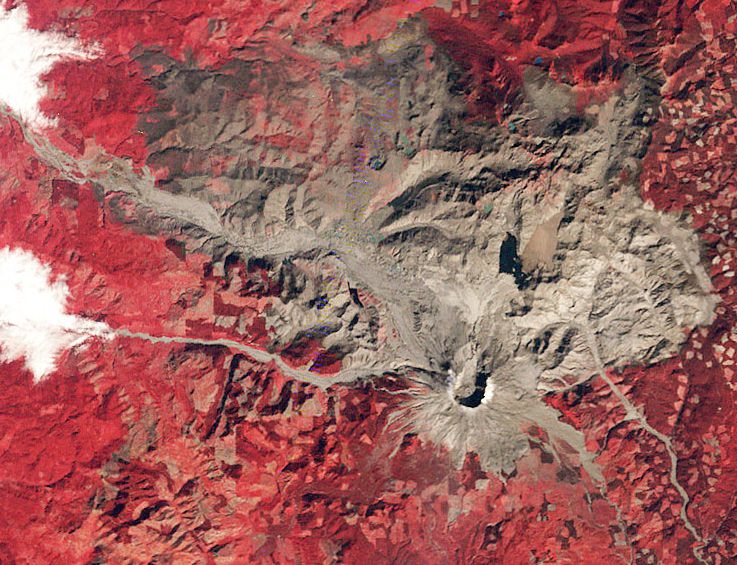
Mount St. Helens
When Washington State’s Mount St. Helens exploded in May 1980, it killed 57 people and obliterated much of the surrounding countryside. For American volcanologists, however, St. Helens was an easy target to study both up close and with the Landsat satellite. This 1980 image shows the devastated countryside in the weeks after the eruption. Landsat photos from every year since demonstrate how the area has recovered in the past two decades.
3-D Antarctica
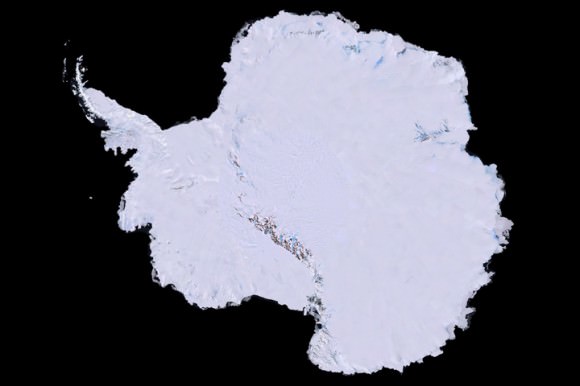
That image up there was years in the making. First, scientists collected 1,100 images of Antarctica using the Landsat 7 satellite. That process took three years, between 1999 and 2001. They combined elevation data and field measurements. Next came the painstaking process of stitching it together. It was finally released to the public in 2007. An unexpected benefit? Spying the continent from space allowed scientists to better track Emperor penguins. That brown stain on the image is actually where the penguins were sitting when the pictures were taken.
Rushing to Kuwait’s rescue
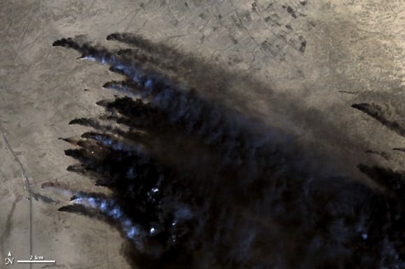
As Iraq pulled out from Kuwait during the Persian Gulf War in 1991, Iraqi troops set fire to some 650 oil wells. The environmental devastation was enormous. This Landsat image, among many others, was crucial for Kuwaiti emergency responders to figure out where the fires were burning and how best to approach them.
Landsat’s Van Gogh image
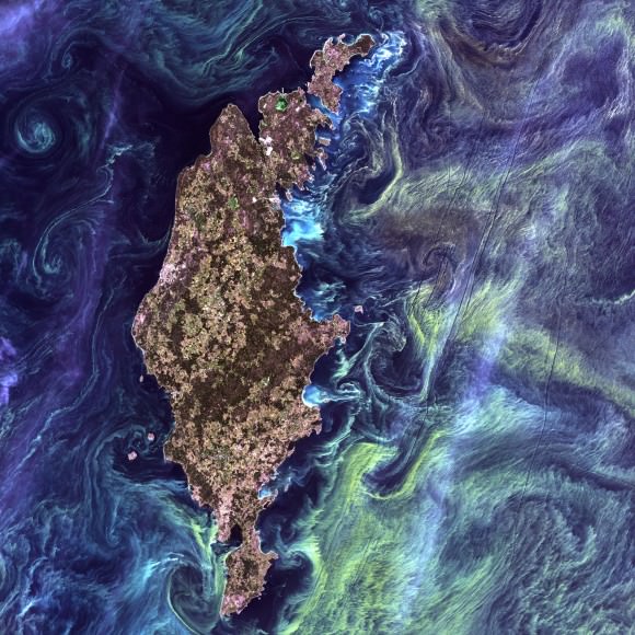
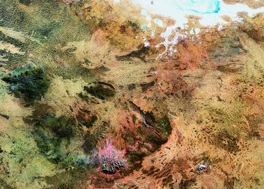
Are those stars and nebulas we see above? Not quite, but NASA points out it does look very similar to the Vincent Van Gogh image “Starry Night.” That 2005 snapshot from Landsat 7 actually shows phytoplankton surrounding the Swedish island of Gotland in the Baltic Sea. The picture was voted the top snapshot by NASA visitors to the “Earth As Art” contest held in 2012.
Shrinking Aral Sea
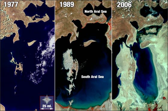
The series of Landsat images above show just how much of the Aral Sea disappeared between 1977 and 2006. The body of water, located between Uzbekistan (south) and Kazakhstan, used to be the fourth-largest lake in the world. The Soviets tapped into the sea several decades ago to irrigate the surrounding area. While local authorities are working to reverse the damage, the sea is still about half the size it used to be.
There’s more Landsat magic to come in the next few years. The Landsat Data Continuity Mission left Earth last month and will take more pictures of the Earth in even better resolution than its ancestors. Take a look at its launch video below.