Are you up for another Where In The Universe Challenge? Take a look and see if you can name where in the Universe this image is from. Give yourself extra points if you can name the spacecraft responsible for the image. As usual, we'll provide the image today, but won't reveal the answer until tomorrow. This gives you a chance to mull over the image, and provide your answer/guess in the comment section — if you're up to the challenge! Check back tomorrow on this same post to see how you did. Good luck!
UPDATE: (1/15) The answer has been posted below. No peeking before you make your guess!
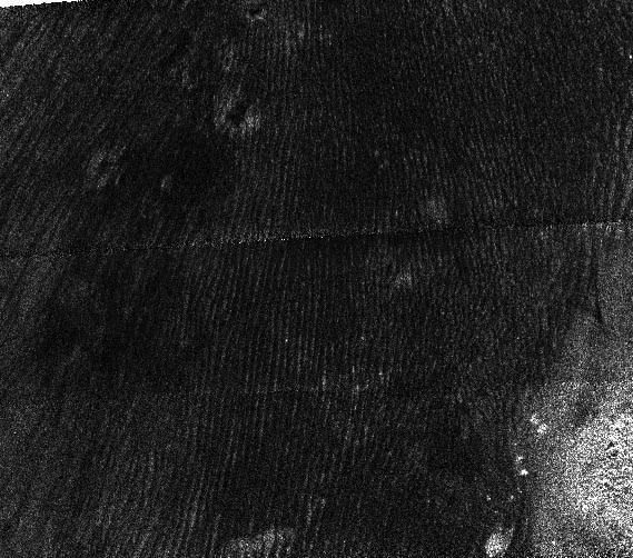
As many of you guessed (knew), these are radar images taken by the Cassini spacecraft of Saturn's moon Titan. The image shows dunes 330 feet (100 meters) high that run parallel to each other for hundreds of miles at Titan's equator. One dune field runs more than 930 miles (1500 km) long.
The images look just like radar images of deserts in Africa, as seen below, showing that similar wind-driven processes might be taking place on Titan: [caption id="attachment_23699" align="aligncenter" width="461" caption="Top image courtesy Earth Sciences and Image Analysis Laboratory, NASA Johnson Space Center; bottom image "]
[/caption]
Great job, everyone. Come back again next week for another WITU Challenge!