OK, let's duke it out. Who had it worse this past week as far as wintery weather: the entire United Kingdom, or the middle part of the United States? We'll the the satellite images tell story.
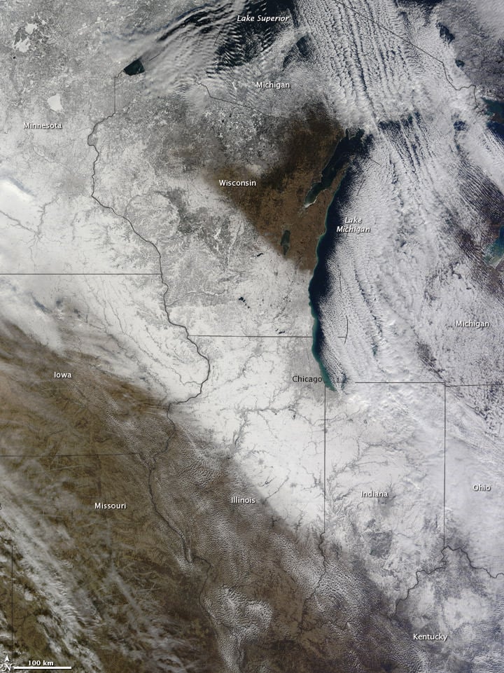
The Moderate Resolution Imaging Spectroradiometer (MODIS) on NASA’s Terra satellite acquired the image above on December 7, two days after the weekend snow storm. A swath of white defines the path of the storm from Minnesota to Kentucky in the image. Weather predictions look there is more on the way this weekend.
And for the UK:
Snow and clouds present an almost uniform white to this satellite image. Snow extends from Northern Ireland southward past Dublin, and from Scotland southward into England. Snow cover stops short of London; the white expanses in that area are clouds. Snow and clouds present an almost uniform white to the satellite sensor, but clouds can be distinguished from the underlying snow by their billowy shapes and indistinct margins.
The United Kingdom Met Office forecast that the cold weather would gradually loosen its grip on the region. For December 9 and 10, 2010, the Met Office forecast rain, but also warned of widespread icy roads.
Source: NASA Earth Observatory
