Except these are mountains made of water, not rock! Taken from an altitude of 65,000 feet, the image above shows enormous storm cells swirling high over the mountains of western North Carolina on May 23, 2014. It was captured from one of NASA's high-altitide
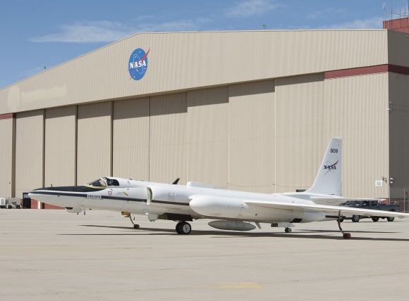
ER-2
aircraft during a field research flight as part of the
Integrated Precipitation and Hydrology Experiment (IPHEx) campaign.
The photo was NASA's
Image of the Day
for June 19, 2014.
[caption id="attachment_112715" align="alignright" width="230"]
Visualization of the GPM Core Observatory satellite (NASA/Britt Griswold)[/caption]
For six weeks the IPHEx campaign team from NASA, NOAA, and Duke University set up ground stations and flew ER-2 missions over the southeastern U.S., collecting data on weather and rainfall that will be used to supplement and calibrate data gathered by the
GPM Core Observatory
launched in February.
By the time its role in IPHEx was completed on June 16, the Lockheed ER-2 aircraft had flown more than 95 hours during 18 flights over North and South Carolina, Georgia, Florida, and Tennessee. Its high-altitude capabilities allow researchers to safely fly above storm systems, taking measurements like a satellite would.
Learn more about the ER-2 flights
here
, and read more about the IPHEx campaign
on Duke University's Pratt School of Engineering site here.
Source: NASA
[caption id="attachment_112717" align="aligncenter" width="580"]
NASA's ER-2 at the Armstrong Flight Research Center's Building 703 in Palmdale, CA (NASA/Tom Tschida)[/caption]
 Universe Today

