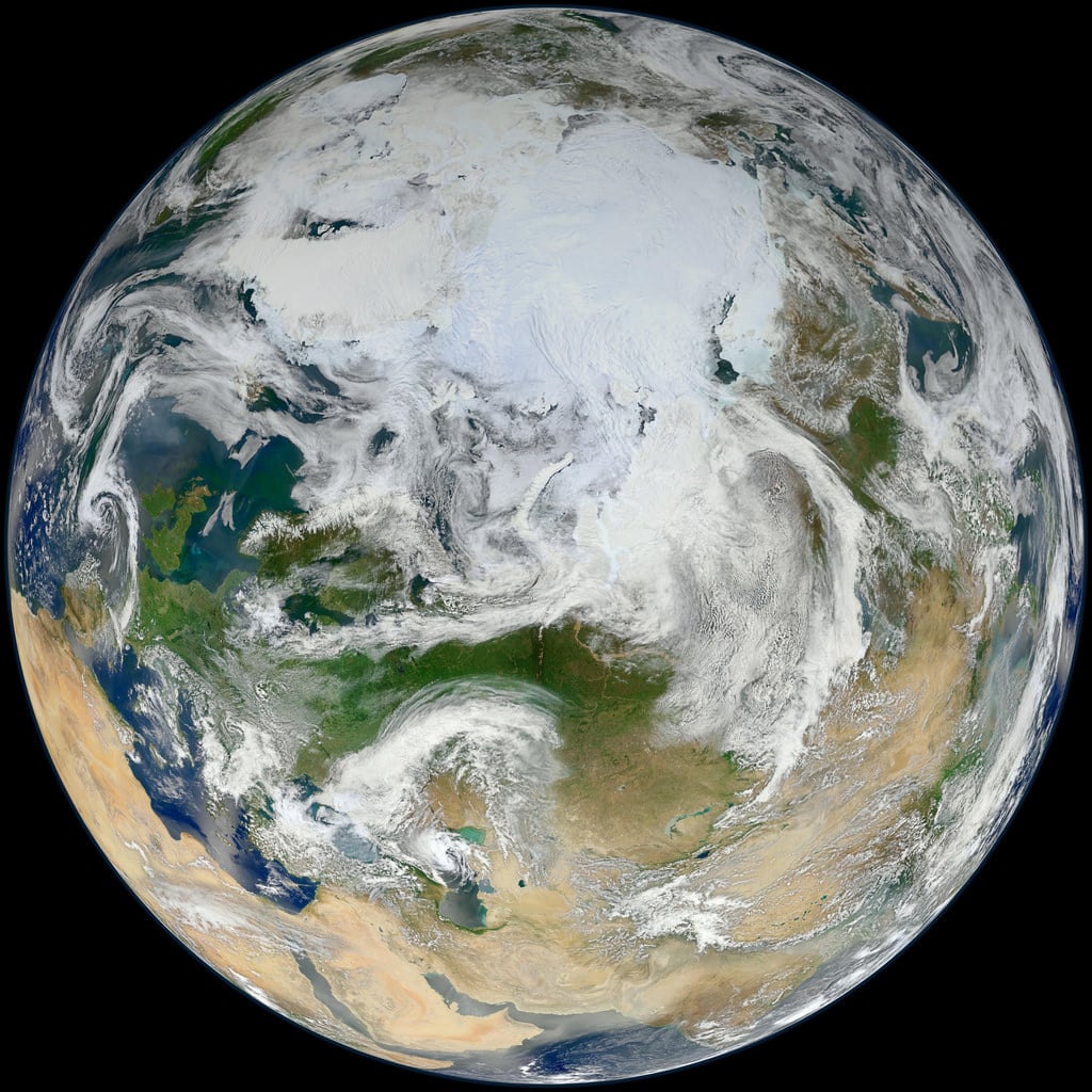
This latest portrait of Earth from NASA's
Suomi NPP
satellite puts the icy Arctic in the center, showing the ice and clouds that cover our planet's northern pole. The image you see here was created from data acquired during fifteen orbits of Earth.
In January of this year Suomi NPP images of Earth were used to create an
amazing "Blue Marble" image
that spread like wildfire across the internet, becoming one of the latest "definitive" images of our planet. Subsequent images have been released by the team at Goddard Space Flight Center, each revealing a
different perspective
of Earth.
See a full-sized version of the image above
here
.
NASA launched the National Polar-orbiting Operational Environmental Satellite System Preparatory Project (or NPP) on October 28, 2011 from Vandenberg Air Force Base. On Jan. 24, NPP was
renamed Suomi National Polar-orbiting Partnership
, or Suomi NPP, in honor of the late
Verner E. Suomi
. It's the first satellite designed to collect data to improve short-term weather forecasts and increase understanding of long-term climate change.
Suomi NPP orbits the Earth about 14 times each day and observes nearly the entire surface of the planet.
Image credit: NASA/GSFC/Suomi NPP