Even with all we've learned about Mars in recent decades, the planet is still mysterious. Most of the mystery revolves around life and whether the planet ever supported any. But the planet teases us with more foundational mysteries, too.
One of those mysteries is the Martian dichotomy: Why are the planet's northern and southern hemispheres so different?
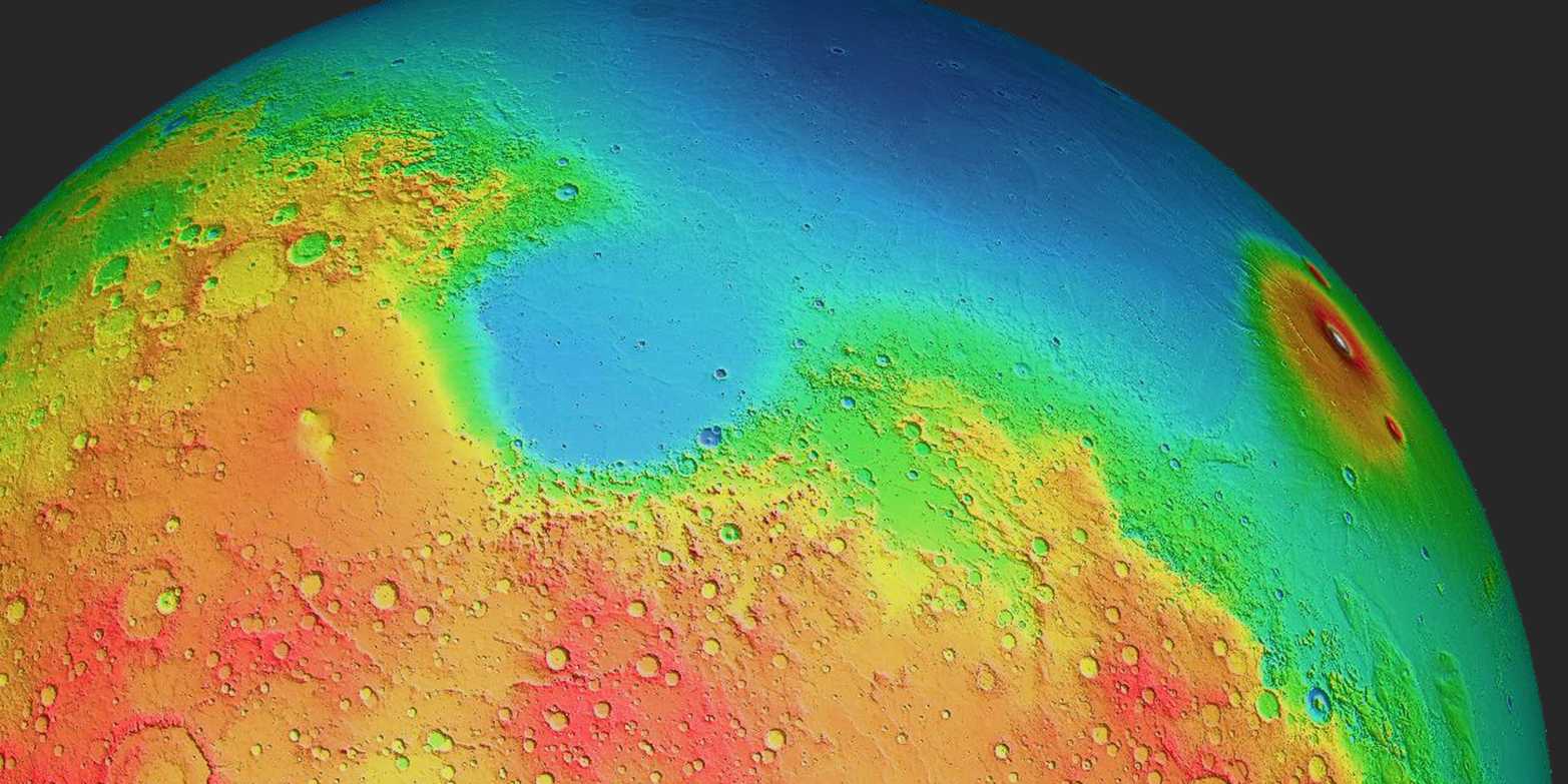
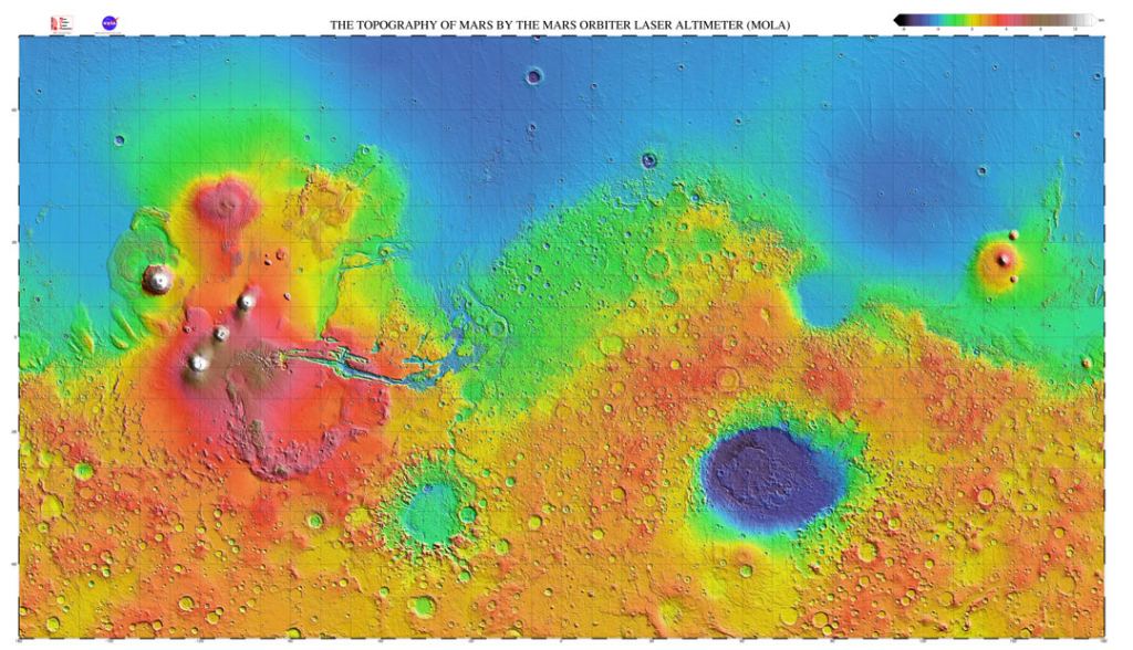
For some reason, Mars' southern hemisphere is predominantly highlands and has a higher elevation than the northern hemisphere—about 5km (3 mi) higher. The south also has a thicker crust, is older and is covered in craters.
The northern hemisphere is a vast, smooth plain with a thinner crust and fewer craters. It is also less magnetized than the south.
Scientists have been puzzling over this dichotomy and have proposed different reasons for it. One leading theory involves a massive impact. Some researchers using geophysical modelling have suggested that a Pluto-sized body struck Mars early in its history. The impact could've created the northern lowlands as a gigantic impact basin.
Other researchers have proposed that the planet's internal (endogenic) processes created the dichotomy. Plate tectonics or mantle convection could've been behind it.
Either way, the dichotomy is fundamental to understanding Mars. We can't understand the planet's evolution without revealing the mystery behind the dichotomy. This is why NASA and the DLR launched the InSight lander, which reached the Martian surface in November 2018.
The lander's name stands for Interior Exploration using Seismic Investigations, Geodesy, and Heat Transport. Among its instruments was SEIS, the Seismic Experiment for Interior Structure. SEIS helped scientists better understand Marsquakes by detecting and measuring hundreds of them. It also helped them measure crustal thickness and investigate the mantle. InSight's data also helped them constrain the size of Mars' core.
Scientists are still working with InSight's data, and a new research letter published in the AGU's Geophysical Research Letters suggests that Mars' convection is behind the Martian dichotomy. It's titled " Constraints on the Origin of the Martian Dichotomy From Southern Highlands Marsquakes." The authors are Weijia Sun from the Chinese Academy of Sciences and Professor and geophysicist Hrvoje Tkalcic from the Australian National University.
The authors state the Martian dichotomy in clear terms: "The Martian hemispheric dichotomy is delineated by significant differences in elevation and crustal thickness between the Northern Lowlands and Southern Highlands." The altitude difference is about equal to the height of the tallest mountains on Earth.
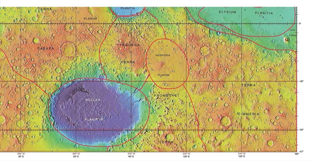
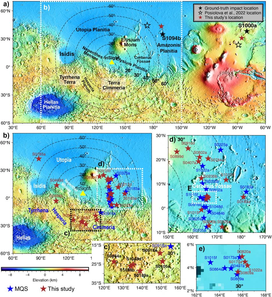
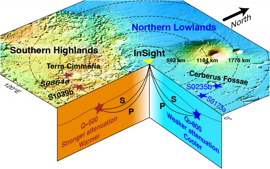
This research is based on a cluster of Marsquakes in the Terra Cimmeria region of the southern highlands. "We analysed waveform data from so-called low frequency marsquakes captured by NASA's InSight seismograph on Mars," Professor Tkalcic said. "In doing this, we located a cluster of six previously detected, but unlocated marsquakes in the planet's southern highlands, in the Terra Cimmeria region."
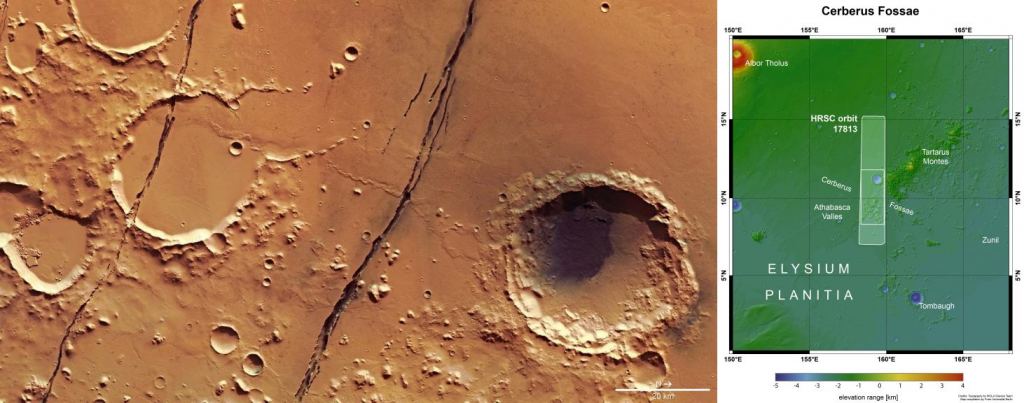
These quakes gave the researchers new seismic data from previously unstudied regions, which is significant because it allows them to compare the data to seismic data from other regions, especially from the Cerberus Fossae region in the northern lowlands.
Cerberus Fossae is a series of near-parallel fissures on Mars. Scientists think they were created by the Tharsis volcanoes to the east and Elysium to the west.
The researchers worked with InSight's seismic data and improved the signal-to-noise ratio. That improvement allowed them to pinpoint the locations of the marsquakes. "Here, we improve the signal-to-noise ratios and determine the locations of the low-frequency marsquakes recorded during the InSight mission. We find a new cluster of marsquakes in Terra Cimmeria, Southern Highlands, in addition to those previously located in Cerberus Fossae, Northern Lowlands," they write.
The researchers used what's called the spectral ratio method to determine the quality of the waves. In this context, quality refers to how quickly seismic waves lose energy as they travel through the Martian interior. It's expressed as a value for 'Q' which was different between the Cerberus Fossae region and the Terra Cimmeria region.
"Using the spectral ratio method, we estimate the quality factor Q in the range 481–543 for Terra Cimmeria versus 800–2,000 determined for Cerberus Fossae," the researchers explain. A higher Q in the Southern Highlands' Terra Cimmeria indicates that seismic waves there 'attenuate' or lose energy more quickly.
Such a large difference in Q between regions indicates that the subsurfaces are substantially different from one another. Temperature and mantle convection could be the key. "The attenuation difference might be linked to the temperature differences between the two hemispheres, along with more vigorous convection beneath the Southern Highlands," the paper states.
"The data from these marsquakes, when compared with the well-documented northern hemisphere marsquakes, reveal how the planet's southern hemisphere is significantly hotter compared to its northern hemisphere," Professor Tkalcic said. "Understanding whether convection is taking place offers clues into how Mars has evolved into its current state over billions of years."
Researchers' primary goal in studying the Martian dichotomy has been to determine whether endogenic or exogenic processes or events are responsible. However, the impact theory is hampered by timing. There are significant geochronological constraints for giant impacts on Mars. Crater data, mineral distribution, and the presence of river channels all conflict with the impact hypothesis, which most researchers suggest had to have happened early in the Solar System's history.
"These seismological observations, together with geochronological constraints of giant impacts, reinforce the "endogenic" hypothesis that mantle convection causes the crustal dichotomy," they explain.
Are these findings a breakthrough in understanding the Martian dichotomy? Possibly. Compared to our seismic probings of Earth's interior, Mars is practically undiscovered.
"On Earth, we have thousands of seismic stations scattered around the planet. But on Mars, we have a single station, so the challenge is determining the location of these marsquakes when you have only a single instrument," Professor Tkalcic said.
It seems that the researchers have met that challenge.
"These findings, supported by geochemical analysis of Martian meteorites, provide valuable in situ seismological observations that support the "endogenic" hypothesis, suggesting that mantle convection plays a crucial role in forming the Martian crustal dichotomy," the authors explain.