Remember how exciting it was in 2017 when a total solar eclipse crossed the United States? We're in for two more well-placed eclipses over the next year, so it's time to get organized to take advantage of these unparalleled celestial events.
On October 14, 2023, an annular eclipse will be visible to millions of people in the US, crossing northwest to south central, from the coast of Oregon down to the Texas Panhandle.
Then, on April 8, 2024, a total solar eclipse will be visible to millions more, crossing south central to northeast, from southern Texas to Eastern Canada. It will be visible in parts of Mexico, too.
Now is the time to make plans of where you want to be for either or both events. But, if you live near San Antonio, don't go anywhere! You'll get to see both eclipses right from your backyard.
No matter where you live, if you have the opportunity to see a solar eclipse – whether it is annular or total – DO IT!
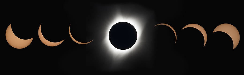
What is the difference? An annular solar eclipse is where the Moon passes between Earth and the Sun, with the Moon obscures all but an outer portion of the Sun, creating a stunning 'ring of fire' appearance of the Sun.
Total solar eclipses happen when the New Moon comes between the Sun and Earth and completely obscures the face of the Sun. The few minutes or seconds when the Sun is completely covered is called totality, which is an incredible experience.
But of course, you'll need to be careful -- never look at partial phases of the solar eclipses with out certified eye protection.
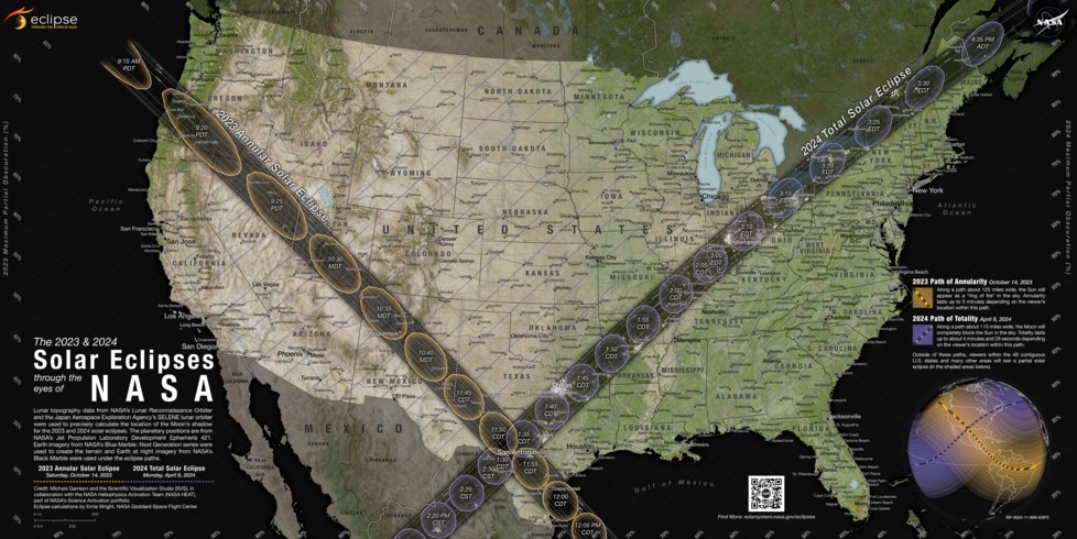
When and where will these eclipses happen? Thankfully there are tons of resources to help you make your plans. NASA has just released an eclipse map for both these eclipses. You can download the full resolution version here.
The map details the path of the eclipses across the contiguous U.S. Only within the dark paths will viewers experience the annular and total solar eclipses. But, if you can't travel on these dates, don't despair! Viewers elsewhere will see partial eclipses. NASA says that on both dates, all 48 contiguous states in the U.S. will experience at least a partial solar eclipse, as will Mexico and most of Canada.
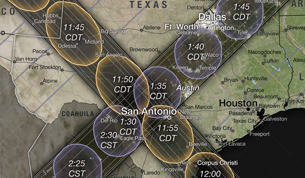
Look closely on the map and you'll see smaller lines, which indicate how much of the Sun will become covered by the Moon during the partial eclipse. For the annular eclipse, these lines appear faint yellow. For the total eclipse, they're faint purple. Percentage labels for the annular eclipse lines appear along the left and top edges of the map. The percentage labels for the total eclipse appear along the bottom and right edges of the map. (Tip: The percentages appear at the same angles as the lines.)
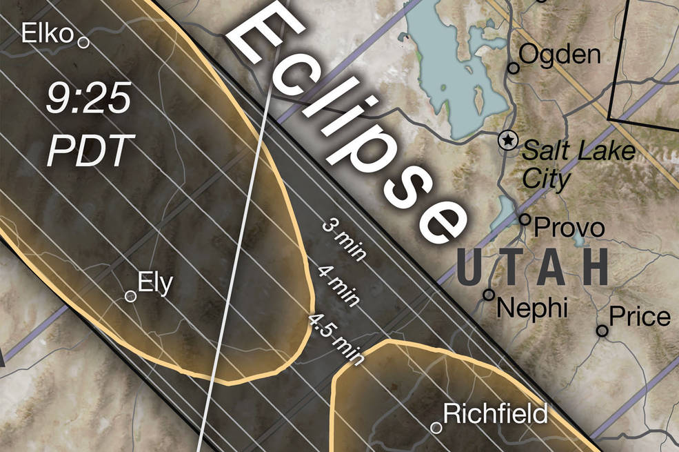
But within the dark paths is where the real magic happens. The closer you can be to the center of the dark path, the longer the eclipses will last. On the map, inside each path are white lines that indicate how long annularity or totality will last. On the above image, for the annular eclipse path, you can find labels (ranging from 3 to 4.5 minutes) near the Nevada-Utah border in the north and between San Antonio and Corpus Christi, Texas, in the south.
NASA explains more in this video:
Here are more resources to help you plan your eclipse adventure:
- The Great American Eclipse website has tons of information on both eclipses, including how to purchase protective eyewear
- The Eclipse2024 website has a list of all the US states, Canadian provinces and Mexican states where you can look for specific towns, where you can find out the start and end times of the 2024 total solar eclipse and how long totality will last in those locations. The also have a great solar eclipse simulator to show what both the annular and total eclipses will look like in your selected location.
- The National Eclipse website has more mapsNASA's overview of the October 14, 2023 annular eclipse
- NASA's overview of the April 4, 2024 total solar eclipse
- More details about NASA's eclipse maps
- The American Astronomical Society has a great list of other resources.