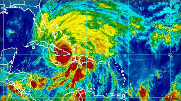
Hurricane Sandy made landfall on Cuba early Thursday Oct. 25, 2012 as strong Category 2. Credit: NOAA/National Hurricane Center
Meteorologists keeping an eye on Hurricane Sandy say the storm threatens to move up along the east coast of the United States and could mix with a wintery storm coming from the west to form a monster storm that has been informally dubbed “Frankenstorm.” The hurricane could reach the US coast by this weekend and when the two storms collide, it could continue to pound the eastern seaboard well into the week of Halloween.
Hurricane Sandy is now in the Caribbean as a Category 2 storm coastal areas from Florida to Maine will feel some effects, forecasters predict. The mix of the two storms could cause weather problems in the Washington DC area to New York city, some of the most populous areas of the US.
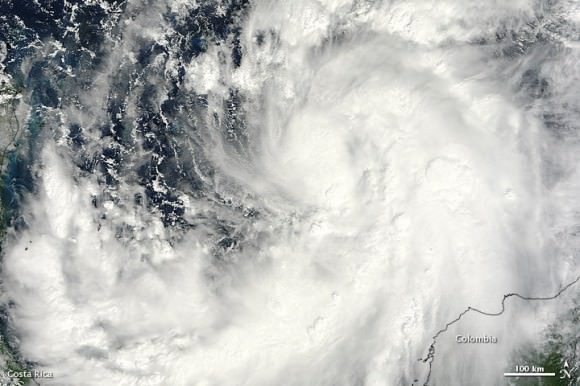
Satellite image of then Tropical Storm Sandy taken on October 23, 2012 as it was over the Caribbean Sea taken by the Moderate Resolution Imaging Spectroradiometer (MODIS) on NASA’s Terra satellite. NASA image courtesy Jeff Schmaltz, LANCE MODIS Rapid Response Team at NASA GSFC.
Forecasters are saying this could be a major mess, with a 90 percent chance that the East will get steady gale-force winds, heavy rain, flooding and maybe snow.
While no one can positively predict what Hurricane Sandy will do and how the two storms might mesh into one monster storm, the Washington Post’s Capital Weather Gang has outlined the possible scenarios from worst case to where the storms collide and remained parked over the region for days, to best case, where Sandy heads to the northeast sparing the East Coast from a direct hit.
We’ll post additional updated satellite views as they become available.
Sources: NASA Earth Observatory, CBS News, Climate Central
, NOAA


Many times I have seen such approaching storms be whisked to the east by steering winds just before landfall. I am interested to see what will happen this time.
Pfft Frankenstorm – Its a Snowicane!