 Universe Today
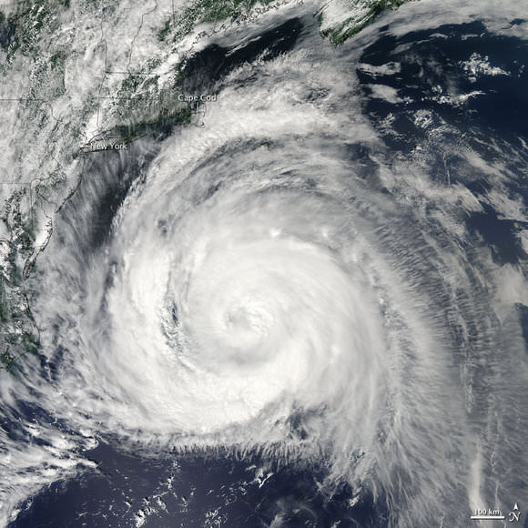
Hurricane Bill kept its distance from the US mainland, seemingly skirting along the eastern seaboard and fitting perfectly within the coastline curves on this NASA satellite image. Thankfully, the storm largely missed the eastern states, with the center of the storm well off the coast. It appears Bill will keep its distance from the Canadian coast as well. It has now been downgraded to a tropical storm, and is expected to weaken over the next 24 hours. As of late Sunday night, the storm had maximum sustained winds near 120 kilometers (75 miles) per hour with higher gusts. This image was taken by the Moderate Resolution Imaging Spectroradiometer (MODIS) on NASA’s Aqua satellite, taken at 2:00 p.m. EDT (14:00 UTC) on August 23, 2009. Source: NASA Earth Observation website
How Close Did Hurricane Bill Come to the US East Coast?
 Space Bites+
▶
Our latest video — free on Patreon
Moon Cities Are Not Happening. Here's Why
The extended edition: ad-free, with extra content. Free to watch — no account needed.
▶ Watch it free
Space Bites+
▶
Our latest video — free on Patreon
Moon Cities Are Not Happening. Here's Why
The extended edition: ad-free, with extra content. Free to watch — no account needed.
▶ Watch it free
