Since its deployment in 2012 to the surface of Mars, the
Curiosity
rover has sent back many breathtaking images of the Red Planet. In addition to snapping photos of the comet
Siding Spring
and
Earth from the surface
, not to mention some wonderful
panoramic selfies
, the rover has also taken countless images that show the geology and surface features of Mars' in stunning detail.
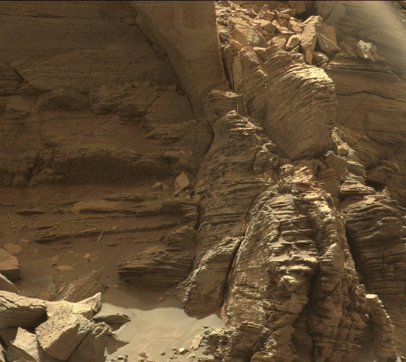
And with the latest photos to be released by NASA, the Curiosity rover has provided us with a wonderful look at the "Murray Buttes" region, which is in the lower part of Mount Sharp. These images were taken by the Curiosity Mast Camera (Mastcam) on Sept. 8th, and provide some lovely insight into the geological history of the region.
Using these images, the
Curiosity
team hopes to assemble another impressive color mosaic that will give a detailed look at the region's rocky, desert-like landscape. As you can see from the images provided, the region is characterized by mesas and buttes, which are the eroded remnants of ancient sandstone. Much like other spots around Mount Sharp, the area is of particular interest to the Curiosity team.
For years, scientists have understood that the rock layers that form the base of Mount Sharp accumulated as a result of sediment being deposited within the ancient lake bed billions of years ago. In this respect, the geological formations are similar to those found in the desert regions of the southwestern United States.
Ashwin Vasavada, the Curiosity Project Scientist of NASA's Jet Propulsion Laboratory, told Universe Today via email:
These sediment layers are believed to have been laid down over the course of 2 billion years, and may have completely filled the crater at one time. Since it is widely believed that lakes and streams existed in the Gale Crater 3.3 - 3.8 billion years ago, some of the lower sediment layers may have originally been deposited on a lake bed.
For this reason, the
Curiosity
team also took drill samples from the Murray Buttes area for analysis. This began on Sept. 9th, after the rover was finished taking pictures of the area. As Vasavada explained:
After the drilling is completed, Curiosity will continue farther south and higher up Mount Sharp, leaving behind these spectacular formations. These pictures represent
Curiosity
's last stop in the Murray Buttes, where the rover has been spending the past month.
And as of this past September 11th, 2016,
Curiosity
has been on the planet Mars for a total of 4 years and 36 days (or 1497 Earth days; 1458 sols) since it landed on August 6th, 2012.
One has to wonder how the pareidolia folks are going to interpret these ones. After "seeing" a rat, a lizard, a doughnut, a coffin, and so forth, what's left? Might I suggest that the top image kind of looks like a statue-column?
Further Reading: NASA - Solar System Exploration
