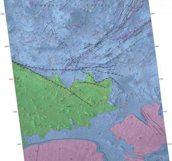
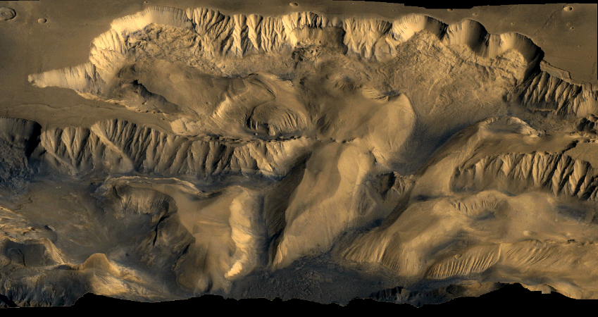
Mars today is a planet that appears to be mostly shaped by wind, but that wasn’t always the case. A new map adds information to the hypothesis that “marsquakes” affected at least a part of the planet’s vast canyon, Valles Marineris, while the area contained spring-filled lakes.
When the damp sand got shaken up, it deposited itself in hills. NASA says the new map, based on observations from the Mars Reconnaissance Orbiter (which you can see below), adds credence to the theory that it was water that made these deposits.
“The conditions under which sedimentary deposits in it formed have been an open issue for decades,” NASA wrote in a press release. “Possibilities proposed have included accumulation in lakebeds, volcanic eruptions under glaciers within the canyons, and accumulation of wind-blown sand and dust.”
The map you see below was created by the U.S. Geological Survey, which has more extensive information on the findings at this website. The observations also produced a suite of research in recent years, such as this 2009 paper led by Scott Murchie at the Johns Hopkins University Applied Research Laboratory.


The caption for the first image is incorrect. That was not taken by either Voyager 1 or 2. Maybe Viking 1 or 2 orbiters? Not sure. Maybe they were taken by MRO, Odyssey, or even Mars Global Surveyor; which is now dead.
True. Data taken from the the two Vikings
http://nssdc.gsfc.nasa.gov/imgcat/html/object_page/vom_nj05s070.html
Is NASA feeding us crap?
During my present cycling trip, I traveled down state road 250 through Hollister. That town is famous for its frequent quakes. The San Andreas runs right through town and also alongside 250. The following link is a still frame from a video I took of a slumped hillside right on the great fault. It was a remarkable site. Not uncommon at all around the Earth and the San Andreas but this one I just recently passed by. Consider this to the “Voyager” – err – Viking Mars image (that will get fixed… great writer’s minor error). https://www.dropbox.com/s/oiacar05dksdjar/SlumpingHillside-nearHollister-SanAndreas.jpg
Looks not unlike my stomach… lol.
Although no Marsquakes have been detected on the ground as yet, they are sure to happen sooner or later? from either an asteroid/cometary body impact or even subsurface magma activity?