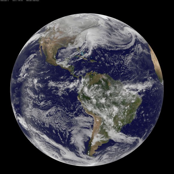
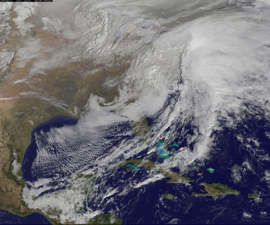
This visible image of the winter storm over the U.S. south and East Coast was taken by NOAA’s GOES-13 satellite on Feb. 13 at 1455 UTC/9:45 a.m. EST. Snow covered ground can be seen over the Great Lakes region and Ohio Valley. Image Credit: NASA/NOAA GOES Project
Story updated[/caption]
A deadly monster storm is battering virtually the entire US Eastern seaboard today, Thursday, Feb. 13, as it moves from the Southeast to the Northeast and into the New England states, wreaking havoc and causing miserable weather conditions for over 100 million Americas.
This afternoon, NASA and NOAA published a new image taken by a GOES satellite that showed the extent of the clouds associated with the massive winter storm over the US East Coast – see above and below.
Blizzard, white out and slippery conditions have already caused more than 18 deaths.
The killer storm has brought relentless waves of snow, sleet and ice over the past two days covering a vast swath stretching from inland to coastal areas as it moved up from the southern to northern states.
More than a foot of snow has already fallen in many areas today stretching from the Mid-Atlantic into the entire Northeast region.
Several states have declared states of emergency.
This is the season’s 12th snow storm. In many Northeast localities, the accumulated snowfall totals are three times the normal average. As a result many municipalities are running out of road salt.
And to add insult to injury, much more icy snow is falling overnight into Friday on top of the massive existing mounds and piles of frozen ice and snow that’s accumulated over the past few weeks of subfreezing temperatures.
There are also predictions for patches of “thunder snow” — which is a snow storm mixed with thunder and lightning!
Incredibly, another round of snow is forecast for Saturday.
Much of the I-95 corridor where I also live has been especially hard hit.
The image above was created from data captured by NOAA’s GOES-East satellite today, Feb. 13 at 1455 UTC/9:45 a.m. EST by a team from the NASA/NOAA’s GOES Project at NASA’s Goddard Space Flight Center in Greenbelt, Md.
“The clouds and fallen snow data from NOAA’s GOES-East satellite were overlaid on a true-color image of land and ocean created by data from the Moderate Resolution Imaging Spectroradiometer or MODIS instrument that flies aboard NASA’s Aqua and Terra satellites,” said NASA in a statement.
An eight months pregnant 36 year old women was tragically killed in New York City accident today by a snowplow. Thank God the unborn baby was saved and delivered by cesarean section.
The storm has caused thousands of traffic accidents and several deaths.
Video Caption: This animation of NOAA’s GOES satellite data shows the progression of the major winter storm in the U.S. south from Feb. 10 at 1815 UTC/1:15 p.m. EST to Feb. 12 to 1845 UTC/1:45 p.m. EST. Credit: NASA/NOAA GOES Project, Dennis Chesters
Hundreds of thousands of customers have lost power due to fallen tree limbs on exposed power lines, mostly in the southeast. In recent days, hundreds of thousands of us here in the Northeast lost power after a severe ice storm.
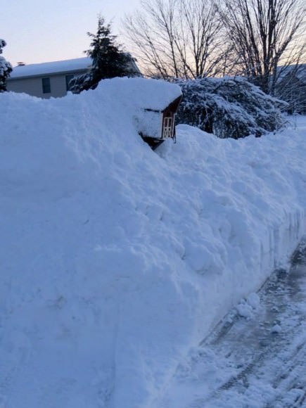
Most of those affected were left with no heat in subfreezing temperatures. It’s definitely no fun when you can see you exhaled breath – indoors.
Many school districts were closed today. But not in NYC where the new Mayor Bill DeBlasio kept schools open, and faced a hail of criticism – including from NBC News weatherman Al Roker.
Over 6500 airplane flights have been cancelled, stranding over a half million people.
So after days of shoveling, even more is on tap for the morning. Be careful, pace yourself and don’t overdo it – as several people died from heart attacks digging out the heavy slushy mess
Here is this evenings forecast (Feb 13) from the National Weather Service (NWS):
STORM SUMMARY NUMBER 09 FOR SOUTHERN PLAINS TO EAST COAST WINTER STORM
NWS WEATHER PREDICTION CENTER COLLEGE PARK MD – – 1000 PM EST THU FEB 13 2014
…LOW PRESSURE CENTER HAS MOVED OFF THE NEW JERSEY COAST AND IS
RAPIDLY INTENSIFYING…HEAVY SNOW BANDS IMPACTING INTERIOR
NORTHEAST AND I 95 CORRIDOR…WINDS INCREASING ACROSS THE AFFECTED
REGION…
WINTER STORM WARNINGS AND WINTER WEATHER ADVISORIES ARE IN EFFECT
FOR THE NORTHERN MID ATLANTIC AND NORTHEAST….
FOR A DETAILED GRAPHICAL DEPICTION OF THE LATEST
WATCHES…WARNINGS AND ADVISORIES…PLEASE SEE WWW.WEATHER.GOV
AT 900 PM EST…THE MAIN CENTER OF A RAPIDLY INTENSIFYING LOW
PRESSURE SYSTEM WITH ESTIMATED CENTRAL PRESSURE OF 986 MB…29.12
INCHES…WAS LOCATED JUST EAST OF THE SOUTHERN NEW JERSEY COAST.
NATIONAL WEATHER SERVICE DOPPLER RADAR AND SURFACE OBSERVATIONS
INDICATED THAT OVER THE PAST FEW HOURS…A BAND OF HEAVY SNOW WAS
IMPACTING CENTRAL PENNSYLVANIA ACROSS NORTHERN NEW ENGLAND TO
NORTHERN MAINE. MEANWHILE…ANOTHER BAND OF MODERATE TO HEAVY
SNOW WAS LOCATED ALONG THE I 95 CORRIDOR FROM WASHINGTON DC TO NEW YORK CITY. EAST OF I 95 THE PRECIPITATION TYPE IS MAINLY RAIN…BUT A CHANGEOVER BACK TO SNOW IS EXPECTED.
Stay tuned here for Ken’s continuing planetary and human spaceflight news.

Gad, I’d hate to witness what would happen if the weather was actually bad.
The media hype is disgusting. The politicians’ response pathetic. And the under 50 population is undeniably, worthless, weak and generally not deserving of the appellation, responsible adult.
I’m in Connecticut. This wasn’t media hype. It was quite a storm, and areas not too far away got hit even harder. BTW, I’m 60.
Denver – you have no idea what you are talking about. try living with no heat/power in subfreezing temps.
Indeed… almost daily we read of one weather calamity or another somewhere in the world. Records breaking everywhere, hot/cold, wet/dry and STORMS! Then the amazing… it gets worse year after year. HOW LONG America? How long will you live in denial? STOP THE KEYSTONE PIPELINE!
Lets put together new ‘X’ prizes. How about one prize for long lived roofing shingles that convert sunlight directly into electricity – amorphous semiconductor materials advance. OR Hydrogen powered turbojets? SAVE the upper atmosphere! Lets talk super electrolytic conversion processes?
Bravo! I agree entirely.