Spying on Spy Satellites with Thierry Legault

Ground-based images of three different classified satellites: the X-37B, USA-186 Keyhole, and the LaCrosse 3. Credit: Thierry Legault and Emmanuel Rietsch

[/caption]

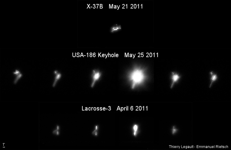
Shhhh! Don’t tell anyone, but we’ve got pictures….. ground-based pictures of secret spy satellites in Earth orbit. We’re not revealing our sources, but … oh wait, I guess we might as well tell you. Even if we didn’t reveal our source, you’d probably guess that astrophotographer extraordinaire Thierry Legault — who has been sharing his wonderfully detailed ground-based images of the space shuttle and International Space Station with Universe Today – has been working on capturing other satellites in orbit as well. Legault and his partner in imaging crime, Emmanuel Rietsch have tackled the difficult task of tracking down spy satellites and then tracking them with a telescope. For imaging the shuttle and ISS, they developed their own design of a motorized mount outfitted with a computer program so it can slowly and precisely rotate in order to track and follow an object in Earth orbit with a telescope and video camera. Now they are able to image even smaller objects.

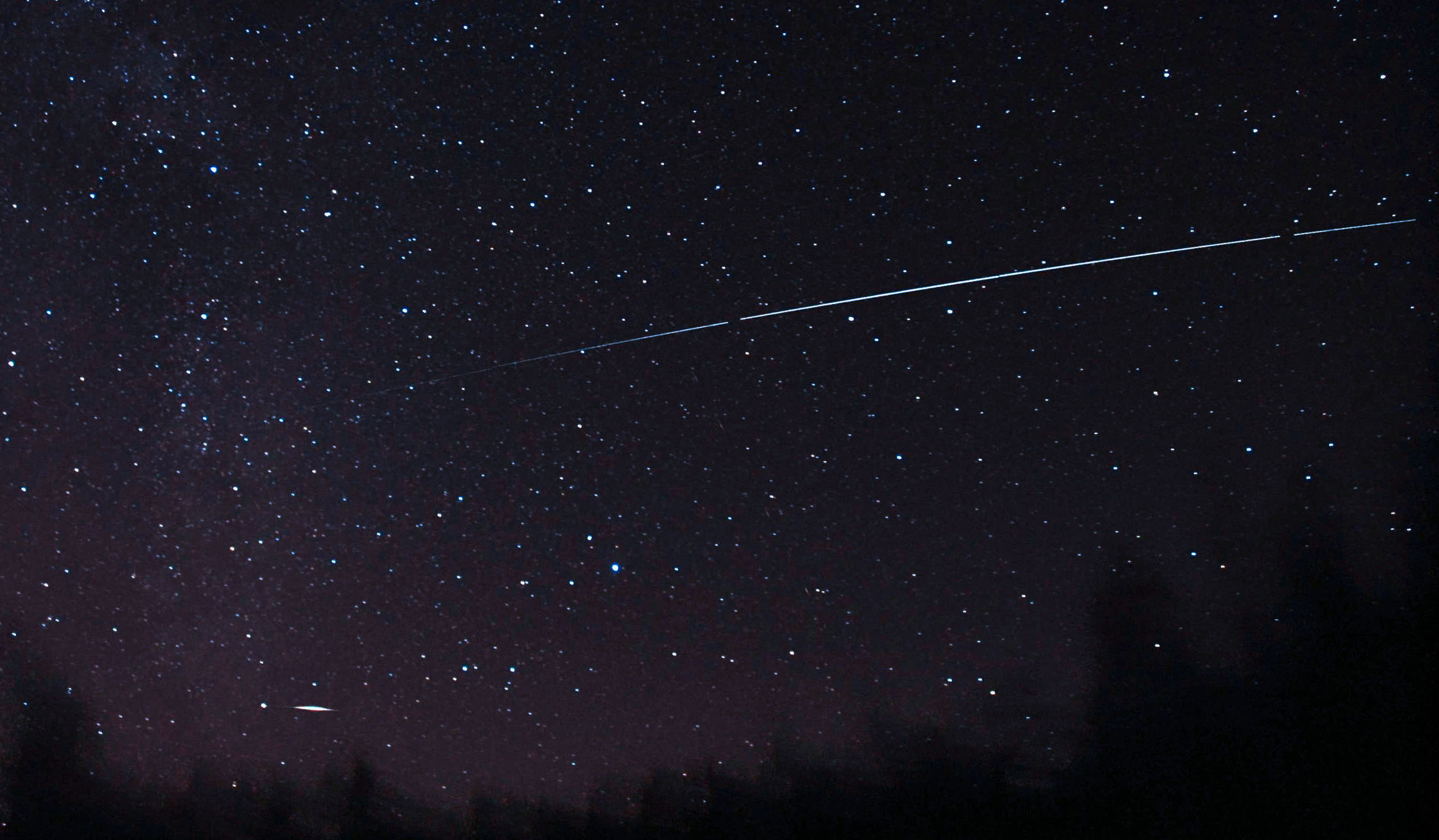
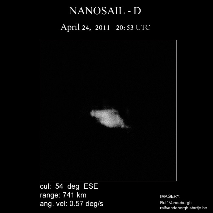
Above are images they were able to capture of three different spy satellites, including the X-37B spaceplane. More images and videos are available at Legault’s website.

Thierry Legault with his customized satellite tracking system. Photo courtesy Thierry Legault.

Since October 2010, Legault has been using the autoguided mount, with the help of a DMK 31AF03 Firewire video camera mounted on the finder (FL 200 mm) and of the software Videos Sky, created by Rietsch, and then modified by Reitsch and Legault for fast tracking with the Takahashi EM400 mount.

The X-37B spaceplane now in orbit is the second of the two Orbital Test Vehicles launched by the US Air Force, launched on March 5, 2011. Reportedly, it will conduct experiments and tests for close to nine months and then autonomously de-orbit and land. Legault and Rietsch were able to image the spaceplane in late May of this year with fairly good results.

“I tried to get help to identify the real orientation of X-37B,” Legault told Universe Today via Skype today, “but on the contrary of the Keyhole and Lacrosse satellites, it’s not easy considering its complex shape with several wings.”

And the Air Force isn’t telling.

“Keyhole-class” (KH) reconnaissance satellites have been used for more than 30 years and are typically used to take overhead photos for military missions. Some of the keyhole satellites resemble the Hubble Space Telescope, but instead of looking out into space, it looks back at Earth. A similar type of spy satellites are the Lacrosse satellites, which are radar-imaging satellites.

But even with the tracking system, getting images of small satellites is not easy. “Despite this performing tracking system and hours of training on airplanes passing in the sky, keeping the space ship inside a sensor of a few millimeters at a focal length of 5000 mm and a speed over 1°/s needs a lot of concentration and training,” said Legault on his website.

The autoguiding and acquisition are done via a laptop with a double hard drive (one of which is a Solid State Drive – made with flash memory), enabling the precision of tracking of about one arc minute.

For security reasons, the sighting times for spy satellites are not published on an official website like NASA does for the shuttle and ISS. But with a bit of digging, Legault said others can try their luck at trying to spot these secret satellites.

“Orbital data are in the Calsky database,” Legault told UT, “therefore their passages are forecast as for the ISS. Generally, orbits are determined by amateurs, some of them are specialized in this activity, especially Kevin Fetter (and data are exchanged on the Seesat mailing list, owned by Ted Molczan).”

Legault is well-known for his images of the shuttle and ISS transiting the sun, but he said the accuracy of orbital data for the spy satellites is not sufficient for capturing a solar transit – and besides, these satellites are much smaller than the ISS and would appear as a small dark dot, at best.

“But for nighttime passages the data is sufficient,” Legault said. “Generally they are not visible with the naked eye or barely (except during flares), but they are easily visible with a finder.”

See more information, information and videos — including a view of what the tracker sees, on Legault’s website.

You can follow Universe Today senior editor Nancy Atkinson on Twitter: @Nancy_A. Follow Universe Today for the latest space and astronomy news on Twitter @universetoday and on Facebook.
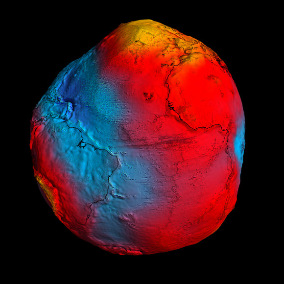
Aquarius Satellite Launches to Observe Earth’s Oceans

A picture-perfect launch on a Delta II rocket from Vandeberg Air Force Base in California sent the newest satellite into orbit. The Aquarius/SAC-D spacecraft lifted off June 10, 2011 at 7:20 a.m. PDT (1420 UTC) to gather global measurements of ocean surface salinity, leading to a better understanding of ocean circulation, climate and Earth’s water cycle. NASA’s Aquarius instrument is part of the SAC-D spacecraft built by CONAE, Argentina’s space agency.

Continue reading “Aquarius Satellite Launches to Observe Earth’s Oceans”

Friday Special: Two Rocket Launches in Less Than Two Hours

It was a busy launch day around the world on Friday. Above, the Ariane 5 rocket carrying the ST-2 and GSAT-8 communications satellites launched from Kourou, French Guiana, and below, about an hour and a half earlier, a Proton rocket blasted off from the Baikonur Cosmodrome in Kazakhstan bringing a Telstar 14R satellite to orbit. The Telstar satellite will provide communications services over the United States, Brazil and other parts of South America for Telesat of Canada, and the ST 2 will provide fixed and mobile voice and Internet to Asia and the Middle East.

Thanks to Chris Calubquib on Twitter for the updates and posting the launch videos on You Tube.

Continue reading “Friday Special: Two Rocket Launches in Less Than Two Hours”

New Satellite Will ‘Taste’ Earth’s Salty Seas from Orbit

Artist's concept of the Aquarius/SAC-D spacecraft, a collaboration between NASA and Argentina's space agency, with participation from Brazil, Canada, France and Italy. Aquarius, the NASA-built primary instrument on the spacecraft, will take NASA's first space-based measurements of ocean surface salinity, a key missing variable in satellite observations of Earth that links ocean circulation, the global balance of freshwater and climate. The mission is scheduled to launch in June. Image credit: NASA

[/caption]

From a JPL press release:

Final preparations are under way for the June 9 launch of the international Aquarius/SAC-D observatory. The mission’s primary instrument, Aquarius, will study interactions between ocean circulation, the water cycle and climate by measuring ocean surface salinity.

Engineers at Vandenberg Air Force Base in California are performing final tests before mating Aquarius/SAC-D to its Delta II rocket. The mission is a collaboration between NASA and Argentina’s space agency, Comision Nacional de Actividades Espaciales (CONAE), with participation from Brazil, Canada, France and Italy. SAC stands for Satelite de Applicaciones Cientificas. Aquarius was built by NASA’s Jet Propulsion Laboratory in Pasadena, Calif., and the agency’s Goddard Space Flight Center in Greenbelt, Md.

In addition to Aquarius, the observatory carries seven other instruments that will collect environmental data for a wide range of applications, including studies of natural hazards, air quality, land processes and epidemiology.

The mission will make NASA’s first space observations of the concentration of dissolved salt at the ocean surface. Aquarius’ observations will reveal how salinity variations influence ocean circulation, trace the path of freshwater around our planet, and help drive Earth’s climate. The ocean surface constantly exchanges water and heat with Earth’s atmosphere. Approximately 80 percent of the global water cycle that moves freshwater from the ocean to the atmosphere to the land and back to the ocean happens over the ocean.

Salinity plays a key role in these exchanges. By tracking changes in ocean surface salinity, Aquarius will monitor variations in the water cycle caused by evaporation and precipitation over the ocean, river runoff, and the freezing and melting of sea ice.

Salinity also makes seawater denser, causing it to sink, where it becomes part of deep, interconnected ocean currents. This deep ocean “conveyor belt” moves water masses and heat from the tropics to the polar regions, helping to regulate Earth’s climate.

“Salinity is the glue that bonds two major components of Earth’s complex climate system: ocean circulation and the global water cycle,” said Aquarius Principal Investigator Gary Lagerloef of Earth & Space Research in Seattle. “Aquarius will map global variations in salinity in unprecedented detail, leading to new discoveries that will improve our ability to predict future climate.”

Aquarius will measure salinity by sensing microwave emissions from the water’s surface with a radiometer instrument. These emissions can be used to indicate the saltiness of the surface water, after accounting for other environmental factors. Salinity levels in the open ocean vary by only about five parts per thousand, and small changes are important. Aquarius uses advanced technologies to detect changes in salinity as small as about two parts per 10,000, equivalent to a pinch (about one-eighth of a teaspoon) of salt in a gallon of water.

Aquarius will map the entire open ocean every seven days for at least three years from 408 miles (657 kilometers) above Earth. Its measurements will produce monthly estimates of ocean surface salinity with a spatial resolution of 93 miles (150 kilometers). The data will reveal how salinity changes over time and from one part of the ocean to another.

The Aquarius/SAC-D mission continues NASA and CONAE’s 17-year partnership. NASA provided launch vehicles and operations for three SAC satellite missions and science instruments for two.

JPL will manage Aquarius through its commissioning phase and archive mission data. Goddard will manage Aquarius mission operations and process science data. NASA’s Launch Services Program at the agency’s Kennedy Space Center in Florida is managing the launch.

CONAE is providing the SAC-D spacecraft, an optical camera, a thermal camera in collaboration with Canada, a microwave radiometer,; sensors from various Argentine institutions and the mission operations center there. France and Italy are contributing instruments.

See the Aquarius/SAC-D website for more information. , visit:

Gravity Probe B Confirms Two of Einstein’s Space-Time Theories

Einstein's predicted geodetic and frame-dragging effects, and the Schiff Equation for calculating them. Credit: Stanford University

[/caption]

Researchers have confirmed two predictions of Albert Einstein’s general theory of relativity, concluding one of NASA’s longest-running projects. The Gravity Probe B experiment used four ultra-precise gyroscopes housed in an Earth-orbiting satellite to measure two aspects of Einstein’s theory about gravity. The first is the geodetic effect, or the warping of space and time around a gravitational body. The second is frame-dragging, which is the amount a spinning object pulls space and time with it as it rotates.

Gravity Probe-B determined both effects with unprecedented precision by pointing at a single star, IM Pegasi, while in a polar orbit around Earth. If gravity did not affect space and time, GP-B’s gyroscopes would point in the same direction forever while in orbit. But in confirmation of Einstein’s theories, the gyroscopes experienced measurable, minute changes in the direction of their spin, while Earth’s gravity pulled at them.

The project as been in the works for 52 years.

The findings are online in the journal Physical Review Letters.

Artist concept of Gravity Probe B orbiting the Earth to measure space-time, a four-dimensional description of the universe including height, width, length, and time. Image credit: NASA

“Imagine the Earth as if it were immersed in honey,”.said Francis Everitt, Gravity Probe-B principal investigator at Stanford University. “As the planet rotates, the honey around it would swirl, and it’s the same with space and time,” “GP-B confirmed two of the most profound predictions of Einstein’s universe, having far-reaching implications across astrophysics research. Likewise, the decades of technological innovation behind the mission will have a lasting legacy on Earth and in space.”

NASA began development of this project starting in the fall of 1963 with initial funding to develop a relativity gyroscope experiment. Subsequent decades of development led to groundbreaking technologies to control environmental disturbances on spacecraft, such as aerodynamic drag, magnetic fields and thermal variations. The mission’s star tracker and gyroscopes were the most precise ever designed and produced.

GP-B completed its data collection operations and was decommissioned in December 2010.

“The mission results will have a long-term impact on the work of theoretical physicists,” said Bill Danchi, senior astrophysicist and program scientist at NASA Headquarters in Washington. “Every future challenge to Einstein’s theories of general relativity will have to seek more precise measurements than the remarkable work GP-B accomplished.”

Innovations enabled by GP-B have been used in GPS technologies that allow airplanes to land unaided. Additional GP-B technologies were applied to NASA’s Cosmic Background Explorer mission, which accurately determined the universe’s background radiation. That measurement is the underpinning of the big-bang theory, and led to the Nobel Prize for NASA physicist John Mather.

The drag-free satellite concept pioneered by GP-B made a number of Earth-observing satellites possible, including NASA’s Gravity Recovery and Climate Experiment and the European Space Agency’s Gravity field and steady-state Ocean Circulation Explorer. These satellites provide the most precise measurements of the shape of the Earth, critical for precise navigation on land and sea, and understanding the relationship between ocean circulation and climate patterns.

GP-B also advanced the frontiers of knowledge and provided a practical training ground for 100 doctoral students and 15 master’s degree candidates at universities across the United States. More than 350 undergraduates and more than four dozen high school students also worked on the project with leading scientists and aerospace engineers from industry and government. One undergraduate student who worked on GP-B became the first female astronaut in space, Sally Ride. Another was Eric Cornell who won the Nobel Prize in Physics in 2001.

“GP-B adds to the knowledge base on relativity in important ways and its positive impact will be felt in the careers of students whose educations were enriched by the project,” said Ed Weiler, associate administrator for the Science Mission Directorate at NASA Headquarters.

Sources: NASA, Stanford University

Satellite Imagery Shows How Tornadoes Slashed Across Alabama, Mississippi

This image shows the path of exposed ground left in the wake of an EF5 tornado in Mississippi. Credit: MODIS Rapid Response Team at NASA GSFC.

[/caption]

Some extraordinary satellite and radar imagery shows how the deadly tornado supercell slashed through Alabama and Mississippi last week, as in the image above, leaving a gash of exposed ground and destruction that is visible from space. The latest reports indicate fatalities from the outbreak now exceed 342 people, and according to the Washington Post, this is the most people killed by tornadoes in a two-day period since April 5-6, 1936 when 454 people died. The image was taken by the Moderate Resolution Imaging Spectroradiometer (MODIS) on NASA’s Aqua satellite on April 28. See more imagery below.

Part of the path of a 12-mile swath of destruction in Alabama from an EF4 tornado on April 27. Click to see the entire swath taken by a NOAA satellite. Credit: NOAA

The National Weather Service said an EF4, with winds around 175 miles per hour, created a 12-mile-long track of destruction. This tornado caused more than 20 deaths.

Radar sequence of tornado supercell thunderstorms that tracked from western Mississippi into southwest North Carolina. Credit: NCAR, Brian Tang.

This image is pretty amazing: it is a radar montage of the supercell showing some of the 150 tornadoes that were reported on April 27 and 28, 2011. This cell traveled about 450 miles and lasted over 8 hours.

This animation from the NASA Earth Observatory team starts on April 26 and runs through the morning of April 28. It shows a relatively stable mass of cold air—visible as a swirl of more-or-less continuous clouds—rotates in the north along the top of the image, and meanwhile, moist air pushes north and west from the Atlantic Ocean and Gulf of Mexico. The two air masses collide and generate severe weather, but the bad weather also was amplified by the jet stream on April 27, which helped generate the lines of intense thunderstorms and tornadoes.

Sources: NASA Earth Observatory, Washington Post, NOAA

Last & Best Chances to See NanoSail-D

Nanosail-D Pass Credit: Vesa Vauhkonen, Spaceweather.com

[/caption]

Over the next few weeks, skywatchers will have excellent viewing opportunities for the NanoSail-D solar sail.

The satellite is coming to the end of its 95-day mission to test the viability of de-orbiting decommissioned satellites or space debris. NanoSail-D is now de-orbiting and slowly losing altitude in the Earths thin upper atmosphere.

As the satellite descends, viewing opportunities will improve.

To see NanoSail-D pass over, you will need to know exactly when it will be visible from your location. To do this, go to Heavens-above.com or Spaceweather.com where star charts with times and pass details will be displayed after you enter your observing site.

Once you know the time and location in the sky of the pass of the satellite, make sure you are able to get a good view of the part of the sky where the satellite due to appear. Give yourself plenty of time, go outside and get ready. I always set a 30 second reminder on my watch or cell phone, so I don’t have to fumble around or guess the time.

To enjoy the NanoSail-D passes:

• Make sure you know the right place in the sky and the time of the pass, by checking on the web.
• Make sure you will be able to get a clear view of it from your viewing location.
• Set an alarm or get ready for the pass as it only lasts a few seconds.
• NASA expects NanoSail-D to stay in orbit through May 2011.
• If you are an astrophotographer, don’t forget, NASA and SpaceWeather.com are having an imaging contest of NanoSail-D. Find out more here.
• Most of all, get your friends and family outside with you to watch NanoSail-D and enjoy!

Artist concept of Nanosail-D in Earth orbit. Credit: NASA

Satellite Captures 3-D View of Violent Storms that Ravaged the US on April 27-28

The Tropical Rainfall Measuring Mission satellite captured the rainfall rates occurring in the line of thunderstorms associated with a powerful cold front moving through the eastern U.S. on April 28, 2011. The yellow and green areas indicate moderate rainfall between .78 to 1.57 inches per hour. The very small red areas are heavy rainfall at almost 2 inches (50 mm) per hour. Credit: NASA/SSAI, Hal Pierce

[/caption]

NASA’s Tropical Rainfall Measuring Mission (TRMM) satellite captured 3-D images of severe thunderstorms that were spawning tornadoes over the eastern United States on April 28, detecting massive thunderstorms and very heavy rainfall. Tornadoes associated with this extremely unstable weather left at least 202 dead across the Eastern U.S, with injuries numbering over a thousand.

The Tropical Rainfall Measuring Mission satellite captured the rainfall rates occurring in the line of thunderstorms associated with a powerful cold front moving through the eastern U.S. on April 28, 2011. The yellow and green areas indicate moderate rainfall between .78 to 1.57 inches per hour. The very small red areas are heavy rainfall at almost 2 inches (50 mm) per hour. Credit: NASA/SSAI, Hal Pierce

TRMM flew over the strong cold front and captured data at 0652 UTC (2:52 AM EDT) on April 28, 2011. Most of the rainfall was occurring at moderate rates however, there were pockets of very heavy rainfall in Virginia, North Carolina, South Carolina, Georgia and Alabama where rain was falling at a rate of 2 inches (50 millimeters) per hour.

This TRMM radar vertical cross section shows that some of these violent storms reached to incredible heights of almost 17 km (~10.6 miles). Credit: NASA/SSAI, Hal Pierce

In the image above and the lead animation, TRMM data was used to generate a 3-D look at the storm. TRMM’s Precipitation Radar (PR) data was used by Hal Pierce of SSAI at NASA’s Goddard Space Flight Center in Greenbelt, Md. to create a 3-D structure of those storms. The image Pierce created is a TRMM radar vertical cross section that shows some of these violent storms reached to incredible heights of almost 17 km (~10.6 miles).

TRMM, is the Energizer Bunny of satellites as it keeps going and going. It was launched in 1997 and was scheduled at one time to be decommissioned in 2004. But its systems keep operating and it is has been able to keep gathering useful information on storms and climate. It now has operated well over a decade past its original life expectancy.

TRMM is managed by both NASA and the Japanese Space Agency.

Source: NASA

New Results from GOCE: Earth is a Rotating Potato

In this GOCE image, gravity is strongest in yellow areas; it is weakest in blue ones. Credit: ESA

Although they aren’t particularly fond of the comparison, scientists from the GOCE satellite team had to admit that new data showing Earth’s gravity field – or geoid — makes our planet look like a rotating potato. After just two years in orbit, ESA’s sleek and sexy GOCE satellite (Gravity Field and Steady-State Ocean Circulation Explorer) has gathered sufficient data to map Earth’s gravity with unrivalled precision. While our world certainly doesn’t look like a spinning tuber, this exaggerated view shows the most accurate model of how gravity varies across the planet.

The geoid is nothing more than how the oceans would vary if there were no other forces besides gravity acting on our planet.

“If we had an homogeneous sphere, it would be a boring sphere,” said GOCE scientist Roland Pail from Technical University in Munich, speaking at the press briefing today. “But due to rotation, you get a flattening of the Earth, and we have topography such as mountains, and irregular mass distribution in Earth’s interior. What we are showing you here, in principle, is the gravity field by any deviations due to inhomogeneous mass distributions on the Earth and the Earth’s interior.”

[/caption]

While a previous gravity satellite, the Gravity Recovery And Climate Experiment (GRACE) operated for 8 years, most of the new data from GOCE was gathered in about 14 months, and provides data where there was none before.

GOCE is able to sense tiny variations in the pull of gravity over Earth, and the data is used to construct an idealized surface, which traces gravity lumps and bumps, and is the shape the oceans would take without winds, currents, Earth’s rotation and other forces.

By comparing sea level and geoid data, GOCE is revealing data on ocean currents and circulation, sea-level change, ice dynamics, said Rory Bingham, from the University of Newcastle, which helps understand heat transport and the changing climate.

But also of interest is how GOCE data reveals shifting tectonic plates in earthquakes and magma movements under volcanoes. Following the earthquakes in Japan, scientists are looking closely, as the data should reveal a three-dimensional view of what was going on inside the Earth. Even though the motion cannot be observed directly from space, earthquakes create signatures in gravity data, which could be used to understand the processes leading to these natural disasters and ultimately help to predict them.

“Even though these quakes resulted from big movements in the Earth, at the altitude of the satellite the signals are very small. But we should still seem them in the data,” said Dr. Johannes Bouman from the German Geodetic Research Institute.

GOCE in orbit. Credit: ESA

“GOCE will give us dynamic topography and circulation patterns of the oceans with unprecedented quality and resolution,” said professor Reiner Rummel, former Head of the Institute for Astronomical and Physical Geodesy at the Technische Universität München. “I am confident that these results will help improve our understanding of the dynamics of world oceans.”

“You could say that, at its early conception, GOCE was more like science fiction,” said Volker Liebig, Director of ESA’s Earth Observation Program. “GOCE has now clearly demonstrated that it is a state-of-the-art mission.”

Sources: GOCE press briefing, ESA press release

From the Earth and Moon (and Russia) With Love

Russia's Elektro-L spacecraft captured this view of the Moon over the Red Sea region of the Earth. Credit: NPO Lavochkin

[/caption]

This stunning picture of the Moon and Earth was taken by Russia’s new Elektro-L spacecraft, a weather-forecasting satellite that launched in January 2011. This is the first major spacecraft developed in post-Soviet Russia, and it is designed to give Russian meteorologists the ability to watch the entire disk of the planet, thanks to the satellite’s position in the geostationary orbit 36,000 kilometers above the equator. The clarity of the images is fantastic, as you can see in another image of just the Earth, below. The Elektro-L is designed to last at least a decade, and will enable local and global weather forecasting, analysis of oceanic conditions, as well as space weather monitoring, such as measurements of solar radiation, properties of Earth’s ionosphere and magnetic field.

On Feb. 26, 2011, at 14:30 Moscow Time, the Elektro-L satellite produced its first breathtaking image of the home planet. Credit: NPO Lavochkin

Learn more about the Elektro-L mission at their website.

h/t: SDO Facebook page.