NASA’s Curiosity rover celebrated a milestone anniversary today, June 24 – 1 Martian Year on Mars!
A Martian year is equivalent to 687 Earth days, or nearly two Earth years.
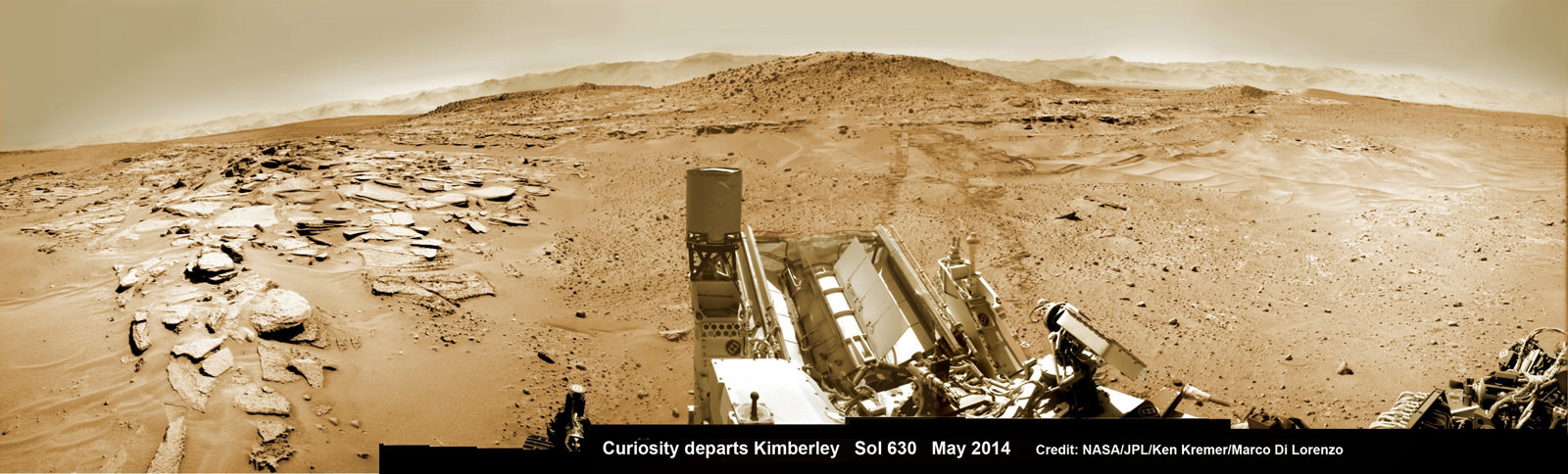
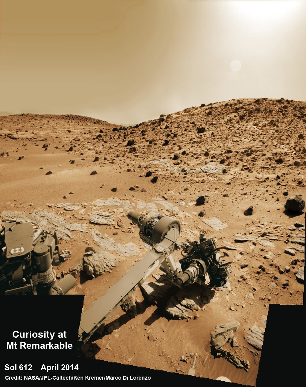
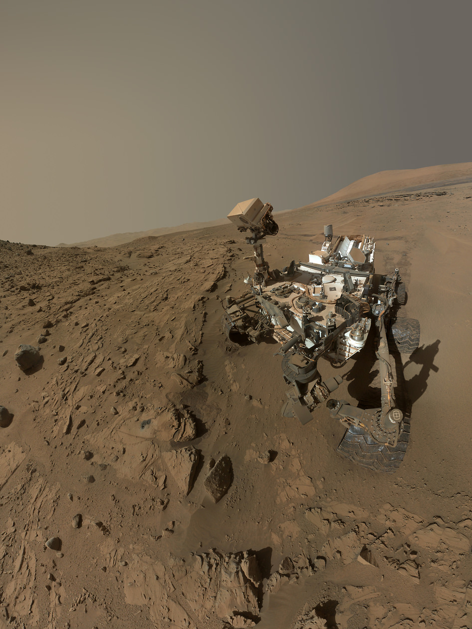
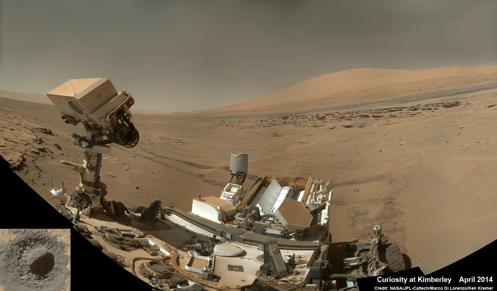
NASA marked the illustrious achievement with the release of a new ‘selfie’ captured recently while drilling deep into the Red Planet to unlock the secrets of Mars hidden past eons ago when the planet was far warmer and wetter and more conducive to the origin of life.
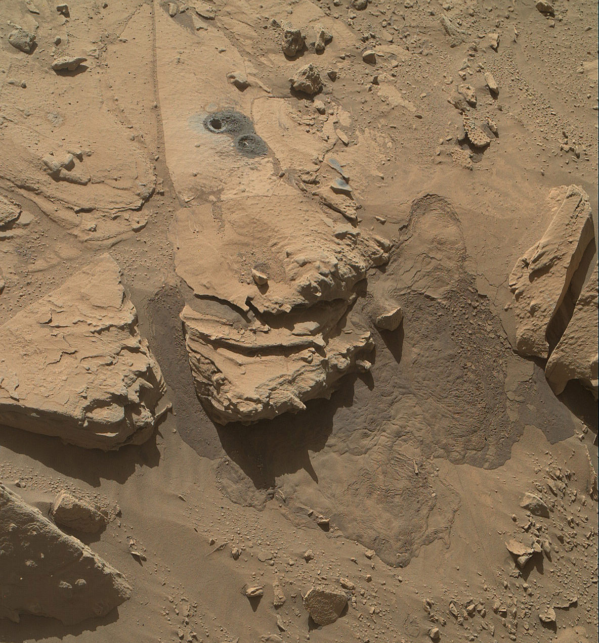
Curiosity’s new self-portrait was taken at the ‘Windjana’ Drilling Site in April and May 2014 using the Mars Hand Lens Imager (MAHLI) camera at the end of the robotic arm.
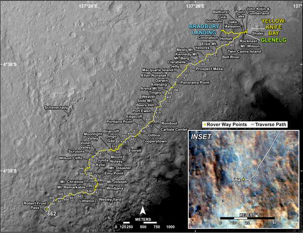
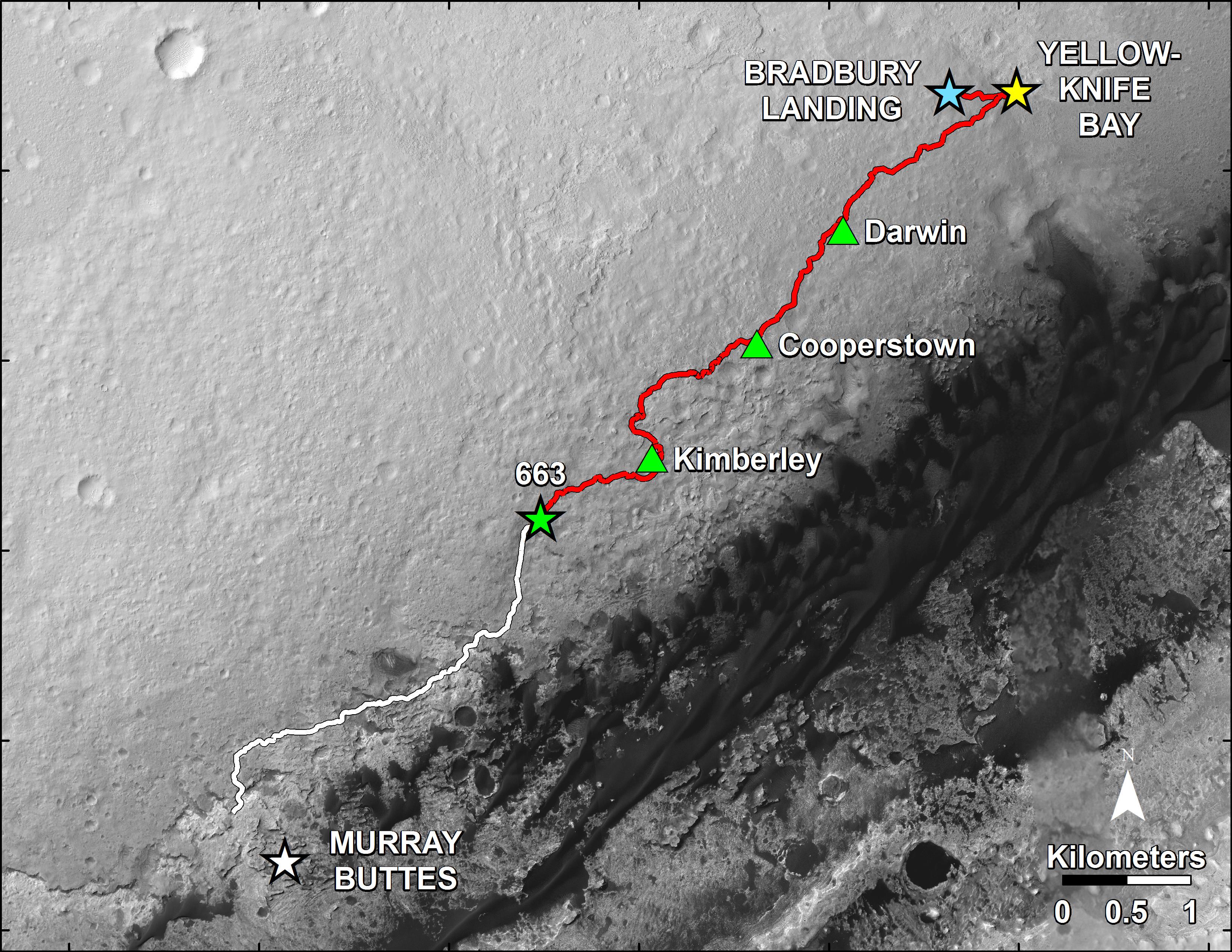
As of today the 1 ton rover has been exploring the alien surface for a full Martian year since her nail biting touchdown inside Gale Crater on Aug. 5, 2012 – using the unprecedented sky crane maneuver which culminated in a rocket assisted touchdown astride a humongous mountain named Mount Sharp.
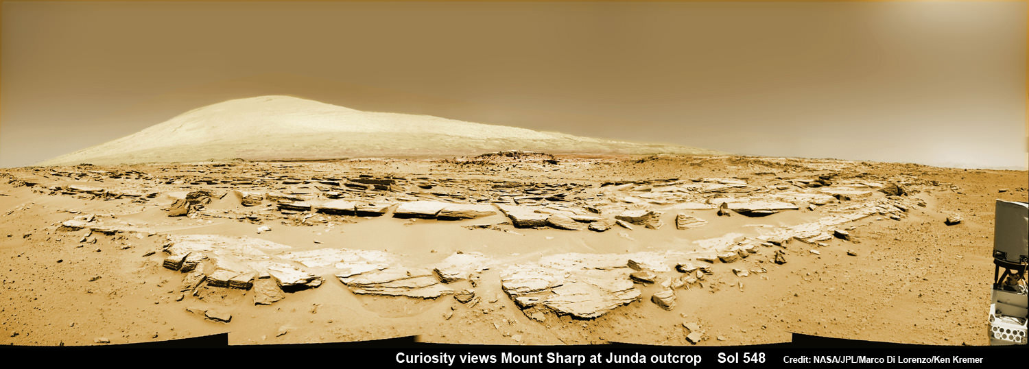
Mount Sharp dominates the center of Gale Crater and reaches 3.4 miles (5.5 km) into the Martian sky – taller than Mount Rainier.
During Mars Year 1 on Mars, Earth’s metallic emissary has already accomplished her primary objective of discovering a habitable zone on the Red Planet that contains the chemical ingredients necessary to support microbial life in the ancient past.

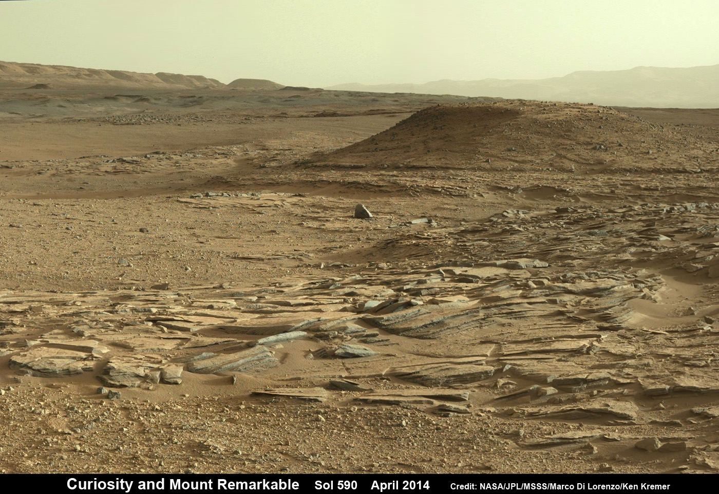
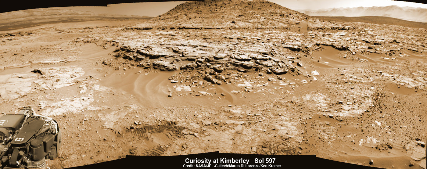
During 2013, Curiosity conducted the first two drill campaigns at the ‘John Klein’ and ‘Cumberland’ outcrop targets inside Yellowknife Bay. They were both mudstone rock outcrops and the interiors were markedly different in color and much lighter compared to the new drill site at ‘Windjana’ into a slab of red, sandstone rock.
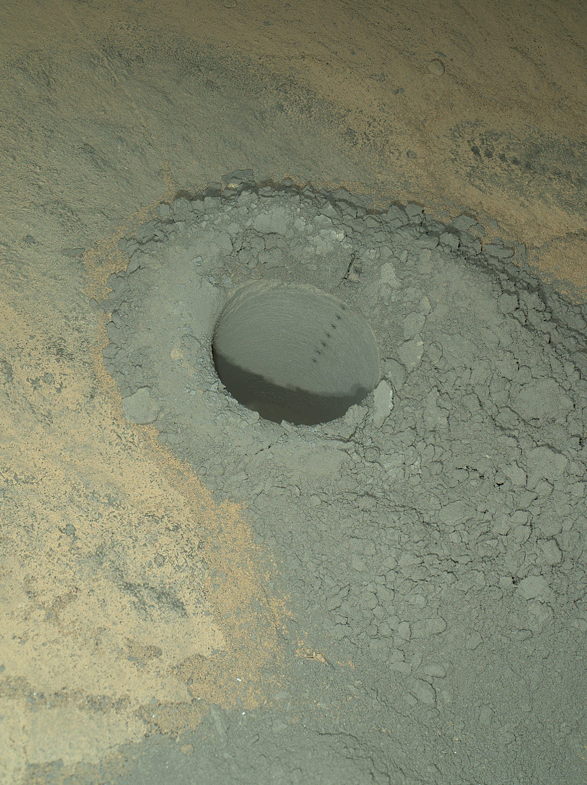
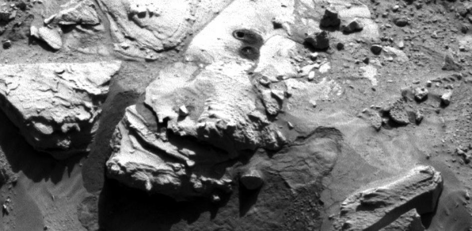
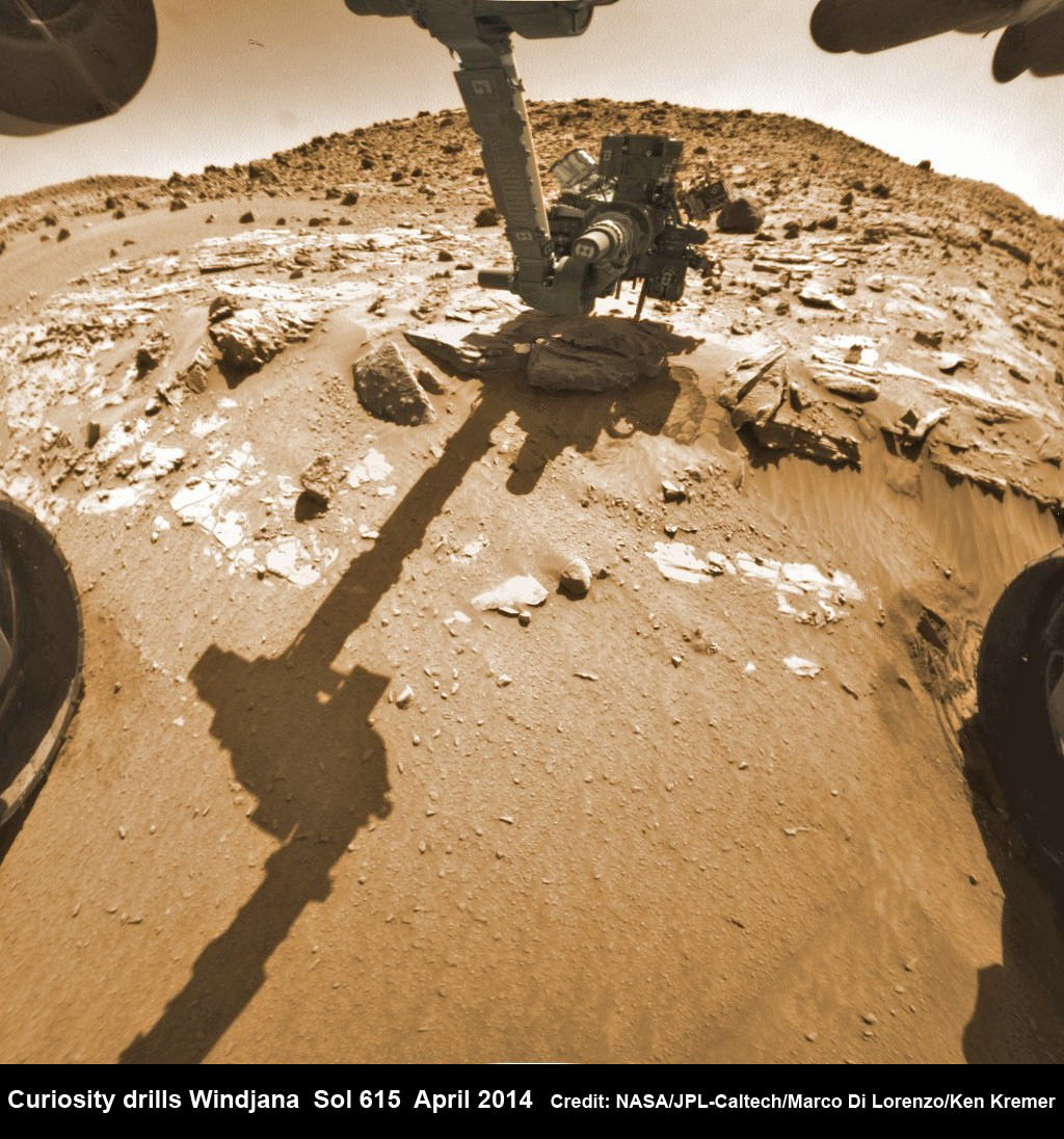
The fresh bore hole was drilled into the “Windjana” rock outcrop on May 5, 2014, Sol 621, at the base of Mount Remarkable at a science stopping point called “The Kimberley Waypoint.”
It was 0.63 inch (1.6 centimeters) in diameter and about 2.6 inches (6.5 centimeters) deep and resulted in a mound of dark grey colored drill tailings piled around.

Windjana lies some 2.5 miles (4 kilometers) southwest of Yellowknife Bay.
Curiosity has successfully delivered pulverized and sieved samples from all three drill sites to the pair of onboard miniaturized chemistry labs; the Chemistry and Mineralogy instrument (CheMin) and the Sample Analysis at Mars instrument (SAM) – for chemical and compositional analysis.

It was through the results of the SAM and CheMin analysis and the discovery of clay minerals that the science team was able to determine that this area on the floor of Gale Crater is a habitable zone.
“Windjana has more magnetite than previous samples we’ve analyzed,” said David Blake, principal investigator for Curiosity’s Chemistry and Mineralogy (CheMin) instrument at NASA’s Ames Research Center, Moffett Field, California, in a statement.
“A key question is whether this magnetite is a component of the original basalt or resulted from later processes, such as would happen in water-soaked basaltic sediments. The answer is important to our understanding of habitability and the nature of the early-Mars environment.”
Chemical analysis and further sample deliveries are in progress as NASA’s rover is ‘on the go’ to simultaneously maximize movement and research activities.

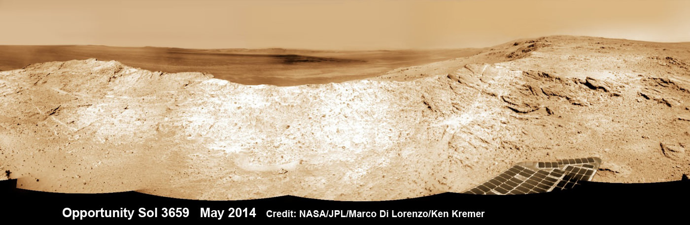
Featured on APOD – Astronomy Picture of the Day on May 7, 2014
The lower reaches of Mount Sharp are the rovers ultimate goal because the sedimentary layers are believed to hold caches of water altered minerals based on high resolution measurements obtained by the CRISM spectrometer aboard NASA’s powerful Martian ‘Spysat’ – the Mars Reconnaissance Orbiter (MRO) – soaring overhead.
Curiosity still has about another 2.4 miles (3.9 kilometers) to go to reach the entry way at a gap in the dunes at the foothills of Mount Sharp sometime later this year.
To date, Curiosity’s odometer totals over 4.9 miles (7.9 kilometers) since landing inside Gale Crater on Mars in August 2012. She has taken over 159,000 images.
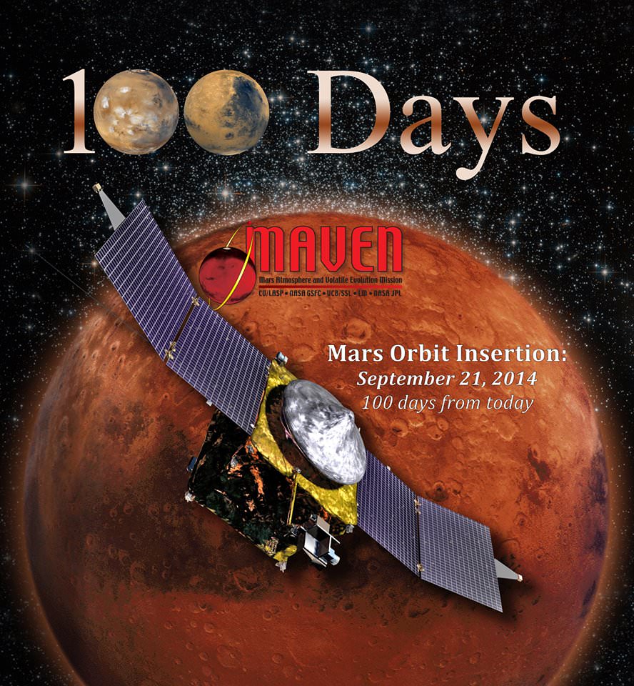
Stay tuned here for Ken’s continuing Curiosity, Opportunity, Orion, SpaceX, Boeing, Orbital Sciences, commercial space, MAVEN, MOM, Mars and more planetary and human spaceflight news.
Ken Kremer
…………….
Learn more about NASA’s Mars missions, upcoming sounding rocket and Orbital Sciences Antares ISS launch from NASA Wallops, VA in July and more about SpaceX, Boeing and commercial space and more at Ken’s upcoming presentations.
June 25: “Antares/Cygnus ISS Launch (July 10) and Suborbital Rocket Launch (June 26) from Virginia” & “Space mission updates”; Rodeway Inn, Chincoteague, VA, evening