Mars Polar Cap Mystery Solved

The spiral troughs and gian canyon Chasma Borale have puzzled scientists for 40 years.

[/caption]

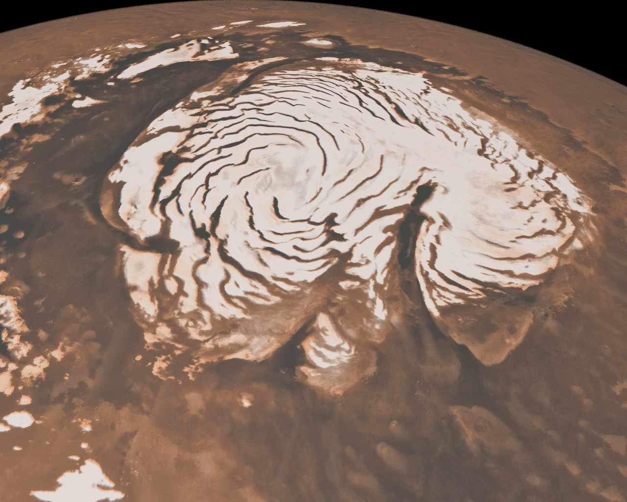
The shape of the two-mile-tall Texas-sized ice cap at the north pole of Mars has puzzled scientists for forty years, but new results to be published in a pair of papers in the journal Nature on May 27 have put the controversy to rest.

The polar caps of Mars have been known since the first telescopic views of the planet, but early spacecraft images revealed that the north polar cap is scored by enigmatic troughs that spiral out from its center, as well as a chasm larger than the Grand Canyon. The origin of these features has been debated since they were first discovered in 1972.

One hypothesis to explain the giant canyon, called Chasma Boreale, is that volcanic heat melted the ice and caused a catastrophic flood that formed the chasm. Other scientists have suggested that wind sweeping downhill from the top of the cap carved Chasma Boreale from the ice.

Multiple explanations have been suggested for the spiral troughs too. One explains the troughs as fractures caused by the flow of ice from the pole. Another uses a model to suggest that the troughs are the natural result of solar heating and lateral heat conduction in the ice.

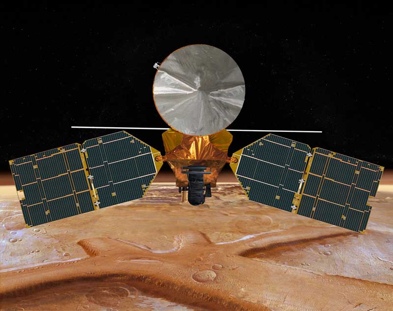
The two new papers, led by Jack Holt and Isaac Smith of The University of Texas at Austin’s Institute for Geophysics, used data from the Shallow Subsurface Radar (SHARAD) on the Mars Reconnaissance Orbiter (MRO) to study the internal structure of the ice cap and discover the origin of the troughs and the chasm.

“SHARAD sends pulses of radio waves from orbit, 700 times per second,” Holt explained. “Some energy is reflected from the surface, and then from subsurface interfaces if the intervening material allows the radio waves to penetrate.  Radar at this wavelength (about 20 meters) penetrates ice very well, and it has been used from airplanes on Earth to map large portions of Earth’s ice sheets.”

“By putting all of the reflections together one can make an image of what lies beneath the
surface,” Smith added.

Holt explained that the ability to map not only the surface features but also the internal structure of the ice cap “opens the door to better understand what we see on the surface by providing critical context in time.”

Top: An example SHARAD radar cross section of the martian north polar cap. Bottom: An annotated version of the same cross-section.

By mapping the three-dimensional structure of the north polar ice cap, Smith and Holt have determined that both the troughs and Chasma Boreale were formed by katabatic winds, which blow down from the top of the ice cap.

“We aren’t saying they were carved by wind, rather that wind had a strong role in their formation and evolution.” Holt said. “Chasma Boreale is an old feature that persisted because new ice did not accumulate there, likely due to persistent winds coming from the highest point on the ice cap.”

Holt also discovered evidence for another old canyon that has been completely filled in over time. “No evidence remains on the surface to indicate that it was there previously,” Holt said.  “We can map it in the radar data, however.”

The spiral troughs likewise are controlled by the wind. “The radar layers we see show evidence for wind transport because they vary in thickness and elevation [across the troughs],” Smith, lead author of the trough paper, explained. “The wind moves across the trough instead of through it [and] moves ice from the upwind side (thereby thinning they layer) to the downwind side (adding more to the existing layer).”

This causes the spiral troughs to migrate upwind over time, a phenomenon first proposed by Alan Howard, a researcher at the University of Virginia, in 1982. “Many people proposed other hypotheses suggesting he was wrong,” Smith said. “But when you look at a hypothetical cross section from his paper, it looks almost exactly like what we see in the radar data. We were amazed at how accurate Alan Howard predicted what we would
see.”

The troughs are spiral shaped due to the planet’s rotation. As the katabatic winds blow from the center of the cap down to lower latitudes they are twisted by the same “coriolis force” that causes hurricanes to spiral on the Earth.

The layers that Holt and Smith mapped using radar data also suggest that ice flows are much rarer on Mars than they are on Earth. The lack of flows means that the polar ice on Mars preserves more complex layers than expected. “This complexity provides very specific constraints on the climatic processes responsible for [the layers],” Holt said.  “We will eventually be able to reconstruct winds and accumulation patterns across the polar cap and through time.”

Holt plans to use the ancient polar landscapes inferred from the SHARAD data along with simulations of the martian climate to model the formation of the polar cap. “If we can recreate the major features such as Chasma Boreale [in the models], then we will have learned a great deal about climate on Mars during that period.”

Smith and Holt also plan to study the effect of Mars’ tilt on the formation of the ice cap. “Because Mars’ orbit and tilt change so much with respect to the sun, it would be nice to see how that has affected deposition of ice on the cap.  This requires much more mapping, and we have already begun that process,” Smith said.

“There is still much research to do on Mars,” Smith said. “The planet has a lot of mysteries, some of which we haven’t even found yet.”

Latest Mars Avalanche Likely Triggered by Impact Event

Big Impact-Triggered Dust Avalanche seen by the HIRSE camera on the Mars Reconnaissance Orbiter. (ESP_017229_2110) Credit: NASA/JPL/University of Arizona

[/caption]

The HiRISE team from the Mars Reconnaissance Orbiter has captured a few avalanches on Mars, some actually while in progress. But this latest landslide is a little different. Above is a dust avalanche that created a streak on the slopes of Olympus Mons, the solar system’s largest volcano. While scientists believe some of the previous avalanches seen on Mars occur due to the expansion and contraction of ice from seasonal temperature differences, this one was caused by an impact event. This HiRISE image was taken on March 31, 2010 and reveals a small, pristine impact crater (blue arrow). “It shows a fuzzy source area, which resembles the airblast patterns seen at many other recent impact sites,” said Alfred McEwen, Principal Investigator for HiRISE. “The crater is only about 4.5 meters across, meaning the bolide was only about a half a meter wide, so it didn’t take much to trigger this landslide.”

CTX images from Nov. 18, 2007 and Feb. 14, 2010. Credit: NASA/JPL/University of Arizona

MRO’s Context Camera (CTX) took an image of this area on Nov. 18, 2007 (left) and the adjacent image on Feb. 14, 2010, which shows a large new avalanche. HiRISE then took the follow-up image in March. McEwen said slope streaks , or dust avalanches are common on Mars, but this one is unusually wide and began from an unusual extended or “fuzzy” source area. This made HiRISE team conclude that an impact event occurred sometime between the dates of the CTX images and triggered the large dust avalanche.

“Sometimes, these dust avalanches are easily triggered,” McEwen told Universe Today. “We’ve seen them caused just by dust devils. The dark area was created by an atmospheric blast associated with the impact event, with the bolide coming in at about 10 km per second that distributes the dust. You can see that the upper most fresh dust on the surface is bright, so this landslide disturbed either bare substrate or compacted, older dust.

Color image of the impact-triggered dust avalanche. Credit: NASA/JPL/University of Arizona

Planetary scientists say that landslides or avalanches on Mars can also be caused by small Mars-quakes or the sublimation of carbon dioxide frost which dislodges rocks.

Sources: HiRISE, phone conversation with Alfred McEwen.

MRO Sees Opportunity on the Edge of Concepcion Crater (and more!)

Opportunity at the Edge of Concepción Crater (ESP_016644_1780) Opportunity at the Edge of Concepción Crater. Credit: NASA/JPL/University of Arizona

[/caption]
It has been a while since I’ve posted a batch of new images from the Mars Reconnaissance Orbiter HiRISE camera, and what a treat when I saw what had just been released! This image shows the Mars Exploration Rover Opportunity perched on the edge of Concepción Crater in Meridiani Planum, Mars. This image was taken by HiRISE on February 13, 2010, on sol 2153 of Opportunity’s mission on Mars. If you look closely, you can see rover tracks in the ripples to the north and northwest of the rover! Wow! See below for a wonderful colorized close-up version by Stu Atkinson that shows the tracks very clearly. Scientists use these high-resolution images (about 25 cm/pixel) to help navigate the rover. In addition, rover exploration of areas covered by such high-resolution images provides “ground truth” for the orbital data. Oppy has moved along from Concepcion and is now heading towards a set of twin craters. You can check out Stu’s blog Road to Endeavour to see what Opportunity is seeing these days. One milestone (meterstone?) Oppy recently reached was hitting 20 km on her odometer and she seems to continue to be in great operating condition. Go Opportunity! Click here to be able to download larger versions of the image.

Tracks by the Opportunity rover, as seen by HiRISE, color version by Stu Atkinson. Credit: NASA/JPL/U of AZ

Signs of Aeolian and Periglacial Activity at Vastitas Borealis Credit: NASA/JPL/University of Arizona

This image is interesting because of all the interesting different aspects you can find if you look closely. The surface must be relatively young because there are no recent impact craters. There are numerous dust devil tracks crisscrossing across the image. Plus, there are polygon features in the soil – the same features seen around the Phoenix lander area which are produced by repeated expansion and contraction of the soil-ice mixture due to seasonal temperature changes. This is the Vastitas Borealis region on Mars’ northern plains.

Another interesting feature is the circle of boulders that appears on the right side. Is there an impact crater buried under shifting Martian sand? A visit by a rover or human could tell us for sure.

The image covers approximately 400 x 250 meters (350 x 225 yards).

Layers and Dark Debris in Melas Chasma (PSP_002419_1675) 
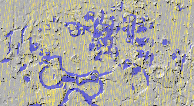
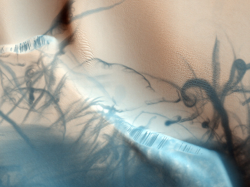
Layers and Dark Debris in Melas Chasma Credit: NASA/JPL/University of Arizona

This is an impressive looking region in Melas Chasma. Scientists say the layers are sedimentary in origin, but there are many processes that could have deposited them, such as volcanic airfall from explosive eruptions, or dust-size particles settling out of the atmosphere due to cyclic changes, and deposition in standing bodies of water.

See more great images at the HiRISE website.

MRO Radar Maps Extensive Subsurface Martian Ice

A radar on NASA's Mars Reconnaissance Orbiter has detected widespread deposits of glacial ice in the mid-latitudes of Mars.NASA/JPL-Caltech/ASI/University of Rome/Southwest Research Institute

[/caption]

Sure, it’s big news the Moon has water ice on the north pole, but Mars is loaded! A new extensive radar mapping of the middle-latitude region of northern Mars shows that thick masses of buried ice are quite common beneath the surface. The Mars Reconnaissance Orbiter’s Shallow Radar instrument has detected subsurface ice deposits that extend for hundreds of kilometers in the rugged region called Deuteronilus Mensae, about halfway from the equator to the Martian north pole. “We have mapped the whole area with a high density of coverage,” said Jeffrey Plaut from JPL. “These are not isolated features. In this area, the radar is detecting thick subsurface ice in many locations.”

The Shallow Radar instrument has been charting the locations of these hidden glaciers and ice-filled valleys, finding that the most common locations are around the bases of mesas and scarps, and confined within valleys or craters. After obtaining more than 250 observations of the study area, which is about the size of California, the science team is beginning to understand how these deposits may have been left as remnants when regional ice sheets retreated.

“The hypothesis is the whole area was covered with an ice sheet during a different climate period, and when the climate dried out,” Plaut said, “these deposits remained only where they had been covered by a layer of debris protecting the ice from the atmosphere.”

These buried masses of ice are a significant fraction of the known non-polar ice on Mars. The ice could contain a record of environmental conditions at the time of its deposition and flow, making the ice masses an intriguing possible target for a future mission with digging capability.

MRO will continue mapping the area to provide more insight into the buried ice.

Source: JPL

Multi-Layer Mars Parfait Provides Environmental Record

This oblique view shows geological layers of rock exposed on a mound inside Gale Crater on Mars. Image credit: NASA/JPL-Caltech/University of Arizona/USGS

[/caption]

Is Mars more like a Peanut Buster Parfait, a granola-yogurt parfait, –or perhaps — maybe a seven-layer salad? Near the center of a Martian crater about the size of Connecticut, hundreds of exposed rock layers form a mound as tall as the Rockies and reveal a record of major environmental changes on Mars billions of years ago. According to a new report by geologists using instruments on the Mars Reconnaissance Orbiter to look at the “parfait” of layers inside Gale Crater, the layers show that Mars was likely wet at one point, but gradually dried over time.

“Looking at the layers from the bottom to the top, from the oldest to the youngest, you see a sequence of changing rocks that resulted from changes in environmental conditions through time,” said Ralph Milliken from JPL. “This thick sequence of rocks appears to be showing different steps in the drying-out of Mars.”

Layers of rock exposed in the lower portion of a tall mound near the center of Gale Crater on Mars exhibit variations in layer thickness and range between dark and light tones. Image credit: NASA/JPL-Caltech/University of Arizona

Milliken and two co-authors of a paper in Geophysical Research Letters say that clay minerals, which form under very wet conditions, are concentrated in layers near the bottom of the Gale stack. Above that, sulfate minerals are intermixed with the clays. Sulfates form in wet conditions and can be deposited when the water in which they are dissolved evaporates. Higher still are sulfate-containing layers without detectable clays. And at the top is a thick formation of regularly spaced layers bearing no detectable water-related minerals.
Layers of rock in the upper portion of a tall mound near the center of Gale Crater on Mars exhibit a regular thickness of several meters, unlike the less regular pattern of layers in the lower formation on the same mound. Image credit: NASA/JPL-Caltech/University of Arizona

Rock exposures with compositions like various layers of the Gale stack have been mapped elsewhere on Mars, and researchers, including Jean-Pierre Bibring of the University of Paris, have proposed a Martian planetary chronology of clay-producing conditions followed by sulfate-producing conditions followed by dry conditions. However, Gale is the first location where a single series of layers has been found to contain these clues in a clearly defined sequence from older rocks to younger rocks.

“If you could stand there, you would see this beautiful formation of Martian sediments laid down in the past, a stratigraphic section that’s more than twice the height of the Grand Canyon, though not as steep,” said Bradley Thomson of the Johns Hopkins University Applied Physics Laboratory, Laurel, Md. He and John Grotzinger of the California Institute of Technology in Pasadena are Milliken’s co-authors.

NASA selected Gale Crater in 2008 as one of four finalist sites for the Mars Science Laboratory rover, Curiosity, which has a planned launch in 2011. The finalist sites all have exposures of water-related minerals, and each has attributes that distinguish it from the others. This new report is an example of how observations made for evaluating the landing-site candidates are providing valuable science results even before the rover mission launches.

Stunning New Views From HiRISE; Plus Big Announcement?

Caption: Dune symmetry on Mars. Credit: NASA/JPL/University of Arizona

It is so wonderful to see the Mars Reconnaissance Orbiter back in action, especially our favorite camera, the High-Resolution Imaging Science Experiment, or HiRISE. The HiRISE team released some of their latest images this week, and they are particularly stunning, including this one of symmetrical dunes in a small crater in Noachis Terra, west of the giant Hellas impact basin. Alfred McEwan, from the HiRISE team and the University of Arizona says the dunes here are linear, and are thought to be created due to shifting wind directions. In places, each dune is remarkably similar to adjacent dunes. The linear dune fields on Mars are similar to the ones seen on Titan, although not quite as large. The debris between the dunes are large boulders.

More images below, but on another note, HiRISE Twitter notes there will be a “big announcement” on Wednesday, January 20. A major discovery? Mission extension? Website redesign? Stay tuned.

This jaw-dropping beauty accompanied a press release announcing that 21 articles from HiRISE made up the entire contents of a special January issue of the journal Icarus . The papers analyzed Martian landforms shaped by winds, water, lava flow, seasonal icing and more.

This view shows color variations in bright layered deposits on a plateau near Juventae Chasma in the Valles Marineris region of Mars.


Contortions on the floor of Hellas Basin. Credit: NASA/JPL/University of Arizona

This almost looks like etchings on Mars’ surface, and they are very strange landforms indeed. McEwan notes that materials appear to have flowed in a viscous manner, like ice, here on the floor of Hellas Basin. Viscous flow features are common over the middle latitudes of Mars, but those in Hellas are especially unique, for unknown reasons.

Frost covered dunes. Credit: NASA/JPL/University of Arizona

This is a beautiful shot of frost covered dunes inside a crater. The HiRISE team says that on the floor of this crater where there are no dunes, the ice forms an uninterrupted layer. On the dunes however, dark streaks form as surface material from below the ice is mobilized and deposited on top of the ice. In some cases this mobile material probably slides down the steep face of the dune, while in other cases it may be literally blown out in a process of gas release similar to removing a cork from a champagne bottle.


Recent impact crater. Credit: NASA/JPL/University of Arizona

This impact crater could be relatively new, as it does not appear in images taken by the Viking Orbiters in 1976. McEwan said the HiRISE team suspects that the crater is more than several decades old, however, “because at full resolution we see a textured surface that is common in dust-mantled regions of Mars, but absent in the youngest craters.” While it could have been created recently, the other explanation is that there may have been more dust on the surface in 1976 or the air may have been hazy, obscuring the crater.

Click on each of the images for access to the higher resolution versions, or go directly to the HiRISE website.

MRO Comes Out of Safe Mode

Artist impression of MRO. Image credit: NASA/JPL

[/caption]

The latest word on the Mars Reconnaissance Orbiter is that the spacecraft has successfully come out of safe mode. The various instruments, including the HiRISE camera are still “safed” at this point, and engineers are waiting for acquisition of signal to confirm mapping orientation. MRO spontaneously rebooted its computer on Aug. 26, and since this was the fourth time this type of event had occurred, flight engineers decided to keep the spacecraft in safe mode, and have been working to figure out possible root causes, as well as repercussions if these events were to continue to happen. Several protective files were uploaded to MRO in late November, with hopes of returning the orbiter to its regularly scheduled research and relay activities. Once engineers check out of all the science instruments, normal science operations may resume next week.

“The patient is out of danger but more steps have to be taken to get it back on its feet,” said Mars Reconnaissance Orbiter Project Manager Jim Erickson.

Since August, the team worked painstakingly on a plan to ensure the safety and operation of the orbiter. “This process is to bulletproof the spacecraft against a remote vulnerability that our team identified,” said Erickson. “Meanwhile, analysis of possible root causes for the four reboots this year continues as another important part of our path toward resuming science operations.”

The preventive care required amending some data files in the computers’ non-volatile, or “flash” memories where the computers check for default settings when they reboot.

The four reboots involved a device, called the “computer module interface controller,” that controls which of two redundant main computers on the spacecraft is active. Still undetermined is whether trouble lies with that controller itself or with a voltage glitch elsewhere on the spacecraft. The Aug. 6 reboot, though not the other three, prompted a switch from one computer to its backup twin. More than 100 factors are under consideration as possible root causes.

MRO has six instruments on board to examine Mars in detail, from subsurface layers to the top of the atmosphere.

“The precautionary steps we are taking are not driven by the calendar, but by our commitment to care for this valuable national resource,” Erickson said. “We are all eager to have science observations resume as soon as a properly cautious process allows.”

Amazing and Marvelous Mars Dunes

Sand dunes on Mars from MRO's HiRISE camera. Credit: NASA/JPL University of Arizona

[/caption]
I see the Bad Astronomer has beat me to the punch by posting this image before I could. But what an amazing and gorgeous image of dunes on Mars! However, my initial thought when I saw this on the HiRISE webpage was perhaps this was the first long-awaited look at Phil’s tattoo. Seriously, doesn’t this look like it could be body art? The dunes even have a Phil-like flesh color. But this wonderful image was taken by the HiRISE camera on the Mars Reconnaissance Orbiter. There is a great database of dune images gathered for the US Geological Survey on the HiRISE website, and below, take a gander at more lovely dune images:

Click on each image to learn more from the HiRISE website.

More Martian dunes from HiRISE.
Russell Crater dunes. Credit: Credit: NASA/JPL/University of Arizona
Dunes in the Western Nereidum Montes. Credit: NASA/JPL University of Arizona
Sand dunes. Credit: NASA/JPL/University of Arizona
Dark dunes.  Credit: NASA/JPL/University of Arizona
Dark dunes. Credit: NASA/JPL/University of Arizona

Check out the HiRISE website for more great images from Mars!

HiRISE Highlights: Crater Within a Crater, Awesome View of Victoria and More

Interesting Crater in Meridiani Planum. Credit: NASA/JPL/University of Arizona

[/caption]
I was just thinking it had been awhile since we featured images from the HiRISE camera onboard the Mars Reconnaissance Orbiter spacecraft, so I moseyed over to the HiRISE website only to be blown away by their newest releases. This incredible crater in Meridiani Planum shows a possible double whammy of impacts. It looks as though material filled in the original crater only to be blown out a second time. Another option is that the material in the crater could have collapsed, giving the appearance of a second impact. You can bet the HiRISE team will be looking more closely at this one. Before we move on to more great images, an update on MRO, which unexpectedly went into “safe” mode last week: MRO has now been restored to full operations, after switching to its backup computer. Engineers successfully transitioned the orbiter out of limited-activity “safe” mode on Saturday, Aug. 8, and resumed use of the spacecraft’s science instruments on Monday, Aug. 10. This has happened a few times, and engineers are trying to figure out the root cause of this.

Now, on to the images!
Continue reading “HiRISE Highlights: Crater Within a Crater, Awesome View of Victoria and More”