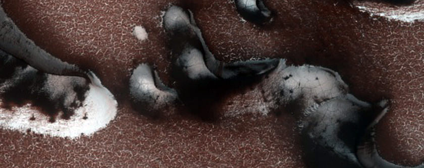
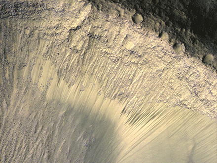
"Defrosting of dunes with large gullies", one of the images released in February 2014 from the Mars Reconnaissance Orbiter's High Resolution Imaging Science Experiment. Credit: NASA/JPL/University of Arizona
As NASA’s missions at the Red Planet age, it’s so important not to take any of the pictures beamed back to Earth for granted.
The latest release of raw images from the University of Arizona’s High Resolution Imaging Science Experiment (aboard the Mars Reconnaissance Orbiter, launched in 2005) is as close as most of us will get to seeing the Red Planet, and each picture captures a planet in action.
Snow, dust and wind are combining to make the incredible images you will see below. These shots, by the way, are close-ups colorized at the source; to see the full raw image, click on each picture you see below.
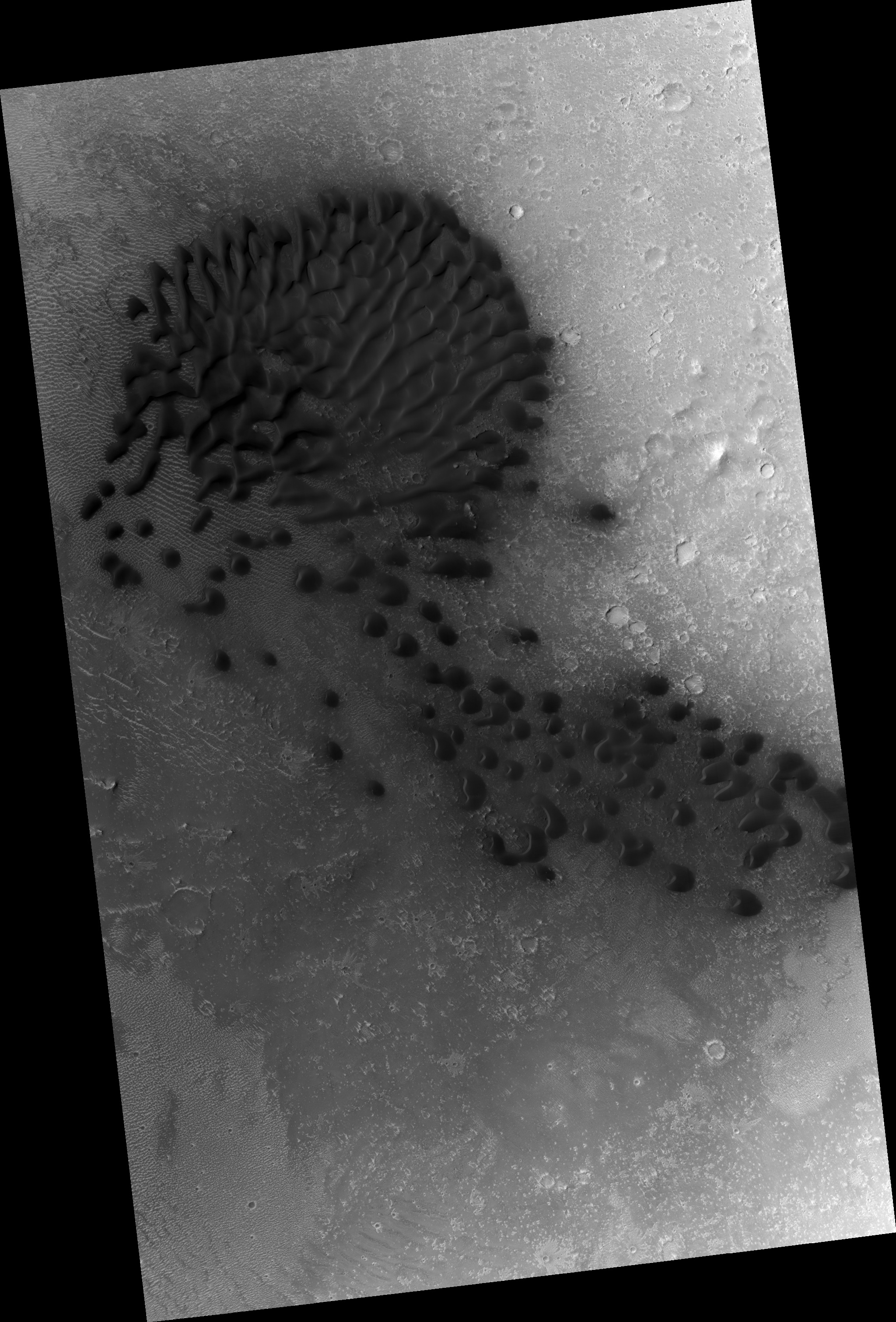
“Avalanche monitoring at steep chasma boreale headscarp”, one of the images released in February 2014 from the Mars Reconnaissance Orbiter’s High Resolution Imaging Science Experiment. Credit: NASA/JPL/University of Arizona“Avalanche monitoring at steep north polar scarp”, one of the images released in February 2014 from the Mars Reconnaissance Orbiter’s High Resolution Imaging Science Experiment. Credit: NASA/JPL/University of Arizona“Dunes with serious slope streaks dubbed tleilax”, one of the images released in February 2014 from the Mars Reconnaissance Orbiter’s High Resolution Imaging Science Experiment. (“Tleilax” is a reference to Dune, a science-fiction book series most famous for the eponymous first one concerning a desert planet.) Credit: NASA/JPL/University of Arizona“Cerberus region intracrater dune and ripple changes”, one of the images released in February 2014 from the Mars Reconnaissance Orbiter’s High Resolution Imaging Science Experiment. Credit: NASA/JPL/University of Arizona
A series of images from the High Resolution Imaging Science Experiment (HiRISE) camera on NASA's Mars Reconnaissance Orbiter show how the appearance of dark markings on Martian slope changes with the seasons. Image credit: NASA/JPL-Caltech/Univ. of Arizona.
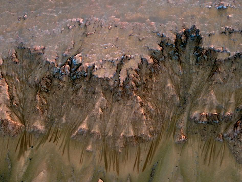
Get ready, because here are some more findings about possible water on Mars. This picture above from the Mars Reconnaissance Orbiter is a series showing changing dark lines on an equatorial hillside — which could be an indication of salty water, scientists said.
As MRO circled the planet and peered at the lines with its High Resolution Imaging Science Experiment (HiRISE) camera, it tracked these changes at five locations in Valles Marineris, the biggest canyon our solar system has to offer. The lines were on slopes that faced the north and the south, and most intriguingly, they activated when the sun hit their respective sides.
“The equatorial surface region of Mars has been regarded as dry, free of liquid or frozen water, but we may need to rethink that,” stated Alfred McEwen of the University of Arizona in Tucson.
“The explanation that fits best is salty water is flowing down the slopes when the temperature rises,” added McEwen, who is HiRISE principal investigator. “We still don’t have any definite identification of water at these sites, but there’s nothing that rules it out, either.”
A 2010 image of ice excavated on Mars after a recent meteorite impact. Image from the Mars Reconnaissance Orbiter’s High Resolution Imaging Science Experiment (HiRISE) camera. Credit: NASA/JPL-Caltech/Univ. of Arizona
Scientists first spotted these types of features two years ago in the mid-latitudes of Mars, but in that case these were small features (usually less than 16 feet or five meters wide). The slopes observed here range as wide as 4,000 feet (1,200 meters).
Salt can keep water flowing even in temperatures where more pure water gets frozen, and also reduce the evaporation rate. NASA also noted it used data from two other MRO instruments (Compact Reconnaissance Imaging Spectrometer for Mars and the Context Camera) and the Mars Oddysey’s Thermal Emission Imaging System.
That’s not all, however. Scientists also reported 15 fresh craters that excavated ice that used to be hidden underneath the soil of Mars.
A radar on NASA’s Mars Reconnaissance Orbiter has detected widespread deposits of glacial ice in the mid-latitudes of Mars.NASA/JPL-Caltech/ASI/University of Rome/Southwest Research Institute
“The more we find, the more we can fill in a global map of where ice is buried,” stated Colin Dundas of the United States Geological Survey in Flagstaff, Ariz.
“We’ve now seen icy craters down to 39 degrees north, more than halfway from the pole to the equator. They tell us that either the average climate over several thousand years is wetter than present or that water vapor in the current atmosphere is concentrated near the surface. Ice could have formed under wetter conditions, with remnants from that time persisting today, but slowly disappearing.”
Results were presented at the American Geophysical Union’s fall meeting this week.
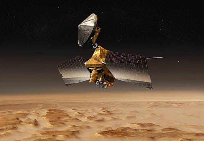
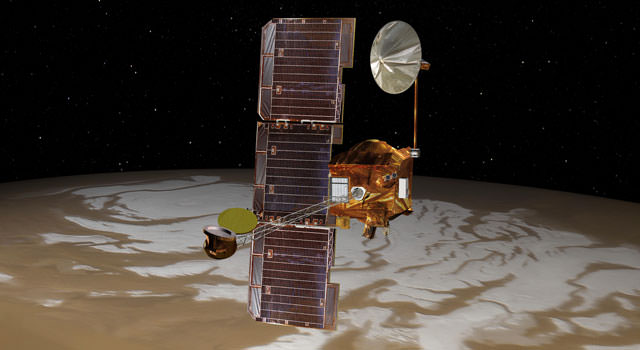
Artist's conception of NASA's Mars Reconnaissance Orbiter. Credit: NASA/JPL
Imagine being able to watch three months’ worth of high-definition space video sequentially — maybe real-time coverage on the International Space Station, or getting to watch the Mars Reconnaissance Orbiter zoom across the Red Planet over and over again. Well, that’s how much science data MRO itself has sent back in 10 years of operations, NASA said.
“The sheer volume is impressive, but of course what’s most important is what we are learning about our neighboring planet,” stated the Jet Propulsion Laboratory’s Rich Zurek, the project scientist for the Mars Reconnaissance Orbiter.
MRO has sent back 200 terabits, all told. It’s a wealth of science data on its own merits as it examined evidence of water, ancient volcanoes and other parts of the Red Planet’s history from above. The spacecraft, however, also serves as a relay for the NASA Curiosity and Opportunity rovers on the surface.
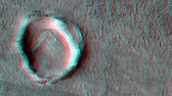
A crater imaged by the Mars Reconnaissance Orbiter’s HiRISE (High Resolution Imaging Science Experiment). Credit: NASA/JPL/University of Arizona
“Data gathered by the orbiter’s instruments and relayed from rovers are recorded onto the orbiter’s central memory. Each orbit around Mars takes the spacecraft about two hours. For part of each orbit, Mars itself usually blocks the communication path to Earth,” NASA stated.
“When Earth is in view, a Deep Space Network antenna on whichever part of Earth is turned toward Mars at that hour can be listening. Complex preparations coordinate scheduling the use of the network’s antennas by all deep-space missions — 32 of them this month. Mars Reconnaissance Orbiter typically gets several sessions every day.”
Once the Deep Space Network antennas in Spain, California and Australia pick up the data, JPL organizes them into their separate “products”, ranging from radar measurements from above to data picked up by a rover below. The information is then sent to various organizations around the world that have interests in the work.
MRO arrived at Mars in 2006 and its mission has been extended three times, with the latest one taking place in 2012. NASA also relays information from the planet using Mars Odyssey, which has been there since 2002.
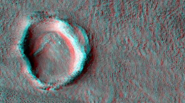
A crater imaged by the Mars Reconnaissance Orbiter's HiRISE (High Resolution Imaging Science Experiment). Credit: NASA/JPL/University of Arizona
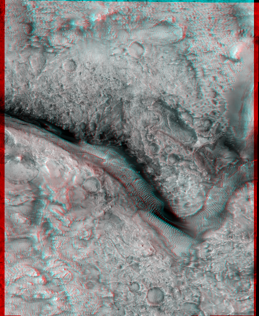
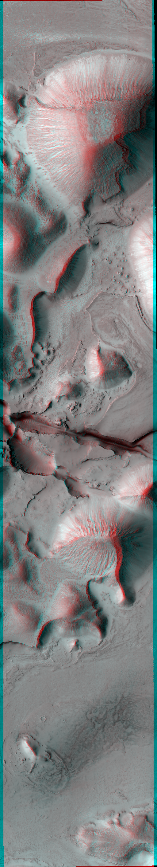
Stop what you’re doing, grab the nearest 3-D glasses (red/blue type) you have available and then pretend you’re hovering above Mars for a while. These are some of the latest images from the Mars Reconnaissance Orbiter, which has been cruising above the planet since 2006.
“Candidate Future Landing Site at Valley North of Jezero Crater”, imaged by the Mars Reconnaissance Orbiter’s HiRISE (High Resolution Imaging Science Experiment). Credit: NASA/JPL/University of Arizona“Fossae Source of Outflows,” a picture taken by Mars Reconnaissance Orbiter’s HiRISE (High Resolution Imaging Science Experiment). Credit: NASA/JPL/University of Arizona“Floor of East Candor Chasma,” a picture taken by the Mars Reconnaissance Orbiter’s HiRISE (High Resolution Imaging Science Experiment). Credit: NASA/JPL/University of Arizona“Knobs with bright layers in Noctis Labyrinthus”, a picture taken by the Mars Reconnaissance Orbiter’s HiRISE (High Resolution Imaging Science Experiment). Credit: NASA/JPL/University of Arizona
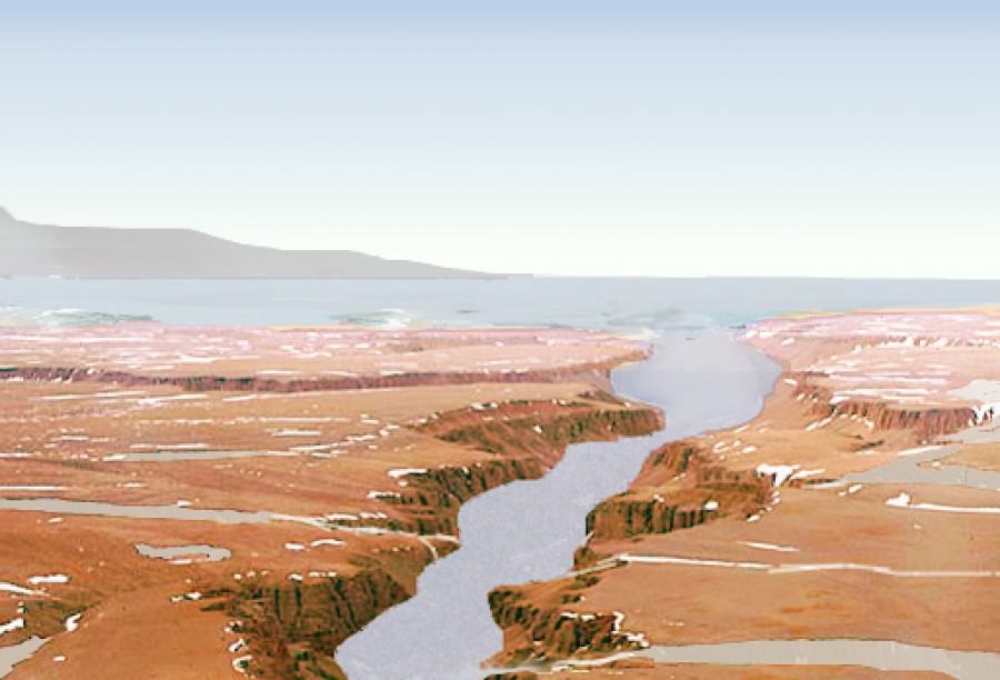
An artist's rendition of what water on Mars may have looked like. Source Credit: NASA
When it comes to Mars, the hot topic of study is water – a prerequisite for life.
While liquid water is currently not stable on the surface of Mars, there is extensive evidence that it may have been in the past. Astronomers have discovered dried up riverbeds, lake deltas, and evidence of widespread glaciers – to name but a few examples.
However, evidence for a massive standing body of water, such as an ocean, is hard to come by. Early climate models struggle to create circumstances under which liquid water would be stable at all. Nonetheless, an ocean spanning the northern lowlands (approximately one third of the planet) has been long hypothesized.
Scientists at Caltech may have just now confirmed this long-held hope in finding recent evidence for a vast Martian ocean.
The region under investigation is known as Aeolis Dorsa – a plain located at the border between the northern lowlands and the southern highlands. This plain contains many ridges, which are interpreted as ancient river channels.
“These ‘inverted’ channels are now elevated because the coarse sand and gravel carried by the channels is more resistant to erosion than the surrounding mud and silt making up the floodplain material,” Dr. Roman DiBiase, lead author on the study, told Universe Today.
Satellite images of Aeolis Dorsa were collected using the HiRISE camera aboard the Mars Reconnaissance Orbiter. The resolution was so precise scientists could distinguish features as small as 25 centimeters – an impressive feat even when compared to images of the Earth.
For certain locations “repeat pictures taken with a slight offset enable the creation of stereo-images from which we can determine the relative elevations of features on the planet’s surface,” explains DiBiase. This impressive technique led to high-resolution topographic models, allowing the team to analyze the geometry and patterns of these inverted channels in unprecedented detail.
Not only do the channels spread out toward the end, they also slope steeply downward, forming a delta – a sedimentary deposit that forms where rivers flow into lakes or oceans.
While deltas have been identified on Mars before, all lie within distinct topographic boundaries, such as an impact crater. This is the most compelling evidence for a delta leading into an unconfined region – an ocean.
Final proof of a Martian ocean will advance our knowledge of the intricate interplay between water, climate, and life. “The history of water on Mars has implications not only for the evolution of Martian climate, but also for learning about the early evolution of Earth and Earth’s climate,” explains DiBiase.
As always, further research is needed. Perhaps in the nearby future the Mars Reconnaissance Orbiter and Curiosity will compliment each other quite well – the orbiter taking images from above while Curiosity plays in the dirt, gathering samples in the riverbed.
The study was published in the Journal of Geophysical Research and may be found here.
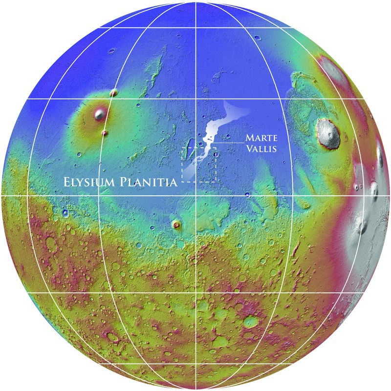
Mars Reconnaissance Orbiter revealed about 1,000 km of underground channels, called Marte Vallis, shown at center in this map. The rendering of Mars is in false color to highlight elevation differences. Credit: NASA/MOLA Team/Smithsonian Institute
Massive floodwaters on Mars gouged a channel more than 600 miles (1,000 kilometers) long, making a trench that was hidden to scientists until now because volcanic flows buried it underground.
Erupting groundwater, perhaps triggered by a volcano or an earthquake, forced water across the surface during the past 500 million years. This carved a trench about 62 miles (100 kilometers) wide; it would take runners more than two marathons (at 26 miles each) to cross the expanse.
Later, as volcanoes erupted in Mars’ Elysium Planitia plain, lava flows covered the channel. The trench, now called Marte Vallis, finally came to light from radar measurements by an orbiting spacecraft. The results were published in the journal Science Thursday.
“This work demonstrates the importance of orbital sounding radar in understanding how water has shaped the surface of Mars,” stated Gareth A. Morgan, the paper’s lead author and a geologist at the National Air and Space Museum’s Center for Earth and Planetary Studies.
Scientists stumbled on the trench using the radar capabilities of NASA’s Mars Reconnaissance Orbiter and its Italian-made Mars SHAllow RADar sounder, also known as SHARAD, designed to pick up ice and water underground. The instrument has a horizontal resolution of between 0.3 and 3 kilometers (between 2/10 of a mile and almost 2 miles) horizontally and 15 meters (about 50 feet) vertically.
SHARAD revealed that the largest or main channel was 370 feet (113 meters) deep, which is skyscraper height.
“This is comparable with the depth of incision of the largest known megaflood on Earth, the Missoula floods,” the paper stated, referring to bursts of water that swept across western North America after the last ice age, some 12,000 to 18,000 years ago.
Mars today is considered pretty dry, save for the water that is locked in the ice caps at the north and south poles. In recent years, however, several spacecraft and rovers revealed ancient signs of water at various points in the past.
The Curiosity rover found a streambed where hip-deep water flowed, while the Spirit and Opportunity rovers analyzed rocks such as hematite “blueberries” that form in wet conditions. From above, orbiters with NASA and the European Space Agency regularly take pictures of ancient channels and water carvings on the surface.
This is the first time scientists found a trench underground, however.
“Understanding Marte Vallis is essential to our assessment of recent Mars hydrologic activity during a period otherwise considered to be cold and dry,” the paper stated.
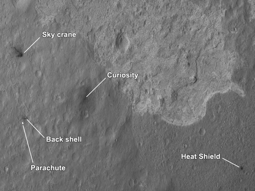
More awesomeness from HiRISE! A new orbital image shows the Curiosity rover sitting on Mars’ surface, along with all the accoutrements needed to get it there safely: the heat shield, backshell, parachute, and the Sky Crane. The High-Resolution Imaging Science Experiment (HiRISE) camera captured this image just 24 hours after MSL’s landing.
“This is like the crime scene photo here,” HiRISE team member Sarah Milkovich said during a press conference on Aug. 7.
In re-inacting the scene of the crime, er… incredible landing, the heat shield, lower right, was the first piece to hit the ground, followed by the back shell attached to the parachute, then the rover itself touched down. Then, and finally, after cables were cut, the sky crane flew away to the northwest and crashed.
The heat shield is about 1,220 meters (4,000 feet) from Curiosity, the backshell and parachute are about 610 meters (2,000 feet) away from the rover, and the Sky Crane is about 620 meters (2,100 feet) away.
The relatively dark areas in all four spots are from disturbances of the bright surface dust, revealing darker soil underneath. If you look closely, even visible are the black streaks where the sky crane thrusters kicked up dust. Malkovich said scientists have looked at the streak patterns to verify Curiosity’s orientation — which confirms the information from the rover’s first pictures from surface.
Close-up of Curiosity sitting on Mars’ surface. Credit: NASA/JPL/University of Arizona
The darkened radial jets from the sky crane are downrange from the point of oblique impact, much like the oblique impacts of asteroids. In fact, NASA said, they make an arrow pointing to Curiosity.
Close-up of the Sky Crane. Credit: NASA/JPL/University of Arizona
HiRISE’s image of MSL’s landing site shows the rover and the hardware doing their jobs exactly as they were designed to do.
The image was acquired from a special 41-degree roll of MRO, larger than the normal 30-degree limit. It rolled towards the west and towards the Sun, which increases visible scattering by atmospheric dust as well as the amount of atmosphere the orbiter has to look through, thereby reducing the contrast of surface features. Malkovich said that future images taken from a higher angle will show the hardware in greater detail.
Close-up of the parachute and backshell. Credit: NASA/JPL/University of Arizona
Close-up of the heat shield. Credit: NASA/JPL/University of Arizona
Caption: NASA’s Mars Odyssey spacecraft passes above Mars’ south pole in this artist’s illustration. The spacecraft has been orbiting Mars since October 24, 2001. Image credit: NASA/JPL
The “seven minutes of terror” could stretch into a longer time of trepidation for the hopeful Mars rover team and fans waiting back on Earth to find out if the Curiosity rover has landed safely. A problem with the Mars Odyssey orbiter means there could be a delay in the telemetry relayed to Earth as the Mars Science Laboratory descends and lands on Mars on August 5/6, 2012.
“There’s no impact to landing itself,” said NASA’s Mars exploration program chief Doug McCuistion at a press briefing on Monday. “It’s simply how that data gets returned to us and how timely that data is.”
McCuistion said the Odyssey team is assessing why the orbiter has gone into safe mode several times since early June, as well as having problems with its attitude control system. The glitches possibly could mean the spacecraft may not be in position to track and relay real-time data from MSL as it descends through Mars’ atmosphere and lands, possibly delaying the telemetry to Earth by several hours.
Curiosity’s automated landing sequence won’t be affected; it’s just that the data won’t be sent immediately – and the 14-minute communications lag between Earth and Mars means that the MSL team won’t be getting real-time updates about the rover’s perilous journey anyway; however, now it might be an even longer delay.
Caption: This artist’s concept from an animation depicts Curiosity, the rover to be launched in 2011 by NASA’s Mars Science Laboratory, as it is being lowered by the mission’s rocket-powered descent stage during a critical moment of the “sky crane” landing in 2012. Image Credit: NASA/JPL-Caltech
The rover is scheduled to land at 10:31 p.m. PDT on Aug. 5 (05:31 UTC, 1:31 a.m. EDT on Aug. 6).
Under normal circumstances, it’s a challenge for the orbiters to get in position to welcome another spacecraft to Mars, and provide tracking data and telemetry relay.
“If we were not to do anything, the Mars’ orbiting spacecraft may be on the other side of the planet,” said MSL navigation team chief Tomas Martin-Mur, during a previous interview with UT. “So as soon as we launch, we tell the other spacecraft where we are going to be by the time of entry so they can change their orbits over time, so they will be flying overhead as MSL approaches the planet.”
The orbiters – which also includes NASA’s Mars Reconnaissance Orbiter and ESA’s Mars Express – have been doing special maneuvers to be aligned in just the right place, nearby to MSL’s point of entry into Mars’ atmosphere.
But the glitches for Odyssey means it may not be in the right place.
MRO will be attempting to image the rover as it descends and lands — with possible hopes of catching the rover as it is descending on the “sky-crane” landing system — but MRO can only record data for later playback, whereas Odyssey could provide immediate relay. Mars Express won’t be aligned to see the last minute of flight, McCuistion said.
The Odyssey orbiter put itself in the precautionary, Earth-pointed status called safe mode on July 11, as it finished a maneuver adjusting, or trimming, its orbit. Odyssey’s computer did not reboot, so diagnostic information was subsequently available from the spacecraft’s onboard memory. Based on analysis of that information, the mission’s controllers sent commands yesterday morning taking Odyssey out of safe mode and reorienting it to point downward at Mars.
“We are on a cautious path to resume Odyssey’s science and relay operations soon,” said Gaylon McSmith, Odyssey project manager. “We will also be assessing whether another orbit trim maneuver is warranted.”
The landing is one of the most perilous times for a rover. “Those seven minutes are the most challenging part of this entire mission,” said Pete Theisinger, MSL’s project manager. “For the landing to succeed, hundreds of events will need to go right, many with split-second timing and all controlled autonomously by the spacecraft. We’ve done all we can think of to succeed. We expect to get Curiosity safely onto the ground, but there is no guarantee. The risks are real.”
We’ll provide updates as to Odyssey’s status. Here’s a look at the seven minutes of terror MSL will experience:
An image combining orbital imagery with 3-D modeling shows flows that appear in spring and summer on a slope inside Mars' Newton crater. Image credit: NASA/JPL-Caltech/Univ. of Arizona
[/caption]
In a news conference today, NASA announced discoveries that provide additional evidence of seasonal water flows on Mars. Using data collected by the Mars Reconnaissance Orbiter, the MRO team presented images of dark lines that form on slopes during the martian spring/summer and fade in winter.
During the news conference, HIRISE principal investigator Alfred McEwen (University of Arizona), discussed that these “finger-like” features were found in Mars’ mid-southern latitudes. “The best explanation for these observations so far is the flow of briny water,” he said.
McEwen based his explanation on several key facts: First, salt lowers the freezing point of water (“plain” water would simply stay frozen on Mars) Secondly, the temperature on Mars during these flows ranges from -23 to +27 degrees Celsius, which rules out CO2. While there is significant evidence of flowing water, the team did state that there is no direct detection of water since it evaporates quickly on Mars.
Regarding the dark color of the flows, McEwen added, “The flows are not dark because of being wet, they are dark for some other reason.” McEwen also mentioned that researchers will need to re-create Mars-like conditions in the lab to better understand these flows, stating, “It’s a mystery now, but I think it’s a solvable mystery with further observations and laboratory experiments.”
MRO Project Scientist Richard Zurek (JPL) offered his thoughts as well. “These dark lineations are different from other types of features on Martian slopes,” he said, “and repeated observations show they extend ever farther downhill with time during the warm season.”
This series of images shows warm-season features that might be evidence of salty liquid water active on Mars today. Image credit: NASA/JPL-Caltech/Univ. of Arizona (click to view full animation)
What also proves intriguing to the team is that while gullies are very abundant on colder slopes that face the poles, the dark flows discussed in today’s news conference are found on warmer slopes which face the equator.
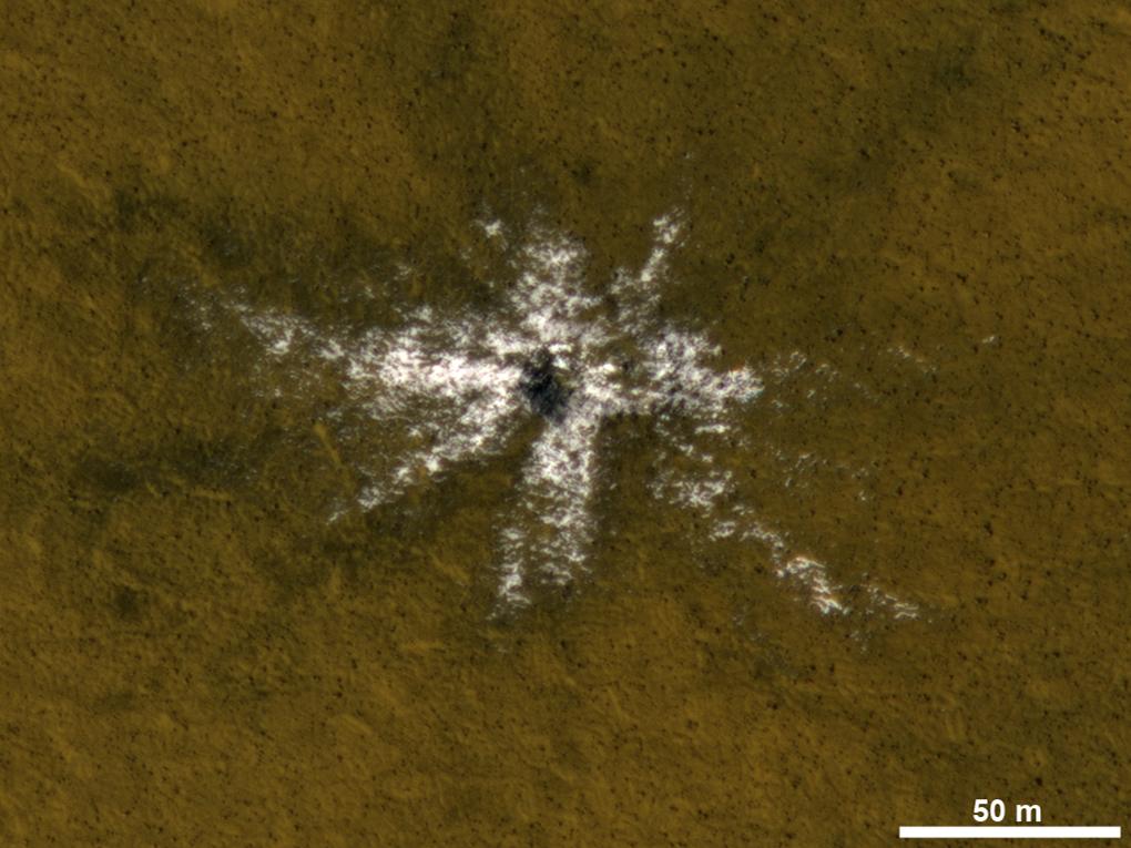
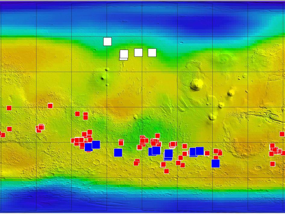
During the conference, Philip Christensen (Arizona State University) presented a map showing concentrations of “salts” in the same locations that the dark, “finger-like” flows were found.
McEwen reiterated during the Q&A session that the Compact Reconnaissance Imaging Spectrometer for Mars (CRISM), hasn’t detected any signs of water and that laboratory simulations will be necessary to gain a better understanding of these features – basically the team is seeing signs of flowing water, but not the water itself.
If you’d like to learn more about the Mars Reconnaissance Orbiter and today’s announcement, you can visit: http://www.nasa.gov/mro
This map of Mars shows relative locations of three types of findings related to salt or frozen water, plus a new type of finding that may be related to both salt and water. Credit: NASA/JPL-Caltech/ASU/UA/LANL/MSSS
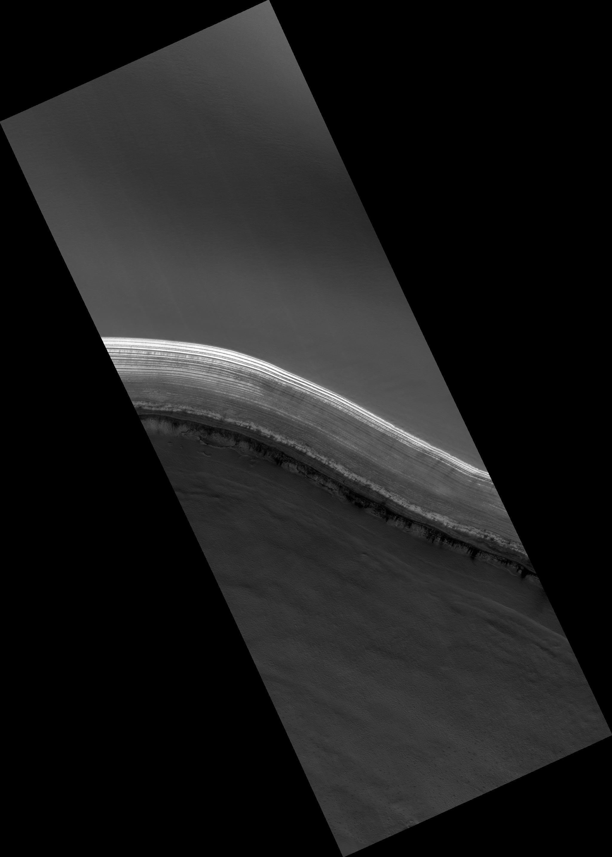
A new image from the HiRISE camera on the Mars Reconnaissance Orbiter shows an ethereal landscape near Mars north pole. Credit: NASA/HiRISE team
[/caption]
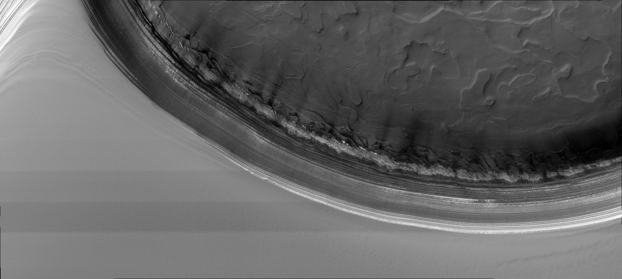
Wow! These two latest images from the HiRISE Camera on the Mars Reconnaissance Orbiter are simply amazing. I couldn’t decide which to post on top as the lead image, so did a coin flip. This observation shows dune gullies laced with beautiful swirls of tracks left by dust devils. Just like on Earth, dust devils move across the Martian surface and expose the underlying darker material, creating a striking view. The HiRISE team has been tracking changes in this location (-70.3 degrees latitude and 178.2 degrees Longitude East), and they also compare it with dune gully activity going on in other regions. The science team says the activity here is rather anomalous for their high altitude location.
And the other image….
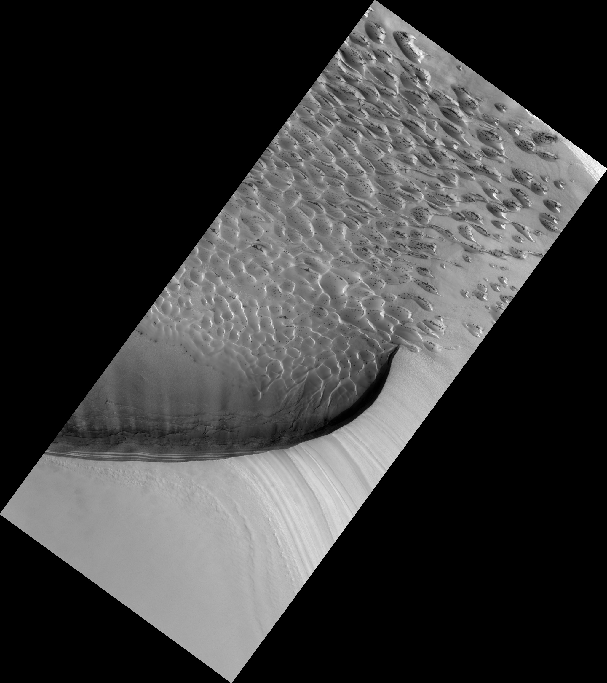
Dunes and bedrock near Noachis Terra on Mars. Credit: NASA/HiRISE team.
This HiRISE image shows a very unique butter brickle-like landscape — it is actually dunes and bedrock on the floor of a crater near Noachis Terra. What strikes me most is the clarity of the detail in this image — it is absolutely stunning.
Scientifically, this crater is unique because it has been very well characterized as being olivine-rich. Olivine is a magnesium-iron silicate that is very common on Earth. There are other regions of Mars that are also rich in olivine, and since olivine turns into other minerals in the presence of water, scientists are interested in looking for those minerals as well.
The science team says that while the large scale morphology of these craters is well characterized, this is not the case with fine scale layering and fracturing, such as what is seen here. Studying landscapes like this could help the understanding of large scale crustal processes on Mars, including the genesis of magmas and the creation of regolith.