Study of Martian Sedimentary Layers Reveals More About the Planet’s Past

An artist’s impression of what Mars might have looked like with water. Credit: ESO/M. Kornmesser

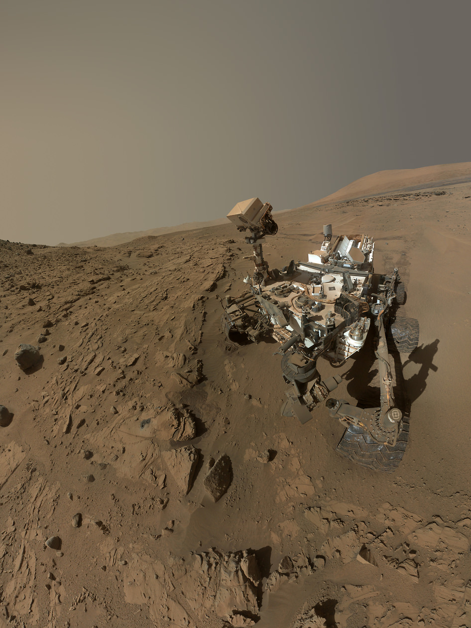
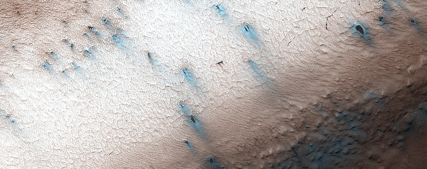
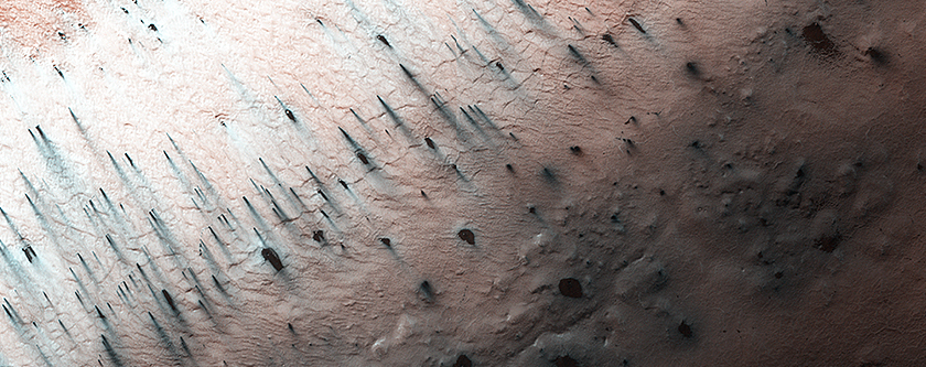
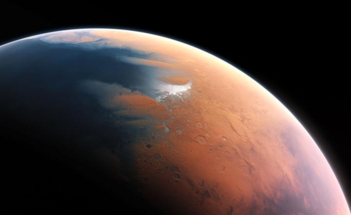
As of 2016, Mars became the permanent residence of no less than eight robotic missions, a combination of orbiters, rovers and landers. Between extensive studies of the Martian atmosphere and surface, scientists have learned a great deal about the planet’s history and evolution. In particular, they have uncovered voluminous amounts of evidence that Mars once had flowing water on its surface.

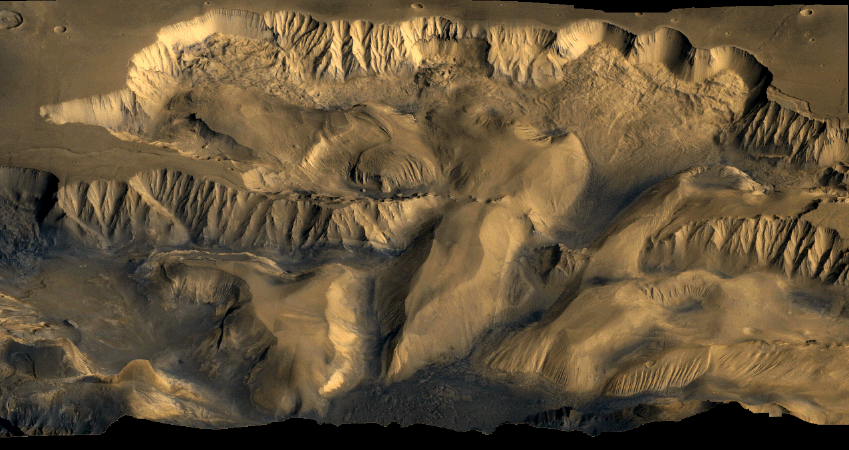
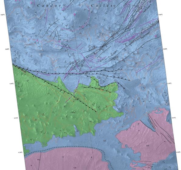
The most recent evidence to this effect from the University of Texas at Austin, where researchers have produced a study detailing how water deposited sediment in Mars’ Aeolis Dorsa region. According to their research, this area contains extensive sedimentary deposits that act as a historical record of Mars, cataloguing the influence played by water-based erosion over time.

The study, titled “Fluvial Stratigraphy of Valley Fills at Aeolis Dorsa, Mars: Evidence for Base-Level Fluctuations Controlled by a Downstream Water Body“, recently appeared in the scientific journal GeoScienceWorld. Led by Benjamin D. Cardenas – a geologist with the Jackson School of Geosciences at the University of Texas at Austin – the team examined satellite data of the Aeolis Dorsa region to study the structure of sedimentary deposits.

MOLA Topographic Map of Aeolis Quadrangle (MC-23) on the planet Mars. Credit: USGS

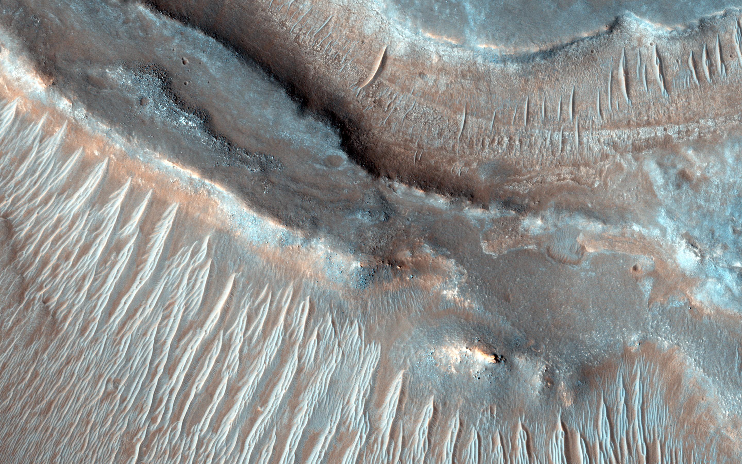
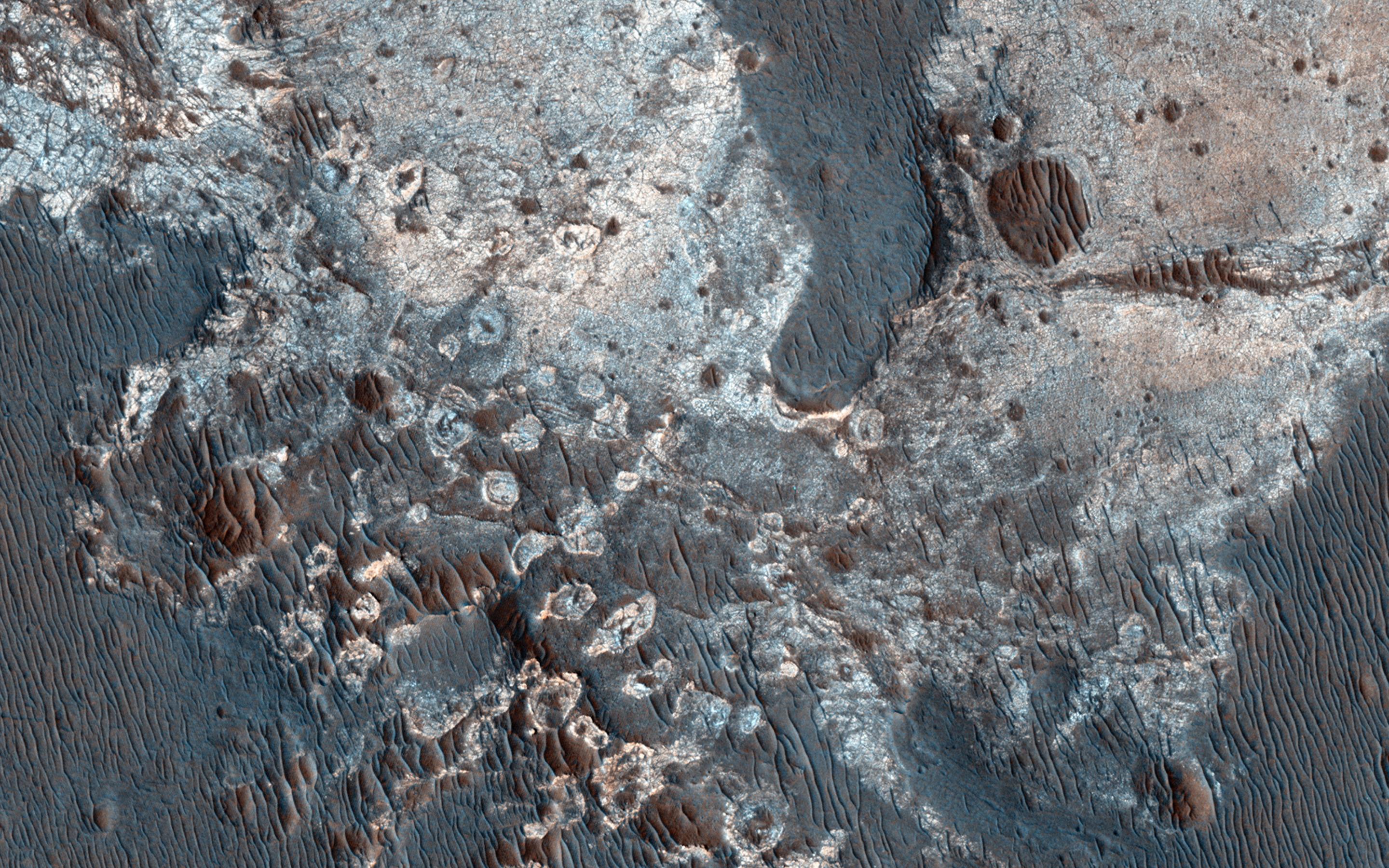
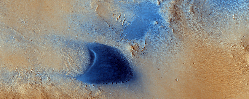
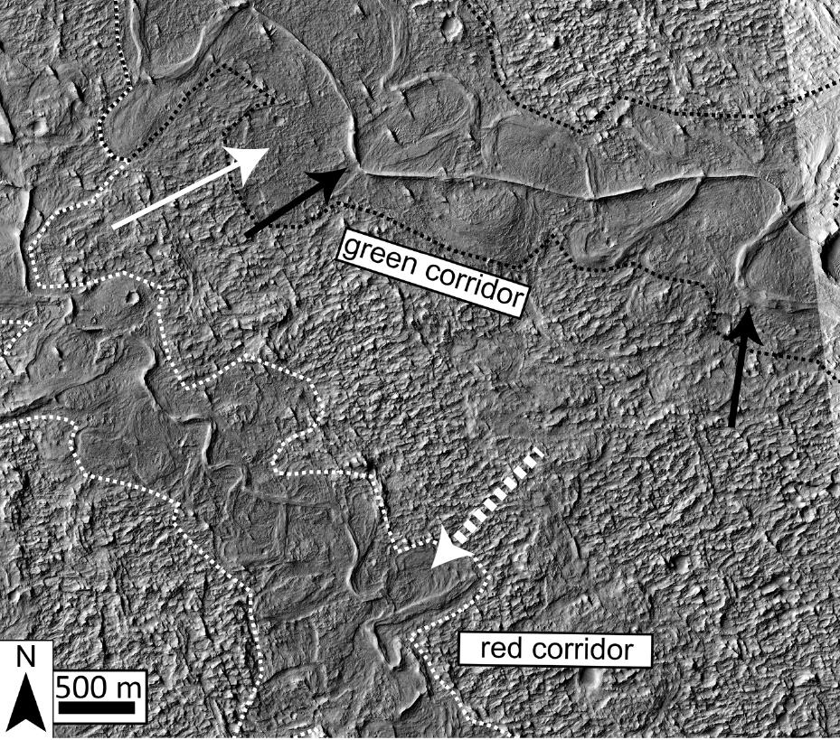
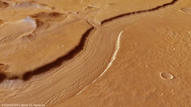
For years, Aeolis Dorsa has been of interest to scientists since it contains some of the most densely-packed sedimentary layers on Mars, which were deposited by flowing water (aka. fluvial deposits). These deposits are visible from orbit because of the way they have undergone a process known as “topographic inversion” – which consists of deposits filling low river channels, then being exhumed to create incised valleys.

By definition, incised valleys are topographic lows produced by “riverine” erosion – i.e. relating to a river or riverbank. On Earth, these valleys are commonly created by rising sea levels, and then filled with sediment as a result of falling sea levels. As sea levels rise, the valleys are cut from the landscape as the waters move inland; and as the sea levels drop, retreating waters deposit sediment within them.

According to the study, this process has created an opportunity for geophysicists and planetary scientist to observe Mars’ geological record in three dimensions and across significant distances. As Cardenas told Universe Today via email:

“Sedimentary rocks in general record information about the environments under which they were deposited. Fluvial (river) deposits specifically record information about the way rivers migrated laterally, the way they aggraded vertically, and how these things changed over time.”
The dotted white arrow points to curved strata recording point bar growth and river migration while the black arrow shows topographically inverted river deposits outcropping as ridges (e.g., black arrow). Credit: hou.usra.edu

Here on Earth, the statigraphy (i.e. the order and position of sedimentary layers) of sedimentary rocks has been used by geologists for generations to place constraints on what conditions were like on our planet billions of years ago. It has only been in recent history that the study of sedimentary layers has been used to place constraints on what environmental conditions were like on other planetary bodies (like Mars) billions of years ago.

However, most of these studies have produced data that has been unable to resolve sedimentary packaging at the sub-meter scale. Instead, satellite images have been used to define large-scale stratigraphic relationships, such as deposition patterns along past water channels. In other words, the studies have focused on cataloging the existence of past water flows on Mars more than what has happened since then.

As Cardenas indicated, he and his team took a different approach, one which considered that Mars has experienced changes over the past 3.5 billion years. As he explained:

“In general, there has been the assumption that a lot of the martian surface is not particularly different than it was 3.5 billion years ago. We make an effort to demonstrate that the modern surface at our study area, Aeolis Dorsa, is the result of burial, exhumation, and un-equal erosion, and it can’t be assumed that the modern surface represents the ancient surface at all. We really try to show that what we see today, the features we can measure today, are sedimentary deposits of rivers, and not actual rivers. This is incredibly important to realize when you start making interpretations of your observations, and it is frequently a missed point.”
Perspective view of Reull Vallis based on images taken by the ESA’s Mars Express. Reull Vallis, a river-like structure, is believed to have formed when running water flowed in the distant martian past. Credit and Copyright: ESA/DLR/FU Berlin (G. Neukum)

For the sake of their research, Cardenas and his team used stereo pairs of high-resolution images and topographic data taken by the Context Camera (CTX) and the High Resolution Imaging Science Experiment (HiRISE) aboard the Mars Reconnaissance Orbiter (MRO). This data was then combined with the Integrated Software for Imagers and Spectrometers (ISIS) –  a digital image-processing package used by the U.S. Geological Survey (USGS) – and NASA’s Ames Stereo Pipeline.

These processed the paired images into high-resolution topographic data and digital elevation models (DEMs) which were then compared to data from the Mars Orbiting Laser Altimeter (MOLA) instrument aboard the Mars Global Surveyor (MSG). The final result was a series of DEMs that were orders of magnitude higher in terms of resolution than anything previously produced.

For all of this, Cardenas and his colleagues were able to identify stacking patterns in the fluvial deposits, noted changes in sedimentation styles, and suggested mechanisms for their creation. In addition, the team introduced a brand new method to measure the flow direction of the rivers that left these deposits, which allowed them to see how the landscape has changed over the past few billion years.

“The study shows there was a large body of water on Mars ~3.5 billion years ago, and that this body of water increased and decreased in volume slowly enough that river sedimentation had time to adjust styles,” said Cardenas. “This is more in line with slower climatic changes, and less in line with catastrophic hydrologic events. Aeolis Dorsa is positioned along hypothesized coastlines of an ancient northern ocean on Mars. It’s interesting to find coastal river deposits at Aeolis Dorsa, but it doesn’t help us constrain the size of the water body (lake, ocean, etc.)”

Nanedi Valles, a roughly 800-kilometre valley believed to be caused by ground-water outflow. Copyright ESA/DLR/FU Berlin (G. Neukum)

In essence, Cardenas and his colleagues concluded that – similar to Earth – falling and rising water levels in a large water body forced the formation of the paleo-valleys in their study area. And in a way that is similar to what is happening on Earth today, rivers that formed in coastal regions were strongly influenced by changes in water levels of a large, downstream water body.

For some time, it has been something of a foregone conclusion that the surface of Mars is dead, its features frozen in time. But as this study demonstrated, the landscape has undergone significant changes since it lost its atmosphere and surface water. These findings will no doubt be the subject of interest as we get closer to mounting a crewed mission to the Martian surface.

Further Reading: GSA, GeoScienceWorld

Best Photos Yet of the Mars Lander’s Demise

Credit: Schiaparelli lander protected by its heat shield as it enters the Martian atmosphere. Credit: ESA
A closeup of the dark, approximately circular crater about 7.9 feet (2.4 meters) in diameter marking the crash of the Schiaparelli test lander on Mars. The photo was taken on October 25 by NASA's Mars Reconnaissance Lander (MRO). Credit:
A closeup of the dark, approximately circular crater about 7.9 feet (2.4 meters) in diameter that marks the crash of the Schiaparelli test lander on Mars. The new, higher-resolution photo was taken on October 25 by NASA’s Mars Reconnaissance Lander (MRO). A hint of an upraised rim is visible along the crater’s lower left side. The tiny white specks may be pieces of the lander that broke away on impact. The odd dark curving line has yet to be explained.  Credit: NASA/JPL-Caltech

What’s the most powerful telescope for observing Mars? A telephoto lens on the HiRise camera on the Mars Reconnaissance Orbiter that can resolve features as small as 3 feet (1-meter) across. NASA used that camera to provide new details of the scene near the Martian equator where Europe’s Schiaparelli test lander crashed to the surface last week.

The Schiaparelli test lander was protected by its heat shield as it descended through the Martian atmosphere at high speed. Credit: ESA

During an October 25 imaging run HiRise photographed three locations where hardware from the lander hit the ground all within about 0.9 mile (1.5 kilometers) of each other. The dark crater in the photo above is what you’d expect if a 660-pound object (lander) slammed into dry soil at more than 180 miles an hour (300 km/h). The crater’s about a foot and a half (half a meter) deep and haloed by dark rays of fresh Martian soil excavated by the impact.

But what about that long dark arc northeast of the crater?  Could it have been created by a piece of hardware jettisoned when Schiaparelli’s propellant tank exploded? The rays are curious too. The European Space Agency says that the lander fell almost vertically when the thrusters cut out, yet the asymmetrical nature of the streaks — much longer to the west than east — would seem to indicate an oblique impact. It’s possible, according to the agency, that the hydrazine propellant tanks in the module exploded preferentially in one direction upon impact, throwing debris from the planet’s surface in the direction of the blast, but more analysis is needed. Additional white pixels in the image could be lander pieces or just noise.

This Oct. 25, 2016, image shows the area where the European Space Agency's Schiaparelli test lander reached the surface of Mars, with magnified insets of three sites where components of the spacecraft hit the ground. It is the first view of the site from the High Resolution Imaging Science Experiment (HiRISE) camera on NASA's Mars Reconnaissance Orbiter taken after the Oct. 19, 2016, landing event and our highest resolution of the scene to date. Annotations by the author. Click for a full-resolution image. Credit: NASA/JPL-Caltech
This Oct. 25, 2016, image shows the area where the European Space Agency’s Schiaparelli test lander reached the surface of Mars, with magnified insets of three sites where components of the spacecraft hit the ground. It is the first view of the site from the High Resolution Imaging Science Experiment (HiRISE) camera on NASA’s Mars Reconnaissance Orbiter taken after the Oct. 19, 2016, landing event and our highest resolution of the scene to date. Click for a full-resolution image. Credit: NASA/JPL-Caltech

In the wider shot, several other pieces of lander-related flotsam are visible. About 0.8 mile (1.4 km) eastward, you can see the tiny crater dug out when the heat shield smacked the ground. Several bright spots might be pieces of its shiny insulation. About 0.6 mile (0.9 kilometer) south of the lander impact site, two features side-by-side are thought to be the spacecraft’s parachute and the back shell.  NASA plans additional images to be taken from different angle to help better interpret what we see.

The last happy scene for the lander when it still dangled from its chute before dropping and slamming into the surface. Credit: ESA
Schiaparelli dangles from its parachute in this artist’s view. A software error caused the chute to deploy too soon. Credit: ESA

The test lander is part of the European Space Agency’s ExoMars 2016 mission, which placed the Trace Gas Orbiter into orbit around Mars on Oct. 19. The orbiter will investigate the atmosphere and surface of Mars in search of organic molecules and provide relay communications capability for landers and rovers on Mars. Science studies won’t begin until the spacecraft trims its orbit to a 248-mile-high circle through aerobraking, which is expected to take about 13 months.

Everything started out well with Schiaparelli, which successfully transmitted data back to Earth during its descent through the atmosphere, the reason we know that the heat shield separated and the parachute deployed as planned. Unfortunately, the chute and its protective back shell ejected ahead of time followed by a premature firing of the thrusters. And instead of burning for the planned 30 seconds, the rockets shut off after only 3. Why? Scientists believe a software error told the lander it was much closer to the ground than it really was, tripping the final landing sequence too early.

Landing on Mars has never been easy. We’ve done flybys, attempted to orbit the planet or land on its surface 44 times. 15 of those have been landing attempts, with 7 successes: Vikings 1 and 2, Mars Pathfinder, the Spirit and Opportunity rovers, the Phoenix Lander and Curiosity rover. We’ll be generous and call it 8 if you count the 1971 landing of Mars 3 by the then-Soviet Union. It reached the surface safely but shut down after just 20 seconds.

Mars can be harsh, but it forces us to get smart.

**** Want to learn more about Mars and how to track it across the sky? My new book, Night Sky with the Naked Eye, which will be published on Nov. 8, covers planets, satellites, the aurora and much more. You can pre-order it right now at these online stores. Just click an icon to go to the site of your choice – Amazon, Barnes & Noble or Indiebound. It’s currently available at the first two outlets for a very nice discount.

Night Sky book cover Amazon anno
Night Sky book cover BN

Night Sky book cover Indie

What Does Earth Look like from Mars?

Image taken by the HiRISE camera on NASA's Mars Reconnaissance Orbiter, showing Earth and the Moon. Credit: NASA/JPL

Modern astronomy and space exploration has blessed us with a plethora of wonderful images. Whether they were images of distant planets, stars and galaxies taken by Earth-based telescopes, or close-ups of planets or moons in our own Solar System by spacecraft, there has been no shortage of inspiring pictures. But what would it look like to behold planet Earth from another celestial body?

We all remember the breathtaking photos taken by the Apollo astronauts that showed what Earth looked like from the Moon. But what about our next exploration destination, Mars? With all the robotic missions on or in orbit around the Red Planet, you’d think that there would have been a few occasions where they got a good look back at Earth. Well, as it turn out, they did!

Pictures from Space:

Pictures of Earth have been taken by both orbital missions and surface missions to Mars. The earliest orbiters, which were part of the Soviet Mars and NASA Mariner programs, began arriving in orbit around Mars by 1971. NASA’s Mariner 9 probe was the first to establish orbit around the planet’s (on Nov. 14, 1971), and was also the first spacecraft to orbit another planet.

Image of Earth and Moon, taken by the Mars Orbiter Camera of Mars Global Surveyor on May 8 2003. Credit: NASA/JPL/Malin Space Science Systems

The first orbiter to capture a picture of Earth from Mars, however, was the Mars Global Surveyor, which launched in Nov. 7th, 1996, and arrived in orbit around the planet on Sept. 12th, 1997. In the picture (shown above), which was taken in 2003, we see Earth and the Moon appearing closely together.

At the time the picture was taken, the distance between Mars and Earth was 139.19 million km (86.49 million mi; 0.9304 AU) while the distance between Mars and the Moon was 139.58 million km (86.73 million mi; 0.9330 AU). Interestingly enough, this is what an observer would see from the surface of Mars using a telescope, whereas a naked-eye observer would simply see a single point of light.

Usually, the Earth and Moon are visible as two separate points of light, but at this point in the Moon’s orbit they were too close to resolve with the naked eye from Mars. If you look closely at Earth, you can just make out the shape of South America.

Earth and the Moon, captured by the Mars Express spacecraft on July 3, 2003. Credit: ESA

The picture above was snapped by the Mars Express’s High Resolution Stereo Camera (HRSC) on the ESA’s Mars Express probe. It was also taken in 2003, and is similar in that it shows the Earth and Moon together. However, in this image, we see the two bodies at different points in their orbit – which is why the Moon looks like its farther away. Interestingly enough, this image was actually part of the first data sets to be sent by the spacecraft.

The next orbiter to capture an image of Earth from Mars was the Mars Reconnaissance Orbiter (MRO), which was launched in August of 2005 and attained Martian orbit on March 10th, 2006. When the probe reached Mars, it joined five other active spacecraft that were either in orbit or on the surface, which set a record for the most operational spacecraft in the vicinity of Mars at the same time.

In the course of its mission – which was to study Mars’ surface and weather conditions, as well as scout potential landing sites – the orbiter took many interesting pictures. The one below was taken on Oct. 3rd, 2007, which showed the Earth and the Moon in the same frame.

Mars Reconnaissance Orbiter's High Resolution Imaging Science Experiment (HiRISE) camera can also be used to view other planets. MRO took this image of the Earth and the Moon on 3 October 2007. Credit: NASA/JPL
Image of Earth and the Moon taken by the Mars Reconnaissance Orbiter’s High Resolution Imaging Science Experiment (HiRISE) on Oct. 3rd, 2007. Credit: NASA/JPL

Pictures from the Surface:

As noted already, pictures of Earth have also been taken by robotic missions to the surface of Mars. This has been the case for as long as space agencies have been sending rovers or landers that came equipped with mobile cameras. The earliest rovers to reach the surface – Mars 2 and Mars 3– were both sent by the Soviets.

However, it was not until early March of 2004, while taking photographs of the Martian sky, that the Spirit rover became the first to snap a picture of Earth from the surface of another planet. This image was caught while the rover was attempting to observe Mars’ moon Deimos making a transit of the Sun (i.e. a partial eclipse).

This is something which happens quite often given the moon’s orbital period of about 30 hours. However, on this occasion, the rover managed to also capture a picture of distant Earth, which appeared as little more than a particularly bright star in the night sky.

Earth as seen from Mars, shortly before daybreak. This is the first image of the Earth from the surface of another planet. Credit: NASA/JPL
Earth seen from Mars shortly before daybreak. This is the first image of the Earth from the surface of another planet. Credit: NASA/JPL

The next rover to snap an image of Earth from the Martian surface was Curiosity, which began sending back many breathtaking photos even before it landed on Aug. 6th, 2012. And on Jan. 31st, 2014 – almost a year and a half into its mission – the rover managed to capture an image of both Earth and the Moon in the night sky.

In the image (seen below), Earth and the Moon are just visible as tiny dots to the naked eye – hence the inset that shows them blown up for greater clarity. The distance between Earth and Mars when Curiosity took the photo was about 160 million km (99 million mi).

Earth has been photographed from Mars several times now over the course of the past few decades. Each picture has been a reminder of just how far we’ve come as a species. It also provides us with a preview of what future generations may see when looking out their cabin window, or up at the night sky from other planets.

Image taken by NASA's Curiosity Mars rover, showing Earth and the Moon shining in the night sky. Credit: NASA/JPL
Image taken by NASA’s Curiosity Mars rover, showing Earth and the Moon shining in the night sky. Credit: NASA/JPL

We have written many interesting articles about Earth and Mars here at Universe Today. Here’s Incredible Image of Mars from Earth, Mars Compared to Earth, How Far is Mars from Earth, and How Long Does it Take to get to Mars?

For more information, be sure to check out NASA’s Solar System Exploration page on Mars.

Astronomy Cast also has an interesting episode on the subject – Episode 52: Mars

Sources:

New Highest Resolution Images Of Long-Lost Beagle 2 Lander

On the left are original photos from NASA's Mars Reconnaissance Orbiter. On the right are sharper photos of the same, created by stacking matching photos on top of one another. Image: NASA/JPL-Caltech/Univ. of Arizona/Yu Tao et al/University College London.

We like to focus on successful space missions and celebrate what those successes add to our knowledge. But, obviously, not all missions are completely successful. And since some missions are at such huge distances from Earth, their fate can remain a mystery.

This was true of the Beagle 2 Lander, until recently.

The Beagle 2 was a UK contribution to the ESA’s Mars Express mission, launched in 2003. Mars Express consisted of two components; the Mars Express Orbiter and the Beagle 2 Lander. The mission arrived at Mars in December 2003, when the Beagle 2 separated from the orbiter and landed on the Martian surface.

Beagle 2’s destination was Isidis Planitia, a vast sedimentary basin. Beagle 2 was supposed to operate for 180 days, with a possible extension up to one Martian year. But the ESA was unable to contact the lander after several attempts, and in February 2004, the ESA declared the mission lost.

The Beagle 2, named after the ship that Darwin took on his famous voyage, had some solid science goals in mind. It was going to study the geology, mineralogy, and the geochemistry of the landing site, and also the physical properties of the atmosphere and Mars’ surface. It was also going to study the Martian meteorology and climate, and search for biosignatures. But all that was lost.

There was lots of conjecture, but the Beagle 2’s fate was a mystery.

Now, thanks to a new method of ‘stacking and matching’ photos of the Martian surface, which results in higher resolution images than previously possible, the likely fate of the Beagle 2 is known. It appears that the spacecraft landed softly as planned, but that solar panels failed to deploy properly. This not only starved the lander of electrical power, but blocked the craft’s antenna from functioning. This is why no signal was ever received from Beagle 2.

This is a zoomed in image of the Beagle 2 on Mars, with a to-scale sketch of the Beagle 2 super-imposed beside it. Credit: NASA/JPL-Caltech/Univ. of Arizona/Yu Tao et al/University College London/University of Leicester

It took quite a bit of sleuthing to find the Beagle 2. The MRO has used its High Resolution Imaging Science Experiment (HiRise) camera to search for other craft on the surface of Mars, but the Beagle 2 was harder to find. It never sent even a brief signal after touchdown, which would have made it much easier to locate.

Adding to the difficulty is the huge landing area the Beagle 2 had. Beagle 2’s landing site at the time of its launch was an ellipse 170 km by 100 km in the Isidis Planitia. That’s an enormous area in which to locate a spacecraft that’s less than a few meters across once deployed, with a camera that has an image scale of about 0.2m, (10 inches).

The MRO has been using its HiRise to look for Beagle 2 since it was lost. As it went about the business of its science objectives, it captured occasional images of the Beagle 2’s landing site. Eventually, the lander was identified by Michael Croon, a former member of the ESA’s Mars Express Orbiter team. In HiRise images from February 2013 and June 2014, Croon found visual evidence of the lander and its entry and descent components.

The puzzling thing was that the image seemed to shift around in different photos. This could be because the lander deployed its solar panels like flower petals arranged around the center. The panels will reflect light differently in different lighting conditions, which could make the lander appear to change location in subsequent photos. If Beagle 2 is sitting on an uneven surface, that could add to the illusion.

The HiRise images are consistent with the idea that the panels failed to deploy, and that also makes sense if the panels blocked the antenna from operating. It’s also possible that the sun glinting off the panels only makes it appear that not all of them opened.

A replica of the Beagle 2 lander at the London Science Museum. Image: By user:geni - Photo by user:geni, GFDL, https://commons.wikimedia.org/w/index.php?curid=5258554
A replica of the Beagle 2 lander at the London Science Museum. Image: By user:geni – Photo by user:geni, GFDL, https://commons.wikimedia.org/w/index.php?curid=5258554

But what’s bad news for Beagle 2 is good news for the human endeavour to study Mars. The new technique of combining images of the surface of Mars yields photos with 5 times the resolution that MRO can provide. This will make selecting landing sites for future missions much easier, and will also contribute to the science objectives of the MRO itself.

These two images show the power of the new high-resolution imaging technique. The top shows two original images, on the left a rock field, and on the right, an area containing tracks left by the Spirit rover. Image: Credit: NASA/JPL-Caltech/Univ. of Arizona/Yu Tao et al/University College London

The Mars Express Orbiter is still in operation above Mars, and has been for over 12 years. Among its achievements are the detection of water ice in Mars’ South Polar cap and the discovery of methane in the atmosphere of Mars. The orbiter also performed the closest-ever flyby of Mars’ moon Phobos.

How Many Moons Does Mars Have?

Phobos and Deimos, photographed here by the Mars Reconnaissance Orbiter, are tiny, irregularly-shaped moons that are probably strays from the main asteroid belt. Credit: NASA - See more at: http://astrobob.areavoices.com/2013/07/05/rovers-capture-loony-moons-and-blue-sunsets-on-mars/#sthash.eMDpTVPT.dpuf

Many of the planets in our Solar System have a system of moons. But among the rocky planets that make up the inner Solar System, having moons is a privilege enjoyed only by two planets: Earth and Mars. And for these two planets, it is a rather limited privilege compared to gas giants like Jupiter and Saturn which each have several dozen moons.

Whereas Earth has only one satellite (aka. the Moon), Mars has two small moons in orbit around it: Phobos and Deimos. And whereas the vast majority of moons in our Solar System are large enough to become round spheres similar to our own Moon, Phobos and Deimos are asteroid-sized and misshapen in appearance.

Continue reading “How Many Moons Does Mars Have?”

Best Space Photos Of 2014 Bring You Across The Solar System

A raw shot from the front hazcam of NASA's Opportunity rover taken on Sol 3757, on Aug. 19, 2014. Credit: NASA/JPL-Caltech

Feel like visiting a dwarf planet today? How about a comet or the planet Mars? Luckily for us, there are sentinels across the Solar System bringing us incredible images, allowing us to browse the photos and follow in the footsteps of these machines. And yes, there are even a few lucky humans taking pictures above Earth as well.

Below — not necessarily in any order — are some of the best space photos of 2014. You’ll catch glimpses of Pluto and Ceres (big destinations of 2015) and of course Comet 67P/Churyumov–Gerasimenko (for a mission that began close-up operations in 2014 and will continue next year.) Enjoy!

The Philae that could! The lander photographed during its descent by Rosetta. Credit: ESA/Rosetta/MPS for Rosetta Team/

The Aurora Borealis seen from the International Space Station on June 28, 2014, taken by astronaut Reid Wiseman. Credit: Reid Wiseman/NASA.

NASA's Mars Curiosity Rover captures a selfie to mark a full Martian year -- 687 Earth days -- spent exploring the Red Planet.  Curiosity Self-Portrait was taken at the  'Windjana' Drilling Site in April and May 2014 using the Mars Hand Lens Imager (MAHLI) camera at the end of the roboic arm.  Credit: NASA/JPL-Caltech/MSSS
NASA’s Mars Curiosity Rover captures a selfie to mark a full Martian year — 687 Earth days — spent exploring the Red Planet. Curiosity Self-Portrait was taken at the ‘Windjana’ Drilling Site in April and May 2014 using the Mars Hand Lens Imager (MAHLI) camera at the end of the roboic arm. Credit: NASA/JPL-Caltech/MSSS

This global map of Dione, a moon of Saturn, shows dark red in the trailing hemisphere, which is due to radiation and charged particles from Saturn's intense magnetic environment. Credit: NASA/JPL/Space Science Institute
This global map of Dione, a moon of Saturn, shows dark red in the trailing hemisphere, which is due to radiation and charged particles from Saturn’s intense magnetic environment. Credit: NASA/JPL/Space Science Institute

Comet Siding Spring shines in ultraviolet in this image obtained by the Mars Atmosphere and Volatile EvolutioN (MAVEN) spacecraft. Credit: Laboratory for Atmospheric and Space Physics/University of Colorado; NASA

This "movie" of Pluto and its largest moon, Charon b yNASA's New Horizons spacecraft taken in July 2014 clearly shows that the barycenter -center of mass of the two bodies - resides outside (between) both bodies. The 12 images that make up the movie were taken by the spacecraft’s best telescopic camera – the Long Range Reconnaissance Imager (LORRI) – at distances ranging from about 267 million to 262 million miles (429 million to 422 million kilometers). Charon is orbiting approximately 11,200 miles (about 18,000 kilometers) above Pluto's surface. (Credit: NASA/Johns Hopkins University Applied Physics Laboratory/Southwest Research Institute)
This “movie” of Pluto and its largest moon, Charon b yNASA’s New Horizons spacecraft taken in July 2014 clearly shows that the barycenter -center of mass of the two bodies – resides outside (between) both bodies. The 12 images that make up the movie were taken by the spacecraft’s best telescopic camera – the Long Range Reconnaissance Imager (LORRI) – at distances ranging from about 267 million to 262 million miles (429 million to 422 million kilometers). Charon is orbiting approximately 11,200 miles (about 18,000 kilometers) above Pluto’s surface. (Credit: NASA/Johns Hopkins University Applied Physics Laboratory/Southwest Research Institute)

The Mars Reconnaissance Orbiter took this image of a "circular feature" estimated to be 1.2 miles (2 kilometers) in diameter. Picture released in December 2014. Credit: NASA/JPL-Caltech/University of Arizona
The Mars Reconnaissance Orbiter took this image of a “circular feature” estimated to be 1.2 miles (2 kilometers) in diameter. Picture released in December 2014. Credit: NASA/JPL-Caltech/University of Arizona

Jets of gas and dust are seen escaping comet 67P/C-G on September 26 in this four-image mosaic. Click to enlarge. Credit: ESA/Rosetta/NAVCAM

Ceres as seen from the Earth-based Hubble Space Telescope in 2004 (left) and with the Dawn spacecraft in 2014 as it approached the dwarf planet. Hubble Credit: NASA, ESA, J. Parker (Southwest Research Institute), P. Thomas (Cornell University), L. McFadden (University of Maryland, College Park), and M. Mutchler and Z. Levay (STScI). Dawn Credit: NASA/JPL-Caltech/UCLA/MPS/DLR/IDA. Photo Combination: Elizabeth Howell

New Map Shows ‘Marsquakes’ Shook Wet Valles Marineris Sand, NASA Says

A color mosaic of Candor Chasma (part of Mars' Valles Marineris) based on data from Voyager 1 and Voyager 2. Credit: NASA

Mars today is a planet that appears to be mostly shaped by wind, but that wasn’t always the case. A new map adds information to the hypothesis that “marsquakes” affected at least a part of the planet’s vast canyon, Valles Marineris, while the area contained spring-filled lakes.

When the damp sand got shaken up, it deposited itself in hills. NASA says the new map, based on observations from the Mars Reconnaissance Orbiter (which you can see below), adds credence to the theory that it was water that made these deposits.

“The conditions under which sedimentary deposits in it formed have been an open issue for decades,” NASA wrote in a press release. “Possibilities proposed have included accumulation in lakebeds, volcanic eruptions under glaciers within the canyons, and accumulation of wind-blown sand and dust.”

The map you see below was created by the U.S. Geological Survey, which has more extensive information on the findings at this website. The observations also produced a suite of research in recent years, such as this 2009 paper led by Scott Murchie at the Johns Hopkins University Applied Research Laboratory.

Part of a map of Candor Chasma (part of Mars' Valles Marineris) based on observations from the Mars Reconnaissance Orbiter. Green is knobby terrain, pink is lobate deposits (ridged material) and blue "stair-stepped morphology" of hills and mesas. Credit: U.S. Geological Survey
Part of a map of Candor Chasma (part of Mars’ Valles Marineris) based on observations from the Mars Reconnaissance Orbiter. Green is knobby terrain, pink is lobate deposits (ridged material) and blue “stair-stepped morphology” of hills and mesas. Credit: U.S. Geological Survey

A Martian Blue Snake, Brought To You By Canadians And A Spacecraft

A false-color image of part of Cerberus Fossae on Mars. The view shows two rifts intersecting with each other, with sand (in deep blue) and dust. Credit: NASA/JPL-Caltech/University of Arizona/Western University Planetary Sciences Division

Here’s the awesome thing about space and social media: in some cases, you can often follow along with a mission almost as soon as the images come to Earth. A group of Canadians is taking that to the next level this month as they take control of the 211th imaging cycle of a powerful camera on the Mars Reconnaissance Orbiter.

While some images need to be kept back for science investigations, the team is sharing several pictures a day on Twitter and on Facebook portraying the views they saw coming back from the High Resolution Imaging Science Experiment (HiRISE) camera. The results are astounding, as you can see in the images below.

“It’s mind-blowing to realize that when the team, myself included, first look at the images, we are likely the first people on Earth to lay eyes upon a portion of the Martian surface that may have not been imaged before at such high resolution,” stated research lead Livio Tornabene, who is part of Western University’s center for planetary science and exploration.

The team will capture up to 150 images between Nov. 30 and Dec. 12, and already have released close to two dozen to the public. Some of the best are below.

Bizarre Mars: Did Lava Bubbles Wrinkle This Giant Circle?

The Mars Reconnaissance Orbiter took this image of a "circular feature" estimated to be 1.2 miles (2 kilometers) in diameter. Picture released in December 2014. Credit: NASA/JPL-Caltech/University of Arizona

NASA is puzzled by this “enigmatic landform” caught on camera by one of its Mars orbiters, but looking around the region provides some possible clues. This 1.2-mile (2-kilometer) feature is surrounded by relatively young lava flows, so they suspect that it could be some kind of volcanism in the Athabasca area that created this rippled surface.

“Perhaps lava has intruded underneath this mound and pushed it up from beneath. It looks as if material is missing from the mound, so it is also possible that there was a significant amount of ice in the mound that was driven out by the heat of the lava,” NASA wrote in an update on Thursday (Dec. 4).

“There are an array of features like this in the region that continue to puzzle scientists. We hope that close inspection of this … image, and others around it, will provide some clues regarding its formation.”

The picture was captured by the Mars Reconnaissance Orbiter’s High Resolution Imaging Science Experiment (HiRISE), a University of Arizona payload which has released a whole slew of intriguing pictures lately. We’ve collected a sample of them below.

These transverse aeolian ridges seen by the Mars Reconnaissance Orbiter are caused by wind, but scientists are unsure why this image (released in December 2014) shows two wavelengths of ripples. Credit: NASA/JPL-Caltech/University of Arizona

This area south of Coprates Chasma is an example of sulfate and clay deposits on Mars, showing water once flowed readily in this region. Why the water evaporated from the Red Planet is one question scientists are hoping to answer with missions such as the Mars Reconnaissance Orbiter, which took this image (released in December 2014). Credit: NASA/JPL-Caltech/University of Arizona

Arabia Terra, one of the dustiest regions on Mars, is filled with dunes such as this one captured by the Mars Reconnaissance Orbiter and released in December 2014. Credit: NASA/JPL/University of Arizona

Mars Needs You! Help Scientists Track Spring Thaw On Red Planet

Carbon dioxide ice begins to feel the heat in the south pole region every spring. In this image of 'Inca City' taken in August 2014, you can see a few fans coming out from channels (araneiforms) that are created when pressurized gas escapes from the melting ice. Picture taken by the Mars Reconnaissance Orbiter's HiRISE camera. Credit: NASA/JPL/University of Arizona

We’ve been watching Mars with spacecraft for about 50 years, but there’s still so little we know about the Red Planet. Take this sequence of images in this post recently taken by a powerful camera on NASA’s Mars Reconnaissance Orbiter. Spring arrives in the southern hemisphere and produces a bunch of mysteries, such as gray-blue streaks you can see in a picture below.

That’s where citizen scientists can come in, according to a recent post for the University of Arizona’s High Resolution Imaging Science Experiment (HiRISE) camera that took these pictures. They’re asking people with a little spare time to sign up for Planet Four (a Zooniverse project) to look at mysterious Mars features. With amateurs and professionals working together, maybe we’ll learn more about these strange changes you see below.

On Aug. 20, 2014, Martian dust mounds are on top of the araneiforms in 'Inca City', as well as dark areas on the terrain showing where the ice cap in the southern hemisphere burst and sent gas and dust into the surroundings. Fans in the area are pointing in multiple directions, showing how the wind has changed. Image taken by the Mars Reconnaissance Orbiter's HiRISE camera. Credit: NASA/JPL/University of Arizona
On Aug. 20, 2014, Martian dust mounds are on top of the araneiforms in ‘Inca City’, as well as dark areas on the terrain showing where the ice cap in the southern hemisphere burst and sent gas and dust into the surroundings. Fans in the area are pointing in multiple directions, showing how the wind has changed. Image taken by the Mars Reconnaissance Orbiter’s HiRISE camera. Credit: NASA/JPL/University of Arizona

On Aug. 25, 2014, more fans and blotches appear on the Martian landscape around "Inca City", a location in the southern polar region, as the ice bursts in the springtime sun. Image obtained by the Mars Reconnaissance Orbiter's HiRISE camera. Credit: NASA/JPL/University of Arizona
On Aug. 25, 2014, more fans and blotches appear on the Martian landscape around “Inca City”, a location in the southern polar region, as the ice bursts in the springtime sun. Image obtained by the Mars Reconnaissance Orbiter’s HiRISE camera. Credit: NASA/JPL/University of Arizona

As of Sept. 6, 2014, fans in "Inca City" in the Martian southern hemisphere are now blue-gray. Why this color appears in the spring is unknown. It could be because of particles falling into ice underneath, or gas bursting from the ice condensing and falling as frost. It could even be a combination of the two. Image taken by the Mars Reconnaissance Orbiter's HiRISE orbiter. Credit: NASA/JPL/University of Arizona
As of Sept. 6, 2014, fans in “Inca City” in the Martian southern hemisphere are now blue-gray. Why this color appears in the spring is unknown. It could be because of particles falling into ice underneath, or gas bursting from the ice condensing and falling as frost. It could even be a combination of the two. Image taken by the Mars Reconnaissance Orbiter’s HiRISE orbiter. Credit: NASA/JPL/University of Arizona

As spring takes hold in the southern polar region of Mars on Sept. 27, 2014, cracks are now developing in the ice at "Inca City" with multiple new dust fans appearing. Cracks develop when the ice does not have a path to easily rupture and release gas. Picture taken by the Mars Reconnaissance Orbiter's HiRISE camera. Credit: NASA/JPL/University of Arizona
As spring takes hold in the southern polar region of Mars on Sept. 27, 2014, cracks are now developing in the ice at “Inca City” with multiple new dust fans appearing. Cracks develop when the ice does not have a path to easily rupture and release gas. Picture taken by the Mars Reconnaissance Orbiter’s HiRISE camera. Credit: NASA/JPL/University of Arizona