Martian Spacecraft Busts A Move To Glimpse Possible Water Flows

Artist's conception of the Mars Odyssey spacecraft. Credit: NASA/JPL

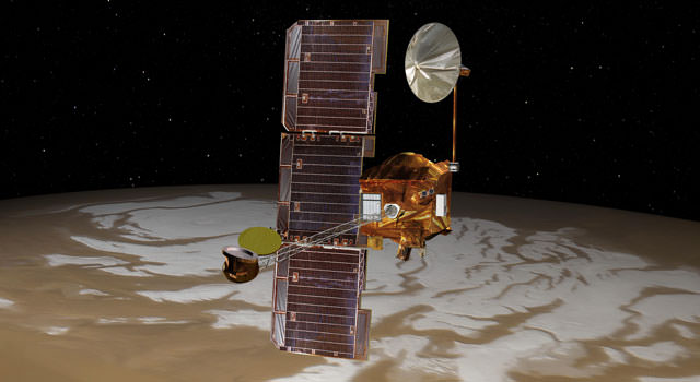
Just a few days ago, we posted about possibly salty water flows on Mars. Of note, the NASA press release noted, moisture is likely more prevalent in the morning and the Mars Reconnaissance Orbiter does most observations in the afternoon, local time. That’s too bad, we thought. But wait! It turns out that NASA Mars Odyssey spacecraft is going to change its orbit to get a better look.

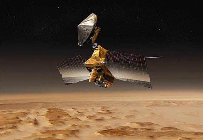
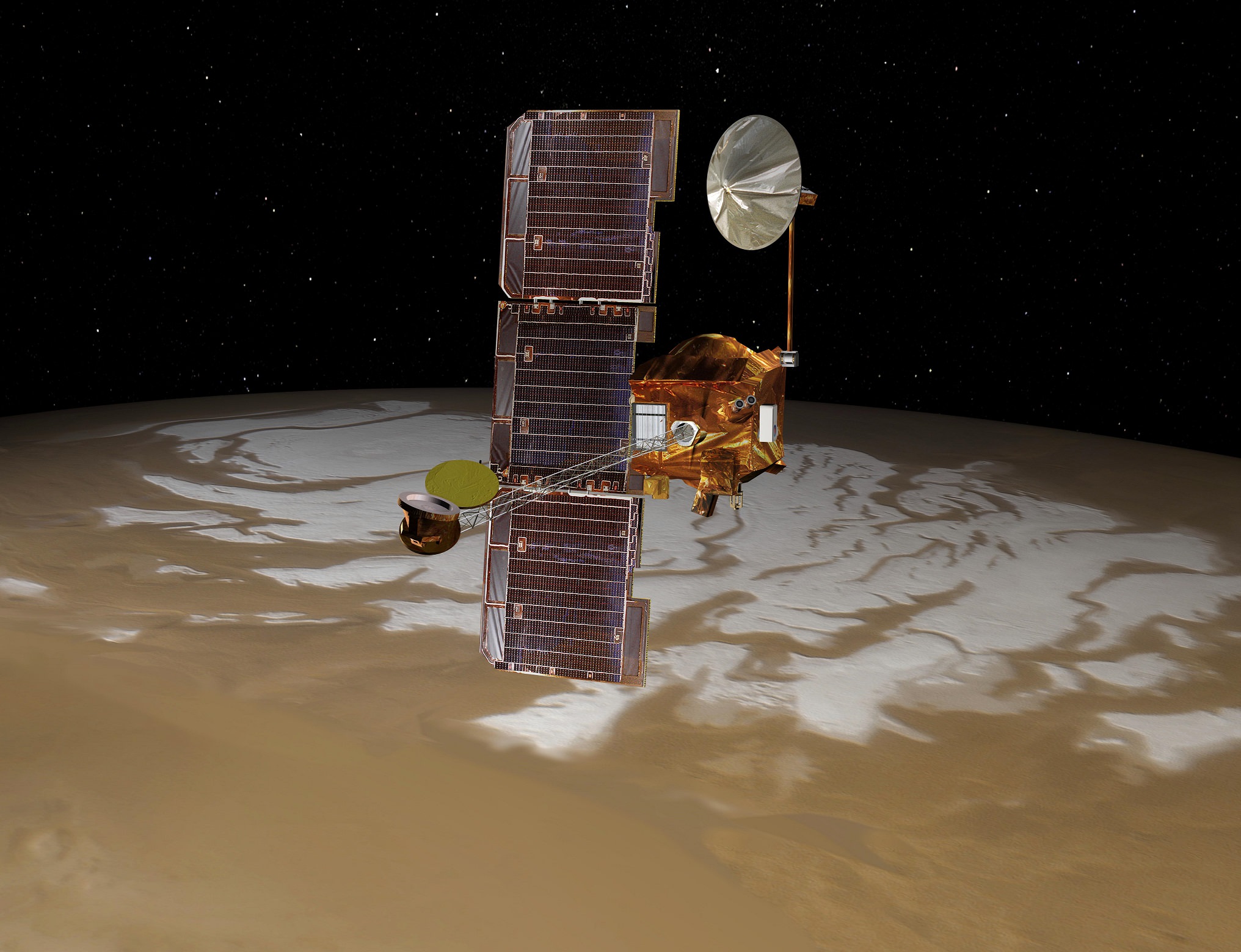
It’s going to take nearly two years for NASA to maneuver the long-running Odyssey to the right spot, but at that point mission managers expect the spacecraft still has another decade of observations ahead of it based on current fuel consumption. That’s great considering that the spacecraft has been beaming back images since 2001!

Odyssey will be the first spacecraft to do dedicated morning observations of the planet since any NASA orbiter of the 1970s, which dates observations back to the Viking era (except for a few glimpses by European Space Agency spacecraft and previous NASA orbiters). Advances in imaging mean we will get a far clearer view of the ground than ever before.

“The change will enable observation of changing ground temperatures after sunrise and after sunset in thousands of places on Mars,” NASA stated. “Those observations could yield insight about the composition of the ground and about temperature-driven processes, such as warm-season flows observed on some slopes, and geysers fed by spring thawing of carbon-dioxide ice near Mars’ poles.”

Morning water-ice clouds on Mars spotted by Viking 1 in 1976. Mars Odyssey's new orbit will reveal more of these types of morning observations. Credit: NASA/JPL
Morning water-ice clouds on Mars spotted by Viking 1 in 1976. Mars Odyssey’s new orbit will reveal more of these types of morning observations. Credit: NASA/JPL

The first maneuver took place Tuesday (Feb. 11) when a brief firing of Odyssey’s engines got the spacecraft pushing faster for an orbital shift. It will drift in that direction until November 2015, when controllers will do another maneuver to keep it in a stable location.

Right now, Odyssey is in a near-polar orbit that keeps local daylight at the same time below it. There have been a few changes to the timing over its dozen years of operation:

  • First six years (approx. 2001-2007): The orbit was mostly at 5 p.m. local solar time (as it flew north to south) and 5 a.m. local solar time on the south-to-north orbit. “That orbit provided an advantage for the orbiter’s Gamma Ray Spectrometer to have its cooling equipment pointed away from the sun,” NASA stated. At that time, the spectrometer found evidence of water ice, through the spectrum of hydrogen.
  • Next five years (approx. 2007-2012): The orbit shifted to 4 p.m. local solar time on north-to-south, and 4 a.m. south to north. While this allowed the Thermal Emission Imaging System to examine warm ground that made the mineral signatures in infrared pop out more easily, on the flip side of the planet Odyssey’s power system was under more strain because the solar panels couldn’t work as well in predawn light. Odyssey remained in that orbit until about the 2012 landing of the Curiosity rover, then was sent on a maneuver to move its orbit to later in the day to keep the battery functioning.
  • What’s next: Once Odyssey is in the right spot, the spacecraft will flip its daylight observations to scan the ground at 6:45 a.m. on the south-to-north part of the orbit. The spacecraft was in fact going in that direction already, but the new maneuver gets it there a bit sooner.

“We don’t know exactly what we’re going to find when we get to an orbit where we see the morning just after sunrise,” stated Philip Christensen of Arizona State University, who is THEMIS principal investigator and the person who suggested the move. “We can look for seasonal differences. Are fogs more common in winter or spring? We will look systematically. We will observe clouds in visible light and check the temperature of the ground in infrared.”

“We know that in places, carbon dioxide frost forms overnight,” he added. “And then it sublimates immediately after sunrise. What would this process look like in action? How would it behave? We’ve never observed this kind of phenomenon directly.”

Sources: NASA Jet Propulsion Laboratory and Arizona State University

How Much Science Data Has The Mars Reconnaissance Orbiter Sent To Earth?

Artist's conception of NASA's Mars Reconnaissance Orbiter. Credit: NASA/JPL

Imagine being able to watch three months’ worth of high-definition space video sequentially — maybe real-time coverage on the International Space Station, or getting to watch the Mars Reconnaissance Orbiter zoom across the Red Planet over and over again. Well, that’s how much science data MRO itself has sent back  in 10 years of operations, NASA said.

“The sheer volume is impressive, but of course what’s most important is what we are learning about our neighboring planet,” stated the Jet Propulsion Laboratory’s Rich Zurek, the project scientist for the Mars Reconnaissance Orbiter.

MRO has sent back 200 terabits, all told. It’s a wealth of science data on its own merits as it examined evidence of water, ancient volcanoes and other parts of the Red Planet’s history from above. The spacecraft, however, also serves as a relay for the NASA Curiosity and Opportunity rovers on the surface.

A crater imaged by the Mars Reconnaissance Orbiter's HiRISE (High Resolution Imaging Science Experiment). Credit: NASA/JPL/University of Arizona
A crater imaged by the Mars Reconnaissance Orbiter’s HiRISE (High Resolution Imaging Science Experiment). Credit: NASA/JPL/University of Arizona

“Data gathered by the orbiter’s instruments and relayed from rovers are recorded onto the orbiter’s central memory. Each orbit around Mars takes the spacecraft about two hours. For part of each orbit, Mars itself usually blocks the communication path to Earth,” NASA stated.

“When Earth is in view, a Deep Space Network antenna on whichever part of Earth is turned toward Mars at that hour can be listening. Complex preparations coordinate scheduling the use of the network’s antennas by all deep-space missions — 32 of them this month. Mars Reconnaissance Orbiter typically gets several sessions every day.”

Once the Deep Space Network antennas in Spain, California and Australia pick up the data, JPL organizes them into their separate “products”, ranging from radar measurements from above to data picked up by a rover below. The information is then sent to various organizations around the world that have interests in the work.

MRO arrived at Mars in 2006 and its mission has been extended three times, with the latest one taking place in 2012. NASA also relays information from the planet using Mars Odyssey, which has been there since 2002.

Source: NASA

Mars Armada Resumes Contact with NASA – Ready to Rock ‘n Roll n’ Drill

Curiosity accomplished historic 1st drilling into Martian rock at John Klein outcrop on Feb 8, 2013 (Sol 182), shown in this context mosaic view of the Yellowknife Bay basin taken on Jan. 26 (Sol 169) - back dropped with Mount Sharp - where the robot is currently working. Curiosity will bore a 2nd drill hole soon following the resumption of contact with the end of the solar conjunction period. Credit: NASA/JPL-Caltech/Ken Kremer/Marco Di Lorenzo

Curiosity accomplished historic 1st drilling into Martian rock at John Klein outcrop on Feb 8, 2013 (Sol 182), shown in this context mosaic view of the Yellowknife Bay basin taken on Jan. 26 (Sol 169) – back dropped with Mount Sharp – where the robot is currently working. Curiosity will bore a 2nd drill hole soon following the resumption of contact with the end of the solar conjunction period. Credit: NASA/JPL-Caltech/Ken Kremer/Marco Di Lorenzo
See drill hole and conjunction videos below[/caption]

After taking a well deserved and unavoidable break during April’s solar conjunction with Mars that blocked two way communication with Earth, NASA’s powerful Martian fleet of orbiters and rovers have reestablished contact and are alive and well and ready to Rock ‘n Roll ‘n Drill.

“Both orbiters and both rovers are in good health after conjunction,” said NASA JPL spokesman Guy Webster exclusively to Universe Today.

Curiosity’s Chief Scientist John Grotzinger confirmed to me today (May 1) that further drilling around the site of the initial John Klein outcrop bore hole is a top near term priority.

The goal is to search for the chemical ingredients of life.

“We’ll drill a second sample,” Grotzinger told Universe Today exclusively. Grotzinger, of the California Institute of Technology in Pasadena, Calif., leads NASA’s Curiosity Mars Science Laboratory mission.

“We’ll move a small bit, either with the arm or the wheels, and then drill another hole to confirm what we found in the John Klein hole.”

Earth, Mars and the Sun have been lined up in nearly a straight line for the past several weeks, which effectively blocked virtually all contact with NASA’s four pronged investigative Armada at the Red Planet.

NASA’s Red Planet fleet consists of the Curiosity (MSL) and Opportunity (MER) surface rovers as well as the long lived Mars Odyssey (MO) and Mars Reconnaissance Orbiter (MRO) robotic orbiters circling overhead. ESA’s Mars Express orbiter is also exploring the Red Planet.

“All have been in communications,” Webster told me today, May 1.

The NASA spacecraft are functioning normally and beginning to transmit the science data collected and stored in on board memory during the conjunction period when a commanding moratorium was in effect.

“Lots of data that had been stored on MRO during conjunction has been downlinked,” Webster confirmed to Universe Today.

Curiosity and Mount Sharp: Curiosity's elevated robotic arm and drill are staring back at you - back dropped by Mount Sharp, her ultimate destination.  The rover team anticipates new science discoveries following the resumption of contact with NASA after the end of solar conjunction.  This panoramic vista of Yellowknife Bay basin was snapped on March 23, Sol 223 prior to conjunction and assembled from several dozen raw images snapped by the rover's navigation camera system.  These images were snapped after the robot recovered from a computer glitch in late Feb and indicated she was back alive and functioning working normally. Credit: NASA/JPL-Caltech/Marco Di Lorenzo/KenKremer (kenkremer.com).
Curiosity and Mount Sharp: Curiosity’s elevated robotic arm and drill stare back at you at the John Klein drill site – back dropped by mysterious Mount Sharp. The rover has resumed contact with NASA following the end of solar conjunction. This panoramic vista was snapped on March 23, 2013, Sol 223. Credit: NASA/JPL-Caltech/Marco Di Lorenzo/KenKremer (kenkremer.com)

And NASA is already transmitting and issuing new marching orders to the Martian Armada to resume their investigations into unveiling the mysteries of the Red Planet and determine whether life ever existed eons ago or today.

“New commanding, post-conjunction has been sent to both orbiters and Opportunity.”

“And the sequence is being developed today for sending to Curiosity tonight (May 1), as scheduled more than a month ago,” Webster explained.

“We’ll spend the next few sols transitioning over to new flight software that gives the rover additional capabilities,” said Grotzinger.

“After that we’ll spend some time testing out the science instruments on the B-side rover compute element – that we booted to before conjunction.”

Curiosity is at work inside the Yellowknife Bay basin just south of the Martian equator. Opportunity is exploring the rim of Endeavour crater at the Cape York rim segment.

Opportunity Celebrates 9 Years and 3200 Sols on Mars snapping this panoramic view from her current location on ‘Matijevic Hill’ at Endeavour Crater. The rover discovered phyllosilicate clay minerals and calcium sulfate veins at the bright outcrops of ‘Whitewater Lake’, at right, imaged by the Navcam camera on Sol 3197 (Jan. 20, 2013). “Copper Cliff” is the dark outcrop, at top center. Darker “Kirkwood” outcrop, at left, is site of mysterious “newberries” concretions. Credit: NASA/JPL-Caltech/Cornell/Marco Di Lorenzo/Ken Kremer

Mars Solar Conjunction is a normal celestial event that occurs naturally about every 26 months. The science and engineering teams take painstaking preparatory efforts to insure no harm comes to the spacecraft during the conjunction period when they have no chance to assess or intervene in case problems arise.

So it’s great news and a huge relief to the large science and operations teams handling NASA’s Martian assets to learn that all is well.

Since the sun can disrupt and garble communications, mission controllers suspended transmissions and commands so as not to inadvertently create serious problems that could damage the fleet in a worst case scenario.

So what’s on tap for Curiosity and Opportunity in the near term ?

“For the first few days for Curiosity we will be installing a software upgrade.”

“For both rovers, the science teams will be making decisions about how much more to do at current locations before moving on,” Webster told me.

The Opportunity science team has said that the long lived robot has pretty much finished investigating the Cape York area at Endeavour crater where she made the fantastic discovery of phyllosilicates clay minerals that form in neutral water.

Signals from Opportunity received a few days ago on April 27 indicated that the robot had briefly entered a standby auto mode while collecting imagery of the sun.

NASA reported today that all operations with Opportunity was “back under ground control, executing a sequence of commands sent by the rover team”, had returned to normal and the robot exited the precautionary status.

Opportunity Celebrates 9 Years on Mars snapping this panoramic view of the vast expanse of 14 mile (22 km) wide Endeavour Crater from atop ‘Matijevic Hill’ on Sol 3182 (Jan. 5, 2013). The rover then drove 43 feet to arrive at ‘Whitewater Lake’ and investigate clay minerals. Photo mosaic was stitched from Navcam images and colorized. Credit: NASA/JPL-Caltech/Cornell/Ken Kremer/Marco Di Lorenzo

“The Curiosity team has said they want to do at least one more drilling in Yellowknife Bay area,” according to Webster.

Curiosity has already accomplished her primary task and discovered a habitable zone that possesses the key ingredients needed for potential alien microbes to once have thrived in the distant past on the Red Planet when it was warmer and wetter.

The robot found widespread evidence for repeated episodes of flowing liquid water, hydrated mineral veins and phyllosilicates clay minerals on the floor of her Gale Crater landing site after analyzing the first powder ever drilled from a Martian rock.

Video Caption: Historic 1st bore hole drilled by NASA’s Curiosity Mars rover on Sol 182 of the mission (8 Feb 2013). Credit: NASA/JPL-Caltech/MSSS/Marco Di Lorenzo/Ken Kremer (http://www.kenkremer.com/)

During conjunction Curiosity collected weather, radiation and water measurements but no imagery.

Check out this wonderful new story at Space.com featuring Curiosity mosaics by me and my imaging partner Marco Di Lorenzo and an interview with me.

Ken Kremer

Curiosity Rover snapped this self portrait mosaic with the MAHLI camera while sitting on flat sedimentary rocks at the “John Klein” outcrop where the robot conducted historic first sample drilling inside the Yellowknife Bay basin, on Feb. 8 (Sol 182) at lower left in front of rover. The photo mosaic was stitched from raw images snapped on Sol 177, or Feb 3, 2013, by the robotic arm camera - accounting for foreground camera distortion. Credit: NASA/JPL-Caltech/MSSS/Marco Di Lorenzo/KenKremer (kenkremer.com).
Curiosity Rover snapped this self portrait mosaic with the MAHLI camera while sitting on flat sedimentary rocks at the “John Klein” outcrop where the robot conducted historic first sample drilling inside the Yellowknife Bay basin, on Feb. 8 (Sol 182) at lower left in front of rover. The photo mosaic was stitched from raw images snapped on Sol 177, or Feb 3, 2013, by the robotic arm camera – accounting for foreground camera distortion. Credit: NASA/JPL-Caltech/MSSS/Marco Di Lorenzo/KenKremer (kenkremer.com).

Watch this brief NASA JPL video for an explanation of Mars Solar Conjunction.

Terran Fleet at Mars Takes a Break for Conjunction – Enjoy the Video and Parting View

Curiosity and Mount Sharp - Parting Shot ahead of Solar Conjunction. Enjoy this parting view of Curiosity's elevated robotic arm and drill are staring at you - back dropped with her ultimate destination - Mount Sharp - in this panoramic vista of Yellowknife Bay basin snapped on March 23, Sol 223, by the rover's navigation camera system. The raw images were stitched by Marco Di Lorenzo and Ken Kremer and colorized. Credit: NASA/JPL-Caltech/Marco Di Lorenzo/KenKremer (kenkremer.com). See video below explaining Mars Solar Conjunction

Curiosity and Mount Sharp – Parting Shot ahead of Mars Solar Conjunction
Enjoy this parting view of Curiosity’s elevated robotic arm and drill staring at you; back dropped with her ultimate destination – Mount Sharp – in this panoramic vista of Yellowknife Bay basin snapped on March 23, Sol 223, by the rover’s navigation camera system. The raw images were stitched by Marco Di Lorenzo and Ken Kremer and colorized. Credit: NASA/JPL-Caltech/Marco Di Lorenzo/KenKremer (kenkremer.com)
See video below explaining Mars Solar Conjunction[/caption]

Earth’s science invasion fleet at Mars is taking a break from speaking with their handlers back on Earth.

Why ? Because as happens every 26 months, the sun has gotten directly in the way of Mars and Earth.

Earth, Mars and the Sun are lined up in nearly a straight line. The geometry is normal and it’s called ‘Mars Solar Conjunction’.

Conjunction officially started on April 4 and lasts until around May 1.

From our perspective here on Earth, Mars will be passing behind the Sun.

Watch this brief NASA JPL video for an explanation of Mars Solar Conjunction.

Therefore the Terran fleet will be on its own for the next month since the sun will be blocking nearly all communications.

In fact since the sun can disrupt and garble communications, mission controllers will be pretty much suspending transmissions and commands so as not to inadvertently create serious problems that could damage the fleet in a worst case scenario.

Right now there are a trio of orbiters and a duo of rovers from NASA and ESA exploring Mars.

The spacecraft include the Curiosity (MSL) and Opportunity (MER) rovers from NASA. Also the Mars Express orbiter from ESA and the Mars Odyssey (MO) and Mars Reconnaissance Orbiter (MRO) from NASA.

Geometry of Mars Solar Conjunction

Because several of these robotic assets have been at Mars for nearly 10 years and longer, the engineering teams have a lot of experience with handling them during the month long conjunction period.

“This is our sixth conjunction for Odyssey,” said Chris Potts of JPL, mission manager for NASA’s Mars Odyssey, which has been orbiting Mars since 2001. “We have plenty of useful experience dealing with them, though each conjunction is a little different.”

But there is something new this go round.

“The biggest difference for this 2013 conjunction is having Curiosity on Mars,” Potts said. Odyssey and the Mars Reconnaissance Orbiter relay almost all data coming from Curiosity and the Mars Exploration Rover Opportunity, as well as conducting the orbiters’ own science observations.

The rovers and orbiters can continue working and collecting science images and spectral data.

But that data will all be stored in the on board memory for a post-conjunction playback starting sometime in May.

Ken Kremer

…………….

Learn more about Curiosity’s groundbreaking discoveries and NASA missions at Ken’s upcoming lecture presentations:

April 20/21 : “Curiosity and the Search for Life on Mars – (in 3-D)”. Plus Orion, SpaceX, Antares, the Space Shuttle and more! NEAF Astronomy Forum, Suffern, NY

April 28: “Curiosity and the Search for Life on Mars – (in 3-D)”. Plus the Space Shuttle, SpaceX, Antares, Orion and more. Washington Crossing State Park, Titusville, NJ, 130 PM

Take a Trip to Explore Gale Crater

Mount Sharp Compared to Three Big Mountains on Earth

Images from the Curiosity rover on Mars are truly spectacular but a large mosaic from the THEMIS camera aboard NASA’s Mars Odyssey orbiter gives a grand perspective of our new foothold on Mars. Take some time to rove and explore Gale Crater.

The viewer, created using a web-imaging technology from Zoomify, is set to move between points of interest, such as Mars Science Laboratory’s landing site in Aeolis Palus, Glenelg, and Aeolis Mons/Mount Sharp itself. The layered sediments flanking Mount Sharp make it the primary target for Curiosity’s two-year mission. Take control at anytime by clicking on the image. This will stop the automatic roving and leave you in control to explore the terrain of Gale Crater. Use your mouse or the toolbar controls to pan and zoom around the image. You can also use the dropdown in the upper right to take you directly to certain points of interest in the image. Over time, we will add to this interactive feature as more geological points of interest are identified.

THEMIS stands for Thermal Emission Imaging System which is a multiband visible and infrared camera aboard Odyssey. The comprehensive mosaic is pieced together from 205 individual scenes, most taken recently but some dating to 2002 shortly after Odyssey entered Mars orbit in 2001. These images were taken before MSL landed on Mars. Even so, as large as the SUV-sized rover is, it would be too small to see in these images. The smallest details in this image are 18 meters or 60 feet across.

This illustration shows the size of Aoelis Mons (Mount Sharp) in comparison to three large mountains on Earth. The elevation of Mount Sharp is given in kilometers above the floor of Gale Crater. The heights of the Earth mountains are given in kilometers above sea level. Image credit: Tanya Harrison, NASA/JPL-Caltech/MSSS

Gale Crater is 154 kilometers (96 miles) wide. Near the center rises Aeolis Mons, a 5 km (3 mile) high mound of layered sediments, informally dubbed Mount Sharp, after planetary geologist Robert Sharp who died in 2004. Scientists for a time referred to the conical mountain as “The Mound.” The mountain, which would stand among the highest on Earth, cannot be seen from Earth and was unknown before planetary probes visited the Red Planet.

“The reason we decided to assemble such a large, comprehensive mosaic of Gale Crater was to give ourselves a better sense of the context around the landing site, said Jonathon Hill, a Mars research at Arizona State University who assembled the mosaic, a press release. “This will help us to better understand what Curiosity sees and measures as it roves the surface.”

Gale Crater zoom tour created by John Williams (TerraZoom) using Zoomify.

About the author: John Williams is owner of TerraZoom, a Colorado-based web development shop specializing in web mapping and online image zooms. He also writes the award-winning blog, StarryCritters, an interactive site devoted to looking at images from NASA’s Great Observatories and other sources in a different way. A former contributing editor for Final Frontier, his work has appeared in the Planetary Society Blog, Air & Space Smithsonian, Astronomy, Earth, MX Developer’s Journal, The Kansas City Star and many other newspapers and magazines.

T Minus 9 Days – Mars Orbiters Now in Place to Relay Critical Curiosity Landing Signals

Image Caption: NASA’s Mars Odyssey will relay near real time signals of this artist’s concept depicting the moment that NASA’s Curiosity rover touches down onto the Martian surface. NASA’s Mars Reconnaissance Orbiter (MRO) and ESA’s Mars Express (MEX) orbiter will also record signals from Curiosity for later playback, not in real time. Credit: NASA

It’s now just T minus 9 Days to the most difficult and complex Planetary science mission NASA has ever attempted ! The potential payoff is huge – Curiosity will search for signs of Martian life

The key NASA orbiter at Mars required to transmit radio signals of a near real-time confirmation of the August 5/6 Sunday night landing of NASA’s car sized Curiosity Mars Science Lab (MSL) rover is now successfully in place, and just in the nick of time, following a successful thruster firing on July 24.

Odyssey will transmit the key signals from Curiosity as she plunges into the Martian atmosphere at over 13,000 MPH (21,000 KPH) to begin the harrowing “7 Minutes of Terror” known as “Entry, Descent and Landing” or EDL – all of which is preprogrammed !

Engines aboard NASA’s long lived Mars Odyssey spacecraft fired for about 6 seconds to adjust the orbiters location about 6 minutes ahead in its orbit. This will allow Odyssey to provide a prompt confirmation of Curiosity’s landing inside Gale crater at about 1:31 a.m. EDT (531 GMT) early on Aug. 6 (10:31 p.m. PDT on Aug. 5) – as NASA had originally planned.

Without the orbital nudge, Odyssey would have arrived over the landing site about 2 minutes after Curiosity landed and the signals from Curiosity would have been delayed.

A monkey wrench was recently thrown into NASA relay signal plans when Odyssey unexpectedly went into safe mode on July 11 and engineers weren’t certain how long recovery operations would take.

“Information we are receiving indicates the maneuver has completed as planned,” said Mars Odyssey Project Manager Gaylon McSmith of NASA’s Jet Propulsion Laboratory, Pasadena, Calif. “Odyssey has been working at Mars longer than any other spacecraft, so it is appropriate that it has a special role in supporting the newest arrival.”

Odyssey has been in orbit at Mars since 2001 conducting orbital science investigations.

Read my review article on Odyssey’s science discoveries – here

Odyssey serves as the primary communications relay for NASA’s other recent surface explorers – Opportunity, Spirit and Phoenix. Opportunity recently passed 3000 Sols of continuous operations.

Two other Mars orbiters, NASA’s Mars Reconnaissance Orbiter and the European Space Agency’s Mars Express, also will be in position to receive radio transmissions from the Mars Science Laboratory during its descent. However, they will be recording information for later playback, not relaying it immediately, as only Odyssey can.

“We began optimising our orbit several months ago, so that Mars Express will have an orbit that is properly “phased” and provides good visibility of MSL’s planned trajectory,” says Michel Denis, Mars Express Spacecraft Operations Manager.

Mars Express has been orbiting the planet since December 2003.


Image Caption: Mars Express supports Curiosity MSL. Credit: ESA

“NASA supported the arrival of Mars Express at Mars in 2003, and, in the past few years, we have relayed data from the rovers Spirit and Opportunity,” says ESA’s Manfred Warhaut, Head of Mission Operations.

“Mars Express also tracked the descent of NASA’s Phoenix lander in 2008 and we routinely share our deep space networks.

“Technical and scientific cooperation at Mars between ESA and NASA is a long-standing and mutually beneficial activity that helps us both to reduce risk and increase the return of scientific results.”

Watch NASA TV online for live coverage of Curiosity landing: mars.jpl.nasa.gov or www.nasa.gov

Ken Kremer

Problems with Mars Odyssey Could Impact Telemetry for Curiosity Rover’s Landing

Caption: NASA’s Mars Odyssey spacecraft passes above Mars’ south pole in this artist’s illustration. The spacecraft has been orbiting Mars since October 24, 2001. Image credit: NASA/JPL

The “seven minutes of terror” could stretch into a longer time of trepidation for the hopeful Mars rover team and fans waiting back on Earth to find out if the Curiosity rover has landed safely. A problem with the Mars Odyssey orbiter means there could be a delay in the telemetry relayed to Earth as the Mars Science Laboratory descends and lands on Mars on August 5/6, 2012.

“There’s no impact to landing itself,” said NASA’s Mars exploration program chief Doug McCuistion at a press briefing on Monday. “It’s simply how that data gets returned to us and how timely that data is.”

McCuistion said the Odyssey team is assessing why the orbiter has gone into safe mode several times since early June, as well as having problems with its attitude control system. The glitches possibly could mean the spacecraft may not be in position to track and relay real-time data from MSL as it descends through Mars’ atmosphere and lands, possibly delaying the telemetry to Earth by several hours.

Curiosity’s automated landing sequence won’t be affected; it’s just that the data won’t be sent immediately – and the 14-minute communications lag between Earth and Mars means that the MSL team won’t be getting real-time updates about the rover’s perilous journey anyway; however, now it might be an even longer delay.

Caption: This artist’s concept from an animation depicts Curiosity, the rover to be launched in 2011 by NASA’s Mars Science Laboratory, as it is being lowered by the mission’s rocket-powered descent stage during a critical moment of the “sky crane” landing in 2012. Image Credit: NASA/JPL-Caltech

The rover is scheduled to land at 10:31 p.m. PDT on Aug. 5 (05:31 UTC, 1:31 a.m. EDT on Aug. 6).

Under normal circumstances, it’s a challenge for the orbiters to get in position to welcome another spacecraft to Mars, and provide tracking data and telemetry relay.

“If we were not to do anything, the Mars’ orbiting spacecraft may be on the other side of the planet,” said MSL navigation team chief Tomas Martin-Mur, during a previous interview with UT. “So as soon as we launch, we tell the other spacecraft where we are going to be by the time of entry so they can change their orbits over time, so they will be flying overhead as MSL approaches the planet.”

The orbiters – which also includes NASA’s Mars Reconnaissance Orbiter and ESA’s Mars Express – have been doing special maneuvers to be aligned in just the right place, nearby to MSL’s point of entry into Mars’ atmosphere.

But the glitches for Odyssey means it may not be in the right place.

MRO will be attempting to image the rover as it descends and lands — with possible hopes of catching the rover as it is descending on the “sky-crane” landing system — but MRO can only record data for later playback, whereas Odyssey could provide immediate relay. Mars Express won’t be aligned to see the last minute of flight, McCuistion said.

The Odyssey orbiter put itself in the precautionary, Earth-pointed status called safe mode on July 11, as it finished a maneuver adjusting, or trimming, its orbit. Odyssey’s computer did not reboot, so diagnostic information was subsequently available from the spacecraft’s onboard memory. Based on analysis of that information, the mission’s controllers sent commands yesterday morning taking Odyssey out of safe mode and reorienting it to point downward at Mars.

“We are on a cautious path to resume Odyssey’s science and relay operations soon,” said Gaylon McSmith, Odyssey project manager. “We will also be assessing whether another orbit trim maneuver is warranted.”

The landing is one of the most perilous times for a rover. “Those seven minutes are the most challenging part of this entire mission,” said Pete Theisinger, MSL’s project manager. “For the landing to succeed, hundreds of events will need to go right, many with split-second timing and all controlled autonomously by the spacecraft. We’ve done all we can think of to succeed. We expect to get Curiosity safely onto the ground, but there is no guarantee. The risks are real.”

We’ll provide updates as to Odyssey’s status. Here’s a look at the seven minutes of terror MSL will experience:

Sources: JPL, NASA

New Analysis of Clay Deposits in Ancient Martian Lakes

Map of 226 ancient lakes on Mars. Credit: Goudge, T.A., Head, J.W., Mustard, J.F. and Fassett, C.I./MOLA/NASA

[/caption]

Mars was once a much wetter world than it is now, with hot springs, rivers, lakes and perhaps even oceans. Just how wet exactly, and for how long, is still a subject of considerable debate. One vital clue comes from clay mineral deposits and sediments left over after the water disappeared, but still visible now. They provide a valuable insight into what Mars used to be like, and why it is the cold, dry place we see today.

A team of scientists from Brown University has just completed a new study of ancient lake beds on Mars, specifically looking at the clay deposits within them, to try to determine how many of these lakes still contain such deposits and their composition. So what do they tell us about conditions on early Mars? How does this affect the search for evidence of life?

As it turns out, about a third of the lake beds examined still show evidence for clay deposits. A total of 79 lake beds out of 226 studied to be exact, indicating that they are less common on Mars than on Earth. The reason for this may be that the chemistry of the water was not ideal for preserving clays or that the lakes were relatively short-lived.

The paper was just published in Icarus on March 2, 2012.

From the abstract:

“These results indicate that hydrated and evaporite minerals are not as commonly associated with lacustrine deposits on Mars as they are on Earth. This suggests in situ alteration and mineral precipitation, a common source of such minerals in terrestrial lakes, was not a major process occurring in these paleolacustrine systems, and that the observed minerals are likely to be present as transported material within the lacustrine deposits. The lack of widespread in situ alteration also suggests that either the water chemistry in these paleolake systems was not conducive to aqueous alteration and mineral precipitation, or that the open-basin lake systems were relatively short-lived.”

Images for the study came from the Mars Reconnaissance Orbiter, Mars Odyssey and Mars Express spacecraft.

Clay deposits have become a primary focus of study by orbiters and rovers, as they could preserve fossil traces of early life, just as they do on Earth. Even if they are less common on Mars, the fact that they do exist there is exciting, and there is now much interest in exploring them further. Apart from underground, they are the best places to look for such evidence of life. It is also possible that additional deposits have been buried underground, waiting to be discovered.

The Opportunity rover is currently very close to a treasure trove of clays in Endeavour crater, and it is expected to head straight for them after its winter “hibernation” is over in the next few months. The Curiosity rover, en route to Mars right now, will land in Gale crater next July, where there are also clay deposits near the base of a mountainous peak within the crater. Gale crater is thought to be another site of a former Martian lake.

The abstract is available here (with full paper available for purchase).

Today’s Martian Weather: Partly Cloudy

Clouds obscure the surface of Mars (NASA/JPL/ASU)

[/caption]

Changing seasons in Mars’ northern hemisphere brings a change in the weather, and the clouds have rolled in to cover part of the polar surface in this intriguing image from the Mars Odyssey spacecraft.

Mars Odyssey’s THEMIS visual imager (VIS) captured this image on Jan. 24, 2012, as it passed over the Red Planet’s northern pole during one of its 2-hour-long orbits.

Clouds on Mars have been seen before, both from orbit and from the surface. They are made up of fine water ice particles and are usually at altitudes of 10 to 15 km high. Read more about Martian weather here.

The full THEMIS scan of the area is below.

Martian polar clouds as seen by THEMIS

The area imaged is about 21 km wide by 73 km high  (13 x 45 miles).

Image credit: NASA / JPL / Arizona State University. Hat-tip to Mr. Bill Dunford at Riding With Robots (@ridingrobots). 

Best Class Project Ever: 7th Graders Find a Cave on Mars

Sixteen seventh-graders at Evergreen Middle School in Cottonwood, Calif., found the Martian pit feature at the center of the superimposed red square in this image. Image Credit: NASA/JPL-Caltech/ASU

[/caption]

Tip number one on “How to impress your classmates:” Find a mysterious cave on Mars. A group of 16 seventh-graders at Evergreen Middle School in Cottonwood, California, USA found a dark pit that appears to be an opening to a cave on Mars. Dennis Mitchell’s science class were examining Martian lava tubes as their project in the Mars Student Imaging Program offered by NASA and Arizona State University, which takes advantage of the huge database of images taken by the Mars Odyssey spacecraft. The students found the skylight pit on the slope of an equatorial volcano named Pavonis Mons, and it appears to be an entrance to an underground lava tube. Similar ‘cave skylight’ features have been found elsewhere on Mars, but this is the first seen on this volcano.

“The students developed a research project focused on finding the most common locations of lava tubes on Mars,” Mitchell said. “Do they occur most often near the summit of a volcano, on its flanks or the plains surrounding it?”

Mitchell said he and his students have been surprised how much interest there has been nation-wide in their discovery. “They were kind of shocked about the interest, and I think that they are just now starting to realize that they made a pretty neat discovery.”

The imaging program allows students in upper elementary grades through to college to participate in Mars research by having them develop a geological question to answer, and then directing the teams for the Mars-orbiting camera to take an image to answer their question. Since MSIP began in 2004, more than 50,000 students have participated.

Now, because of this find, the HiRISE high resolution camera on the Mars Reconnaissance Orbiter will take follow-up images of the pit to provide a better look at the object. HiRISE can image the surface at about 30 centimeters (12 inches) per pixel, which may allow a look inside the hole in the ground. This is part of the HiWISH program, where the public can submit suggestions to the science team for locations on Mars to the camera to image.

“It gives the students a good understanding of the way research is conducted and how that research can be important for the scientific community. This has been a wonderful experience,” Mitchell said.”

“Yeah it was a lot of fun because it wasn’t like any other science that we did, because we actually got to interact with real scientists instead of just people out of the book and stuff,” said 13-year-old Kody Rulofson, one of the students in Mitchell’s class.

Kody’s mother, Doni Rulofson said Kody and his twin brother Chase, also in the class, are inspired by the experience they had finding the cave. “They’re excited. They’re just beyond belief, they’re like, ‘we knew it was something really cool but we had no idea it was this much of an interest to NASA.'”

Odyssey has been orbiting the Red Planet since 2001, returning data and images of the Martian surface and providing relay communications service for Mars Rovers Spirit and Opportunity. Find out more about Odyssey here.

MRO has been in orbit since 2006, and has also amassed a huge database of images, which can be seen here.

Source: NASA