10 Years & Top 10 Discoveries from Marvelous Mars Express

Mars Express over water-ice crater. ESA Celebrates 10 Years since the launch of Mars Express. This artists concept shows Mars Express set against a 35 km-wide crater in the Vastitas Borealis region of Mars at approximately 70.5°N / 103°E. The crater contains a permanent patch of water-ice that likely sits upon a dune field – some of the dunes are exposed towards the top left in this image. Copyright ESA/DLR/FU-Berlin-G.Neukum

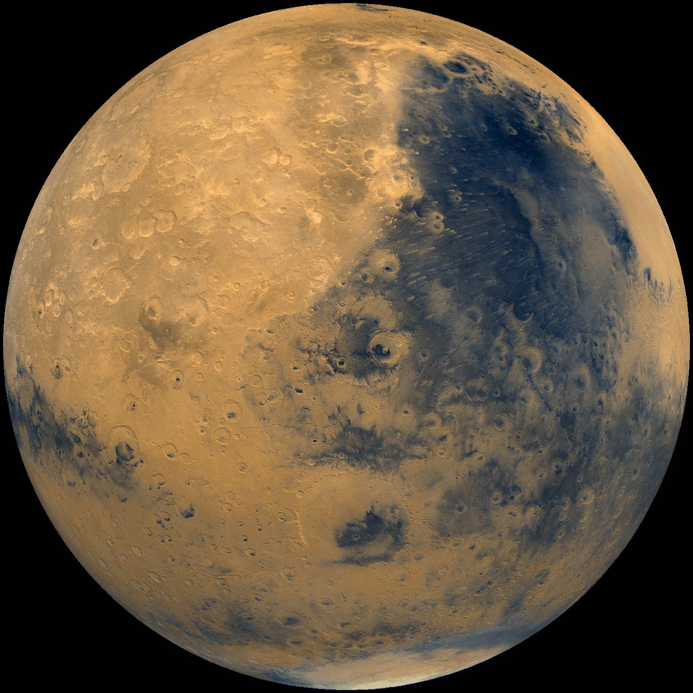
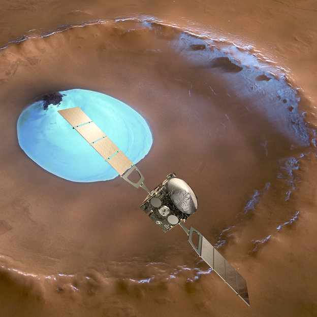
This week marks the 10th anniversary since the launch of the European Space Agencies’ (ESA) Mars Express orbiter from the Baikonur Cosmodrome in Russia on June 2, 2003 and a decade of ground breaking science discoveries at the Red Planet.

2003 was a great year for Mars exploration as it also saw the dual liftoffs of NASA’s now legendary rovers Spirit & Opportunity from Cape Canaveral in Florida.

The immense quantity and quality of science data returned from Mars Express -simultaneously with Spirit and Opportunity – has completely transformed our understanding of the history and evolution of the Red Planet.

All three spacecraft have functioned far beyond their original design lifetime.

Earth’s exploration fleet of orbiters, landers and rovers have fed insights to each other that vastly multiplied the science output compared to working solo during thousands and thousands of bonus Sols at Mars.

Inside a central pit crater.  Perspective view of a 50 km diameter crater in Thaumasia Planum. The image was made by combining data from the High-Resolution Stereo Camera on ESA’s Mars Express with digital terrain models. The image was taken on 4 January 2013, during orbit 11467, and shows a close up view of the central ‘pit’ of this crater, which likely formed by a subsurface explosion as the heat from the impact event rapidly vapourised water or ice lying below the surface. Copyright ESA/DLR/FU-Berlin-G.Neukum
Inside a central pit crater. Perspective view of a 50 km diameter crater in Thaumasia Planum. The image was made by combining data from the High-Resolution Stereo Camera on ESA’s Mars Express with digital terrain models. The image was taken on 4 January 2013, during orbit 11467, and shows a close up view of the central ‘pit’ of this crater, which likely formed by a subsurface explosion as the heat from the impact event rapidly vapourised water or ice lying below the surface. Copyright ESA/DLR/FU-Berlin-G.Neukum

Mars Express derived its name from an innovative new way of working in planetary space science that sped up the development time and cut costs in the complex interactive relationships between the industrial partners, space agencies and scientists.

Indeed the lessons learned from building and operating Mars Express spawned a sister ship, Venus Express that also still operates in Venusian orbit.

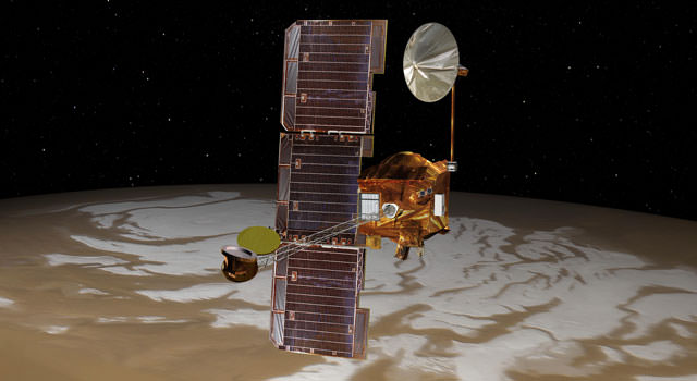
Mars Express (MEX) achieved orbit in December 2003.

MEX began science operations in early 2004 with an array of seven instruments designed to study all aspects of the Red Planet, including its atmosphere and climate, and the mineralogy and geology of the surface and subsurface with high resolution cameras, spectrometers and radar.

The mission has been granted 5 mission extensions that will carry it to at least 2014.

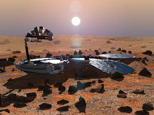
The mission has been wildly successful except for the piggybacked lander known as Beagle 2, which was British built.

Beagle 2
Beagle 2
The ambitious British lander was released from the mothership on December 19, 2003, six days before MEX braked into orbit around Mars. Unfortunately the Beagle 2 was never heard from again as it plummeted to the surface and likely crashed.

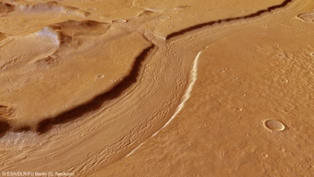
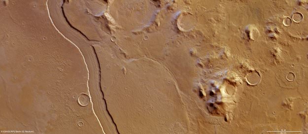
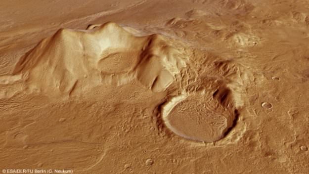
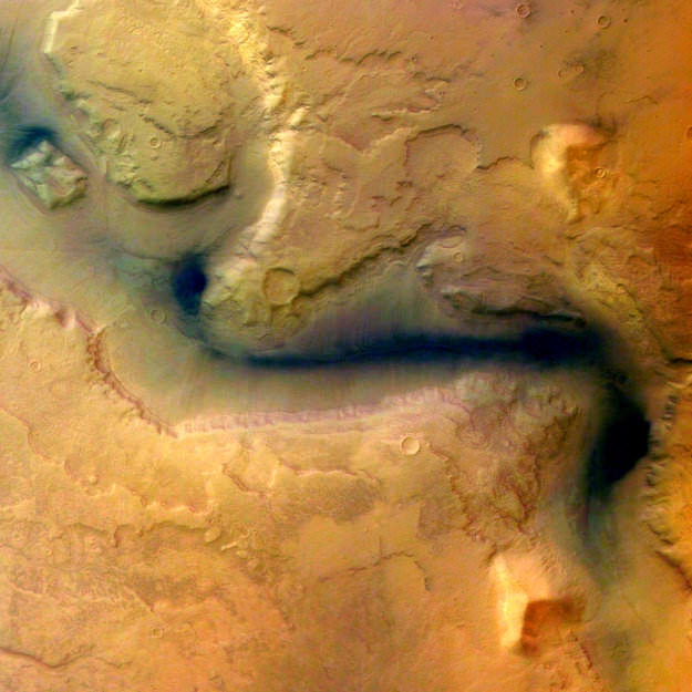
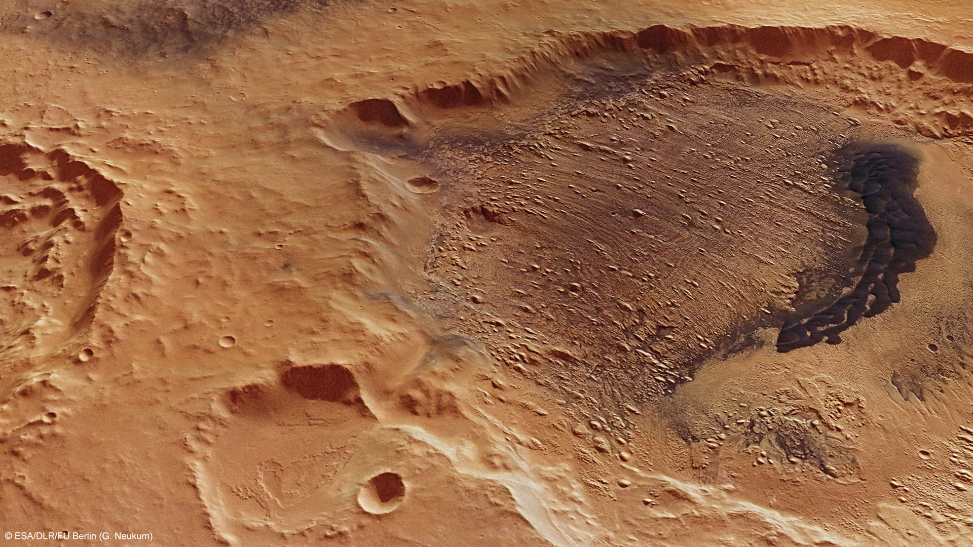
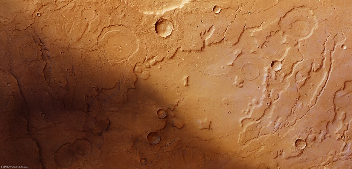
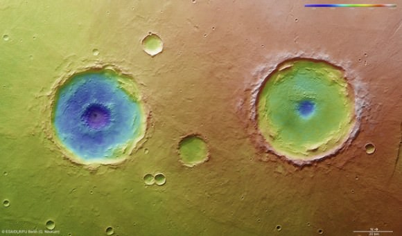
The high resolution camera (HRSC) has transmitted thousands of dramatic 3D images all over Mars ranging from immense volcanoes, steep-walled canyons, dry river valleys, ancient impact craters of all sizes and shapes and the ever-changing polar ice caps.

It carried the first ever radar sounder (MARSIS) to orbit another planet and has discovered vast caches of subsurface water ice.

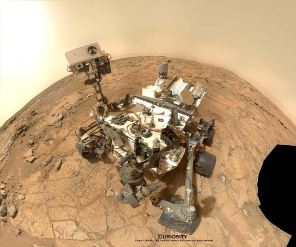
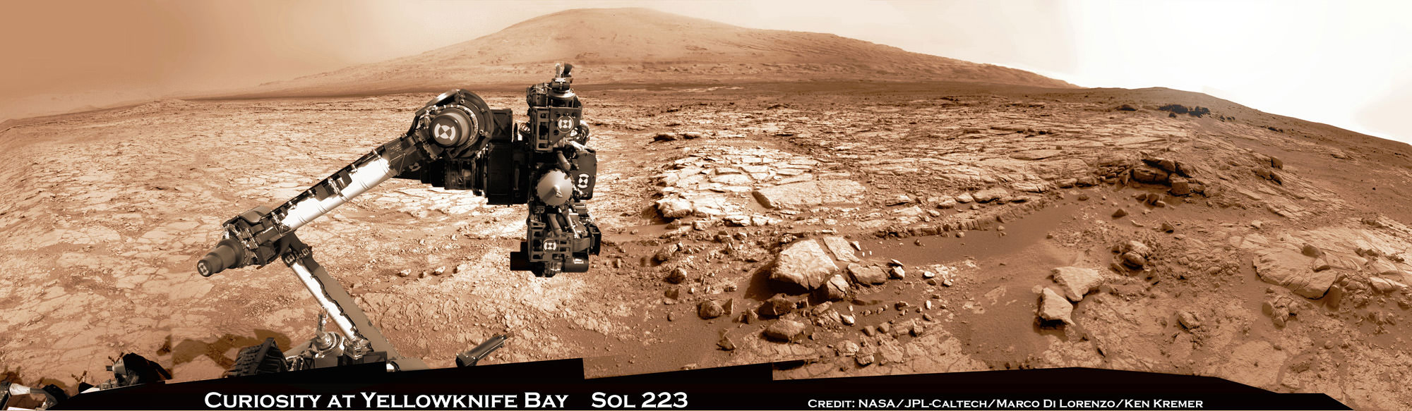
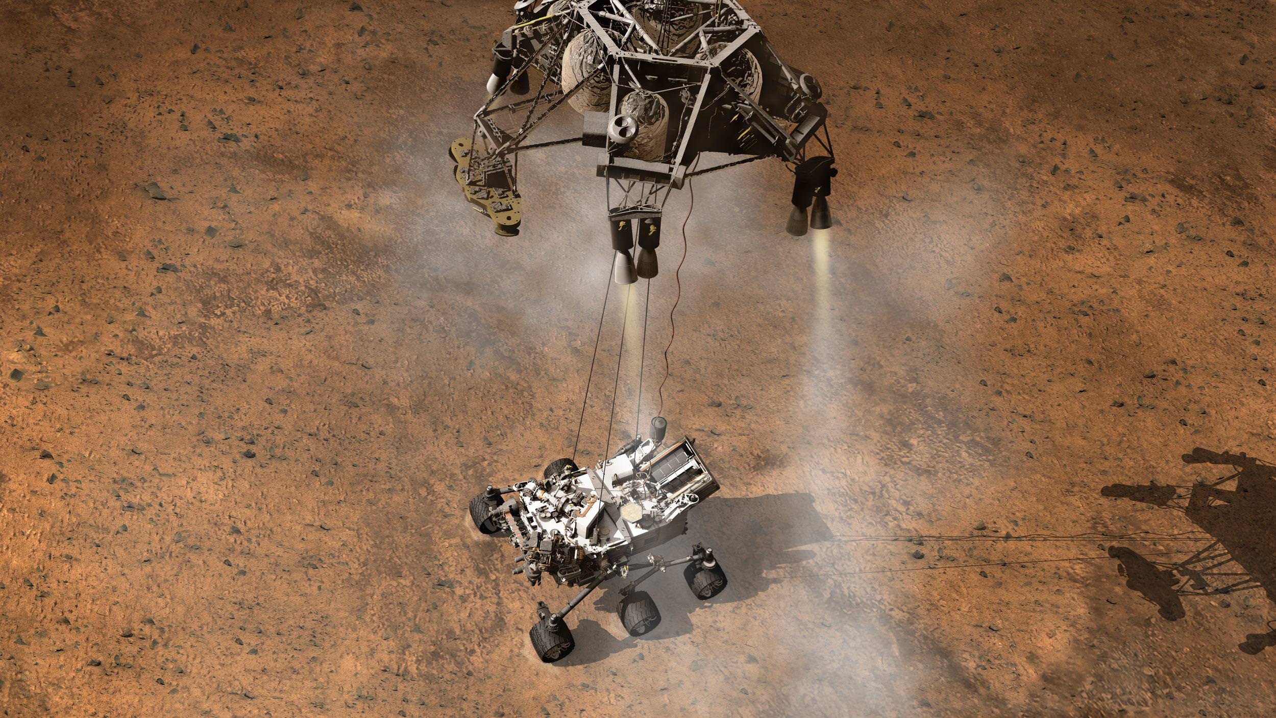
MEX also played a significant role as a data relay satellite for transmissions during the landings of NASA’s Phoenix lander and Curiosity rover. It also occasionally relays measurements from Spirit & Opportunity to NASA.

Arima twins topography. This colour-coded overhead view is based on an ESA Mars Express High-Resolution Stereo Camera digital terrain model of the Thaumasia Planum region on Mars at approximately 17°S / 296°E. The image was taken during orbit 11467 on 4 January 2013. The colour coding reveals the relative depth of the craters, in particular the depths of their central pits, with the left-hand crater penetrating deeper than the right (Arima crater).  Copyright: ESA/DLR/FU-Berlin-G.Neukum
Arima twins topography. This colour-coded overhead view is based on an ESA Mars Express High-Resolution Stereo Camera digital terrain model of the Thaumasia Planum region on Mars at approximately 17°S / 296°E. The image was taken during orbit 11467 on 4 January 2013. The colour coding reveals the relative depth of the craters, in particular the depths of their central pits, with the left-hand crater penetrating deeper than the right (Arima crater). Copyright: ESA/DLR/FU-Berlin-G.Neukum

Here is a list of the Top 10 Discoveries from Mars Express from 2003 to 2013:

Mars Express mineralogy maps. This series of five maps shows near-global coverage of key minerals that help plot the history of Mars. The map of hydrated minerals indicates individual sites where a range of minerals that form only in the presence of water were detected. The maps of olivine and pyroxene tell the story of volcanism and the evolution of the planet’s interior. Ferric oxides, a mineral phase of iron, are present everywhere on the planet: within the bulk crust, lava outflows and the dust oxidised by chemical reactions with the martian atmosphere, causing the surface to ‘rust’ slowly over billions of years, giving Mars its distinctive red hue. Copyright:  ESA/CNES/CNRS/IAS/Université Paris-Sud, Orsay; NASA/JPL/JHUAPL; Background images: NASA MOLA
Mars Express mineralogy maps. This series of five maps shows near-global coverage of key minerals that help plot the history of Mars. The map of hydrated minerals indicates individual sites where a range of minerals that form only in the presence of water were detected. The maps of olivine and pyroxene tell the story of volcanism and the evolution of the planet’s interior. Ferric oxides, a mineral phase of iron, are present everywhere on the planet: within the bulk crust, lava outflows and the dust oxidised by chemical reactions with the martian atmosphere, causing the surface to ‘rust’ slowly over billions of years, giving Mars its distinctive red hue. Copyright: ESA/CNES/CNRS/IAS/Université Paris-Sud, Orsay; NASA/JPL/JHUAPL; Background images: NASA MOLA
#1. First detection of hydrated minerals in the form of phyllosilicates and hydrated sulfates – evidence of long periods of flowing liquid water from the OMEGA visible and infrared spectrometer provided confirmation that Mars was once much wetter than it is today and may have been favorable for life to evolve.

#2. Possible detection of methane in the atmosphere from the Planetary Fourier Spectrometer (PFS) which could originate from biological or geological activity.

#3. Identification of recent glacial landforms via images from the High Resolution Stereo Camera (HRSC) are stem from viscous flow features composed of ice-rich material derived from adjacent highlands.

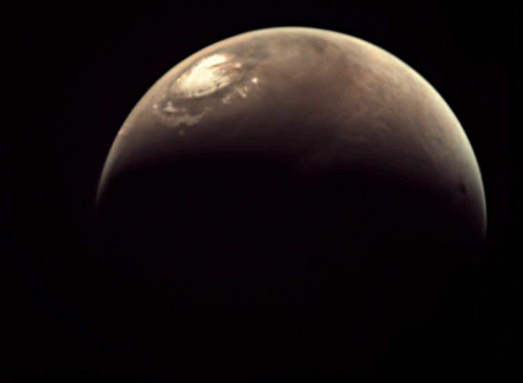
#4. Probing the polar regions. OMEGA and MARSIS determined that the south pole consists of a mixture frozen water ice and carbon dioxide. If all the polar ice melted the planet would be covered by an ocean 11 meters deep.

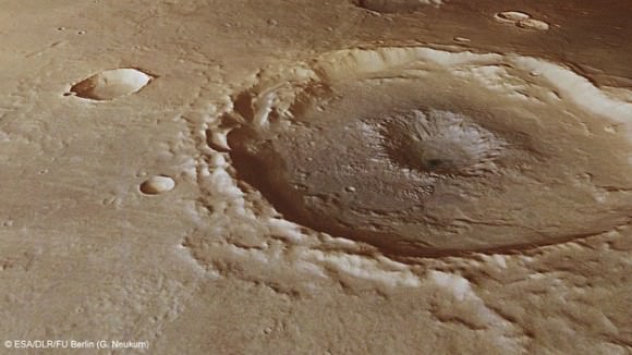
#5. Recent and episodic volcanism perhaps as recently as 2 million years ago. Mars has the largest volcanoes in the solar system . They are a major factor in the evolution of the martian surface, atmosphere and climate.

#6. Estimation of the current rate of atmospheric escape, helps researchers explain how Mars changed from a warm, wet place to the cold, dry place it is today.

#7. Discovery of localised aurora on Mars

#8. A new, meteoric layer in the martian ionosphere created by fast-moving cosmic dust which burns up as it hits the atmosphere.

#9. Unambiguous detection of carbon dioxide clouds. The freezing and vaporisation of CO2 is one of the main climatic cycles of Mars, and it controls the seasonal variations in surface air pressure.

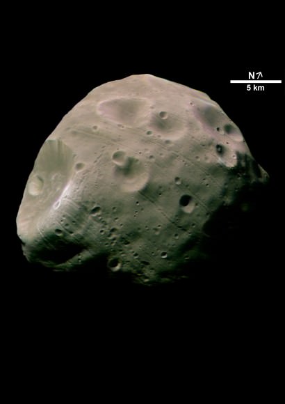
#10. Unprecedented probing of the Martian moon Phobos – which could be a target for future landers and human missions.

The Mars-facing side of Phobos. Credit: ESA/DLR/FU Berlin (G. Neukum)

And don’t forget to “Send Your Name to Mars” aboard NASA’s MAVEN orbiter- details here. Deadline: July 1, 2013

Ken Kremer

…………….
Learn more about Conjunctions, Mars, Curiosity, Opportunity, MAVEN, LADEE, CIBER and NASA missions at Ken’s upcoming lecture presentations

June 11: “Send your Name to Mars on MAVEN” and “LADEE Lunar & Antares Rocket Launches from Virginia”; NJ State Museum Planetarium and Amateur Astronomers Association of Princeton (AAAP), Trenton, NJ, 730 PM.

June 12: “Send your Name to Mars on MAVEN” and “LADEE Lunar & Antares Rocket Launches from Virginia”; Franklin Institute and Rittenhouse Astronomical Society, Philadelphia, PA, 8 PM.

June 23: “Send your Name to Mars on MAVEN” and “CIBER Astro Sat, LADEE Lunar & Antares Rocket Launches from Virginia”; Rodeway Inn, Chincoteague, VA, 8 PM

Mars Armada Resumes Contact with NASA – Ready to Rock ‘n Roll n’ Drill

Curiosity accomplished historic 1st drilling into Martian rock at John Klein outcrop on Feb 8, 2013 (Sol 182), shown in this context mosaic view of the Yellowknife Bay basin taken on Jan. 26 (Sol 169) - back dropped with Mount Sharp - where the robot is currently working. Curiosity will bore a 2nd drill hole soon following the resumption of contact with the end of the solar conjunction period. Credit: NASA/JPL-Caltech/Ken Kremer/Marco Di Lorenzo

Curiosity accomplished historic 1st drilling into Martian rock at John Klein outcrop on Feb 8, 2013 (Sol 182), shown in this context mosaic view of the Yellowknife Bay basin taken on Jan. 26 (Sol 169) – back dropped with Mount Sharp – where the robot is currently working. Curiosity will bore a 2nd drill hole soon following the resumption of contact with the end of the solar conjunction period. Credit: NASA/JPL-Caltech/Ken Kremer/Marco Di Lorenzo
See drill hole and conjunction videos below[/caption]

After taking a well deserved and unavoidable break during April’s solar conjunction with Mars that blocked two way communication with Earth, NASA’s powerful Martian fleet of orbiters and rovers have reestablished contact and are alive and well and ready to Rock ‘n Roll ‘n Drill.

“Both orbiters and both rovers are in good health after conjunction,” said NASA JPL spokesman Guy Webster exclusively to Universe Today.

Curiosity’s Chief Scientist John Grotzinger confirmed to me today (May 1) that further drilling around the site of the initial John Klein outcrop bore hole is a top near term priority.

The goal is to search for the chemical ingredients of life.

“We’ll drill a second sample,” Grotzinger told Universe Today exclusively. Grotzinger, of the California Institute of Technology in Pasadena, Calif., leads NASA’s Curiosity Mars Science Laboratory mission.

“We’ll move a small bit, either with the arm or the wheels, and then drill another hole to confirm what we found in the John Klein hole.”

Earth, Mars and the Sun have been lined up in nearly a straight line for the past several weeks, which effectively blocked virtually all contact with NASA’s four pronged investigative Armada at the Red Planet.

NASA’s Red Planet fleet consists of the Curiosity (MSL) and Opportunity (MER) surface rovers as well as the long lived Mars Odyssey (MO) and Mars Reconnaissance Orbiter (MRO) robotic orbiters circling overhead. ESA’s Mars Express orbiter is also exploring the Red Planet.

“All have been in communications,” Webster told me today, May 1.

The NASA spacecraft are functioning normally and beginning to transmit the science data collected and stored in on board memory during the conjunction period when a commanding moratorium was in effect.

“Lots of data that had been stored on MRO during conjunction has been downlinked,” Webster confirmed to Universe Today.

Curiosity and Mount Sharp: Curiosity's elevated robotic arm and drill are staring back at you - back dropped by Mount Sharp, her ultimate destination.  The rover team anticipates new science discoveries following the resumption of contact with NASA after the end of solar conjunction.  This panoramic vista of Yellowknife Bay basin was snapped on March 23, Sol 223 prior to conjunction and assembled from several dozen raw images snapped by the rover's navigation camera system.  These images were snapped after the robot recovered from a computer glitch in late Feb and indicated she was back alive and functioning working normally. Credit: NASA/JPL-Caltech/Marco Di Lorenzo/KenKremer (kenkremer.com).
Curiosity and Mount Sharp: Curiosity’s elevated robotic arm and drill stare back at you at the John Klein drill site – back dropped by mysterious Mount Sharp. The rover has resumed contact with NASA following the end of solar conjunction. This panoramic vista was snapped on March 23, 2013, Sol 223. Credit: NASA/JPL-Caltech/Marco Di Lorenzo/KenKremer (kenkremer.com)

And NASA is already transmitting and issuing new marching orders to the Martian Armada to resume their investigations into unveiling the mysteries of the Red Planet and determine whether life ever existed eons ago or today.

“New commanding, post-conjunction has been sent to both orbiters and Opportunity.”

“And the sequence is being developed today for sending to Curiosity tonight (May 1), as scheduled more than a month ago,” Webster explained.

“We’ll spend the next few sols transitioning over to new flight software that gives the rover additional capabilities,” said Grotzinger.

“After that we’ll spend some time testing out the science instruments on the B-side rover compute element – that we booted to before conjunction.”

Curiosity is at work inside the Yellowknife Bay basin just south of the Martian equator. Opportunity is exploring the rim of Endeavour crater at the Cape York rim segment.

Opportunity Celebrates 9 Years and 3200 Sols on Mars snapping this panoramic view from her current location on ‘Matijevic Hill’ at Endeavour Crater. The rover discovered phyllosilicate clay minerals and calcium sulfate veins at the bright outcrops of ‘Whitewater Lake’, at right, imaged by the Navcam camera on Sol 3197 (Jan. 20, 2013). “Copper Cliff” is the dark outcrop, at top center. Darker “Kirkwood” outcrop, at left, is site of mysterious “newberries” concretions. Credit: NASA/JPL-Caltech/Cornell/Marco Di Lorenzo/Ken Kremer

Mars Solar Conjunction is a normal celestial event that occurs naturally about every 26 months. The science and engineering teams take painstaking preparatory efforts to insure no harm comes to the spacecraft during the conjunction period when they have no chance to assess or intervene in case problems arise.

So it’s great news and a huge relief to the large science and operations teams handling NASA’s Martian assets to learn that all is well.

Since the sun can disrupt and garble communications, mission controllers suspended transmissions and commands so as not to inadvertently create serious problems that could damage the fleet in a worst case scenario.

So what’s on tap for Curiosity and Opportunity in the near term ?

“For the first few days for Curiosity we will be installing a software upgrade.”

“For both rovers, the science teams will be making decisions about how much more to do at current locations before moving on,” Webster told me.

The Opportunity science team has said that the long lived robot has pretty much finished investigating the Cape York area at Endeavour crater where she made the fantastic discovery of phyllosilicates clay minerals that form in neutral water.

Signals from Opportunity received a few days ago on April 27 indicated that the robot had briefly entered a standby auto mode while collecting imagery of the sun.

NASA reported today that all operations with Opportunity was “back under ground control, executing a sequence of commands sent by the rover team”, had returned to normal and the robot exited the precautionary status.

Opportunity Celebrates 9 Years on Mars snapping this panoramic view of the vast expanse of 14 mile (22 km) wide Endeavour Crater from atop ‘Matijevic Hill’ on Sol 3182 (Jan. 5, 2013). The rover then drove 43 feet to arrive at ‘Whitewater Lake’ and investigate clay minerals. Photo mosaic was stitched from Navcam images and colorized. Credit: NASA/JPL-Caltech/Cornell/Ken Kremer/Marco Di Lorenzo

“The Curiosity team has said they want to do at least one more drilling in Yellowknife Bay area,” according to Webster.

Curiosity has already accomplished her primary task and discovered a habitable zone that possesses the key ingredients needed for potential alien microbes to once have thrived in the distant past on the Red Planet when it was warmer and wetter.

The robot found widespread evidence for repeated episodes of flowing liquid water, hydrated mineral veins and phyllosilicates clay minerals on the floor of her Gale Crater landing site after analyzing the first powder ever drilled from a Martian rock.

Video Caption: Historic 1st bore hole drilled by NASA’s Curiosity Mars rover on Sol 182 of the mission (8 Feb 2013). Credit: NASA/JPL-Caltech/MSSS/Marco Di Lorenzo/Ken Kremer (http://www.kenkremer.com/)

During conjunction Curiosity collected weather, radiation and water measurements but no imagery.

Check out this wonderful new story at Space.com featuring Curiosity mosaics by me and my imaging partner Marco Di Lorenzo and an interview with me.

Ken Kremer

Curiosity Rover snapped this self portrait mosaic with the MAHLI camera while sitting on flat sedimentary rocks at the “John Klein” outcrop where the robot conducted historic first sample drilling inside the Yellowknife Bay basin, on Feb. 8 (Sol 182) at lower left in front of rover. The photo mosaic was stitched from raw images snapped on Sol 177, or Feb 3, 2013, by the robotic arm camera - accounting for foreground camera distortion. Credit: NASA/JPL-Caltech/MSSS/Marco Di Lorenzo/KenKremer (kenkremer.com).
Curiosity Rover snapped this self portrait mosaic with the MAHLI camera while sitting on flat sedimentary rocks at the “John Klein” outcrop where the robot conducted historic first sample drilling inside the Yellowknife Bay basin, on Feb. 8 (Sol 182) at lower left in front of rover. The photo mosaic was stitched from raw images snapped on Sol 177, or Feb 3, 2013, by the robotic arm camera – accounting for foreground camera distortion. Credit: NASA/JPL-Caltech/MSSS/Marco Di Lorenzo/KenKremer (kenkremer.com).

Watch this brief NASA JPL video for an explanation of Mars Solar Conjunction.

Terran Fleet at Mars Takes a Break for Conjunction – Enjoy the Video and Parting View

Curiosity and Mount Sharp - Parting Shot ahead of Solar Conjunction. Enjoy this parting view of Curiosity's elevated robotic arm and drill are staring at you - back dropped with her ultimate destination - Mount Sharp - in this panoramic vista of Yellowknife Bay basin snapped on March 23, Sol 223, by the rover's navigation camera system. The raw images were stitched by Marco Di Lorenzo and Ken Kremer and colorized. Credit: NASA/JPL-Caltech/Marco Di Lorenzo/KenKremer (kenkremer.com). See video below explaining Mars Solar Conjunction

Curiosity and Mount Sharp – Parting Shot ahead of Mars Solar Conjunction
Enjoy this parting view of Curiosity’s elevated robotic arm and drill staring at you; back dropped with her ultimate destination – Mount Sharp – in this panoramic vista of Yellowknife Bay basin snapped on March 23, Sol 223, by the rover’s navigation camera system. The raw images were stitched by Marco Di Lorenzo and Ken Kremer and colorized. Credit: NASA/JPL-Caltech/Marco Di Lorenzo/KenKremer (kenkremer.com)
See video below explaining Mars Solar Conjunction[/caption]

Earth’s science invasion fleet at Mars is taking a break from speaking with their handlers back on Earth.

Why ? Because as happens every 26 months, the sun has gotten directly in the way of Mars and Earth.

Earth, Mars and the Sun are lined up in nearly a straight line. The geometry is normal and it’s called ‘Mars Solar Conjunction’.

Conjunction officially started on April 4 and lasts until around May 1.

From our perspective here on Earth, Mars will be passing behind the Sun.

Watch this brief NASA JPL video for an explanation of Mars Solar Conjunction.

Therefore the Terran fleet will be on its own for the next month since the sun will be blocking nearly all communications.

In fact since the sun can disrupt and garble communications, mission controllers will be pretty much suspending transmissions and commands so as not to inadvertently create serious problems that could damage the fleet in a worst case scenario.

Right now there are a trio of orbiters and a duo of rovers from NASA and ESA exploring Mars.

The spacecraft include the Curiosity (MSL) and Opportunity (MER) rovers from NASA. Also the Mars Express orbiter from ESA and the Mars Odyssey (MO) and Mars Reconnaissance Orbiter (MRO) from NASA.

Geometry of Mars Solar Conjunction

Because several of these robotic assets have been at Mars for nearly 10 years and longer, the engineering teams have a lot of experience with handling them during the month long conjunction period.

“This is our sixth conjunction for Odyssey,” said Chris Potts of JPL, mission manager for NASA’s Mars Odyssey, which has been orbiting Mars since 2001. “We have plenty of useful experience dealing with them, though each conjunction is a little different.”

But there is something new this go round.

“The biggest difference for this 2013 conjunction is having Curiosity on Mars,” Potts said. Odyssey and the Mars Reconnaissance Orbiter relay almost all data coming from Curiosity and the Mars Exploration Rover Opportunity, as well as conducting the orbiters’ own science observations.

The rovers and orbiters can continue working and collecting science images and spectral data.

But that data will all be stored in the on board memory for a post-conjunction playback starting sometime in May.

Ken Kremer

…………….

Learn more about Curiosity’s groundbreaking discoveries and NASA missions at Ken’s upcoming lecture presentations:

April 20/21 : “Curiosity and the Search for Life on Mars – (in 3-D)”. Plus Orion, SpaceX, Antares, the Space Shuttle and more! NEAF Astronomy Forum, Suffern, NY

April 28: “Curiosity and the Search for Life on Mars – (in 3-D)”. Plus the Space Shuttle, SpaceX, Antares, Orion and more. Washington Crossing State Park, Titusville, NJ, 130 PM

Gorgeous Images: Ancient River on Mars?

Perspective view of Reull Vallis. ESA’s Mars Express imaged the striking upper part of the Reull Vallis region of Mars with its high-resolution stereo camera last year. Reull Vallis, the river-like structure in these images, is believed to have formed when running water flowed in the distant martian past, cutting a steep-sided channel through the Promethei Terra Highlands before running on towards the floor of the vast Hellas basin. Credit and Copyright: ESA/DLR/FU Berlin (G. Neukum)

The Mars Express has long been taking pictures of what appears to be an ancient riverbed on Mars. In fact, Reull Vallis was one of the first objects on the Red Planet that Mars Express ever imaged back in 2004 when the spacecraft arrived in orbit. The latest images show the sinuous river-like feature that stretches for nearly 1,500 km across the Martian landscape. This winding depression is 6-10 km wide, and its depth varies from 100-600 meters. In comparison, the Amazon River on Earth is about 6,500 km long and 11 km wide in places.

So, is this really an ancient river?

High-Resolution Stereo Camera image of Reul Vallis taken on May 14, 2012 by ESA’s Mars Express. Credit:  ESA/DLR/FU Berlin (G. Neukum)
High-Resolution Stereo Camera image of Reul Vallis taken on May 14, 2012 by ESA’s Mars Express. Credit: ESA/DLR/FU Berlin (G. Neukum)

Planetary scientists seem to be fairly unanimous that, from orbit, this appears to be a riverbed. There is a system of tributaries and side channels that all appear to flow into the huge Hellas Basin.

There are various theories as to how it may have formed, however. Some scientists say that this feature may have been created quickly in a sudden deluge or runoff event, as the entire system look like stream beds cut by sudden runoff in desert regions on the Earth.

Reull Vallis in context. Credit: NASA MGS MOLA Science Team.

Others suggest this system consists of parts that were formed during several phases rather than being a single continuous channel, and likely had independent formation phases and different sources of water. For example, numerous crescent-shaped features could be older craters distorted by water flow.

There is also evidence of deposits of volatiles in the walls of the channel that could be ice.

In the wider context image above, the tributary intersecting the main channel appears to be part of a forking of the main valley into two distinct branches further upstream before merging back into a single main valley.

The right (northern) part of the main image is dominated by the Promethei Terra Highlands with their high and soft-rounded mountains shown in these images, rising around 2500 m above the surrounding flat plains.

The perspective view below shows one of these mountains with nearby sediment-filled impact craters:

This computer-generated perspective view shows part of the Promethei Terra highlands adjacent to Reull Vallis. Credit: ESA/DLR/FU Berlin (G. Neukum) >
This computer-generated perspective view shows part of the Promethei Terra highlands adjacent to Reull Vallis. Credit: ESA/DLR/FU Berlin (G. Neukum)

What about lava flow? Could this be a giant lava flow or tube that has collapsed? Astronomers say that lava and glacial erosion would have produced very different channels.

And so it appears Reull Vallis provides evidence of past water on Mars. And if so, it means that the planet’s climate has changed dramatically since these features were formed between 3.5 billion and 1.8 billion years ago.

One of the first images taken by Mars Express in 2004 of Reull Vallis. Credit: Credit: ESA/DLR/FU Berlin (G. Neukum)

Sources: ESA Science paper from 1997 by Scott Mest and David Crown, University of Pittsburgh, Paper by Kostama, et al, 2007, ESA 2004.

Video: What Would Mars Look Like to an Astronaut in Orbit?

Image of Mars from Mars Express. Credit: ESA

Future human Mars mission preview! The team from Mars Express put this great video together which shows what Mars looks like from above, during an elliptical orbit. They created it using 600 individual still images captured by the Visual Monitoring Camera (VMC), and it shows the view from a visiting spacecraft’s slow descent from high above the planet, then speeds up during closest approach, and then slows down again as the orbital distance increases.

A Mars Express VMC camera image of Mars from May, 2012. Credit: ESA

Visible are giant Martian volcanoes, a quick glimpse of the ice-covered South Pole, and Mars terminator as day turns to night. Then quickly daylight returns, and then the visitor sees the North Pole, followed by the long climb away from the planet over the equator. Finally, at the end of the movie — look closely! –the disk of Phobos can be seen crossing over Mars.

The VMC is being used almost like a Mars webcam! It consists of a small CMOS-based optical camera, which can be fitted with an on-pixel RGB color filter for color images. So, it is basically an ordinary camera, but it is in an extraordinary place! It originally provided simple, low-tech images of Beagle lander separation — a mission which, unfortunately failed and crashed. But the VMC has been resurrected to provide views of the Red Planet. It’s not a scientific instrument, but it does provide fantastic views of Mars – including crescent views of the planet not obtainable from Earth.

The images used here were taken during Mars Express’ 8,194th orbit of Mars on May 27, 2010 between 02:00 and 09:00 UTC (04:00-11:00 CEST).

More info on VMC.

Zoom into an Ancient and Fractured Martian Landscape

Mars! Martian meteorites make their way to Earth after being ejected from Mars by a meteor impact on the Red Planet. Image: NASA/National Space Science Data Center.

Peer at this new image of Mars’ Ladon Basin and you get some notion of the violence that took place during the early history of Mars.

ESA’s Mars Express imaged the southern part of the partially buried crater informally known as Ladon Basin. The basin is the site of an ancient impact which is about 440 kilometers (273 miles) across. On an earthly scale, Ladon Basin would stretch from London to Paris or fill up most of Colorado.

These zoomable images allows you to quickly zoom into whatever part of the picture you want to see close up. Just slide the scale (between the plus and minus sign) at the bottom of the application to zoom in.

Continue reading “Zoom into an Ancient and Fractured Martian Landscape”

T Minus 9 Days – Mars Orbiters Now in Place to Relay Critical Curiosity Landing Signals

Image Caption: NASA’s Mars Odyssey will relay near real time signals of this artist’s concept depicting the moment that NASA’s Curiosity rover touches down onto the Martian surface. NASA’s Mars Reconnaissance Orbiter (MRO) and ESA’s Mars Express (MEX) orbiter will also record signals from Curiosity for later playback, not in real time. Credit: NASA

It’s now just T minus 9 Days to the most difficult and complex Planetary science mission NASA has ever attempted ! The potential payoff is huge – Curiosity will search for signs of Martian life

The key NASA orbiter at Mars required to transmit radio signals of a near real-time confirmation of the August 5/6 Sunday night landing of NASA’s car sized Curiosity Mars Science Lab (MSL) rover is now successfully in place, and just in the nick of time, following a successful thruster firing on July 24.

Odyssey will transmit the key signals from Curiosity as she plunges into the Martian atmosphere at over 13,000 MPH (21,000 KPH) to begin the harrowing “7 Minutes of Terror” known as “Entry, Descent and Landing” or EDL – all of which is preprogrammed !

Engines aboard NASA’s long lived Mars Odyssey spacecraft fired for about 6 seconds to adjust the orbiters location about 6 minutes ahead in its orbit. This will allow Odyssey to provide a prompt confirmation of Curiosity’s landing inside Gale crater at about 1:31 a.m. EDT (531 GMT) early on Aug. 6 (10:31 p.m. PDT on Aug. 5) – as NASA had originally planned.

Without the orbital nudge, Odyssey would have arrived over the landing site about 2 minutes after Curiosity landed and the signals from Curiosity would have been delayed.

A monkey wrench was recently thrown into NASA relay signal plans when Odyssey unexpectedly went into safe mode on July 11 and engineers weren’t certain how long recovery operations would take.

“Information we are receiving indicates the maneuver has completed as planned,” said Mars Odyssey Project Manager Gaylon McSmith of NASA’s Jet Propulsion Laboratory, Pasadena, Calif. “Odyssey has been working at Mars longer than any other spacecraft, so it is appropriate that it has a special role in supporting the newest arrival.”

Odyssey has been in orbit at Mars since 2001 conducting orbital science investigations.

Read my review article on Odyssey’s science discoveries – here

Odyssey serves as the primary communications relay for NASA’s other recent surface explorers – Opportunity, Spirit and Phoenix. Opportunity recently passed 3000 Sols of continuous operations.

Two other Mars orbiters, NASA’s Mars Reconnaissance Orbiter and the European Space Agency’s Mars Express, also will be in position to receive radio transmissions from the Mars Science Laboratory during its descent. However, they will be recording information for later playback, not relaying it immediately, as only Odyssey can.

“We began optimising our orbit several months ago, so that Mars Express will have an orbit that is properly “phased” and provides good visibility of MSL’s planned trajectory,” says Michel Denis, Mars Express Spacecraft Operations Manager.

Mars Express has been orbiting the planet since December 2003.


Image Caption: Mars Express supports Curiosity MSL. Credit: ESA

“NASA supported the arrival of Mars Express at Mars in 2003, and, in the past few years, we have relayed data from the rovers Spirit and Opportunity,” says ESA’s Manfred Warhaut, Head of Mission Operations.

“Mars Express also tracked the descent of NASA’s Phoenix lander in 2008 and we routinely share our deep space networks.

“Technical and scientific cooperation at Mars between ESA and NASA is a long-standing and mutually beneficial activity that helps us both to reduce risk and increase the return of scientific results.”

Watch NASA TV online for live coverage of Curiosity landing: mars.jpl.nasa.gov or www.nasa.gov

Ken Kremer

Problems with Mars Odyssey Could Impact Telemetry for Curiosity Rover’s Landing

Caption: NASA’s Mars Odyssey spacecraft passes above Mars’ south pole in this artist’s illustration. The spacecraft has been orbiting Mars since October 24, 2001. Image credit: NASA/JPL

The “seven minutes of terror” could stretch into a longer time of trepidation for the hopeful Mars rover team and fans waiting back on Earth to find out if the Curiosity rover has landed safely. A problem with the Mars Odyssey orbiter means there could be a delay in the telemetry relayed to Earth as the Mars Science Laboratory descends and lands on Mars on August 5/6, 2012.

“There’s no impact to landing itself,” said NASA’s Mars exploration program chief Doug McCuistion at a press briefing on Monday. “It’s simply how that data gets returned to us and how timely that data is.”

McCuistion said the Odyssey team is assessing why the orbiter has gone into safe mode several times since early June, as well as having problems with its attitude control system. The glitches possibly could mean the spacecraft may not be in position to track and relay real-time data from MSL as it descends through Mars’ atmosphere and lands, possibly delaying the telemetry to Earth by several hours.

Curiosity’s automated landing sequence won’t be affected; it’s just that the data won’t be sent immediately – and the 14-minute communications lag between Earth and Mars means that the MSL team won’t be getting real-time updates about the rover’s perilous journey anyway; however, now it might be an even longer delay.

Caption: This artist’s concept from an animation depicts Curiosity, the rover to be launched in 2011 by NASA’s Mars Science Laboratory, as it is being lowered by the mission’s rocket-powered descent stage during a critical moment of the “sky crane” landing in 2012. Image Credit: NASA/JPL-Caltech

The rover is scheduled to land at 10:31 p.m. PDT on Aug. 5 (05:31 UTC, 1:31 a.m. EDT on Aug. 6).

Under normal circumstances, it’s a challenge for the orbiters to get in position to welcome another spacecraft to Mars, and provide tracking data and telemetry relay.

“If we were not to do anything, the Mars’ orbiting spacecraft may be on the other side of the planet,” said MSL navigation team chief Tomas Martin-Mur, during a previous interview with UT. “So as soon as we launch, we tell the other spacecraft where we are going to be by the time of entry so they can change their orbits over time, so they will be flying overhead as MSL approaches the planet.”

The orbiters – which also includes NASA’s Mars Reconnaissance Orbiter and ESA’s Mars Express – have been doing special maneuvers to be aligned in just the right place, nearby to MSL’s point of entry into Mars’ atmosphere.

But the glitches for Odyssey means it may not be in the right place.

MRO will be attempting to image the rover as it descends and lands — with possible hopes of catching the rover as it is descending on the “sky-crane” landing system — but MRO can only record data for later playback, whereas Odyssey could provide immediate relay. Mars Express won’t be aligned to see the last minute of flight, McCuistion said.

The Odyssey orbiter put itself in the precautionary, Earth-pointed status called safe mode on July 11, as it finished a maneuver adjusting, or trimming, its orbit. Odyssey’s computer did not reboot, so diagnostic information was subsequently available from the spacecraft’s onboard memory. Based on analysis of that information, the mission’s controllers sent commands yesterday morning taking Odyssey out of safe mode and reorienting it to point downward at Mars.

“We are on a cautious path to resume Odyssey’s science and relay operations soon,” said Gaylon McSmith, Odyssey project manager. “We will also be assessing whether another orbit trim maneuver is warranted.”

The landing is one of the most perilous times for a rover. “Those seven minutes are the most challenging part of this entire mission,” said Pete Theisinger, MSL’s project manager. “For the landing to succeed, hundreds of events will need to go right, many with split-second timing and all controlled autonomously by the spacecraft. We’ve done all we can think of to succeed. We expect to get Curiosity safely onto the ground, but there is no guarantee. The risks are real.”

We’ll provide updates as to Odyssey’s status. Here’s a look at the seven minutes of terror MSL will experience:

Sources: JPL, NASA

Dang, These Features on Mars are Groovy!

This computer-generated view of the yardangs in Danielson Crater on Mars was created using data obtained from the High- Resolution Stereo Camera (HRSC) on ESA’s Mars Express. Credit: ESA/DLR/FU Berlin (G. Neukum)

[/caption]

The term ‘yardangs’ almost sounds like a fictional word from a Barsoomian tale of creatures living on Mars. However, this is a real word, a geologists’ term for narrow, wind-eroded ridges. These are common land features in the desert regions of Earth, eolian features created by wind and dust. With Mars’ dusty soil and frequent winds, these landforms are common on the Red Planet, too. The abrasive dust is blown by wind, impacting on the bedrock, slowly removing parts of the surface, like a sand-blaster. If the winds blow in the same direction for a long enough period, ‘wind-lanes’ are made. These features are called yardangs.

These latest images from the Mars Express mission show yardangs on the floor of Danielson crater, and scientists think this crater may provide evidence that the planet underwent significant periodic fluctuations in its climate due to changes in its rotation axis.

On June 19, 2011, Mars Express took a look at the region pictured here — Arabia Terra region of Mars — imaging Danielson and the smaller Kalocsa crater with its high-resolution stereo camera.

In the case of Danielson crater, scientists think the sediments were cemented in by water, possibly from an ancient deep groundwater reservoir, before being eroded by the wind.

Danielson and Kalocsa craters as seen by Mars Express. Credit: ESA/DLR/FU Berlin (G. Neukum)

The orientation of the yardangs leads scientists to theorize that strong north–northeasterly winds (from the lower right in the image) both deposited the original sediments and then caused their subsequent erosion in a later drier period of Martian history.

A 30 km-long field of darker dunes can be seen bisecting the yardangs and is thought to have formed at a later epoch.

Some scientists believe that this indicates periodic fluctuations in the climate of Mars, triggered by regular changes in the planet’s axis of rotation. The different layers would have been laid down during different epochs.

But Kalocsa crater shows a completely different topography, with no layered sediments. This is thought to be due to the higher altitude of its floor, with the crater not tapping in to the suspected underlying ancient water reservoir.

However, another hypothesis is that this crater is younger than its neighbor, created when water was not present anymore.

Dang.

Source: ESA

More Evidence of Mars’ Watery Past

The transition between Acidalia Planitia and Tempe Terra from the Mars Express High-Resolution Stereo Camera (HRSC). Credit ESA/DLR/FU Berlin (G. Neukum)

[/caption]

ESA’s Mars Express orbiter has sent back images revealing terrain that seems to have been sculpted by flowing water, lending further support to the hypothesis that Mars had liquid water on its surface at some point.

The region seen above in a HRSC image is along the border of the Acidalia Planitia region, a vast, dark swath of Mars’ northern hemisphere so large that it’s visible from Earth.

In 1877 the Italian astronomer Giovanni Schiaparelli named the region after a mythical fountain, where the three Graces of Greek mythology were said to have bathed.

Although there may not be any fountains or ancient Immortals within Acidalia Planitia, there may have been water — enough to carve serpentine channels and steep scallops along the edges of wide valleys, much in the same way that the Grand Canyon was carved by the Colorado River.

In the HRSC image some of the etched valleys extend outwards from craters, implying that they were created by water emptying out from within the craters. In addition, sediments present within older craters indicate that they were once filled with water, likely for an extended time.

Acidalia Planitia in a broader context. (NASA MGS MOLA Science Team)

With images like these, so reminiscent of similar features found here on Earth, it’s hard to discount that Mars once had liquid water upon its surface; perhaps some of it still remains today in pockets beneath the ground!

Read more on the ESA site here.