New Study Says Earth Avoided a “Carbon Overdose” During Formation

A new study from the University of Heidelberg suggests that flash-heating and carbon depletion could have been intrinsic to the emergence and evolution of life on Earth. Credit: NASA

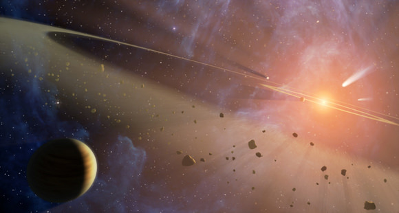
According to the Nebular Hypothesis, the Sun and planets formed 4.6 billion years ago from a giant cloud of dust and gas. This began with the Sun forming in the center, and the remaining material forming a protoplanetary disc, from which the planets formed. Whereas the planets in the outer Solar System were largely made up of gases (i.e. the Gas Giants), those closer to the Sun formed from silicate minerals and metals (i.e. the terrestrial planets).

Despite having a pretty good idea of how this all came about, the question of exactly how the planets of the Solar System formed and evolved over the course of billions of year is still subject to debate. In a new study, two researchers from the University of Heidelberg considered the role played by carbon in both the formation of Earth and the emergence and evolution of life.

Their study, “Spatial Distribution of Carbon Dust in the Early Solar Nebula and the Carbon Content of Planetesimals“, recently appeared in the journal Astronomy and Astrophysics. The study was conducted by Hans-Peter Gail, from the Institute for Theoretical Astrophysics at the University of Heidelberg, and Mario Trieloff – from Heidelberg’s Institute of Earth Sciences and the Klaus-Tschira-Laboratory for Cosmochemistry.

A slice of the Allende meteorite with silicate globules of the size of a millimetre. Credit: Institute of Earth Science

For the sake of their study, the pair considered what role the element carbon – which is essential to life here on Earth – played in planetary formation. Essentially, scientists are of the opinion that during the earliest days of the Solar System – when it was still a giant cloud of dust and gas – carbon-rich materials were distributed to the inner Solar System from the outer Solar System.

Out beyond the “Frost Line” – where volatiles like water, ammonia and methane and are able to condense into ice – bodies containing frozen carbon compounds formed. Much like how water was distributed throughout the Solar System, that these bodies were supposedly kicked out of their orbits and sent towards the Sun, distributing volatile materials to the planetesimals that would eventually grow to become the terrestrial planets.

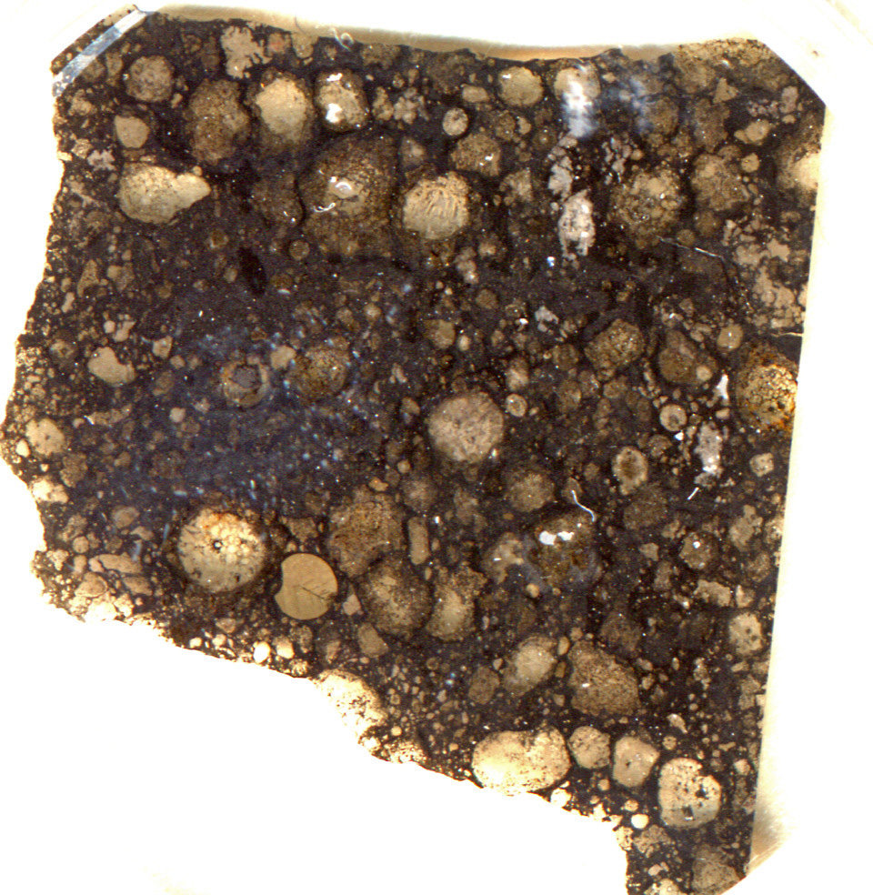
However, when one compares the kinds of meteors that distributed primordial material to Earth – aka. chondrite meteorites –  one notices a certain discrepancy. Basically, carbon is comparatively rare on Earth compared to these ancient rocks, the reason for which has remained a mystery. As Prof. Trieloff, who was the co-author on the study, explained in a University of Heidelberg press release:

“On Earth, carbon is a relatively rare element. It is enriched close to the Earth´s surface, but as a fraction of the total matter on Earth it is a mere one-half of 1/1000th. In primitive comets, however, the proportion of carbon can be ten percent or more.”

Artist’s conception of a solar system in formation. Credit: NASA/FUSE/Lynette Cook

“A substantial portion of the carbon in asteroids and comets is in long-chain and branched molecules that evaporate only at very high temperatures,” added Dr. Grail, the study’s lead author. “Based on the standard models that simulate carbon reactions in the solar nebula where the sun and planets originated, the Earth and the other terrestrial planets should have up to 100 times more carbon.”

To address this, the two researches constructed a model that assumed that short-duration flash-heating events – where the Sun heated the protoplanetary disc – were responsible for this discrepancy. They also assumed that all matter in the inner Solar System was heated to temperatures of between 1,300 and 1,800 °C (2372 to 3272 °F) before small planetesimals and terrestrial planets eventually formed.

Dr. Grail and Trieloff believe the evidence for this lies in the round grains in meteorites that form from molten droplets – known as chondrules. Unlike chondrite meteorites, which can be composed of up to a few percent carbon, chondrules are largely depleted of this element. This, they claim, was the a result of the same flash-heating events that took place before the chondrules could accrete to form meteorites. As Dr. Gail indicated:

“Only the spikes in temperature derived from the chondrule formation models can explain today’s low amount of carbon on the inner planets. Previous models did not take this process into account, but we apparently have it to thank for the correct amount of carbon that allowed the evolution of the Earth’s biosphere as we know it.”

Artist impression of the Late Heavy Bombardment period. Credit: NASA

In short, the discrepancy between the amount of carbon found in chondritic-rock material and that found on Earth can be explained by intense heating in the primordial Solar System. As Earth formed from chrondritic material, the extreme heat caused it to be depleted of its natural carbon. In addition to shedding light on what has been an ongoing mystery in astronomy, this study also offers new insight into how life in the Solar System began.

Basically, the researchers speculate that the flash-heating events in the inner Solar System may have been necessary for life here on Earth. Had there been too much carbon in the primordial material that coalesced into our planet, the result could have been a “carbon overdose”. This is because when carbon becomes oxidized, it forms carbon dioxide, a major greenhouse gas that can lead to a runaway heating effect.

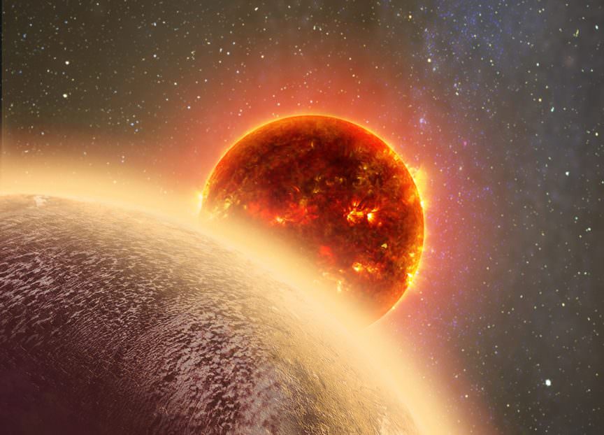
This is what planetary scientists believe happened to Venus, where the presence of abundant CO2 – combined with its increased exposure to Solar radiation – led to the hellish environment that is there today. But on Earth, CO2 was removed from the atmosphere by the silicate-carbonate cycle, which allowed for Earth to achieve a balanced and life-sustaining environment.

“Whether 100 times more carbon would permit effective removal of the greenhouse gas is questionable at the very least,” said Dr. Trieloff. “The carbon could no longer be stored in carbonates, where most of the Earth’s CO2 is stored today. This much CO2 in the atmosphere would cause such a severe and irreversible greenhouse effect that the oceans would evaporate and disappear.”

Artist’s impression of the “Venus-like” exoplanet in a nearby star system. Credit: cfa.harvard.edu

It is a well-known fact that life here on Earth is carbon-based. However, knowing that conditions during the early Solar System prevented an overdose of carbon that could have turned Earth into a second Venus is certainly interesting. While carbon may be essential to life as we know it, too much can mean the death of it. This study could also come in handy when it comes to the search for life in extra-solar systems.

When examining distant stars, astronomers could ask, “were primordial conditions hot enough in the inner system to prevent a carbon overdose?” The answer to that question could be the difference between finding an Earth 2.0, or another Venus-like world!

Further Reading: University of Heidelberg, Astronomy and Astrophysics

Elon Musk Reveals Further Plans to Colonize Mars and Make Aerospace Transit a Reality

The founder of SpaceX said a planned interplanetary transport system would be downsized so it could carry out a range of tasks that would then pay for future Mars missions. Credit: AFP/Peter Parks

For years, Elon Musk and the company he founded to reduce the associated costs of space exploration (SpaceX) have been leading the charge in the development of private spaceflight. Beyond capturing the attention of the world with reusable rocket tests and the development of next-generation space vehicles, Musk has also garnered a lot of attention for his long-term plans.

These plans were the subject of a presentation made on Friday, September 29th, during the International Astronautical Congress (IAC) – which ran from September 25th to September 29th in Adelaide, Australia. During the course of the presentation, Musk detailed his plans to send cargo ships to Mars by 2022 and to conduct regular aerospace trips between major cities here on Earth.

Continue reading “Elon Musk Reveals Further Plans to Colonize Mars and Make Aerospace Transit a Reality”

New Study Sheds Light on How Earth and Mars Formed

Snapshot of a computer simulation of two (relatively small) planets colliding with each other. The colors show how the rock of the impacting body (dark grey, in center of impact area) accretes to the target body (rock; light grey), while some of the rock in the impact area is molten (yellow to white) or vaporised (red). Credit: Philip J. Carter

In accordance with the Nebular Hypothesis, the Solar System is believed to have formed through the process of accretion. Essentially, this began when a massive cloud of dust and gas (aka. the Solar Nebula) experienced a gravitational collapse at its center, giving birth to the Sun. The remaining dust and gas then formed into a protoplanetary disc around the Sun, which gradually coalesced to form the planets.

However, much about the process of how planets evolved to become distinct in their compositions has remained a mystery. Luckily, a new study by a team of researchers from the University of Bristol has approached the subject with a fresh perspective. By examining a combination of Earth samples and meteorites, they have shed new light on how planets like Earth and Mars formed and evolved.

The study, titled “Magnesium Isotope Evidence that Accretional Vapour Loss Shapes Planetary Compositions“, recently appeared in the scientific journal Nature. Led by Remco C. Hin, a senior research associate from the School of Earth Sciences at the University of Bristol, the team compared samples of rock from Earth, Mars, and the Asteroid Vesta to compare the levels of magnesium isotopes within them.

Artist’s impression of the early Solar System, where collision between particles in an accretion disc led to the formation of planetesimals and eventually planets. Credit: NASA/JPL-Caltech

Their study attempted answering what has been a lingering question in the scientific community – i.e. did the planets form the way they are today, or did they acquire their distinctive compositions over time? As Dr. Remco Hin explained in a University of Bristol press release:

“We have provided evidence that such a sequence of events occurred in the formation of the Earth and Mars, using high precision measurements of their magnesium isotope compositions. Magnesium isotope ratios change as a result of silicate vapour loss, which preferentially contains the lighter isotopes. In this way, we estimated that more than 40 per cent of the Earth’s mass was lost during its construction. This cowboy building job, as one of my co-authors described it, was also responsible for creating the Earth’s unique composition.

To break it down, accretion consists of clumps of material colliding with neighboring clumps to form larger objects. This process is very chaotic, and material is often lost as well as accumulated due to the extreme heat generated by these high-speed collisions. This heat is also believed to have created oceans of magma on the planets as they formed, not to mention temporary atmospheres of vaporized rock.

Until planets become about the same size as Mars, their force of gravitational attraction was too weak to hold onto these atmospheres. And as more collisions took place, the composition of these atmosphere and of the planets themselves would have changes substantially. How exactly the terrestrial planets – Mercury, Venus, Earth and Mars – obtained their current, volatile-poor compositions over time is what scientists have hoped to address.

Artist impression of the Late Heavy Bombardment period. Credit: NASA

For example, some believe that the planets current compositions are the result of particular combinations of gas and dust during the earliest periods of planet formation – where terrestrial planets are silicate/metal rich, but volatile poor, because of which elements were most abundant closest to the Sun. Others have suggested that their current composition is a consequence of their violent growth and collisions with other bodies.

To shed light on this, Dr. Hin and his associates analyzed samples of Earth, along with meteorites from Mars and the asteroid Vesta using a new analytical approach. This technique is capable of obtaining more accurate measurements of magnesium isotope rations than any previous method. This method also showed that all differentiated bodies – like Earth, Mars and Vesta – have isotopically heavier magnesium compositions than chondritic meteorites.

From this, they were able to draw three conclusions. For one, they found that Earth, Mars and Vesta have distinct magnesium isotope rations that could not be explained by condensation from the Solar Nebula. Second, they noted that the study of heavy magnesium isotopes revealed that in all cases, the planets lost about 40% percent of their mass during their formation period, following repeated episodes of vaporization.

Last, they determined that the accretion process results in other chemical changes that generate the unique chemical characteristics of Earth. In short, their study showed that Earth, Mars and Vesta all experiences significant losses of material after formation, which means that their peculiar compositions were likely the result of collisions over time. As Dr Hin added:

“Our work changes our views on how planets attain their physical and chemical characteristics. While it was previously known that building planets is a violent process and that the compositions of planets such as Earth are distinct, it was not clear that these features were linked. We now show that vapour loss during the high energy collisions of planetary accretion has a profound effect on a planet’s composition.”

Their study also indicated that this violent formation process could be characteristic of planets in general. These findings are not only significant when it comes to the formation of the Solar System, but of extra-solar planets as well. When it comes time to explore distant star systems, the distinctive compositions of their planets will tell us much about the conditions from which they formed, and how they came to be.

Further Reading: University of Bristol, Nature

NASA’s OSIRIS-REx Captures Lovely Blue Marble during Gravity Assist Swing-by to Asteroid Bennu

A color composite image of Earth taken on Sept. 22, 2017 by the MapCam camera on NASA’s OSIRIS-REx spacecraft just hours after the spacecraft completed its Earth Gravity Assist at a range of approximately 106,000 miles (170,000 kilometers). Credit: NASA/Goddard/University of Arizona

A color composite image of Earth taken on Sept. 22, 2017 by the MapCam camera on NASA’s OSIRIS-REx spacecraft just hours after the spacecraft completed its Earth Gravity Assist at a range of approximately 106,000 miles (170,000 kilometers). Credit: NASA/Goddard/University of Arizona

KENNEDY SPACE CENTER, FL – NASA’s OSIRIS-REx asteroid mission captured a lovely ‘Blue Marble’ image of our Home Planet during last Fridays (Sept. 22) successful gravity assist swing-by sending the probe hurtling towards asteroid Bennu for a rendezvous next August on a round trip journey to snatch pristine soil samples.

The newly released color composite image of Earth was taken on Sept. 22 by the spacecrafts MapCam camera.

It was taken at a range of approximately 106,000 miles (170,000 kilometers), just a few hours after OSIRIS-REx completed its critical Earth Gravity Assist (EGA) maneuver.

“NASA’s asteroid sample return spacecraft successfully used Earth’s gravity on Friday, Sept. 22 to slingshot itself on a path toward the asteroid Bennu, for a rendezvous next August,” the agency confirmed after receiving the eagerly awaited telemetry.

OSIRIS-Rex, which stands for Origins, Spectral Interpretation, Resource Identification, and Security – Regolith Explorer, is NASA’s first ever asteroid sample return mission.

As it swung by Earth at 12:52 p.m. EDT on Sept. 22, OSIRIS-REx passed only 10,711 miles (17,237 km) above Antarctica, just south of Cape Horn, Chile.

The probe departed Earth by following a flight path that continued north over the Pacific Ocean and has already travelled 600 million miles (1 billion kilometers) since launching on Sept. 8, 2016.

OSIRIS-REx flight path over Earth’s surface during the Sept. 22, 2017 slingshot over Antarctica at 12:52 a.m. EDT targeting the probe to Asteroid Bennu in August 2018. Credits: NASA’s Goddard Space Flight Center/University of Arizona

The preplanned EGA maneuver provided the absolutely essential gravity assisted speed boost required for OSIRIS-Rex to gain enough velocity to complete its journey to the carbon rich asteroid Bennu and back.

The mission was only made possible by the slingshot which provided a velocity change to the spacecraft of 8,451 miles per hour (3.778 kilometers per second).

“The encounter with Earth is fundamental to our rendezvous with Bennu,” said Rich Burns, OSIRIS-REx project manager at NASA’s Goddard Space Flight Center in Greenbelt, Maryland, in a statement.

“The total velocity change from Earth’s gravity far exceeds the total fuel load of the OSIRIS-REx propulsion system, so we are really leveraging our Earth flyby to make a massive change to the OSIRIS-REx trajectory, specifically changing the tilt of the orbit to match Bennu.”

The spacecraft conducted a post flyby science campaign by collecting images and science observations of Earth and the Moon that began four hours after closest approach in order to test and calibrate its onboard suite of five science instruments and help prepare them for OSIRIS-REx’s arrival at Bennu in late 2018.

NASA’s OSIRIS-REx spacecraft OTES spectrometer captured these infrared spectral curves during Earth Gravity Assist on Sept. 22 2017, hours after the spacecraft’s closest approach. Credit: NASA/Goddard/University of Arizona/Arizona State University

The MapCam camera Blue Marble image is the first one to be released by NASA and the science team.

The image is centered on the Pacific Ocean and shows several familiar landmasses, including Australia in the lower left, and Baja California and the southwestern United States in the upper right.

“The dark vertical streaks at the top of the image are caused by short exposure times (less than three milliseconds),” said the team.

“Short exposure times are required for imaging an object as bright as Earth, but are not anticipated for an object as dark as the asteroid Bennu, which the camera was designed to image.”

The instrument will gather additional data and measurements scanning the Earth and the Moon for three more days over the next two weeks.

“The opportunity to collect science data over the next two weeks provides the OSIRIS-REx mission team with an excellent opportunity to practice for operations at Bennu,” said Dante Lauretta, OSIRIS-REx principal investigator at the University of Arizona, Tucson.

“During the Earth flyby, the science and operations teams are co-located, performing daily activities together as they will during the asteroid encounter.”

A United Launch Alliance Atlas V rocket lifts off from Space Launch Complex 41 at Cape Canaveral Air Force Station carrying NASA’s Origins, Spectral Interpretation, Resource Identification, Security-Regolith Explorer, or OSIRIS-REx spacecraft on the first U.S. mission to sample an asteroid, retrieve at least two ounces of surface material and return it to Earth for study. Liftoff was at 7:05 p.m. EDT on September 8, 2016. Credit: Ken Kremer/kenkremer.com

The OSIRIS-Rex spacecraft originally departed Earth atop a United Launch Alliance Atlas V rocket under crystal clear skies on September 8, 2016 at 7:05 p.m. EDT from Space Launch Complex 41 at Cape Canaveral Air Force Station, Florida.

Everything with the launch and flyby went exactly according to plan for the daring mission boldly seeking to gather rocks and soil from carbon rich Bennu.

OSIRIS-Rex is equipped with an ingenious robotic arm named TAGSAM designed to collect at least a 60-gram (2.1-ounce) sample and bring it back to Earth in 2023 for study by scientists using the world’s most advanced research instruments.

View of science instrument suite and TAGSAM robotic sample return arm on NASA’s OSIRIS-REx asteroid sampling spacecraft inside the Payloads Hazardous Servicing Facility at NASA’s Kennedy Space Center. Probe is slated for Sep. 8, 2016 launch to asteroid Bennu from Cape Canaveral Air Force Station, FL. Credit: Ken Kremer/kenkremer.com

Watch for Ken’s continuing onsite NASA mission and launch reports direct from the Kennedy Space Center and Cape Canaveral Air Force Station, Florida.

Stay tuned here for Ken’s continuing Earth and Planetary science and human spaceflight news.
Ken Kremer

NASA’s OSIRIS-REx spacecraft OVIRS spectrometer captured this visible and infrared spectral curve, which shows the amount of sunlight reflected from the Earth, after the spacecraft’s Earth Gravity Assist on Sept. 22, 2017. Credit: NASA/Goddard/University of Arizona

LIGO and Virgo Observatories Detect Black Holes Colliding

In February 2016, LIGO detected gravity waves for the first time. As this artist's illustration depicts, the gravitational waves were created by merging black holes. The third detection just announced was also created when two black holes merged. Credit: LIGO/A. Simonnet.
Artist's impression of merging binary black holes. Credit: LIGO/A. Simonnet.

On February 11th, 2016, scientists at the Laser Interferometer Gravitational-wave Observatory (LIGO) announced the first detection of gravitational waves. This development, which confirmed a prediction made by Einstein’s Theory of General Relativity a century ago, has opened up new avenues of research for cosmologists and astrophysicists. Since that time, more detections have been made, all of which were said to be the result of black holes merging.

The latest detection took place on August 14th, 2017, when three observatories – the Advanced LIGO and the Advanced Virgo detectors – simultaneously detected the gravitational waves created by merging black holes. This was the first time that gravitational waves were detected by three different facilities from around the world, thus ushering in a new era of globally-networked research into this cosmic phenomena.

The study which detailed these observations was recently published online by the LIGO Scientific Collaboration and the Virgo Collaboration. Titled “GW170814 : A Three-Detector Observation of Gravitational Waves from a Binary Black Hole Coalescence“, this study has also been accepted for publication in the scientific journal Physical Review Letters.

Aerial view of the Virgo Observatory. Credit: The Virgo collaboration/CCO 1.0

The event, designated as GW170814, was observed at 10:30:43 UTC (06:30:43 EDT; 03:30:43 PDT) on August 14th, 2017. The event was detected by the National Science Foundation‘s two LIGO detectors (located in Livingston, Louisiana, and Hanford, Washington) and the Virgo detector located near Pisa, Italy – which is maintained by the National Center for Scientific Research (CNRS) and the National Institute for Nuclear Physics (INFN).

Though not the first instance of gravitational waves being detected, this was the first time that an event was detected by three observatories simultaneously. As France Córdova, the director of the NSF, said in a recent LIGO press release:

“Little more than a year and a half ago, NSF announced that its Laser Interferometer Gravitational Wave Observatory had made the first-ever detection of gravitational waves, which resulted from the collision of two black holes in a galaxy a billion light-years away. Today, we are delighted to announce the first discovery made in partnership between the Virgo gravitational-wave observatory and the LIGO Scientific Collaboration, the first time a gravitational wave detection was observed by these observatories, located thousands of miles apart. This is an exciting milestone in the growing international scientific effort to unlock the extraordinary mysteries of our universe.”

Based on the waves detected, the LIGO Scientific Collaboration (LSC) and Virgo collaboration were able to determine the type of event, as well as the mass of the objects involved. According to their study, the event was triggered by the merger of two black holes – which were 31 and 25 Solar Masses, respectively. The event took place about 1.8 billion light years from Earth, and resulted in the formation of a spinning black hole with about 53 Solar Masses.

LIGO’s two facilities, located in Livingston, Louisiana, and Hanford, Washington. Credit: ligo.caltech.edu

What this means is that about three Solar Masses were converted into gravitational-wave energy during the merger, which was then detected by LIGO and Virgo. While impressive on its own, this latest detection is merely a taste of what gravitational wave detectors like the LIGO and Virgo collaborations can do now that they have entered their advanced stages, and into cooperation with each other.

Both Advanced LIGO and Advanced Virgo are second-generation gravitational-wave detectors that have taken over from previous ones. The LIGO facilities, which were conceived, built, and are operated by Caltech and MIT, collected data unsuccessfully between 2002 and 2010. However, as of September of 2015, Advanced LIGO went online and began conducting two observing runs – O1 and O2.

Meanwhile, the original Virgo detector conducted observations between 2003 and October of 2011, once again without success. By February of 2017, the integration of the Advanced Virgo detector began, and the instruments went online by the following April. In 2007, Virgo and LIGO also partnered to share and jointly analyze the data recorded by their respective detectors.

In August of 2017, the Virgo detector joined the O2 run, and the first-ever simultaneous detection took place on August 14th, with data being gathered by all three LIGO and Virgo instruments. As LSC spokesperson David Shoemaker – a researcher with the Massachusetts Institute of Technology (MIT) – indicated, this detection is just the first of many anticipated events.

Artist’s impression of two merging black holes, which has been theorized to be a source of gravitational waves. Credit: Bohn, Throwe, Hébert, Henriksson, Bunandar, Taylor, Scheel/SXS

“This is just the beginning of observations with the network enabled by Virgo and LIGO working together,” he said. “With the next observing run planned for fall 2018, we can expect such detections weekly or even more often.”

Not only will this mean that scientists have a better shot of detecting future events, but they will also be able to pinpoint them with far greater accuracy. In fact, the transition from a two- to a three-detector network is expected to increase the likelihood of pinpointing the source of GW170814 by a factory of 20. The sky region for GW170814 is just 60 square degrees – more than 10 times smaller than with data from LIGO’s interferometers alone.

In addition, the accuracy with which the distance to the source is measured has also benefited from this partnership. As Laura Cadonati, a Georgia Tech professor and the deputy spokesperson of the LSC, explained:

“This increased precision will allow the entire astrophysical community to eventually make even more exciting discoveries, including multi-messenger observations. A smaller search area enables follow-up observations with telescopes and satellites for cosmic events that produce gravitational waves and emissions of light, such as the collision of neutron stars.”

Artist’s impression of gravitational waves. Credit: NASA

In the end, bringing more detectors into the gravitational-wave network will also allow for more detailed test’s of Einstein’s theory of General Relativity. Caltech’s David H. Reitze, the executive director of the LIGO Laboratory, also praised the new partnership and what it will allow for.

“With this first joint detection by the Advanced LIGO and Virgo detectors, we have taken one step further into the gravitational-wave cosmos,” he said. “Virgo brings a powerful new capability to detect and better locate gravitational-wave sources, one that will undoubtedly lead to exciting and unanticipated results in the future.”

The study of gravitational waves is a testament to the growing capability of the world’s science teams and the science of interferometry. For decades, the existence of gravitational waves was merely a theory; and by the turn of the century, all attempts to detect them had yielded nothing. But in just the past eighteen months, multiple detections have been made, and dozens more are expected in the coming years.

What’s more, thanks to the new global network and the improved instruments and methods, these events are sure to tell us volumes about our Universe and the physics that govern it.

Further Reading: NSF, LIGO-Caltech, LIGO DD

Hey Citizen Scientists! Help NASA Analyze Images Taken from the Space Station

Astronaut Karen Nyberg looks out at Earth from the International Space Station's Cupola. You can too! Credit: NASA.

Calling all citizen scientists, geography buffs, fans of the International Space Station and those who love that orbital perspective!

CosmoQuest has a brand new project in coordination with NASA and the Astronomical Society of the Pacific (ASP) where you can help identify features in photographs taken by astronauts from the space station.

The project is called Image Detective. I’ve tried it out, and wow, THIS is a lot of fun!

Now, I absolutely love seeing the images taken of Earth from the ISS, and I routinely follow all the astronauts on board on social media so I can see their latest images. And I also love the concept of regular, everyday people doing science. Plus I’m a big fan of CosmoQuest and their ‘quest’ to bring science to the public.

But still, the setup CosmoQuest has is really great and the process is easy. Citizen scientists are asked to help identify geographic features (natural or human-made) and then determine the location on Earth where the photo is centered.

I found that last part to be the most difficult, but I’ve been known to have trouble reading a map … so I’m hoping that I can improve a bit with more practice.

“The astronauts’ photos of Earth are visually stunning, but more than that, they can be used to study our changing Earth,” said our good friend Dr. Pamela Gay, who is the Director of Technology and Citizen Science at ASP. “From erupting volcanoes, to seasonal flooding, these images document the gradual changes that happen to our landscape. The trick is, we need to make these images searchable, and that means taking the time to sort through, analyze, and label (add metadata) the unidentified images within the database of 1.5 million plus photos.”

You can try it out here: http://cosmoquest.org/ImageDetective.

The team says that Image Detective spreads the significant work necessary to label all of the images out to citizen scientists across the world.

“This is a unique, powerful, and beautiful image data set that has already yielded excellent research science. But the data set needs the many eyes and minds of citizen scientists to reach its full potential as a publicly available, searchable catalog,” said Dr. Jennifer Grier, a Senior Scientist and Senior Education and Communication Specialist at Planetary Science Institute (PSI) and CosmoQuest’s lead support scientist. “With the additions that citizen scientists as detectives can make, professional research scientists will be able to conduct more research into our changing world, and do so much more effectively.”

Rosetta Team Finds New, Final Image Hiding in the Data

A final image from Rosetta, shortly before it made a controlled impact onto Comet 67P/Churyumov–Gerasimenko on 30 September 2016. Credit: ESA/Rosetta/MPS for OSIRIS Team MPS/UPD/LAM/IAA/SSO/INTA/UPM/DASP/IDA.

ESA scientists have found one additional image from the Rosetta spacecraft hiding in the telemetry. This new image was found in the last bits of data sent by Rosetta immediately before it shut down on the surface of Comet 67P/Churyumov–Gerasimenko last year.

The new image shows a close-up shot of the rocky, pebbly surface of the comet, and looks somewhat reminiscent of the views the Huygens lander took of the surface of Saturn’s moon Titan.

A final image from Rosetta, shortly before it made a controlled impact onto Comet 67P/Churyumov–Gerasimenko on 30 September 2016. Credit: ESA/Rosetta/MPS for OSIRIS Team MPS/UPD/LAM/IAA/SSO/INTA/UPM/DASP/IDA.

Planetary astronomer Andy Rivkin noted on Twitter that for size context, he estimates the block just right of center looks to be about the size of a hat. That’s a fun comparison to have (not to mention thinking about hats on Comet 67P!)

The picture has a scale of 2 mm/pixel and measures about 1 m across. It’s a really ‘close’ close-up of Comet 67P.

“The last complete image transmitted from Rosetta was the final one that we saw arriving back on Earth in one piece moments before the touchdown at Sais,” said Holger Sierks, principal investigator for the OSIRIS camera at the Max Planck Institute for Solar System Research in Göttingen, Germany. “Later, we found a few telemetry packets on our server and thought, wow, that could be another image.”

The team explains that the image data were put into telemetry ‘packets’ aboard Rosetta before they were transmitted to Earth, and the final images were split into six packets. However, for the very last image, the transmission was interrupted after only three full packets. The incomplete data was not recognized as an image by the automatic processing software, but later, the engineers in Göttingen could make sense of these data fragments to reconstruct the image.

You’ll notice it is rather blurry. The OSIRIS camera team says this image only has about 53% of the full data and “therefore represents an image with an effective compression ratio of 1:38 compared to the anticipated compression ratio of 1:20, meaning some of the finer detail was lost.”

That is, it gets a lot blurrier as you zoom in compared with a full-quality image. They compared it to compressing an image to send via email, versus an uncompressed version that you would print out and hang on your wall.

Rosetta’s final resting spot is in a region of active pits in the Ma’at region on the two-lobed, duck-shaped comet.

A montage of the last few images from Rosetta, including the new image, with context of where the features on the last images are located. Credit: ESA/Rosetta/MPS for OSIRIS Team MPS/UPD/LAM/IAA/SSO/INTA/UPM/DASP/IDA

Launched in 2004, Rosetta traveled nearly 8 billion kilometers and its journey included three Earth flybys and one at Mars, and two asteroid encounters. It arrived at the comet in August 2014 after being in hibernation for 31 months.

After becoming the first spacecraft to orbit a comet, it deployed the Philae lander in November 2014. Philae sent back data for a few days before succumbing to a power loss after it unfortunately landed in a crevice and its solar panels couldn’t receive sunlight.

But Rosetta showed us unprecedented views of Comet 67P and monitored the comet’s evolution as it made its closest approach and then moved away from the Sun. However, Rosetta and the comet moved too far away from the Sun for the spacecraft to receive enough power to continue operations, so the mission plan was to set the spacecraft down on the comet’s surface.

And scientists have continued to sift through the data, and this new image was found. Who knows what else they’ll find, hiding the data?

Read more details about this image at ESA’s website.

Read our article about Rosetta’s mission end here.

Russia Says They’ll Be Pitching in on the Deep Space Gateway

Artist illustration of Habitation Module. Credit: Lockheed Martin
Artist illustration of Habitation Module aboard the Deep Space Gateway. Credit: Lockheed Martin

In Spring of 2017, NASA revealed their plans for what the massive Space Launch System (SLS) rocket would be used for: to build the Deep Space Gateway, a space station in cis-lunar orbit that’ll serve as a stepping stone to the exploration of the Solar System. Until today, it was assumed that this would be a NASA project, with the agency constructing the station over the course of several launches of the SLS from 2021 through 2026, delivering the 4 major modules. The details were hazy, though, with the various components in development with various contractors.

Artist's impression of the Deep Space Gateway, currently under development by Lockheed Martin. Credit: NASA
Artist’s impression of the Deep Space Gateway. Credit: NASA

Today, however, NASA and the Russian Space Agency Roscosmos announced that they’ll be building the Deep Space Gateway together. They signed an agreement in Australia at the 68th International Astronautical Congress in Adelaide, Australia, and announced the news to the world.

What will Russia be contributing? According to TASS, Russian officials said that they’d be providing one to three modules for the station, as well as the docking mechanism that spacecraft would use when approaching the station. Russia also offered to carry some of the station parts on their new super heavy lift rocket. They didn’t specify the rocket, but that sounds like the Angara rocket which is in development, and is expected to make its first flights over the next few years.

The Deep Space Gateway will serve as the primary destination for NASA’s human space exploration efforts, once the SLS and Orion Crew Module are completed. The first launch of SLS will carry an unmanned Orion capsule on a trans-lunar flight in 2018. Then SLS will be used to blast the Europa Clipper off to the Jovian system. Their original strategy was to launch some time between 2021 and 2023 carrying the Solar Power Electric Bus module to the station, followed by the Habitation Module in 2024, the Logistics Module in 2025 and finally the Airlock Module in 2026.

At this point, NASA has solicited proposals from various aerospace contractors for the development of the Power Module, and Habitation System, and they didn’t indicate that Russia’s involvement would have any impact on the construction of these modules.

With the Russians announcing their involvement, we don’t really know how this’ll impact the structure of the station or its configuration of modules. This might also be an incentive for other space agencies (like the newly announced Australian Space Agency) to come on board.

Of course, the Russians were involved in the construction of the International Space Station. They provided the Zarya module for propulsion and navigational guidence, then the Zvezda for living quarters, and the Pirs, Poisk and Rassvet docking modules. They’ve also provided half the support of the station, including astronauts, and provide the only way to get humans up to the station, on their Soyuz rockets. Until recently, Russia had been threatening to pull their support of the International Space Station, before it was ready for retirement. But earlier this year, they agreed to support ISS until 2024, and even to 2028 if necessary. They’ve also been continuing work on their Multi-Purpose Laboratory Module (MLM), which was originally planned for launch in 2007, and is now expected to be attached to the station some time in 2018.

Before announcing their involvement with the Deep Space Gateway, Russia had said that they’d probably be investing in the development of their own orbital space station once the ISS mission was over. They’re also apparently working on a robotic lunar orbiter and lander mission.

This isn’t the only announcement involving the Deep Space Gateway. It might also get a solar sail. Engineers from the Canadian Space Agency proposed attaching a small solar sail to the Gateway, which could serve in re-orienting the space station without needing propellant. It would have a surface area of about 50-meters, and would save hundreds of kilograms of hydrozine fuel which would normally be used over the lifespan of the Deep Space Gateway. Check out Anatoly Zak’s excellent reporting on this development for the Planetary Society.

More information: TASS, Interfax

New Study Provides Explanation for Pluto’s Giant Blades of Ice

Pluto’s bladed terrain as seen from New Horizons during its July 2015 flyby. Credits: NASA/JHUAPL/SwRI

When it made its historic flyby of Pluto in July of 2015, the New Horizons spacecraft gave scientists and the general public the first clear picture of what this distant dwarf planet looks like. In addition to providing breathtaking images of Pluto’s “heart”, its frozen plains, and mountain chains, one of the more interesting features it detected was Pluto’s mysterious “bladed terrain”.

According to data obtained by New Horizons, these features are made almost entirely out of methane ice and resemble giant blades. At the time of their discovery, what caused these features remained unknown. But according to new research by members of the New Horizons team, it is possible that these features are the result of a specific kind of erosion that is related to Pluto’s complex climate and geological history.

Ever since the New Horizons probe provided a detailed look at Pluto’s geological features, the existence of these jagged ridges has been a source of mystery. They are located at the highest altitudes on Pluto’s surface near it’s equator, and can reach several hundred feet in altitude. In that respect, they are similar to penitentes, a type of structure found in high-altitude snowfields along Earth’s equator.

Penitentes, on the southern end of the Chajnantor plain in Chile. Credits: Wikimedia Commons/ESO

These structures are formed through sublimation, where atmospheric water vapor freezes to form standing, blade-like ice structures. The process is based on sublimation, where rapid changes in temperature cause water to transition from a vapor to a solid (and back again) without changing into a liquid state in between. With this in mind, the research team considered various mechanisms for the formation of these ridges on Pluto.

What they determined was that Pluto’s bladed terrain was the result of atmospheric methane freezing at extreme altitudes on Pluto, which then led to ice structures similar to the ones found on Earth.The team was led by Jeffrey Moore, a research scientist at NASA’s Ames Research Center who was also a New Horizons’ team member. As he explained in a NASA press statement:

“When we realized that bladed terrain consists of tall deposits of methane ice, we asked ourselves why it forms all of these ridges, as opposed to just being big blobs of ice on the ground. It turns out that Pluto undergoes climate variation and sometimes, when Pluto is a little warmer, the methane ice begins to basically ‘evaporate’ away.”

But unlike on Earth, the erosion of these features are related to changes that take place over the course of eons. This should come as no surprise seeing as how Pluto’s orbital period is 248 years (or 90,560 Earth days), meaning it takes this long to complete a single orbit around the Sun. In addition, the eccentric nature of it orbit means that its distance from the Sun ranges considerably, from 29.658 AU at perihelion to 49.305 AU at aphelion.

Maps based on New Horizons’ data on the topography (top) and composition (bottom) of Pluto’s surface. Both indicate the section of Pluto where the bladed terrain was observed. Credits: NASA/JHUAPL/SwRI/LPI

When the planet is farthest from the Sun, methane freezes out of the atmosphere at high altitudes. And as it gets closer to the Sun, these ice features melt and turn directly into atmospheric vapor again. As a result of this discovery, we now know that the surface and air of Pluto are apparently far more dynamic than previously thought. Much in the same way that Earth has a water cycle, Pluto may have a methane cycle.

This discovery could also allow scientists to map out locations of Pluto which were not photographed in high-detail. When the New Horizons mission conducted its flyby, it took high-resolution pictures of only one side of Pluto – designated as the “encounter hemisphere”. However, it was only able to observe the other side at lower resolution, which prevented it from being mapped in detail.

But based on this new study, NASA researchers and their collaborators have been able to conclude that these sharp ridges may be a widespread feature on Pluto’s “far side”. The study is also significant in that it advances our understanding of Pluto’s global geography and topography, both past and present. This is due to the fact that it demonstrated a link between atmospheric methane and high-altitude features. As such, researchers can now infer elevations on Pluto by looking for concentrations of methane in its atmosphere.

Not long ago, Pluto was considered one of the least-understood bodies in our Solar System, thanks to its immense distance from the Sun. However, thanks to ongoing studies made possible by the data collected by the New Horizons mission, scientists are becoming increasingly familiar with what its surface looks like, not to mention the types of geological and climatological forces that have shaped it over time.

And be sure to enjoy this video that details the discovery of Pluto’s bladed terrain, courtesy of NASA’s Ames Research Center:

Further Reading: NASA

New Study Could Help Locate Subsurface Deposits of Water Ice on Mars

Mars Express' view of Meridiani Planum. Credits: ESA/DLR/FU Berlin (G. Neukum)

It is a well-known fact that today, Mars is a very cold and dry place. Whereas the planet once had a thicker atmosphere that allowed for warmer temperatures and liquid water on its surface, the vast majority of water there today consists of ice that is located in the polar regions. But for some time, scientists have speculated that there may be plenty of water in subsurface ice deposits.

If true, this water could be accessed by future crewed missions and even colonization efforts, serving as a source of rocket fuel and drinking water. Unfortunately, a new study led by scientists from the Smithsonian Institution indicates that the subsurface region beneath Meridiani Planum could be ice-free. Though this may seem like bad news, the study could help point the way towards accessible areas of water ice on Mars.

This study, titled “Radar Sounder Evidence of Thick, Porous Sediments in Meridiani Planum and Implications for Ice-Filled Deposits on Mars“, recently appeared in the Geophysical Research Letters. Led by Dr. Thomas R. Watters, the Senior Scientist with the Center for Earth and Planetary Studies at the Smithsonian Institution, the team examined data collected by the ESA’s Mars Express mission in the Meridiani Planum region.

Artist’s impression of a global view of Mars, centered on the Meridiani Planum region. Credit: Air and Space Museum/Smithsonian Institution

Despite being one of the most intensely explored regions on Mars, particularly by missions like the Opportunity rover, the subsurface structure of Meridiani Planum has remained largely unknown. To remedy this, the science team led by Dr. Watters examined data that had been collected by the Mars Advanced Radar for Subsurface and Ionospheric Sounding (MARSIS) instrument aboard the ESA’s Mars Express orbiter.

Developed by researchers at the University of Rome in partnership with NASA’s Jet Propulsion Laboratory (and with the help of private contractors), this device used low-frequency radio pulses to study Mars’ ionosphere, atmosphere, surface, and interior structure. The way these pulses penetrated into certain materials and were reflected back to the orbiter was then used to determine the bulk density and compositions of those materials.

After examining the Meridiani Planum region, the Mars Express probe obtained readings that indicated that the subsurface area had a relatively low dielectric constant. In the past, these kinds of readings have been interpreted as being due to the presence of pure water ice. And in this case, the readings seemed to indicate that the subsurface was made up of porous rock that was filled with water ice.

However, with the help of newly-derived compaction models for Mars, the team concluded that these signals could be the result of ice-free, porous, windblown sand (aka. eolian sands). They further theorized that the Meridiani Planum region, which is characterized by some rather unique physiographic and hydrologic features, could have provided an ideal sediment trap for these kinds of sands.

Artist’s impression of the Mars Express rover, showing radar returns from its MARSIS instrument. Credit: ESA/NASA/JPL/KU/Smithsonian

“The relatively low gravity and the cold, dry climate that has dominated Mars for billions of years may have allowed thick eolian sand deposits to remain porous and only weakly indurated,” they concluded. “Minimally compacted sedimentary deposits may offer a possible explanation for other nonpolar region units with low apparent bulk dielectric constants.”

As Watters also indicated in a Smithsonian press statement:

“It’s very revealing that the low dielectric constant of the Meridiani Planum deposits can be explained without invoking pore-filling ice. Our results suggest that caution should be exercised in attributing non-polar deposits on Mars with low dielectric constants to the presence of water ice.”

On its face, this would seem like bad news to those who were hoping that the equatorial regions on Mars might contain vast deposits of accessible water ice. It has been argued that when crewed missions to Mars begin, this ice could be accessed in order to supply water for surface habitats. In addition, ice that didn’t need to come from there could also be used to manufacture hydrazine fuel for return missions.

This would reduce travel times and the cost of mounting missions to Mars considerably since the spacecraft would not need to carry enough fuel for the entire journey, and would therefore be smaller and faster. In the event that human beings establish a colony on Mars someday, these same subsurface deposits could also used for drinking, sanitation, and irrigation water.

A subsurface view of Miyamoto crater in Meridiani Planum from the MARSIS radar sounder. . Credit: ESA/NASA/JPL/KU/Smithsonian

As such, this study – which indicates that low dielectric constants could be due to something other than the presence of water ice – places a bit of a damper on these plans. However, understood in context, it provides scientists with a means of locating subsurface ice. Rather than ruling out the presence of subsurface ice away from the polar regions entirely, it could actually help point the way to much-needed deposits.

One can only hope that these regions are not confined to the polar regions of the planet, which would be far more difficult to access. If future missions and (fingers crossed!) permanent outposts are forced to pump in their water, it would be far more economical to do from underground sources, rather than bringing it in all the way from the polar ice caps.

Further Reading: Smithsonian NASM, Geophysical Research Letters