The Audacity to Dream

Making its debut at the TEDxISU (International Space University) event on July 6, the video above is an inspirational call-to-arms for anyone who’s ever looked to the stars and dreamed of a day when the sky was, in fact, not the limit. From Sputnik to Space Station, from Vostok to Virgin Galactic, the video reminds us of the spirit of adventure that unites us, regardless of time or place or politics. Dreaming, after all, is universal.

Check it out.

“A planet is the cradle of mind, but one cannot live in a cradle forever.”
– Konstantin Tsiolkovsky

Incoming! CME On Its Way Toward Earth

As you read this, a huge cloud of charged solar particles is speeding toward our planet, a coronal mass ejection resulting from the X1.4-class flare that erupted from sunspot 1520 on July 12. The CME is expected to collide with Earth’s magnetic field on Saturday, potentially affecting satellite operations and tripping alarms on power grids, as well as boosting auroral activity. It’s on its way, and all we can do is wait. (Thank goodness for magnetospheres!)

Actually, the effects from the incoming CME aren’t expected to be anything particularly dramatic. NOAA is predicting a geomagnetic storm level raging from G2 to G4, which although ranges from “moderate” to “severe” a G2 (Kp = 6) is most likely, according to Dr. C. Alex Young from NASA’s Goddard Space Flight Center.

[Read: What Is a CME?]

“A G2 level storm can cause some power fluctuations that may set off some voltage alarms for power companies,” Dr. Young told Universe Today. “Damage to transformers is possible for longer events, but unlikely. Satellite companies may have to make some orbit corrections for their satellites, and at higher latitudes where there are aurora they can be some disruption of high frequency radio broadcasts.

“All in all the effects should be minor,” he concluded.

And this may not be the last we hear from 1520, either.

“Its complexity has decreased but it is still large and has a ‘delta’ configuration,” added Dr. Young, “when there is opposite polarity magnetic field of the umbra within the penumbra of the sunspot. This is an unstable configuration that is indicative of larger releases of energy, lots of flares — in particular M and X flares.”

Below is a computer model of the CME from Goddard Space Weather Center. Impact with Earth is expected on 7/14 at 10:20 UT (+-7 hrs), 6:20 am EDT.

Auroras may be visible at lower latitudes this weekend, so check the NOAA’s updated auroral oval map to see if visibility extends into your area over the next several nights. Hopefully aurora photographers around the world will be able to get some great photos of a summer sky show!

You can keep up with the latest news on solar activity on Dr. Young’s blog, The Sun Today. And of course, stay tuned to Universe Today for more updates on any noteworthy space weather!

The video below uses SDO AIA footage in 131(teal), 171(gold) and 335 (blue) angstrom wavelengths, and shows the X1.4 class flare erupted from the center of the sun on July 12, 2012 at 12:52 PM EDT. Each wavelength shows different temperature plasma in the sun’s atmosphere. 171 shows 600,000 Kelvin plasma, 335 shows 2.5 million Kelvin plasma, and 131 shows 10 million Kelvin plasma. The final shot is a composite of 171 and 335 angstrom footage.

Top image: illustration of a CME about to impact Earth’s magnetosphere (NASA). Model animation: NASA/GSFC. Video courtesy NASA/SDO and the AIA science team.

UPDATE: The CME took a bit longer to arrive than expected, but impact with Earth’s magnetic field was detected at around 1800 UT (11 a.m. PDT/2 p.m. EDT), activating a geomagnetic storm. According to SpaceWeather.com: At the moment, conditions appear favorable for auroras over high-latitude places such as Canada, Scandinavia, Antarctica and Siberia. It is too early to say whether the storm will intensify and bring auroras to middle latitudes as well.

Wildfire Smoke is Visible Even at Night from Space

The Whitewater-Baldy fire is the largest wildfire in New Mexico’s history and has charred more than 465 square miles of the Gila National Forest since it started back on May 16, 2012 after several lightning strikes in the area. This wildfire produced so much smoke that it was visible even at night to the astronaut photographers on the International Space Station. This image was taken on June 2, 2012 by the crew of Expedition 31 on the ISS, with a Nikon D3S digital camera. A Russian spacecraft docked to the station is visible on the left side of the image.

Credit: NASA Earth Observatory website.

What are You Doing With Your Added Leap Second Today?

Everyone loves a long weekend, this weekend will be officially one second longer than usual. An extra second, or “leap” second, will be added at midnight UTC tonight, June 30, 2012, to account for the fact that it is taking Earth longer and longer to complete one full turn, or one a solar day. Granted, it the additional time is not very long, but the extra second will ensure that the atomic clocks we use to keep time will be in synch with Earth’s rotational period.

“The solar day is gradually getting longer because Earth’s rotation is slowing down ever so slightly,” says Daniel MacMillan of NASA’s Goddard Space Flight Center.

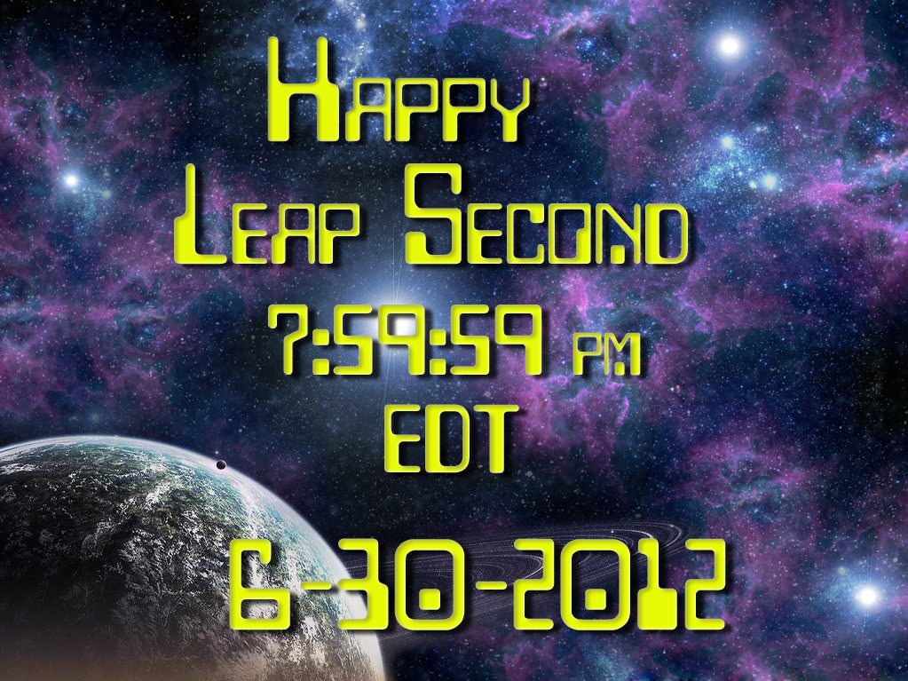
So, rather than changing from 23:59:59 on June 30 to 00:00:00 on July 1, the official time will get an extra second at 23:59:60.

About every one and a half years, one extra second is added to Universal Coordinated Time (UTC) and clocks around the world. Since 1972, a total of 24 seconds have been added. This means that the Earth has slowed down 24 seconds compared to atomic time since then.

However, this doesn’t mean that days are 24 seconds longer now, as only the days on which the leap seconds are inserted have 86,401 seconds instead of the usual 86,400 seconds.

This leap second accounts for the fact that the Earth’s rotation around its own axis, which determines the length of a day, slows down over time while the atomic clocks we use to measure time tick away at almost the same speed over millions of years.

NASA explains it this way:

Scientists know exactly how long it takes Earth to rotate because they have been making that measurement for decades using an extremely precise technique called Very Long Baseline Interferometry (VLBI). VLBI measurements are made daily by an international network of stations that team up to conduct observations at the same time and correlate the results. NASA Goddard provides essential coordination of these measurements, as well as processing and archiving the data collected. And NASA is helping to lead the development of the next generation of VLBI system through the agency’s Space Geodesy Project, led by Goddard.

From VLBI, scientists have learned that Earth is not the most reliable timekeeper. The planet’s rotation is slowing down overall because of tidal forces between Earth and the moon. Roughly every 100 years, the day gets about 1.4 milliseconds, or 1.4 thousandths of a second, longer. Granted, that’s about 100 or 200 times faster than the blink of an eye. But if you add up that small discrepancy every day for years and years, it can make a very big difference indeed.

“At the time of the dinosaurs, Earth completed one rotation in about 23 hours,” says MacMillan, who is a member of the VLBI team at NASA Goddard. “In the year 1820, a rotation took exactly 24 hours, or 86,400 standard seconds. Since 1820, the mean solar day has increased by about 2.5 milliseconds.”

By the 1950s, scientists had already realized that some scientific measurements and technologies demanded more precise timekeeping than Earth’s rotation could provide. So, in 1967, they officially changed the definition of a second. No longer was it based on the length of a day but on an extremely predictable measurement made of electromagnetic transitions in atoms of cesium. These “atomic clocks” based on cesium are accurate to one second in 1,400,000 years. Most people around the world rely on the time standard based on the cesium atom: Coordinated Universal Time (UTC).

Another time standard, called Universal Time 1 (UT1), is based on the rotation of Earth on its axis with respect to the sun. UT1 is officially computed from VLBI measurements, which rely on astronomical reference points and have a typical precision of 5 microseconds, or 5 millionths of a second, or better.

“These reference points are very distant astronomical objects called quasars, which are essentially motionless when viewed from Earth because they are located several billion light years away,” says Goddard’s Stephen Merkowitz, the Space Geodesy Project manager.

For VLBI observations, several stations around the world observe a selected quasar at the same time, with each station recording the arrival of the signal from the quasar; this is done for a series of quasars during a typical 24-hour session. These measurements are made with such exquisite accuracy that it’s actually possible to determine that the signal does not arrive at every station at exactly the same time. From the miniscule differences in arrival times, scientists can figure out the positions of the stations and Earth’s orientation in space, as well as calculating Earth’s rotation speed relative to the quasar positions.

Originally, leap seconds were added to provide a UTC time signal that could be used for navigation at sea. This motivation has become obsolete with the development of GPS (Global Positioning System) and other satellite navigation systems. These days, a leap second is inserted in UTC to keep it within 0.9 seconds of UT1.

Normally, the clock would move from 23:59:59 to 00:00:00 the next day. Instead, at 23:59:59 on June 30, UTC will move to 23:59:60, and then to 00:00:00 on July 1. In practice, this means that clocks in many systems will be turned off for one second.

Proposals have been made to abolish the leap second and let the two time standards drift apart. This is because of the cost of planning for leap seconds and the potential impact of adjusting or turning important systems on and off in synch. No decision will made about that, however, until 2015 at the earliest by the International Telecommunication Union, a specialized agency of the United Nations that addresses issues in information and communication technologies. If the two standards are allowed to go further and further out of synch, they will differ by about 25 minutes in 500 years.

In the meantime, leap seconds will continue to be added to the official UTC timekeeping. The 2012 leap second is the 35th leap second to be added and the first since 2008.

Lead image credit: Rick Ellis

Sources: NASA, TimeandDate.com

Smoking Wildfires Seen From Space

Wildfires continue to rage across the western United States, burning forests and property alike, and even the most remote have sent up enormous plumes of smoke that are plainly visible to astronauts aboard the Space Station.

The photo above was taken by an Expedition 31 crew member on June 27, showing thick smoke drifting northeast from the Fontenelle fire currently burning in Wyoming. More plumes can be seen to the north.

Utah’s Great Salt Lake can be seen at the bottom right of the image. Its two-tone coloration is due to different species of algae that live in the lake, which is split by the physical barrier of a railroad causeway.

You can watch a video of the wildfires in the west taken from the ISS here, and see more “fire and smoke” news and images from space here.

Image: NASA

Blue Marble 2012: The Arctic Edition

This latest portrait of Earth from NASA’s Suomi NPP satellite puts the icy Arctic in the center, showing the ice and clouds that cover our planet’s northern pole. The image you see here was created from data acquired during fifteen orbits of Earth.

In January of this year Suomi NPP images of Earth were used to create an amazing “Blue Marble” image that spread like wildfire across the internet, becoming one of the latest “definitive” images of our planet. Subsequent images have been released by the team at Goddard Space Flight Center, each revealing a different perspective of Earth.

See a full-sized version of the image above here.

NASA launched the National Polar-orbiting Operational Environmental Satellite System Preparatory Project (or NPP) on October 28, 2011 from Vandenberg Air Force Base. On Jan. 24, NPP was renamed Suomi National Polar-orbiting Partnership, or Suomi NPP, in honor of the late Verner E. Suomi. It’s the first satellite designed to collect data to improve short-term weather forecasts and increase understanding of long-term climate change.

Suomi NPP orbits the Earth about 14 times each day and observes nearly the entire surface of the planet.

Image credit: NASA/GSFC/Suomi NPP


There’s a Hole in the Sky!

A vast hole in the cloud cover seen over the southern Pacific

[/caption]

Well, not the sky exactly, but definitely in the clouds!

This image, acquired by NASA’s Aqua satellite on June 5, shows an enormous oval hole in the clouds above the southern Pacific Ocean, approximately 500 miles (800 km) off the southwestern coast of Tasmania. The hole itself is several hundred miles across, and is the result of high pressure air in the upper atmosphere.

According to Rob Gutro of NASA’s Goddard Space Flight Center, “This is a good visible example of how upper-level atmospheric features affect the lower atmosphere, because the cloud hole is right under the center of a strong area of high pressure. High pressure forces air down to the surface blocking cloud formation. In addition, the altocumulus clouds are rotating counter-clockwise around the hole, which in the southern hemisphere indicates high pressure.”

The northwestern tip of Tasmania and King Island can be seen in the upper right of the image.

The Aqua mission is a part of the NASA-centered international Earth Observing System (EOS). Launched on May 4, 2002, Aqua has six Earth-observing instruments on board, collecting a variety of global data sets about the Earth’s water cycle. Read more about Aqua here.

Tomorrow’s Transit Will be the First Photographed From Space

Venus photographed from the ISS (ESA/NASA)

[/caption]

ESA astronaut Andre Kuipers captured this stunning image of Earth’s limb with Venus shining brightly above on the morning of June 4, 2012. While it’s a fantastic shot in its own right, it’s just a warm-up for tomorrow’s big transit event, which will be watched by millions of people all over the world — as well as a select few aboard the ISS!

While many people will be taking advantage of this last opportunity to see Venus pass across the face of the Sun — a relatively rare event that’s only happened six times since the invention of the telescope, and won’t occur again until 2117 — the crew of the International Space Station is preparing to become the first astronaut to photograph it from space!

Transit of Venus by NASA's TRACE spacecraft Image credit: NASA/LMSAL
Transit of Venus in 2004 by NASA's TRACE spacecraft. Image credit: NASA/LMSAL

Expedition 31 flight engineer Don Pettit knew he’d be up in orbit when this transit takes place, and he went prepared.

“I’ve been planning this for a while,” says Pettit. “I knew the Transit of Venus would occur during my rotation, so I brought a solar filter with me when my expedition left for the ISS in December 2011.”

(See more of Don Pettit’s in-orbit photography: Timelapse of a Moonrise Seen From The ISS)

Even though the 2004 transit happened while the ISS was manned, the crew then didn’t have filters through with to safely view it.

Pettit will be shooting the transit through the windows of the cupola. He’ll even be removing a scratch-resistant layer first, in order to get the sharpest, clearest images possible — only the third time that’s ever been done.

Don’s images should be — no pun intended — brilliant.

“I’ll be using a high-end Nikon D2Xs camera and an 800mm lens with a full-aperture white light solar filter,” he says.

And if you want to follow along with the transit as it’s seen from down here on Earth, be sure to tune in to Universe Today’s live broadcast on Tuesday, June 5 at 5 p.m. EDT where Fraser Cain will be hosting a marathon event along with guests Pamela Gay, Phil Plait (a.k.a. the Bad Astronomer) and more as live views are shared from around the world.

Unless you plan on being around in 2117, this will be your last chance to witness a transit of Venus!

Read more about Don Pettit’s photo op on NASA Science News here.

When Everything On Earth Died

Based on fossil records, 250 million years ago over 90% of all species on Earth died out, effectively resetting evolution. (Image: Lunar and Planetary Institute)

[/caption]

Hey, remember that one time when 90% of all life on Earth got wiped out?

I don’t either. But it’s a good thing it happened because otherwise none of us would be here to… not remember it. Still, the end-Permian Extinction — a.k.a. the Great Dying — was very much a real crisis for life on Earth 252 million years ago. It makes the K-T extinction event of the dinosaurs look like a rather nice day by comparison, and is literally the most catastrophic event known to have ever befallen Earthly life. Luckily for us (and pretty much all of the species that have arisen since) the situation eventually sorted itself out. But how long did that take?

An alien Earth: what our planet looked like during the time of the Permian Extinction. (Via The Planetary Habitability Laboratory @ UPR Arecibo, NASA, Ron Blakey and Colorado Plateau Geosystems, Inc., and The PaleoMap Project)

The Permian Extinction was a perfect storm of geological events that resulted in the disappearance of over 90% of life on Earth — both on land and in the oceans. (Or ocean, as I should say, since at that time the land mass of Earth had gathered into one enormous continent — called Pangaea — and thus there was one ocean, referred to as Panthalassa.) A combination of increased volcanism, global warming, acid rain, ocean acidification and anoxia, and the loss of shallow sea habitats (due to the single large continent) set up a series of extinctions that nearly wiped our planet’s biological slate clean.

Exactly why the event occurred and how Earth returned to a state in which live could once again thrive is still debated by scientists, but it’s now been estimated that the recovery process took about 10 million years.

(Read: Recovering From a Mass Extinction is Slow Going)

Research by Dr. Zhong-Qiang Chen from the China University of Geosciences in Wuhan, and Professor Michael Benton from the University of Bristol, UK, show that repeated setbacks in conditions on Earth continued for 5 to 6 million years after the initial wave of extinctions. It appears that every time life would begin to recover within an ecological niche, another wave of environmental calamities would break.

“Life seemed to be getting back to normal when another crisis hit and set it back again,” said Prof. Benton. “The carbon crises were repeated many times, and then finally conditions became normal again after five million years or so.”

“The causes of the killing – global warming, acid rain, ocean acidification – sound eerily familiar to us today. Perhaps we can learn something from these ancient events.”

– Michael Benton, Professor of Vertebrate Palaeontology at the University of Bristol

It wasn’t until the severity of the crises abated that life could gradually begin reclaiming and rebuilding Earth’s ecosystems. New forms of life appeared, taking advantage of open niches to grab a foothold in a new world. It was then that many of the ecosystems we see today made their start, and opened the door for the rise of Earth’s most famous prehistoric critters: the dinosaurs.

“The event had re-set evolution,” said Benton. “However, the causes of the killing – global warming, acid rain, ocean acidification – sound eerily familiar to us today. Perhaps we can learn something from these ancient events.”

The team’s research was published in the May 27 issue of Nature Geoscience. Read more on the University of Bristol’s website here.

Stunning Visualization of 56 Years of Tornadoes in the US

The tracks of tornadoes in the US during the past 56 years, categorized by F-Scale. Credit: John Nelson

[/caption]

It’s a wonder of nature, baby. Using information from data.gov, tech blogger John Nelson has created this spectacular image of tornado paths in the US over a 56 year period. The graphic categorizes the storms by F-scale with the brighter neon lines representing more violent storms.

Makes you want to hang on to something solid.

Nelson also provided some stats on all the storms in the different categories:

The numbers represent total deaths, total injuries, average miles the storms traveled
F0: 7, 267, 2
F1: 111, 3270, 6.58
F2: 363, 10373, 11.4
F3: 958, 18160, 17.80
F4: 1912, 28427, 28.62
F5: 1013, 11038, 38.87

This provides a new appreciation for the term “suck zone” used in the movie “Twister.

While tornadoes don’t travel in straight lines, Nelson explains that based on the data, the vectors were created using touchdown points and liftoff points.

Nelson said he got the data from this Data.gov page doing a “tornado tracks” search.

See Nelson’s original post.